

On behalf of the COMK family we wish all our readers, fellow weather enthusiasts a Happy and Prosperous Deepavali. It is that time of the year when midnight oil burns trying to find that bit of clarity in a season of chaos. Northeast Monsoon is always a rollercoaster ride for weather enthusiasts of Tamil Nadu. The excitement increases manifold when a potential Low Pressure shows up over South Bay. On most occasions this coincides with periods of excitement and disappointment as models churn out diverging solutions.
It is common knowledge there is no straight forward tropical disturbance during Northeast Monsoon. As the popular Vaigai Puyal Comedy goes it is not unusual for the weather enthusiasts of Tamil Nadu to say why does it happen only for us. The upcoming South Bay LPA is also likely to fall into the bucket that features icons like Pethai, Michaung, Fengal. Tropical disturbances that not only test the patience of weather enthusiasts but also throw weather models off track.
NEM season this year has already started well with 58% excess since 1st October. A Well Marked Low that saw its origins over GOM / Comorin Sea brought it widespread very heavy rains over South TN and along the Ghats. So much so people in and around places like Rajapalayam may be happy to see sun return for the next many days. It is now time though to shift from South Arabian Sea to South Bay for yet another humdinger.
It becomes essential to point out here this update will stick only to the next 48 hours time frame. A combination of multiple scenarios in terms of genesis and intensification is throwing off all the models. Keeping this in mind what to expect for the next 48 hours.
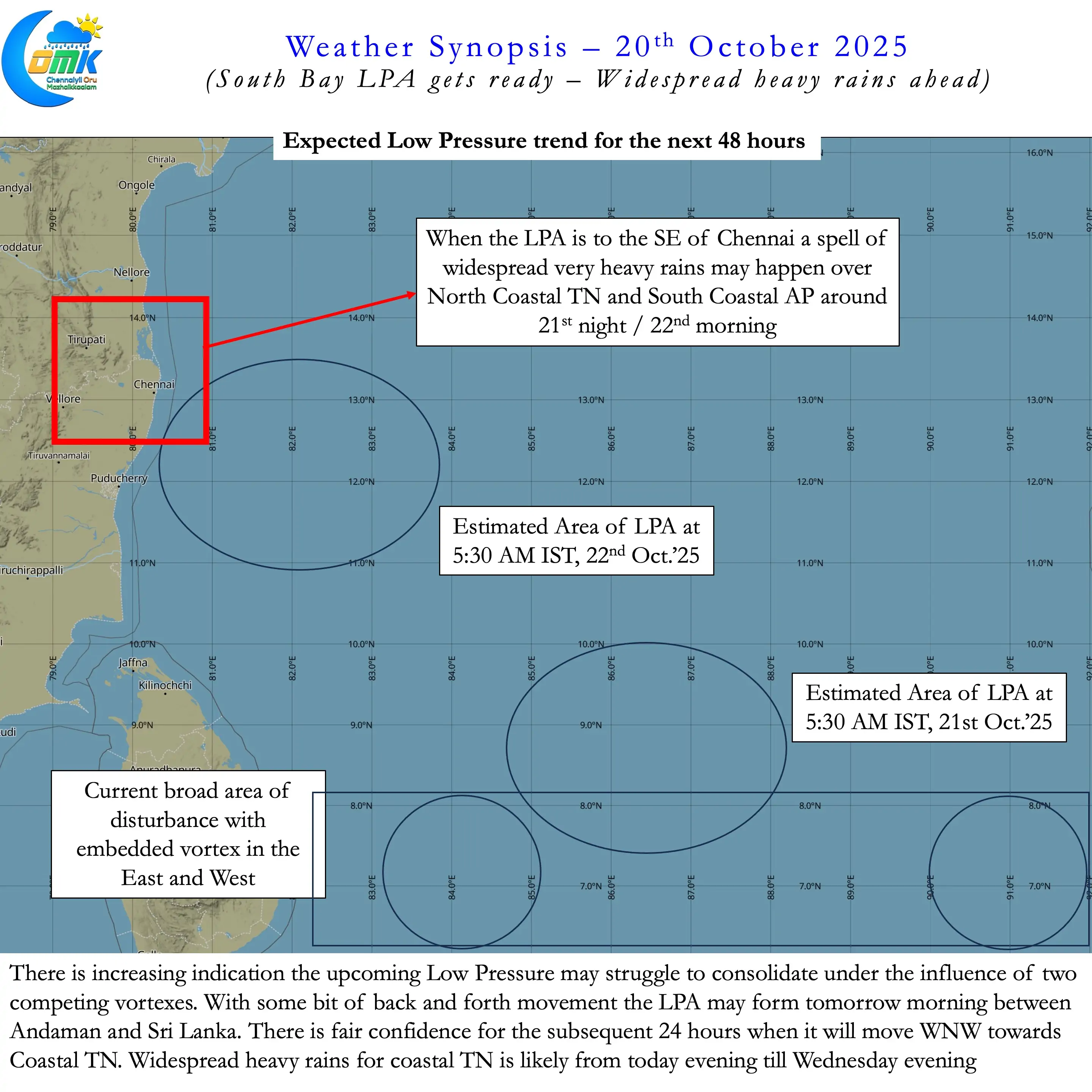
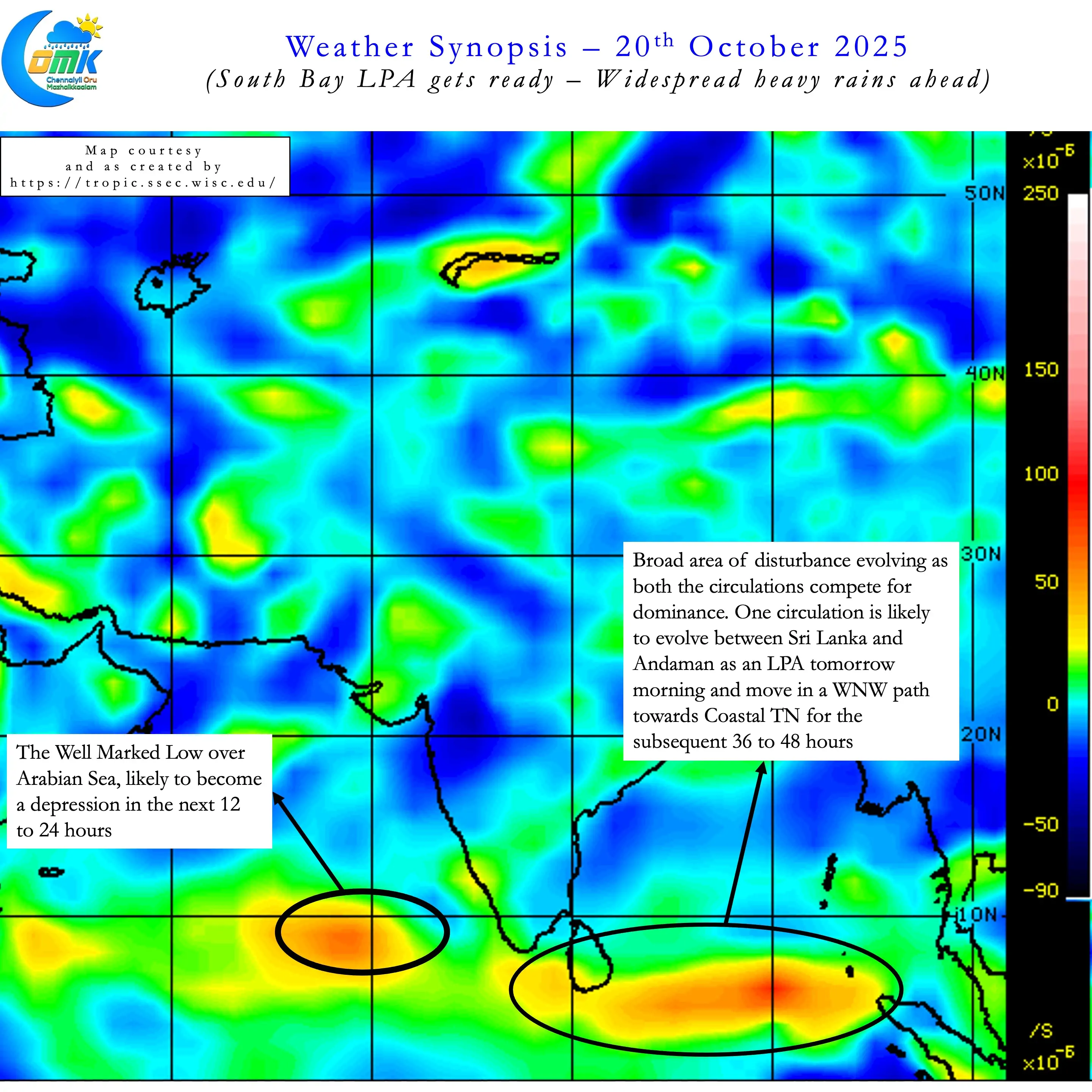
- A Low Pressure Area is likely to form tomorrow morning between Sri Lanka and South Andaman.
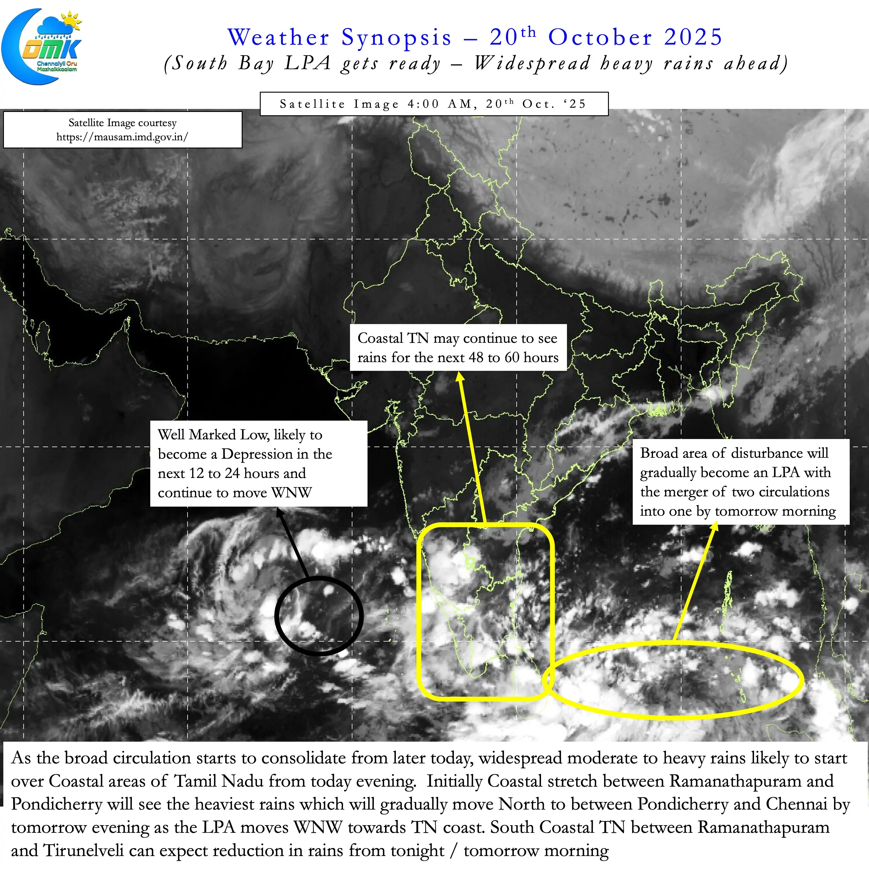
- The current circulations on either side of a broad area of disturbance is likely to merge into one.
- There is also a fair degree of confidence this disturbance may deepen up to WML / Depression with less chance for further strengthening.
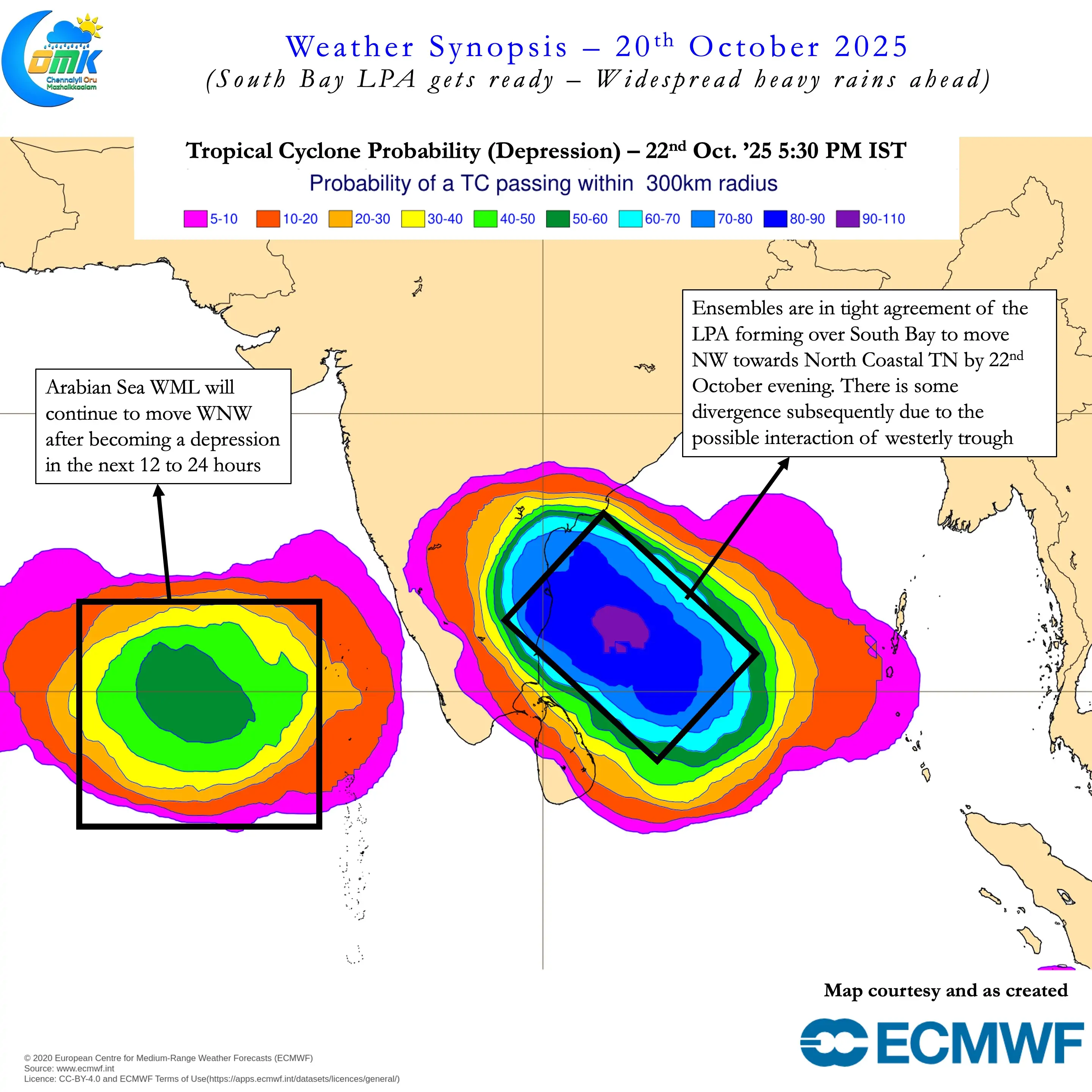
- The WML / Depression is likely to move WNW / NW towards Coastal TN until 22nd October evening.
- By 22nd October morning it is expected to be ESE of Chennai. Subsequently models are showing divergence on further movement with influence of Westerly trough.
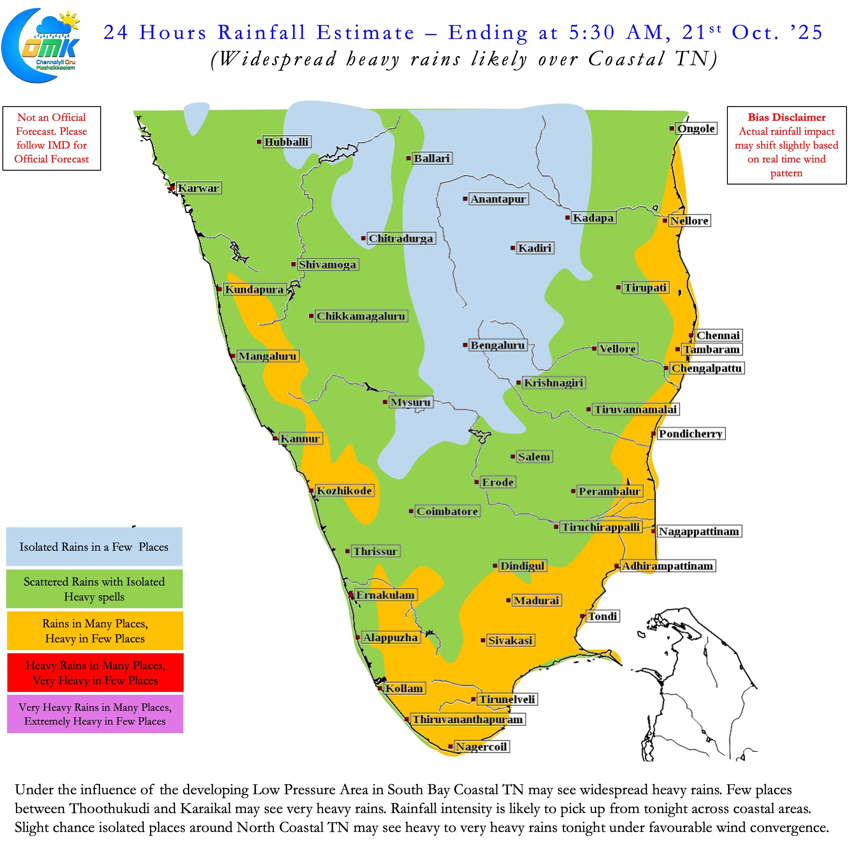
- Widespread rains is likely to start over the coastal areas of TN from tonight.
- Initially the stretch between Ramathanapuram and Karaikal is likely to see the heaviest rains. From tomorrow afternoon / evening the heaviest rains may start to happen between Pondicherry and Chennai.
- There is high chance of widespread heavy to very heavy rains over North Coastal TN and South Coastal AP between tomorrow evening and 22nd morning. This is when the WML / Depression is likely to be SE of Chennai.
- Subsequent rainfall pattern will depend on track of the LPA / WML. This would decide whether interiors get rains or it is restricted to Coastal AP.