
Back in 2014 on this day the COMK journey started as a Facebook page. Today we can look back with satisfaction on the role this blog is playing in creating a weather wise community for Chennai & Tamil Nadu. It is only fair to highlight the assistance people like Selva, Sailesh, Kalyan, & Vignesh have provided in this journey. Also thanks to all of you for supporting us through the highs & low
Yesterday once again Tamil Nadu saw thunderstorms at many places with parts of West TN & South TN. The TN Revenue Department RG at Inspection Bungalow, Tiruppur recorded 18 cms of rains from the evening thunderstorms as isolated places in West TN came under intense thunderstorms. Similarly places in Madurai, Trichy, Pudukottai & Virudhunagar dts also came under moderate rains. In North TN though things were once again relatively quiet with only Kalasapakkam recording meaningful rains. Possibly the early morning drizzle / cloudy skies due to remnant storms around North TN could have influenced convective development over the region.
With Bay of Bengal getting ready for the next Monsoon Low, off the coast of Myanmar things will possibly pick up on the monsoon front slightly though considering we are in the 3rd week of September a repeat of June / July in the form of widespread good rains looks less likely. In all probability we might see a repeat of August in the form of heavy rains over parts of Central India & adjoining areas of UP / Rajasthan & possibly Gujarat which might once again bear the bulk of another extreme rainfall episode before things fall in place for the Monsoon withdrawal.
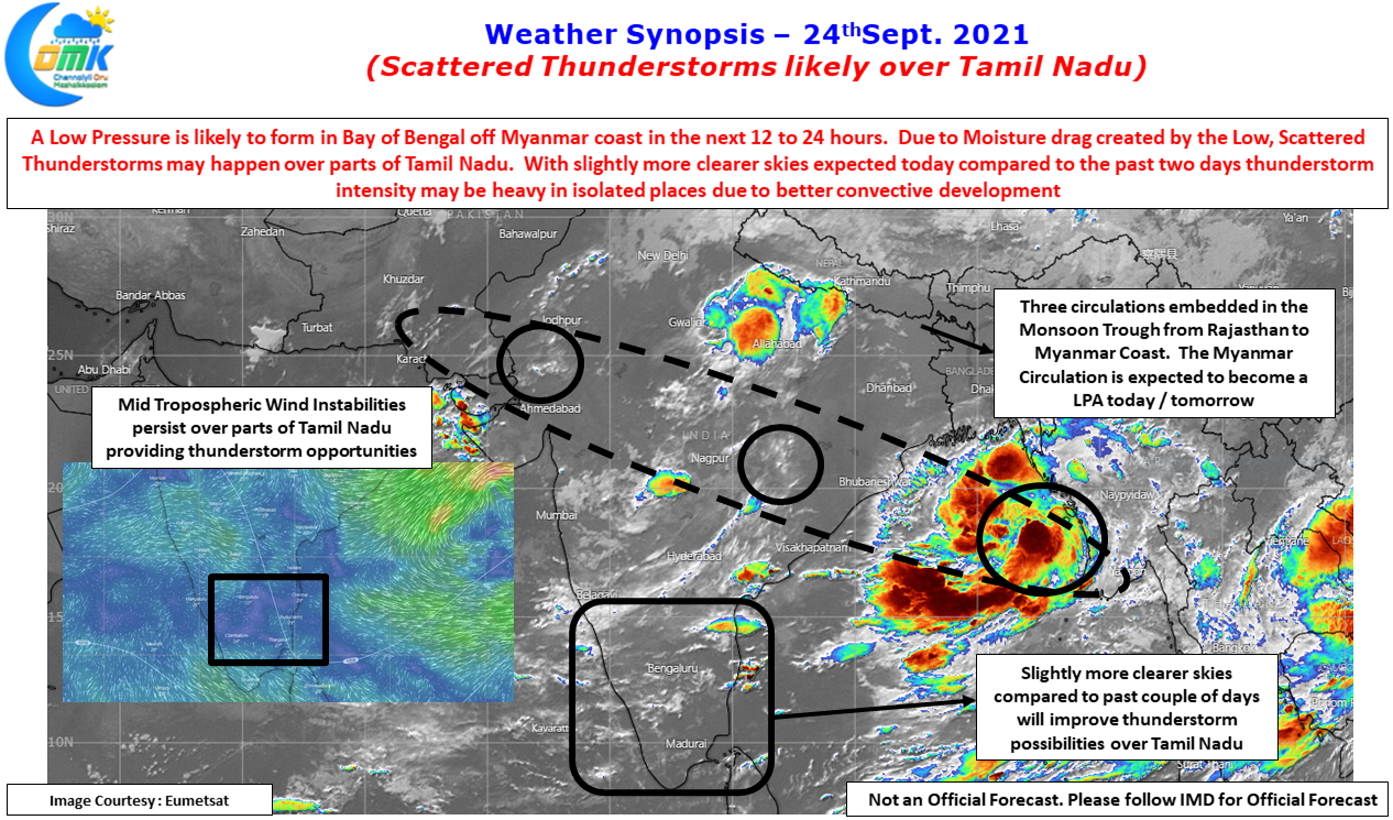

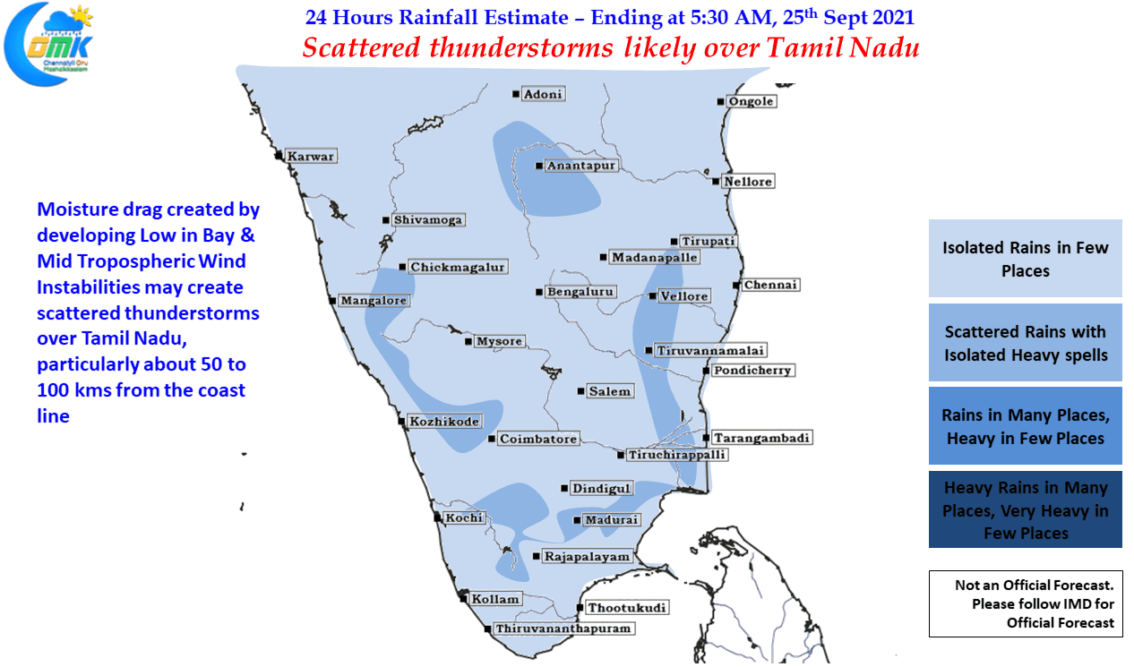
Meanwhile today looks good for another day of scattered thunderstorms for Tamil Nadu under the influence of Mid Tropospheric wind instabilities which is seen persisting. But crucially unlike the past couple of days North TN seems to be under much more clearer skies which augurs well for convective development in the interior areas. Looking at weather model outputs the places about 50 to 100 kms from the coast line are likely to benefit the most from the evening thunderstorms with few places coming under fairly intense spell of heavy rains.
As far as Chennai goes it looks like there is a decent chance for Chennai & Suburbs to catch up with another 3 to 5 cms of rains before the weekend ends. Fingers Crossed