

Yesterday saw thunderstorms return back over parts of Tamil Nadu with the IMD AWS at Erode recording 54 mm rains of which more than 4 cms fell in an one hour spell between 5:30 7 6:30 PM. Parts of Thanjavur district also recorded moderate rains later in the night indicative of the changing conditions in favor of increased thunderstorm activity over Tamil Nadu. One of the key things that is likely to drive the upcoming thunderstorm activity is the presence of a circulation in South Bay that is likely to develop & move in a westward direction over the next few days.
In the meanwhile two embedded well marked lows in the Monsoon Trough is providing for some very heavy rains over parts of both East & West India. These two circulations are feeding moisture off each other in part also being helped by the support provided by the Monsoon Trough as a cocoon. Ironically this is also creating a different problem with the space to maneuver getting reduced for the circulation in the eastern end of the monsoon trough. With the well marked low likely to get support from it straddling over the Arabian Sea it will have an edge over the well marked low in the East. Finally one has to give up and in all probability it is likely to be the well marked low over East India that will meander for a couple of days & end up fading away.
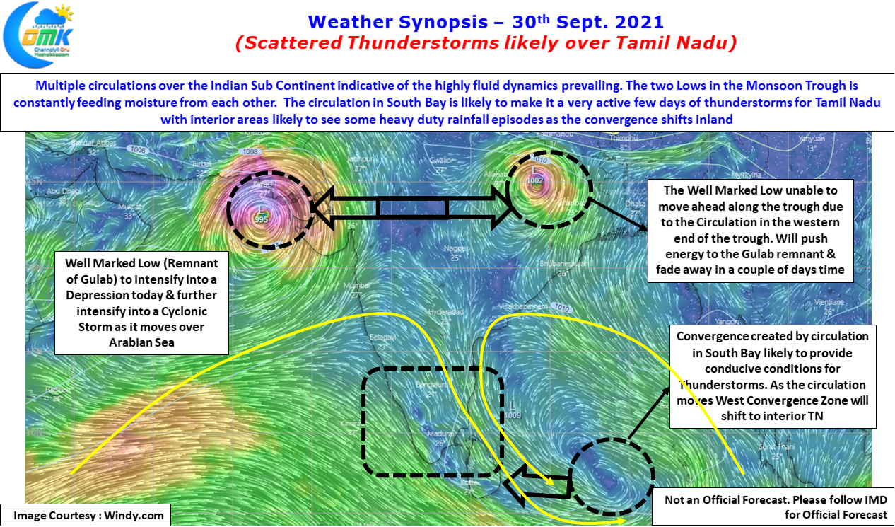
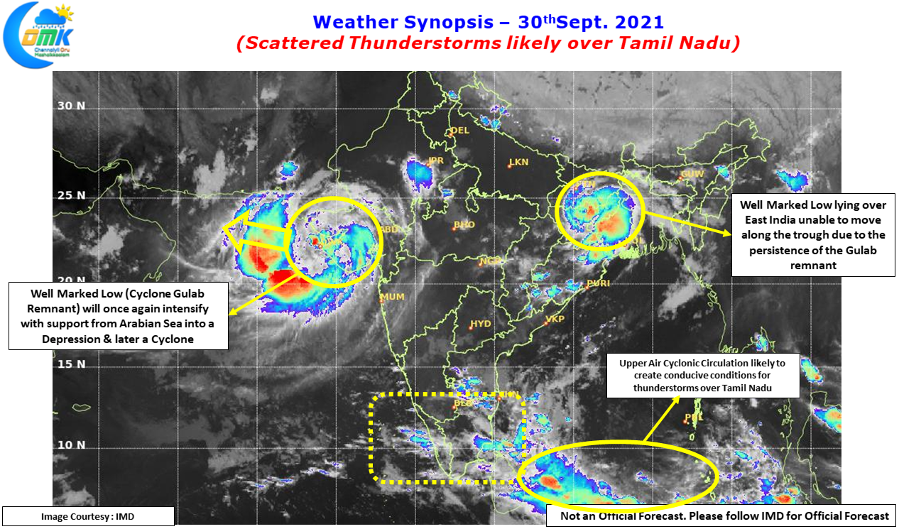
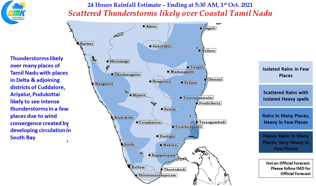
The Well marked low over west India is likely to become a cyclone as it moves west, interestingly this circulation will also play its role in triggering the Anti Cyclonic Circulation over NW of India & adjoining parts of Pakistan in what is likely to be the first stage of Southwest Monsoon withdrawal. Down South it is going to be action packed few days for Peninsular India as the circulation in South Bay is likely to create conducive conditions for thunderstorms to develop almost on a daily basis. While Coastal areas could benefit initially as the circulation moves further west interior areas will come under the wind convergence providing some much needed rains for interior areas of West TN which will get into its second rainy season just as Southwest Monsoon gives way to Northeast Monsoon.
All in All it is going to be an exciting few days to track weather & also the rains. But don’t Forget