
Southwest Monsoon this season has not been a classical season so far. Peninsular India has been seeing the monsoon pendulum wildly. On the other side of spectrum parts of Central India has been seeing active monsoon conditions for weeks together. The rains over the leeward plains of Tamil Nadu has also been erratic. Even when days have seen scattered thunderstorms over North TN the rainfall numbers have been erratic. The IMD observatory at Nungambakkam has recorded 13 cms since 1st June. But about 12 kms to the South as crow flies Airport observatory has not even recorded 3 cms.
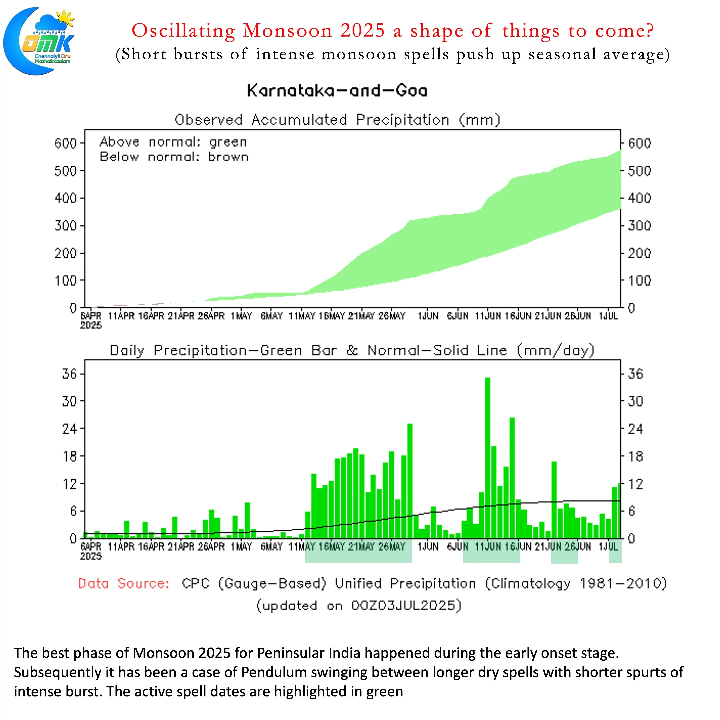
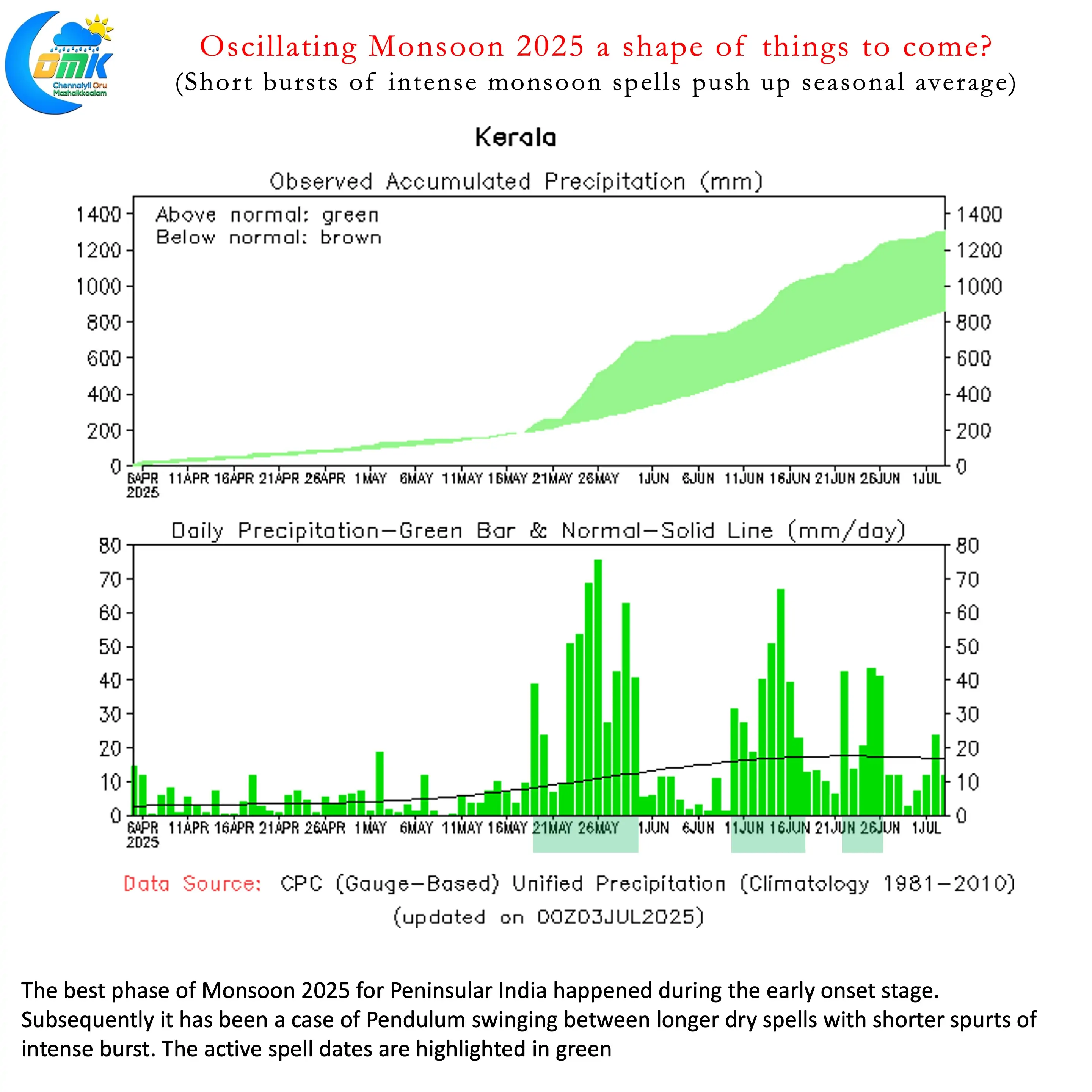
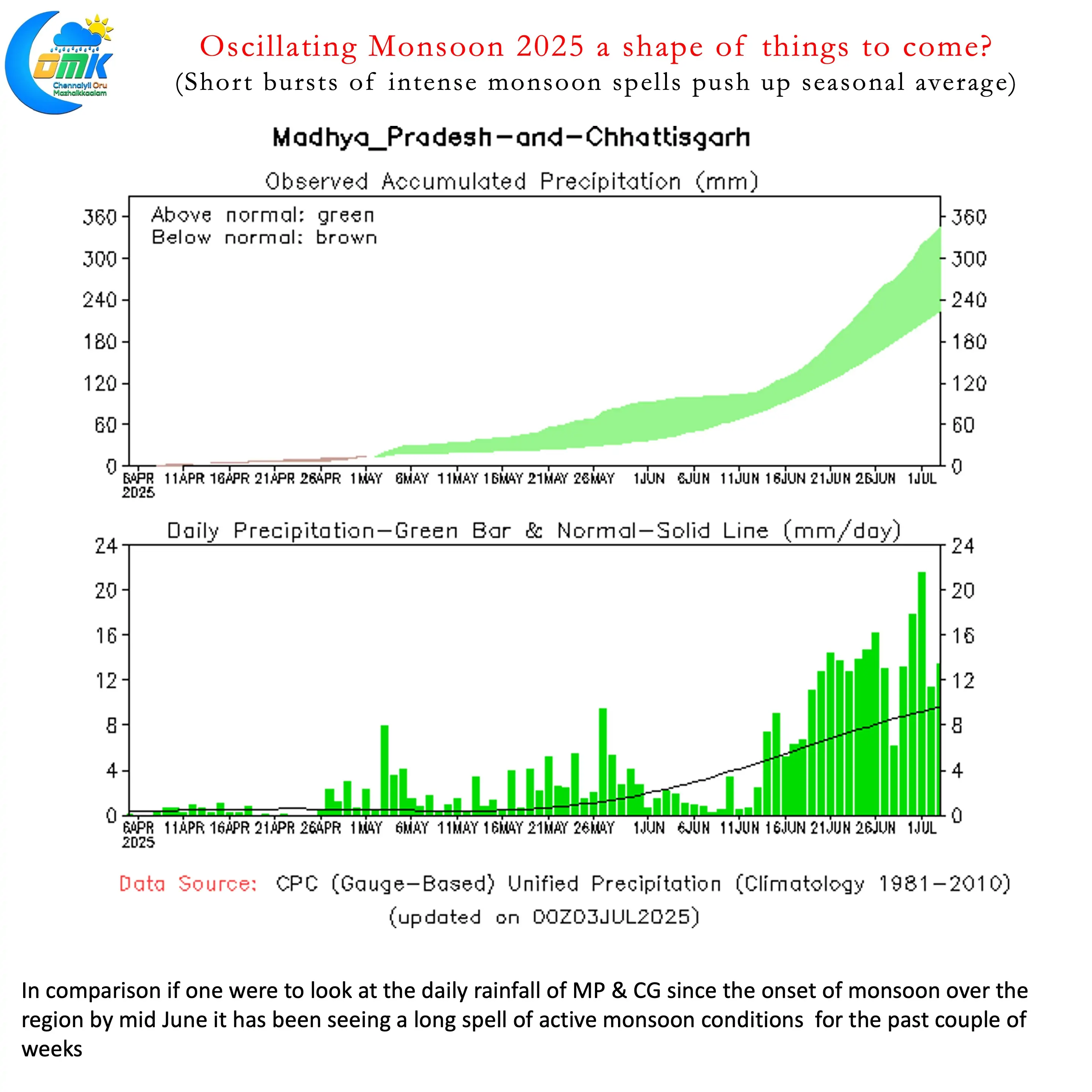
If one were to look at the daily rainfall chart for the Monsoon season over Kerala we can see burst of active conditions followed by longer drier spells. It is similar for Karnataka as well. The best period of Monsoon for Peninsular India was the early onset phase during 2nd half of May. Similar chart for Madhya Pradesh and Chhattisgarh shows monsoon picking up after onset during mid June. Since then it has been consistently seeing normal or above normal rainfall days regularly. In a way the first 5 weeks of Monsoon season has been driven by parked MISO over South China Sea and Bay of Bengal.
Sub seasonal models indicate this swinging monsoon dynamics may continue well into July and possibly August as well. With MJO continuing to struggle to put together a coherent West to East propagation its easy to correlate these forecasts. A clear transition to possibly negative IOD or La Nina base state in Pacific may shuffle things around. We need to wait and watch when this would eventually happen.
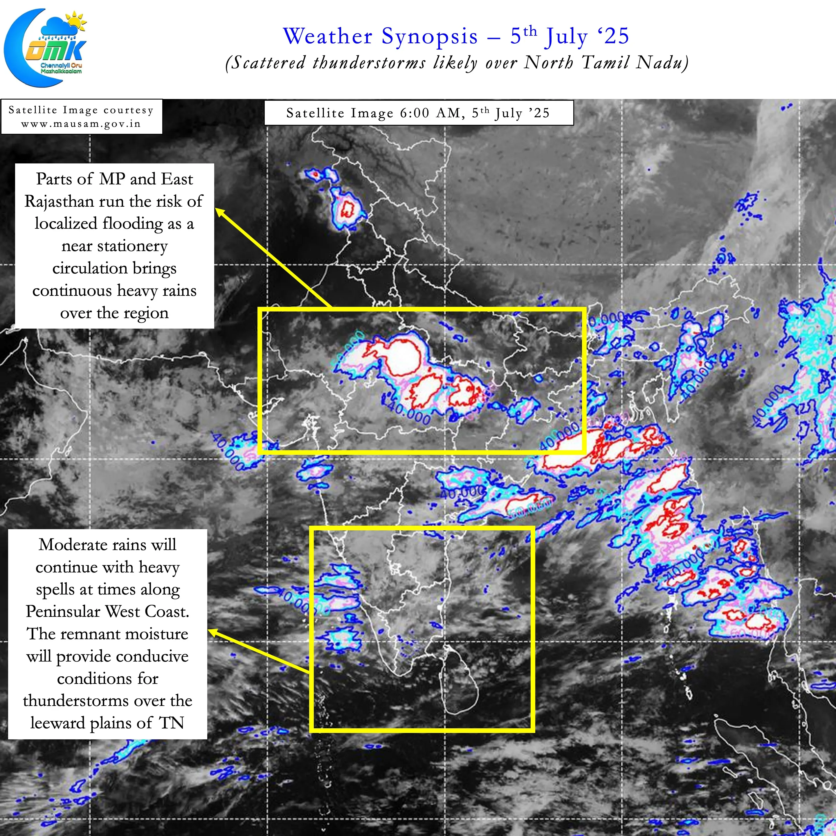
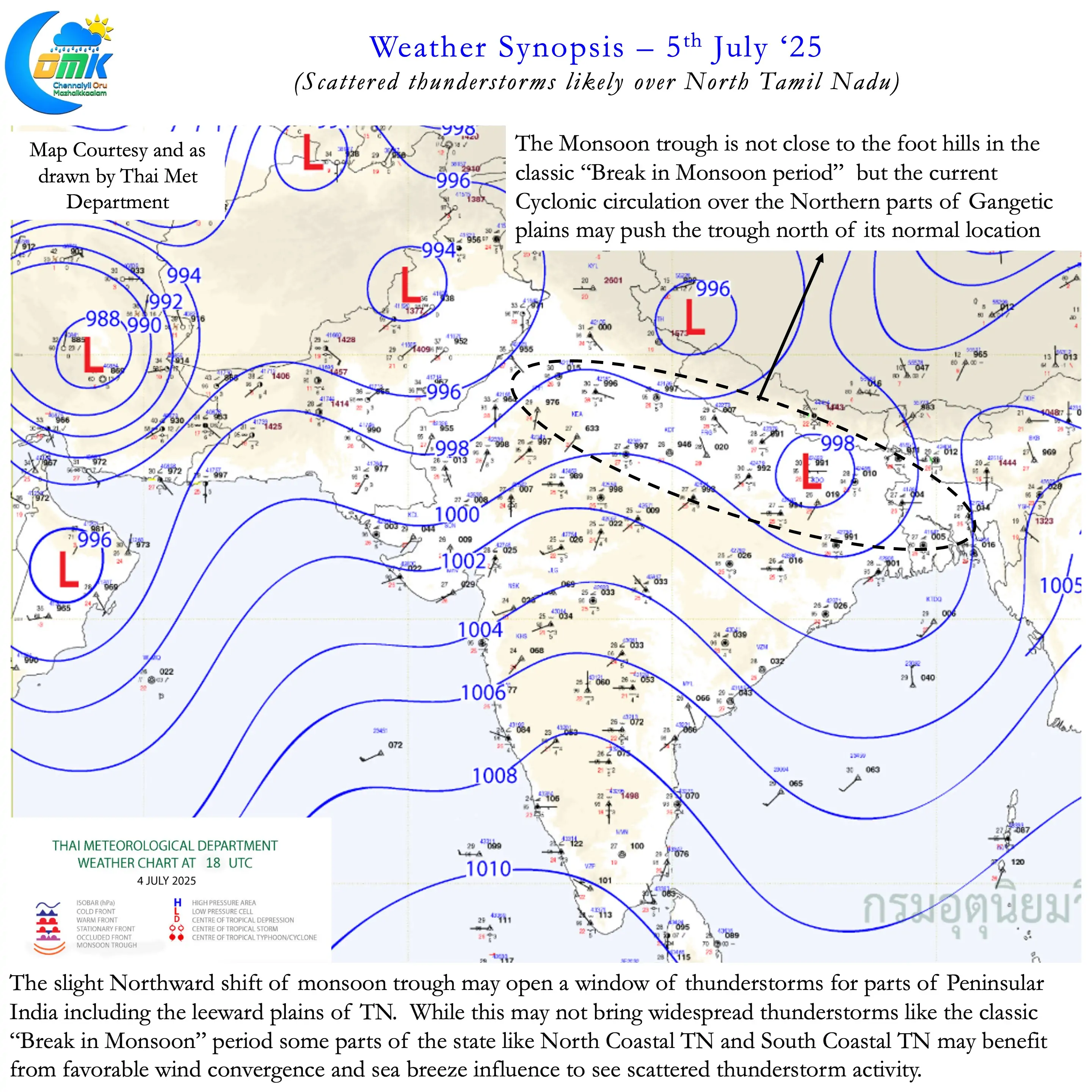
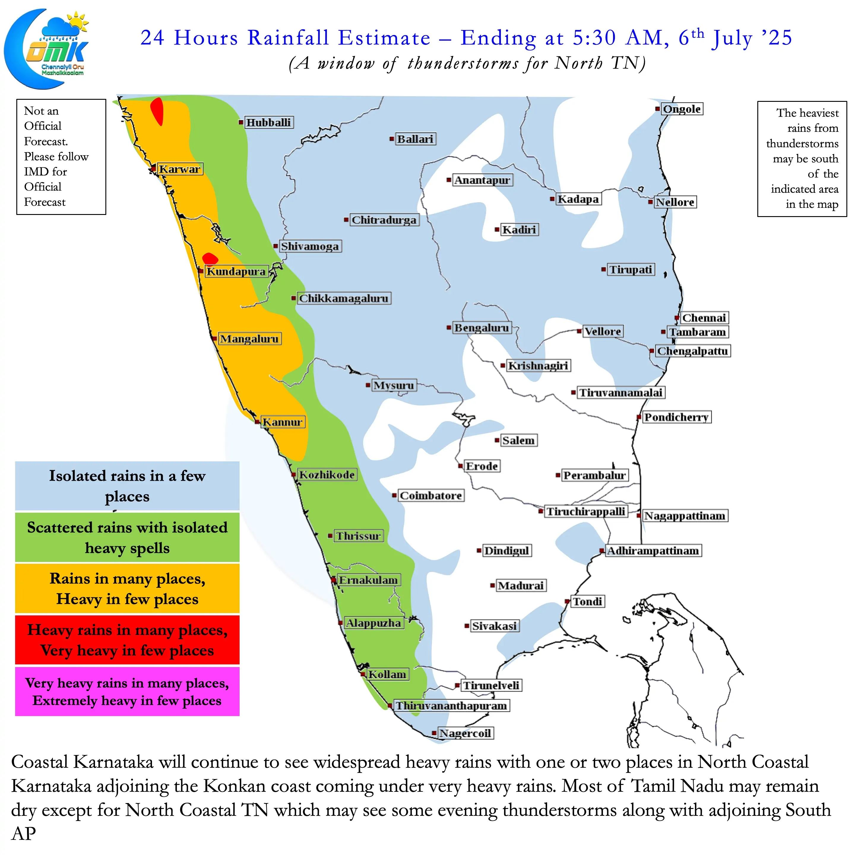
Meanwhile leeward plains of Tamil Nadu can look forward to a spell of scattered thunderstorms. The monsoon trough is likely to push up North slightly for the next few days. Cyclonic circulation over the norther parts of Gangetic Plains will keep the trough North of its normal position. This may not be the classic “Break in Monsoon” conditions which are conducive for thunderstorms. Nevertheless weaker monsoon dynamics with clearer skies may aid convective development. Additionally with westerlies slightly weaker we can expect positive influence from Sea breeze as well.
This spell of scattered thunderstorms may mostly favour parts of North Coastal TN and South Coastal TN. The two areas which see the most favourable influence from sea breeze. Rest of the state may not see thunderstorms as of now. As mentioned above it is not a classic break in monsoon period. But later next week possibly conditions may favour more places in Tamil Nadu to see thunderstorms. There is a slight possibility this may blow into a full break in monsoon period.
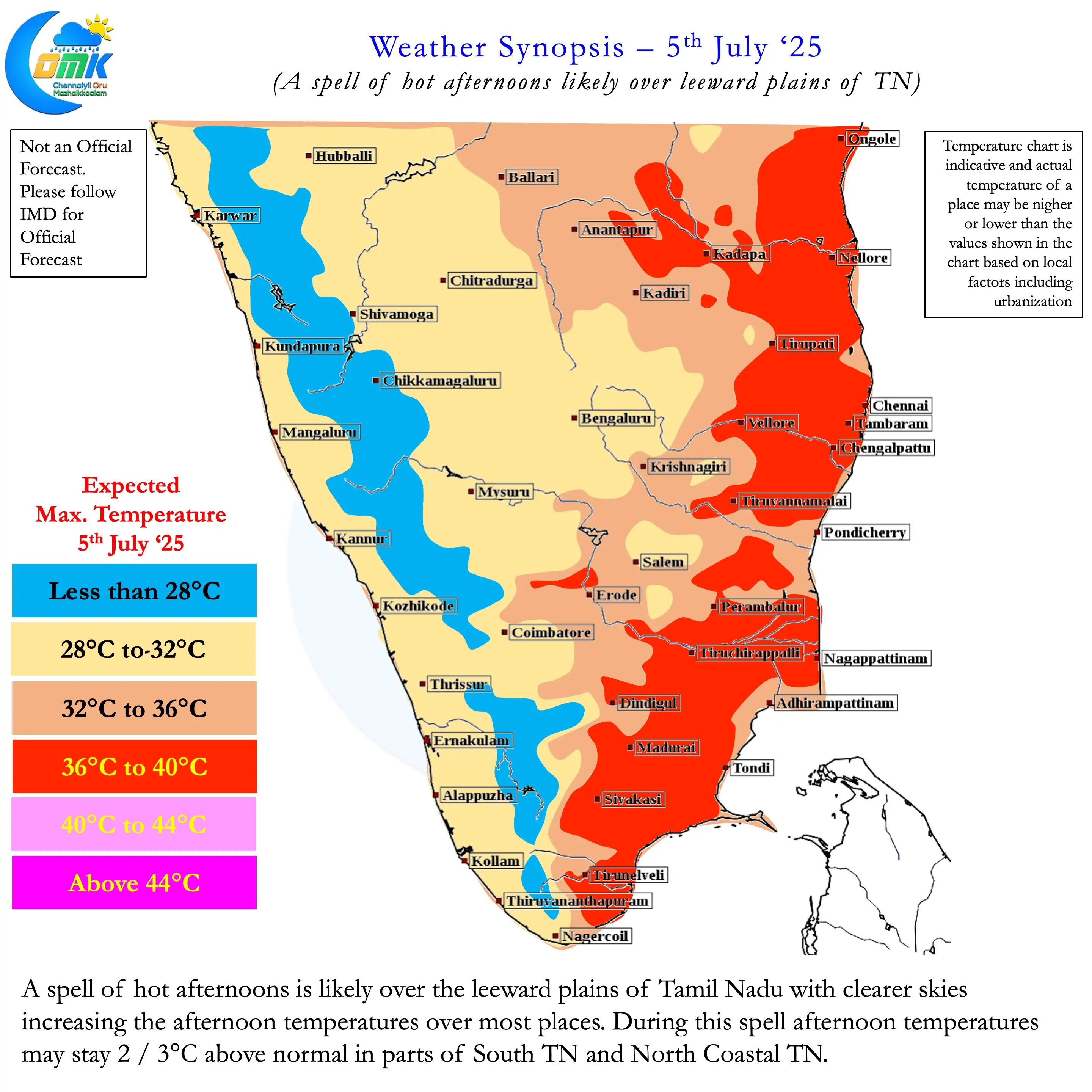
It is also worth noting that afternoons may be abnormally hot over the leeward plains of TN. Parts of North and South TN may see afternoon temperatures stay a degree or two above normal. With these places also expected to see thunderstorms it may be a blessing in disguise as well aiding convective process. The COMK Estimated Rainfall Range page can be referred for the rainfall probability in the coming days.