
Climatology is an often misunderstood term in weather. Even among weather bloggers we use climatology often without a context. Even among common public this is very prevalent. A very good example is the wonderful Anjali Anjali song from the movie Duet. கார்த்திகை மாதம் போனால் கடும் மழை இல்லையே கண்மணி நீயில்லையேல் கவிதைகள் இல்லையே. Wonderful song written by Vairamuthu which talks of rains ending when the Tamil month Margazhi comes in. But most weather bloggers by now know under right conditions rains can happen even during the month of Thai. Thai a period when most parts of Tamil Nadu get ready for the harvest of Samba crops.
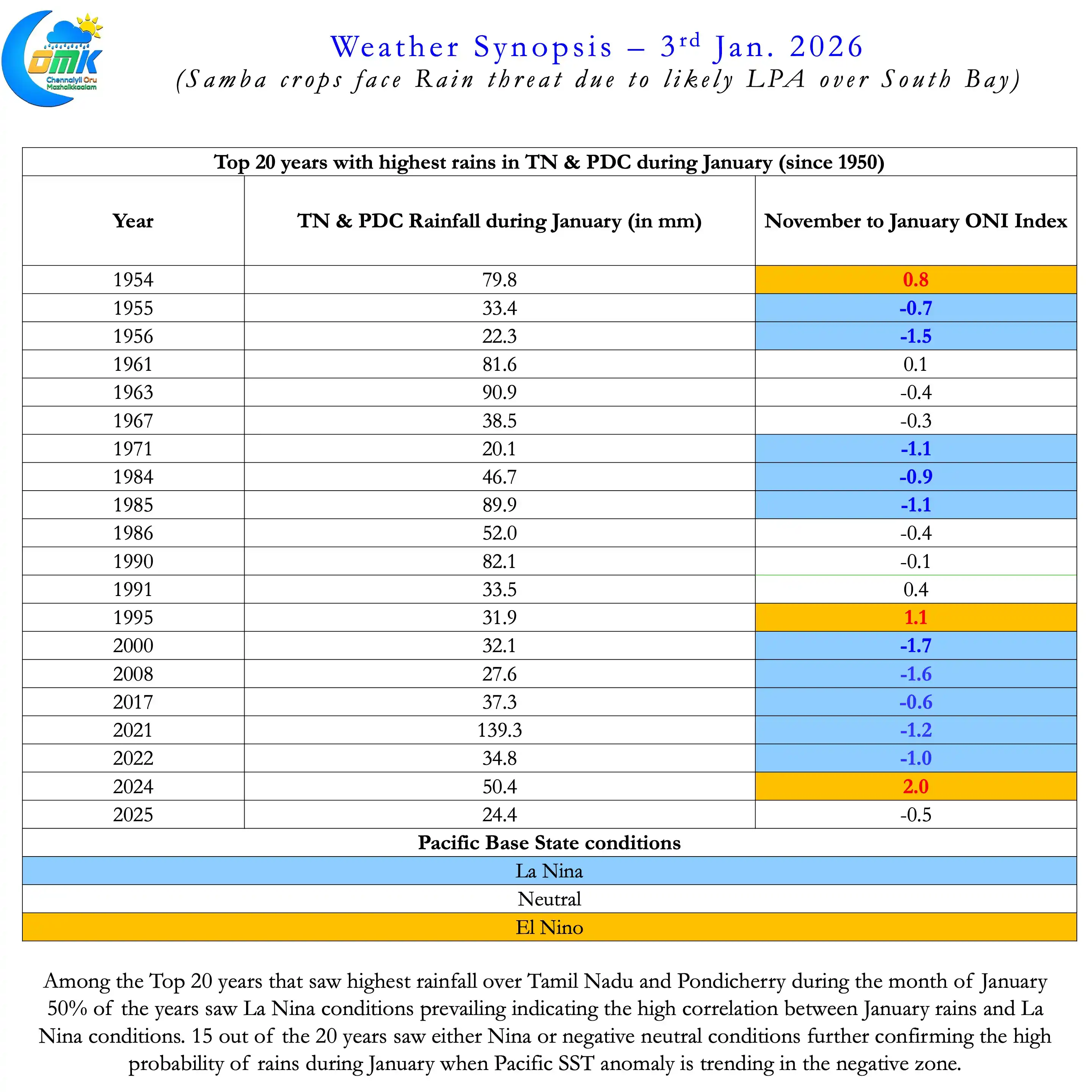
If one were to look at the years that saw the most rains during the month of January in TN & PDC there is a pattern to observe. 50% of the years that saw the most rains during January since 1950 have had La Nina conditions prevailing. 3 out of the 4 best years in this 75 year period has either seen Nina or negative neutral Pacific. Negative neutral due to possibly devolving La Nina that peaked earlier in the season. 2021 which saw the most rains during January since 1950 was amidst a multi year Nina period.
For the common man including farmers getting ready for Samba harvest this becomes unseasonal rains. But scientific reasoning will show us there is nothing unseasonal about late season rains. Years when Nina conditions prevail at the start of the year chance for rains increase. La Nina certainly does not guarantee rains during January. But it makes conditions better for rains during this period if other factors fall in place.
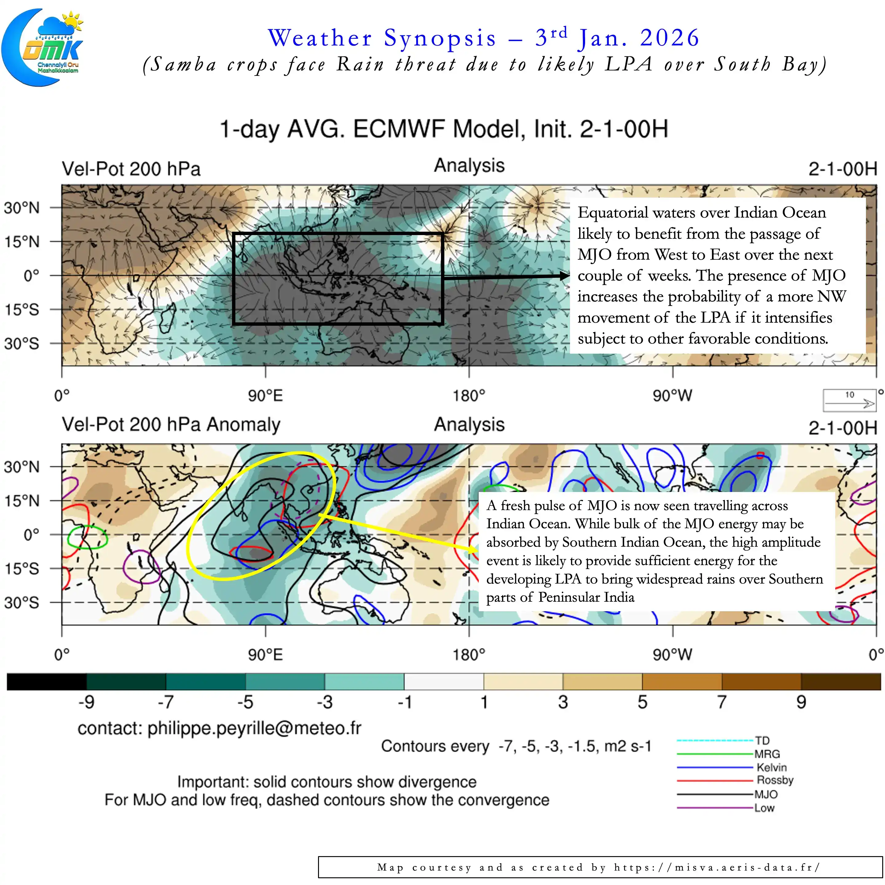
Most January rainfall episodes during La Nina years have a fair bit of tropical and sub tropical interaction. This interaction provides for rains to happen further up over Peninsular India even if the ITCZ is closer to equator. The lower level Easterlies provide the necessary combustion while Westerly trough creates the friction to light up. Alternatively at times favourable transit of MJO may play this role of shifting convection North for a more widespread rainfall episode.
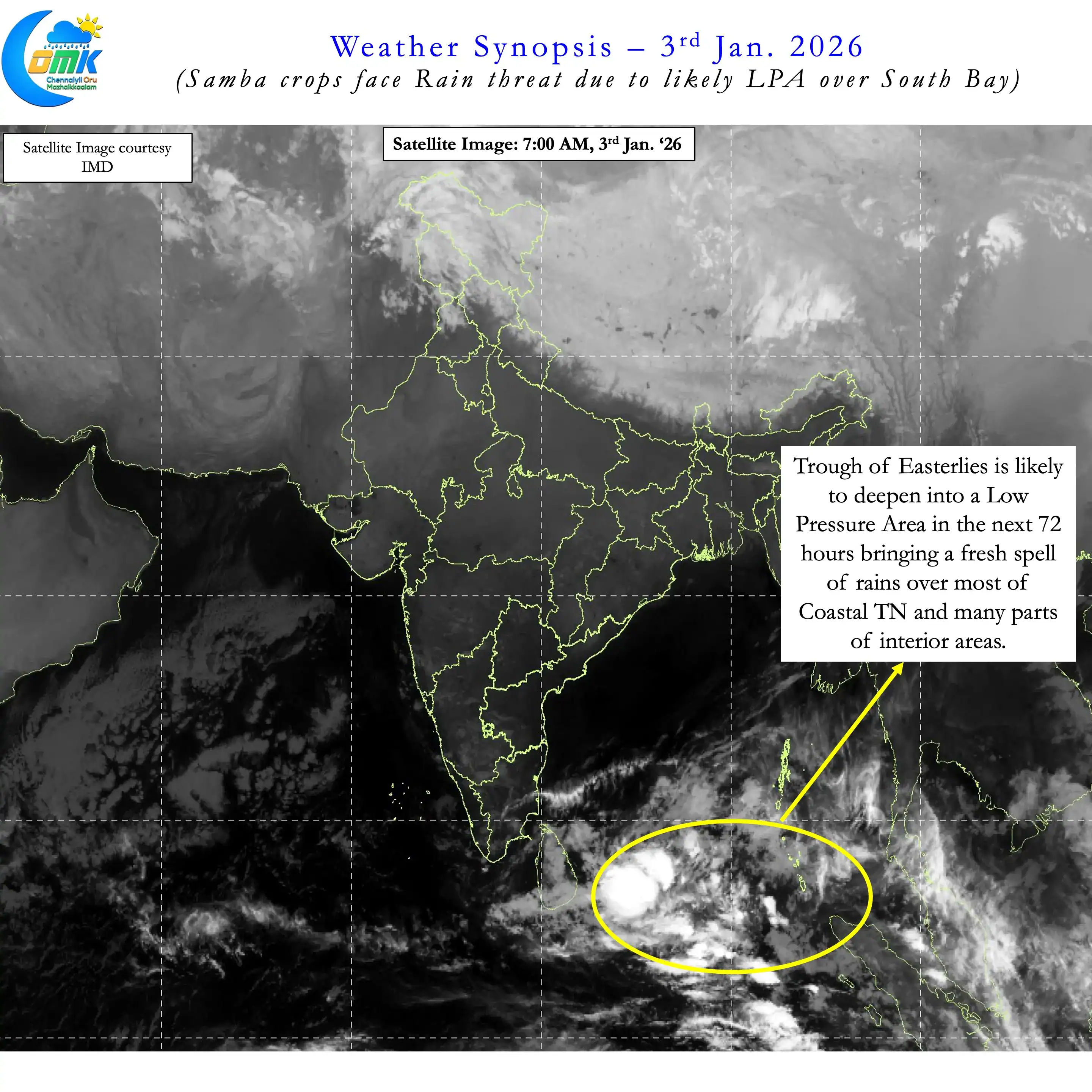
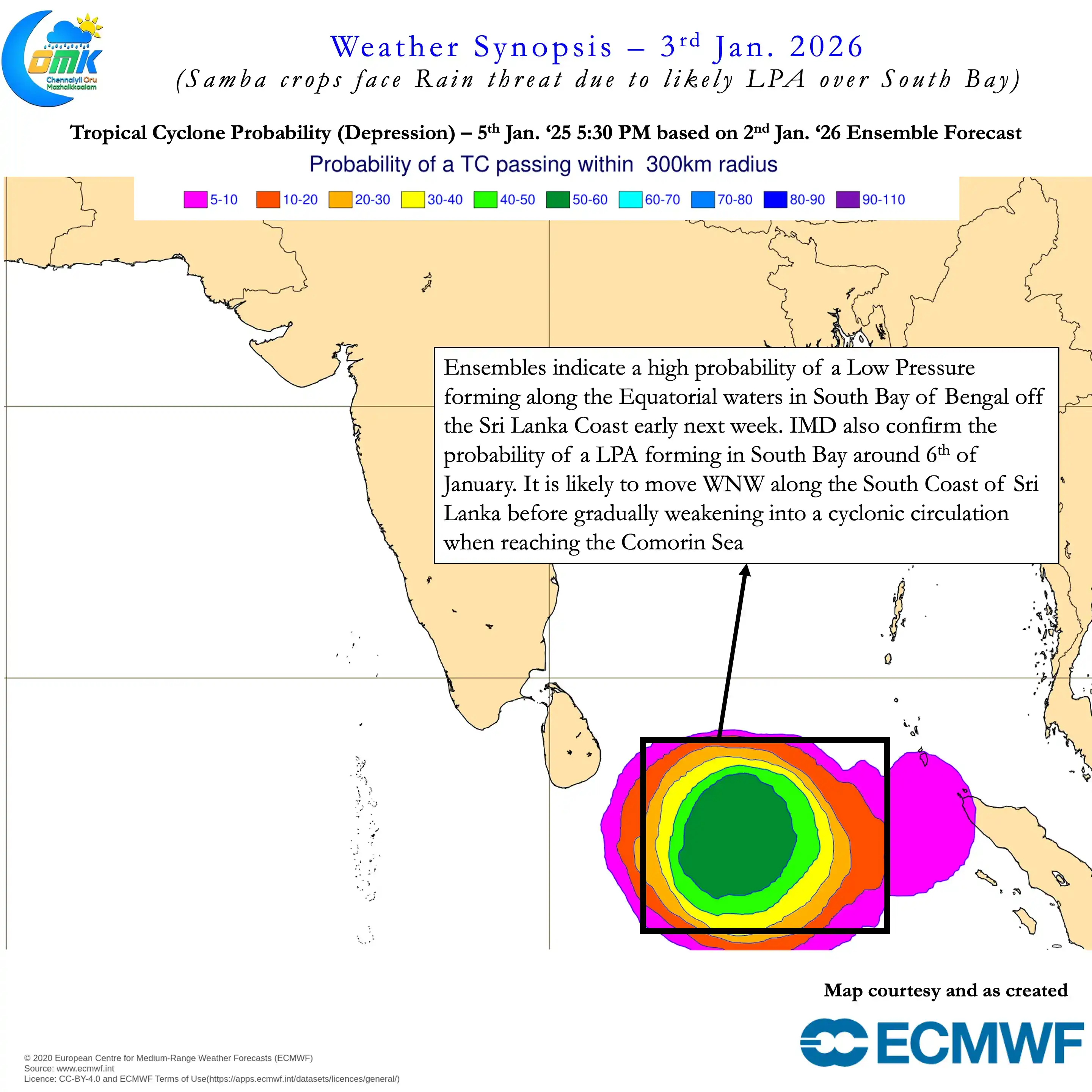
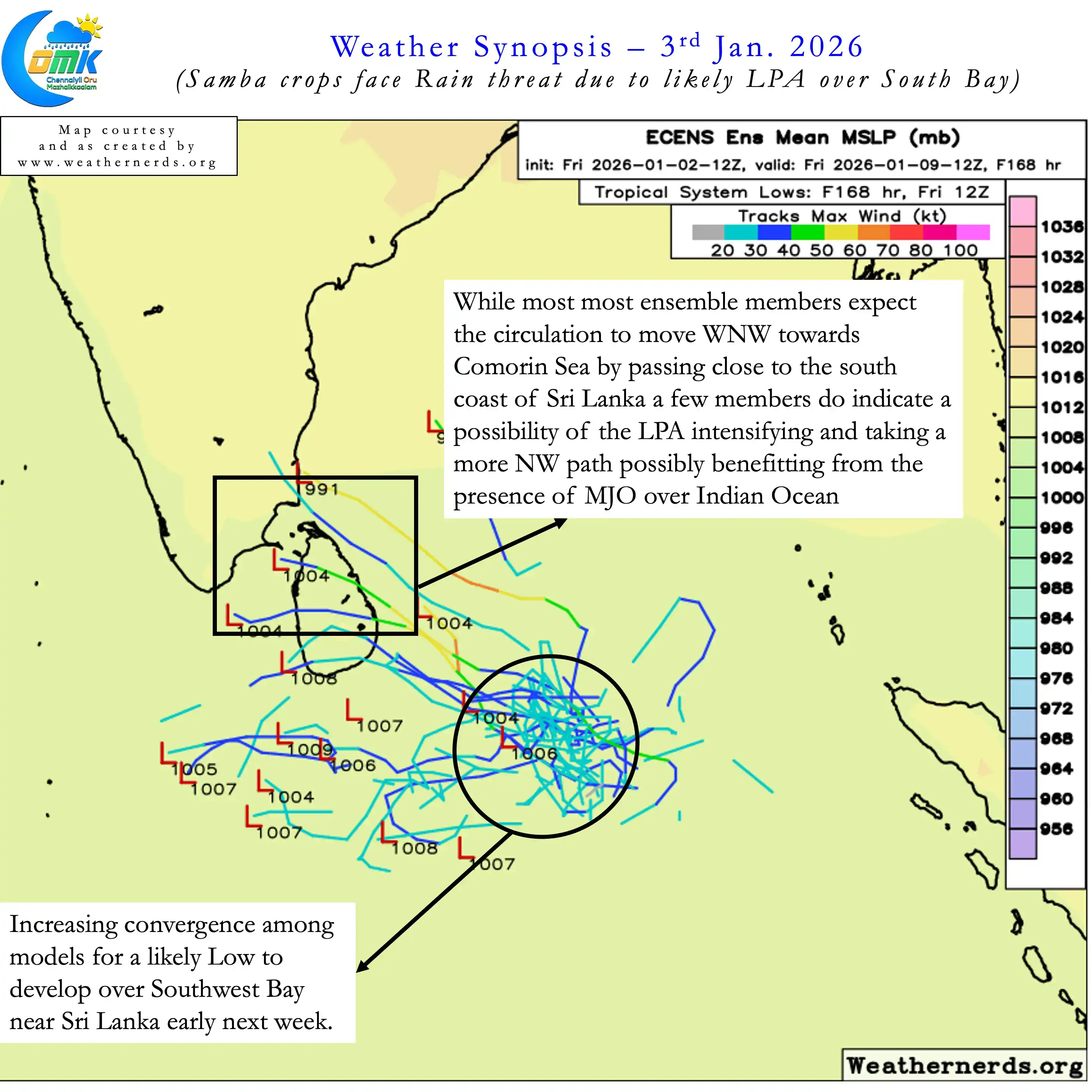
Currently a fresh pulse of MJO is travelling through Indian Ocean. It essential to point out bulk of the MJO energy is likely to be absorbed by South Indian Ocean. But the fairly strong amplitude is likely to allow not only an LPA to develop out of the current trough. But also it may provide conducive conditions for a widespread rainfall episode next week. Due to this there is a slight chance the LPA may also move NW over Sri Lanka. This could enhance the potential for rains over parts of South TN and Delta.
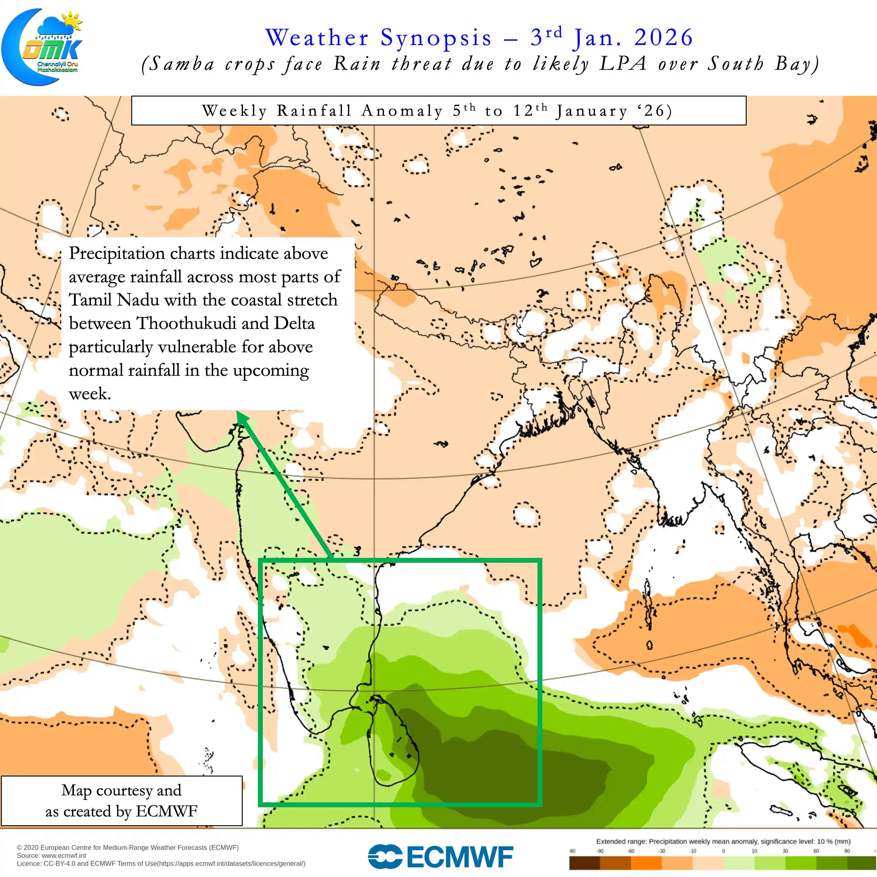
The coastal stretch between Pondicherry and Thoothukudi is likely to be the most vulnerable for heavy rains. This could mean Samba crops that are getting ready for harvest immediately after Pongal may be vulnerable. Most parts of TN is likely to see another spell of rains in the upcoming week. The LPA is expected to form around 5th or 6th of January triggering this episode of rains along with it. Depending on the interaction of the Westerly Trough the heaviest rains may happen between Friday and Sunday. But before that the LPA may bring some rains over parts of South TN and Delta by middle of next week.
Farmers in Delta district need to be ready for rains that could potentially damage standing crops. The rest of coastal areas including South TN Coast may also see moderate to heavy rains. But unlike Delta these areas may not see sustained spell of rains. Parts of South TN may see heavy rains though these places tend to have harvest windows much later than delta districts.