
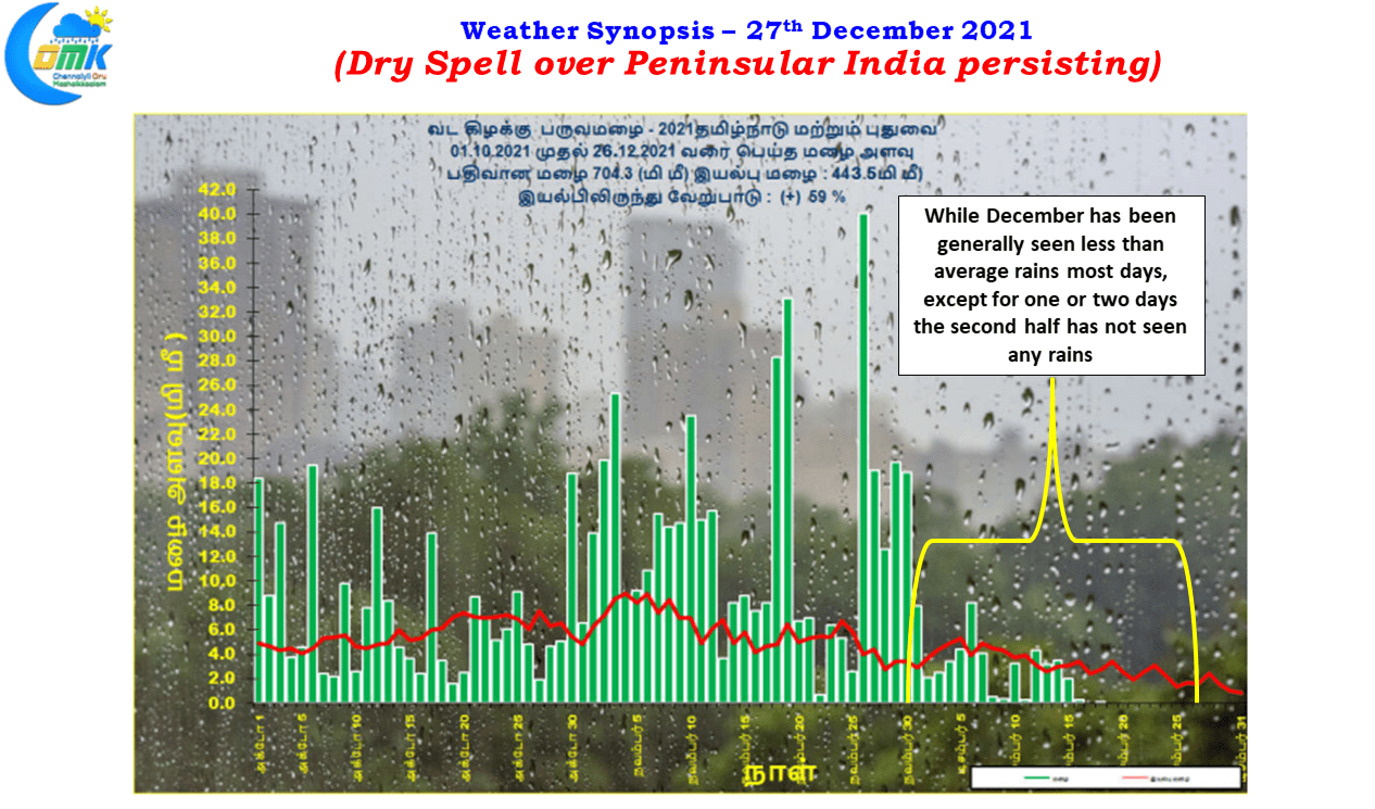
The second fortnight of December has seen dry weather take a stranglehold over Peninsular India with rains pretty much coing to a complete stop since the mid of December. Like an express train which ran at Maximum Permissible Speed (MPS) right from the start Northeast Monsoon picked up pace from the onset and ran non stop at MPS until end November before a series of Yellows & Double Yellows brought the run to crawling speed during the first half of December. After middle of December just as one thought NEM could make a Before Time Arrival (Record Rainfall Season) the home signal before destination was turned to red to bring it to a complete half for the past week or so.
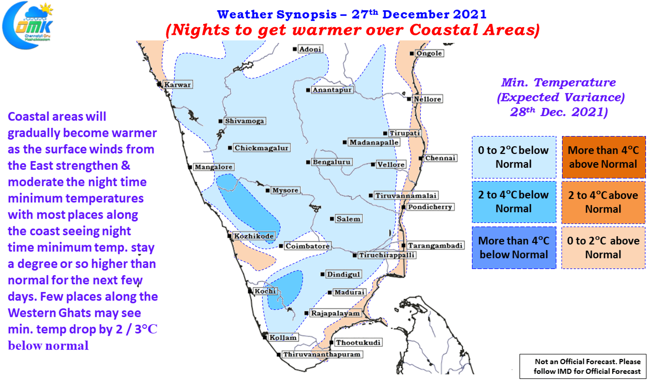
Weather models indicate it may complete its journey (Seasonal Closure on 31st December) on the last day of the year with a cautious run as Easterlies are expected to return back over Peninsular India.While returning Easterlies don’t automatically guarantee heavy Rains it could moderate the night time minimum temperatures as the warmer ocean will increase the temperatures along the coastal areas of Peninsular India. Not only the winds from the sea increase the temperature it also pushes back the land breeze thereby increasing the humidity as well. Starting from tomorrow morning we can gradually see night time minimum temperatures settle at around 1 / 2 degrees above normal compared to couple of degrees below normal for the past week or so.
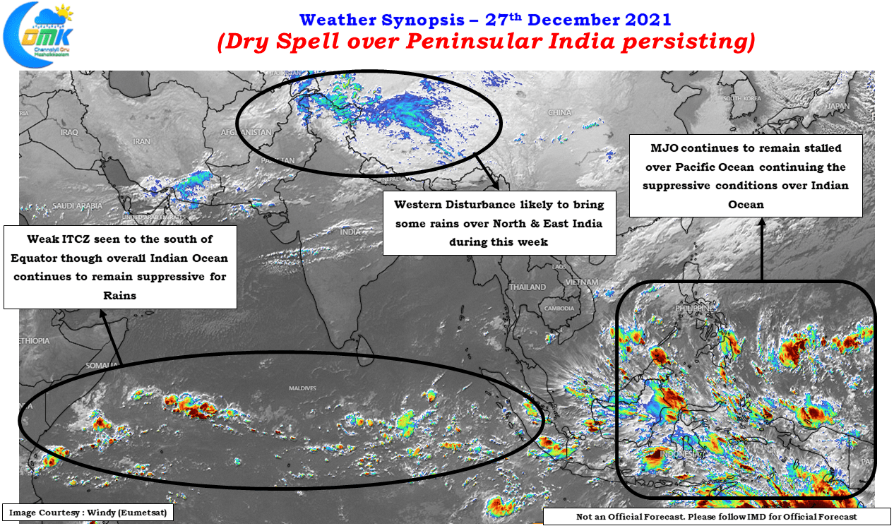
But overall though one will have to keep in mind large scale monsoon dynamics do not exactly favor for a sustained spell of rains over Peninsular India though Easterlies are expected to return back. For a start the ITCZ is seen to the South of Equator over the Indian Ocean an effect of the monsoon fading over Peninsular India. Also MJO continues to remain stalled over Pacific Ocean which has meant the suppressive phase over Indian ocean continues to persist for the past couple of weeks or so. It is nearly 3 weeks now MJO moved into West Pacific and continues to remain rooted over there.
Additionally plain vanilla may not bring widespread rains, particularly under unfavorable conditions currently prevailing, it may need a trigger in the form of some sort of atmospheric disturbance either in the form of a wind convergence or a circulation. Weather models indicate the coming week may not see any strong enough disturbance of either form to trigger widespread rains that could become a spot of bother for people.
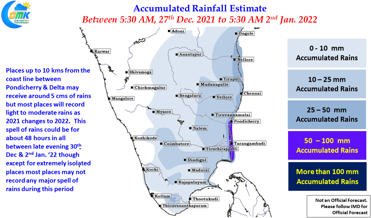
As 2021 turns over its last page & 2022 opens its first page the returning Easterlies are likely to bring a spell of light to moderate rains over parts of Tamil Nadu, particularly coastal areas. The spell though is unlikely to be strong enough to upset the urban flood plains or the farming community who are in the last stage of getting their crops ready for harvest in a couple of weeks time. Most parts of the state will possibly see an accumulated rainfall of one or two cms while isolated places particularly right along the coast between Pondicherry & Delta could see an accumulated rainfall of 5 to 7 cms this week