
After a relatively quiet period of thunderstorm activity over large parts of Tamil Nadu rains are set for a comeback once again on the back of conducive conditions shaping up under the influence of a developing disturbance in Bay. The West Coast was active with the help of a Monsoon Low which now persists as a Well Marked Low around the North MP region. A few days of good rains along the west coast have gone a long way in bringing down the deficits across Kerala. South Int Karnataka. The pendulum is now expected to swing back to East Coast now for a spell of thunderstorm activity over Tamil Nadu
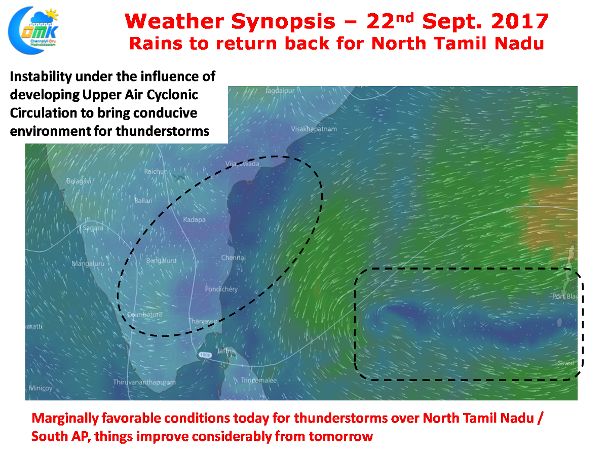
The developing Upper Air Cyclonic Circulation is expected to bring back the conducive environment for thunderstorms to thrive on similar to the first fortnight of September & most of August. As of now things look good for North Tamil Nadu to get a spell of rains over the next few days with things improving considerably from tomorrow. With some models indicating the possible circulation to drift in a more East to West direction interesting times ahead for weather bloggers.
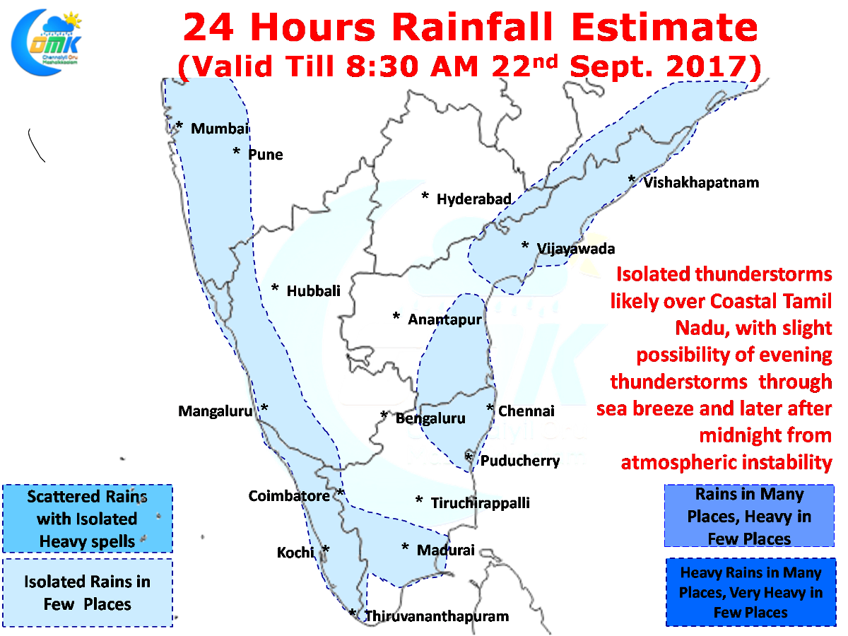
Yesterday evening saw some isolated showers in a few areas of North TN under the influence of a sea breeze front which has started to penetrate inland once again with Westerlies slowing down. Today morning saw some light rains in a few areas of Chennai particularly closer to the coast. Similar pattern is expected to play out today as well with some opportunity for sea breeze triggered thunderstorms in the evening and late night / early morning rains from the wind induced instability.
Powered by WPeMatico