
Northeast Monsoon continues to bring rains to most parts of Tamil Nadu with yesterday also seeing rains across coastal areas of the state along with South TN areas. While heavy rains like Friday did not happen yesterday parts of West Interior TN also recorded light to moderate rains including places like Coimbatore & Pollachi. Chennai & suburbs recorded on and off spells with some of the IMD automatic weather stations like West Tambaram, Taramani recording close to 2 cms while other places recorded around 1 cms of rains.
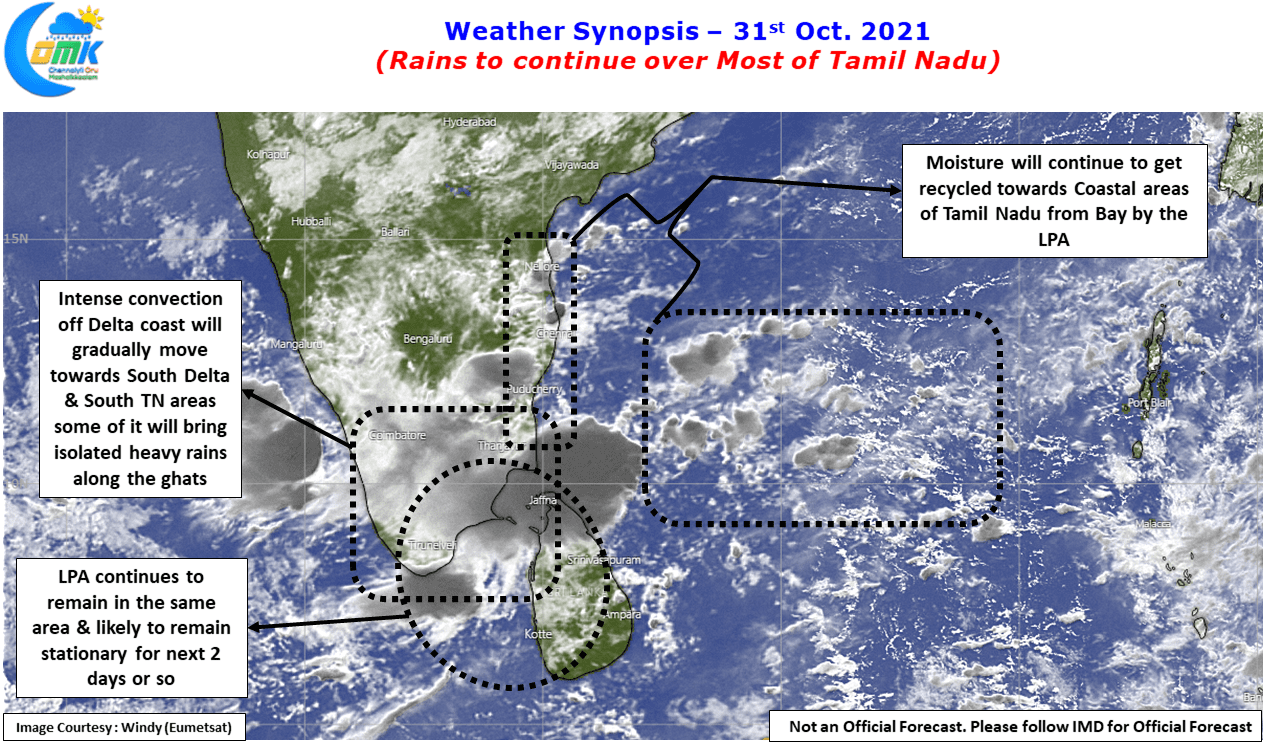
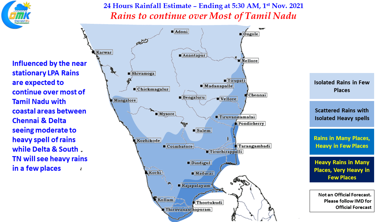
With the Low Pressure Area continuing to remain at an almost stationary position around the Comorin Sea & adjoining areas for the past 36 hours or so. Because of the stationary position the circulation continues to recycle moisture from Bay of Bengal into the coastal areas of Tamil Nadu and is expected to remain in a similar condition for the next 2 / 3 days as well. This could mean for the next few days spells of rains will continue with varying intensity depending on the location of the LPA. Towards middle of the week some of the weather models indicate the LPA to move west which could slightly alter the rainfall pattern skewing it towards places along the Ghats. But that could wait for a couple of days as of now.
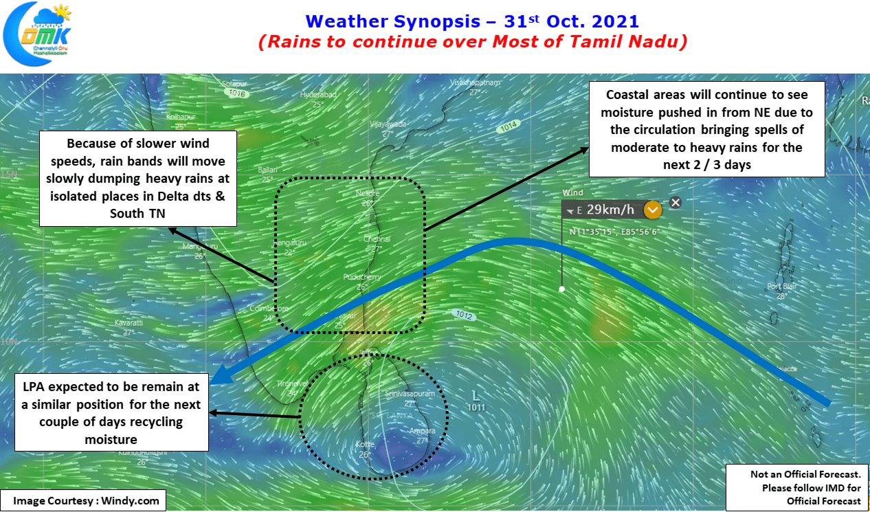
In the meanwhile looking at the wind charts it appears the winds at 1.5 kms ASL is marginally slow due to which the rain bands will move slowly roughly from NE to SW direction dumping rains in the process at a few places. Coastal areas will continue to see on and off spells of rains during the day with the peak spells happening late night / early morning hours. Satellite image indicates an intense convection off Delta coast which may eventually move into South Delta & South TN areas.
Today we could see the coastal stretch between Chennai & Delta come under moderate to heavy spell of rains at times while Delta districts & South Tamil Nadu could see heavy rains at isolated places.