
After battering the capital city of Chennai and surrounding areas in north coastal Tamil Nadu in a much needed relief the rains slowed down from last evening with mostly light to at times moderate rains seen around the Greater Chennai UA during the night. To give a perspective by 7 AM on 1st November the COMK AWS had accumulated more than 3 cms from midnight and on 2nd November it had accumulated more than 7 cms for the same period while today the accumulated rainfall from midnight at the time of writing this post is only 1.8 mm.
While this reduction in rains is not an indication of complete cessation of rains it certainly is likely to bring a phase where the expected rains over Chennai and surrounding north coastal Tamil Nadu will be light to moderate rather than heavy to very heavy rains. In a way the last night’s satellite image which showed fairly intense convection over the delta region between Pondicherry and Nagapattinam is indicative of the shift in the trough slightly to the west and also a bit of weakening as well on account of its movement over the Sri Lankan land mass.
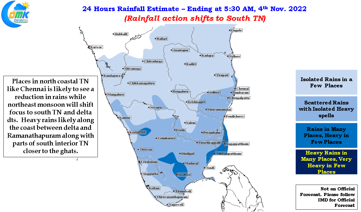
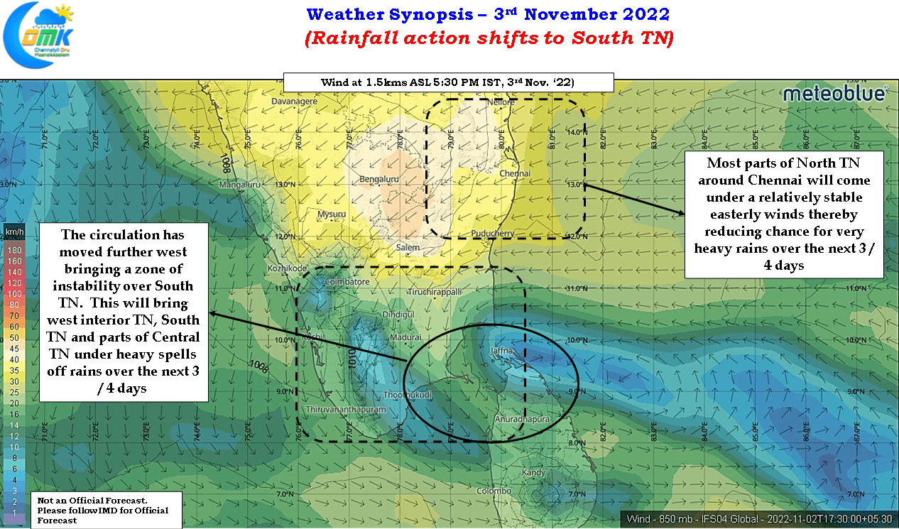
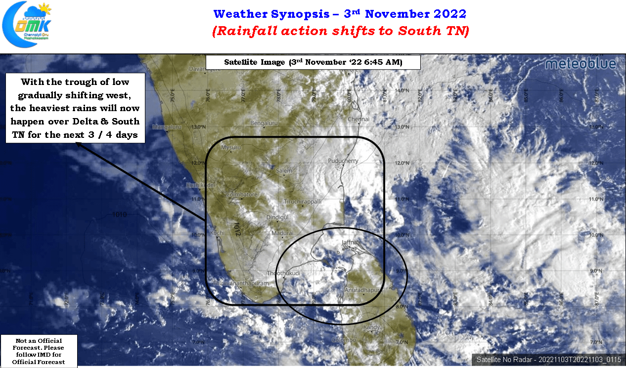
This would now mean the bulk of the rainfall action is likely to be south of Pondicherry today with parts of delta districts along with south TN vulnerable to spells of heavy rains during the evening / night hours as moisture pushed by the easterlies get supportive conditions by the instability provided by the circulation to bring in heavy rains. In addition to the above mentioned areas with the slow westward of the trough we could start seeing places in west interior TN also coming under some moderate to heavy rains under the influence of moisture that gets pushed across peninsular India
As far as Chennai goes, it is going to be light to moderate rains during the night / early morning hours under the influence of the easterlies which are more stable and streamlined. At times a few places may get heavy spells though it may remain isolated mostly.