
After almost a week of average and above average rainfall across most parts of Tamil Nadu the rains have eased yesterday with isolated rains over few pockets of the state with some parts of interior areas getting moderate thunderstorms in the late evening time.
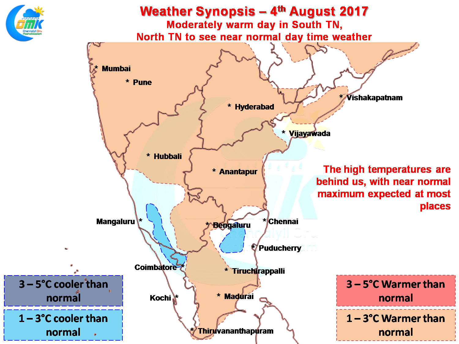
The high temperatures of last week are now going to be behind us as temperatures are expected to be near normal across most parts of the state with pockets of South Tamil Nadu alone possibly seeing slightly above normal day time temperatures with moderately warm conditions prevailing.
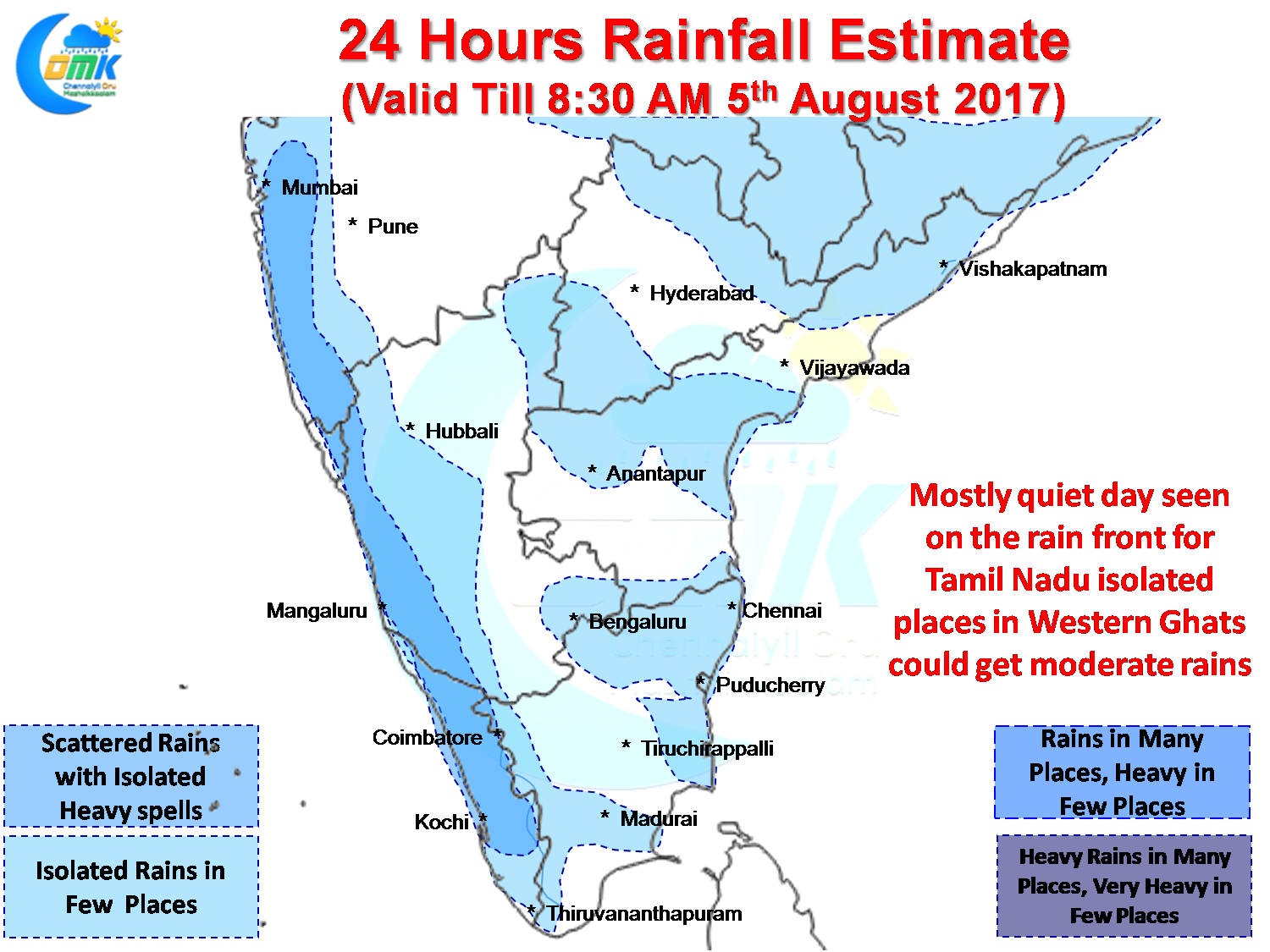
The rains have already slowed down yesterday as mentioned in the opening lines of this post. The next couple of days is likely to see similar trend of quiet evenings with lesser chances of the skies lighting up from the convective thunderstorms that have been giving moderate to heavy rains across the state over many areas. In particular the North Interior Coast around Tiruvannamlai & Kanchipuram districts seem to have got the best out of this spell.
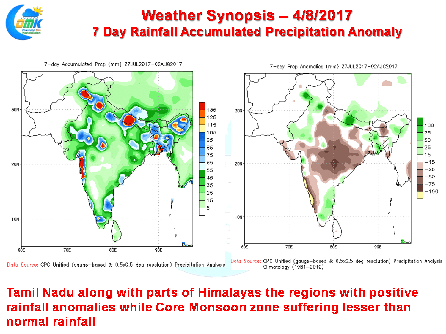
The weather bloggers of Chennai typically look out for the weak monsoon conditions in the west coast because it gives an opportunity for Tamil Nadu to look out for evening convective thunderstorms. The last 7 days rainfall anomaly charts and total precipitation charts confirm once again when the west coast is having a poor period of monsoon the East coast enjoys the best spells.
Powered by WPeMatico