
On Tuesday IMD confirmed the onset of Southwest Monsoon over the southern parts of the archipelago. IMD also expects Monsoon to further progress over entire A&N islands along with parts of Arabian Sea and Comorin Sea. It may be ironic to talk about Pre Monsoon thunderstorms immeidately after Monsoon onset. But in a season that has seen 38% excess rains it is only fair the season ends with a bang.
As things gradually turn towards monsoon dynamics it is normal to see broad area of disturbance developing. In other words called as East West Shear Zone it is an indicator of the monsoon onset window. Currently satellite charts indicate a broad area of disturbance with three cyclonic circulations embedded in it. The 1st one is near Andaman, the 2nd near AP / TN coast and the 3rd off Konkan coast. The presence of these circulations provide a conducive platform for pre monsoon thunderstorms to thrive.
Wind convergence over interior areas of Peninsular India allow the storms to bloom after convective development through day time heating. It is also pertinent to point out here the warm ocean surfaces are playing a role as well. Thunderstorms events are much stronger than model forecasts over the past couple of years. The availability of abundant moisture from warm oceans mean thunderstorms travel longer distances and sustain for longer hours. Essentially this means Pre Monsoon thunderstorms are much bigger than ever before.
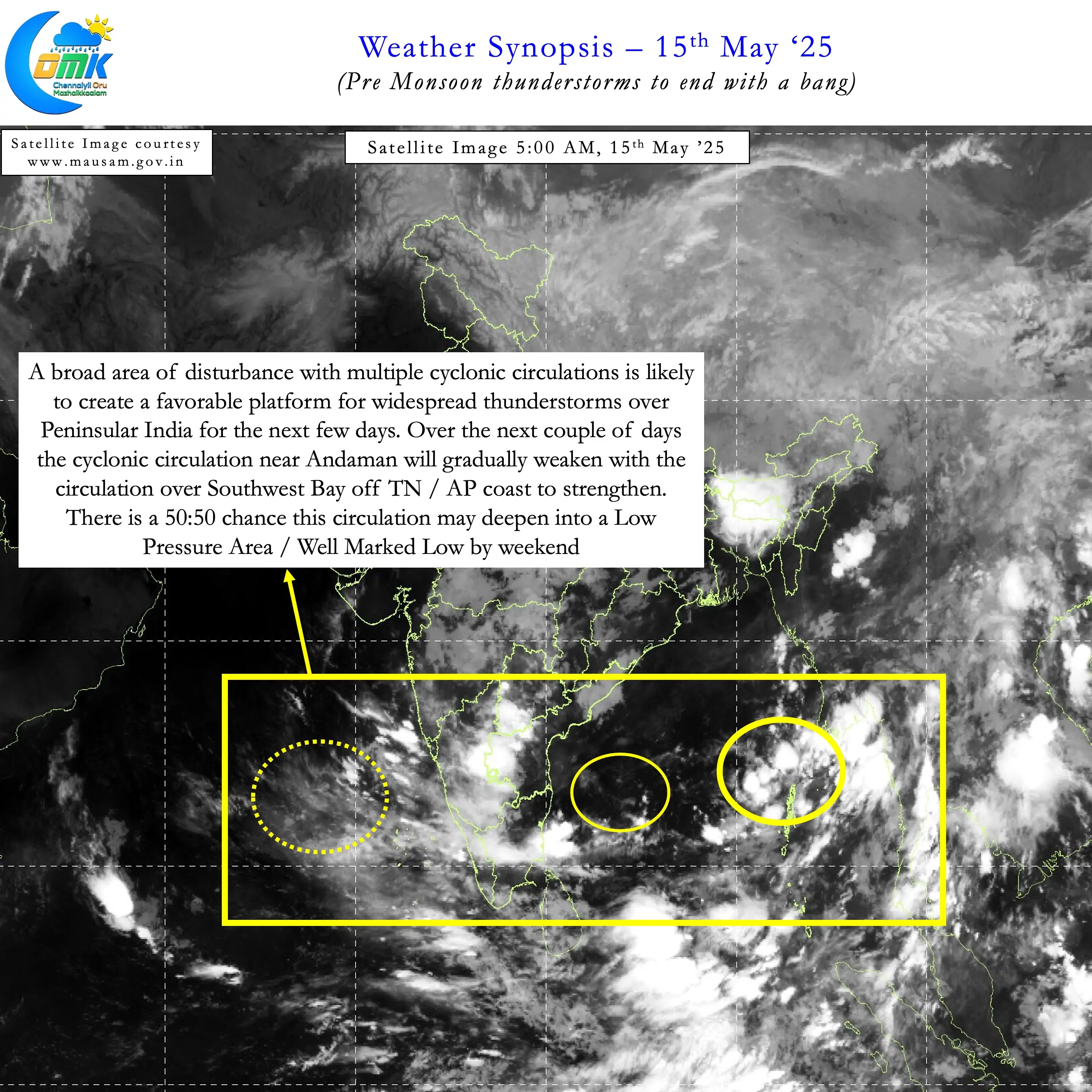
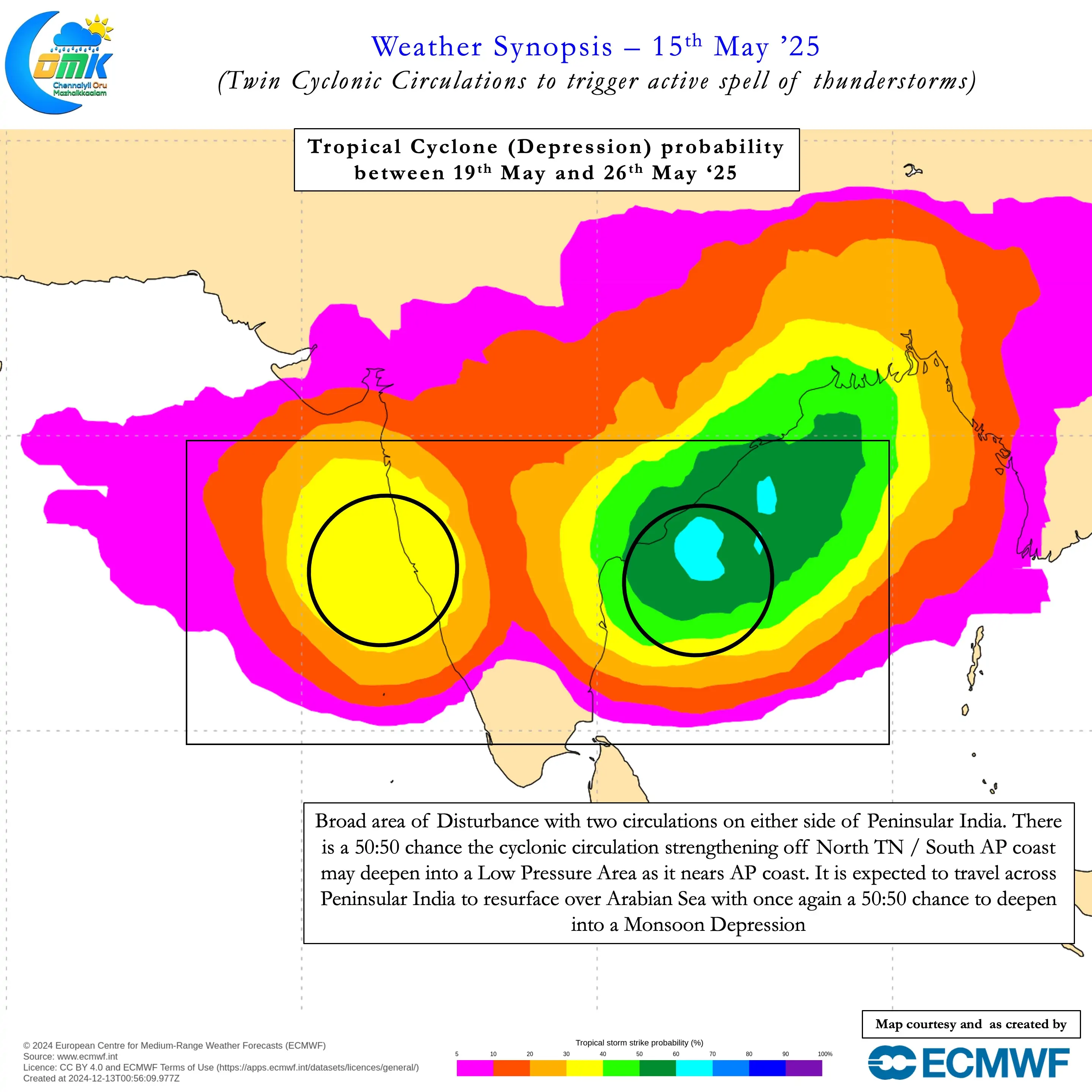
As mentioned above there are three cyclonic circulations currently prevailing. Weather models indicate the one near Andaman Sea that took help from monsoon surge may gradually weaken. As it weakens the energy may get pushed to the cyclonic circulation off AP / TN coast. There is a 50:50 chance this cyclonic circulation may develop into Low Pressure Area. Models indicate this disturbance to move across Peninsular India for the next few days. After reaching Arabian Sea once again there is a possibility it may deepen into an LPA.
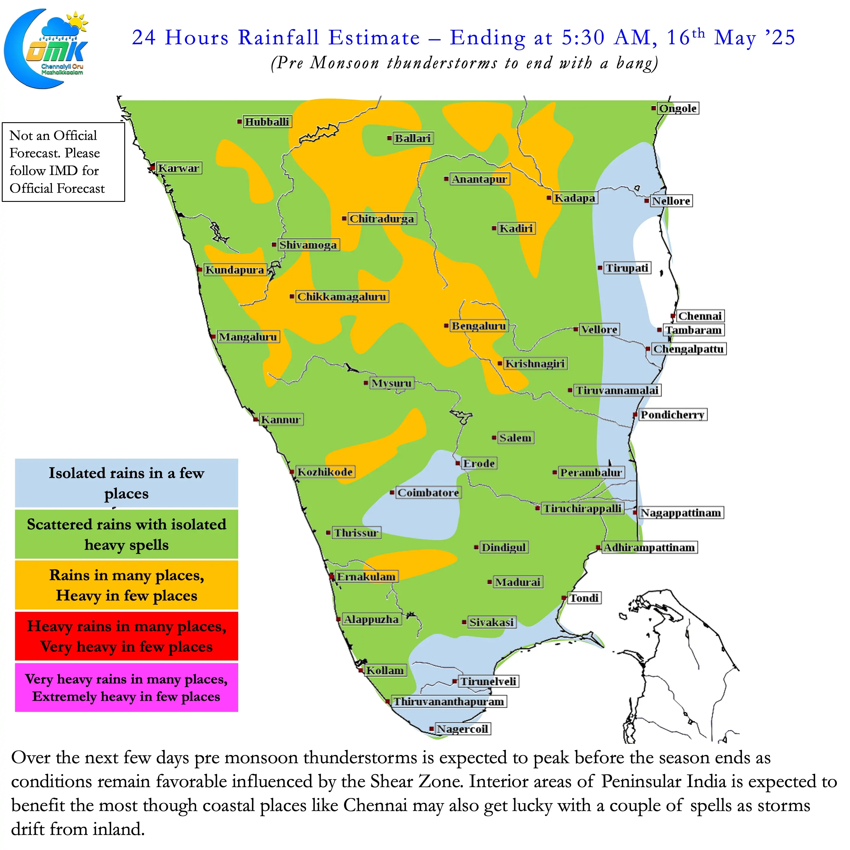
The cyclonic circulation is likely to linger around Peninsular India for the next week to 10 days. This would mean Pre Monsoon thunderstorms is likely to peak before fading away. As the East west shear zone climbs up monsoon dynamics will gradually push in from the South. This will lead to reduced thunderstorm activity over Peninsular India. South TN may be the first region to see reduction in thunderstorms followed by North TN and adjoining Rayalaseema & South Karnataka. But before that interior Peninsular India is likely to see widespread rains from thunderstorms.
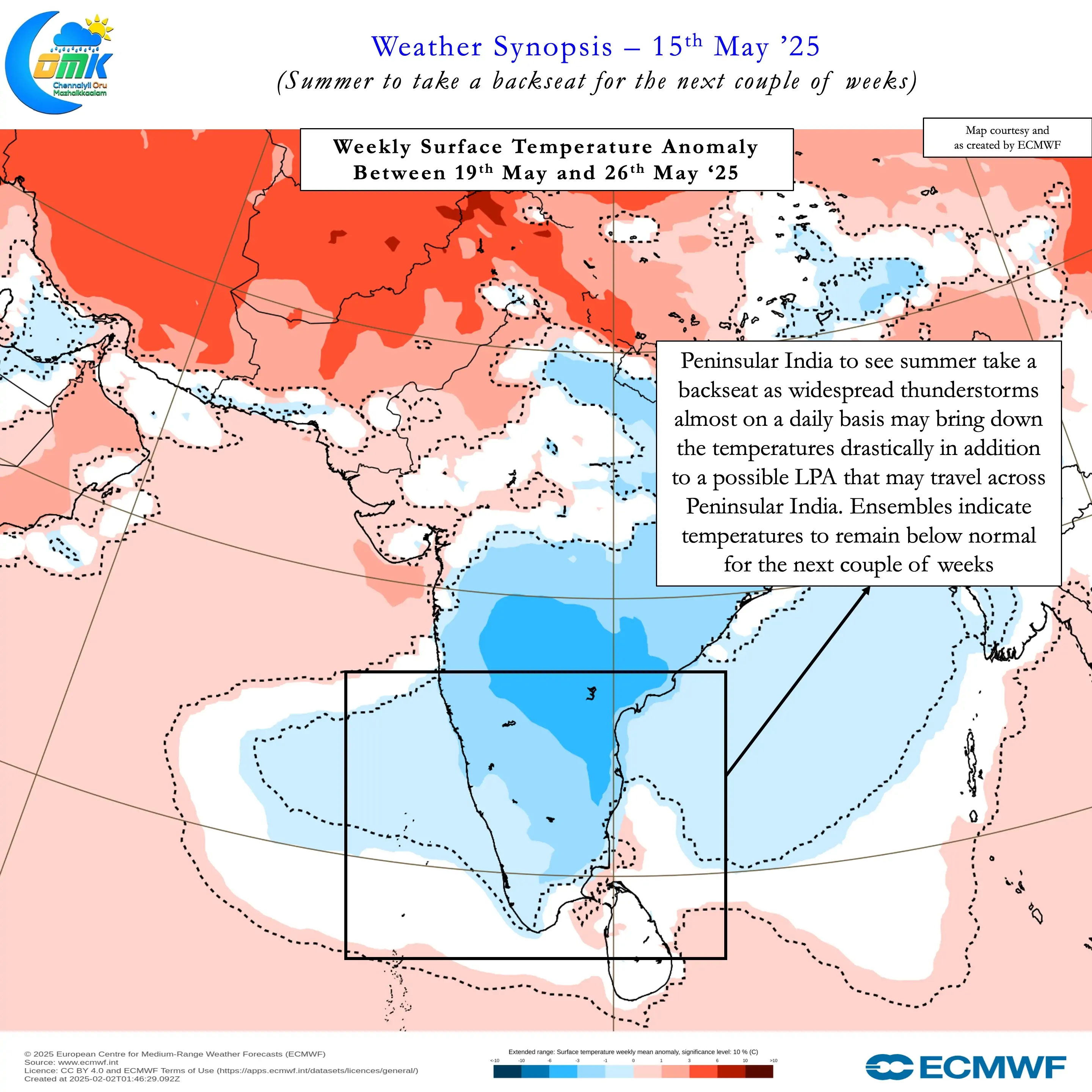
While coastal areas may see less favourable conditions normally during pre monsoon thunderstorms the presence of a cyclonic circulation may help places like Chennai. Though it may not bring in widespread heavy rains, certainly a couple of good spells of rains is likely. Additionally this spell of rains may also bring a halt to Summer for the next couple of weeks.