

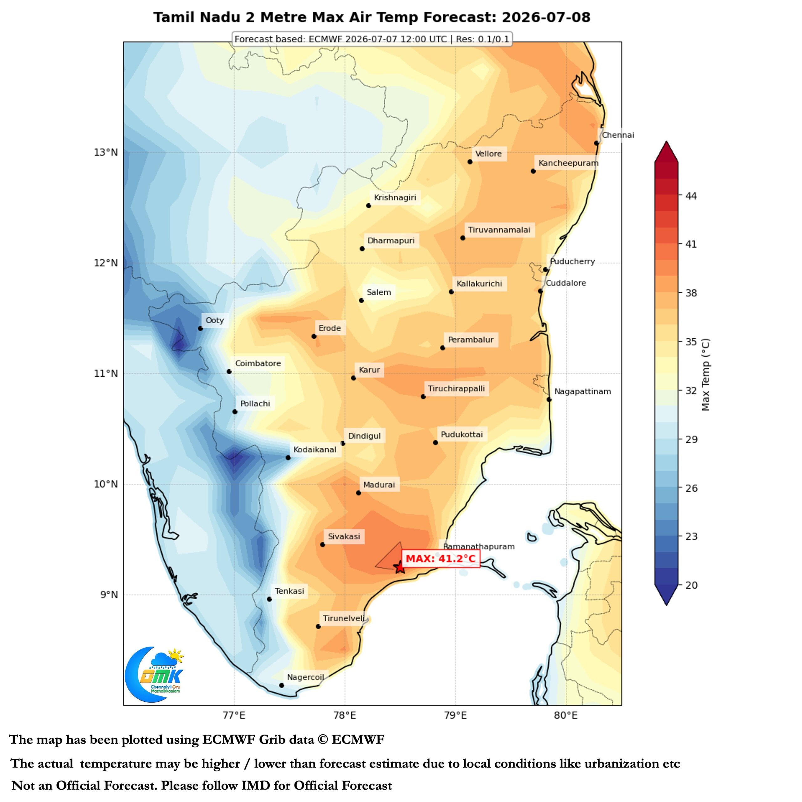
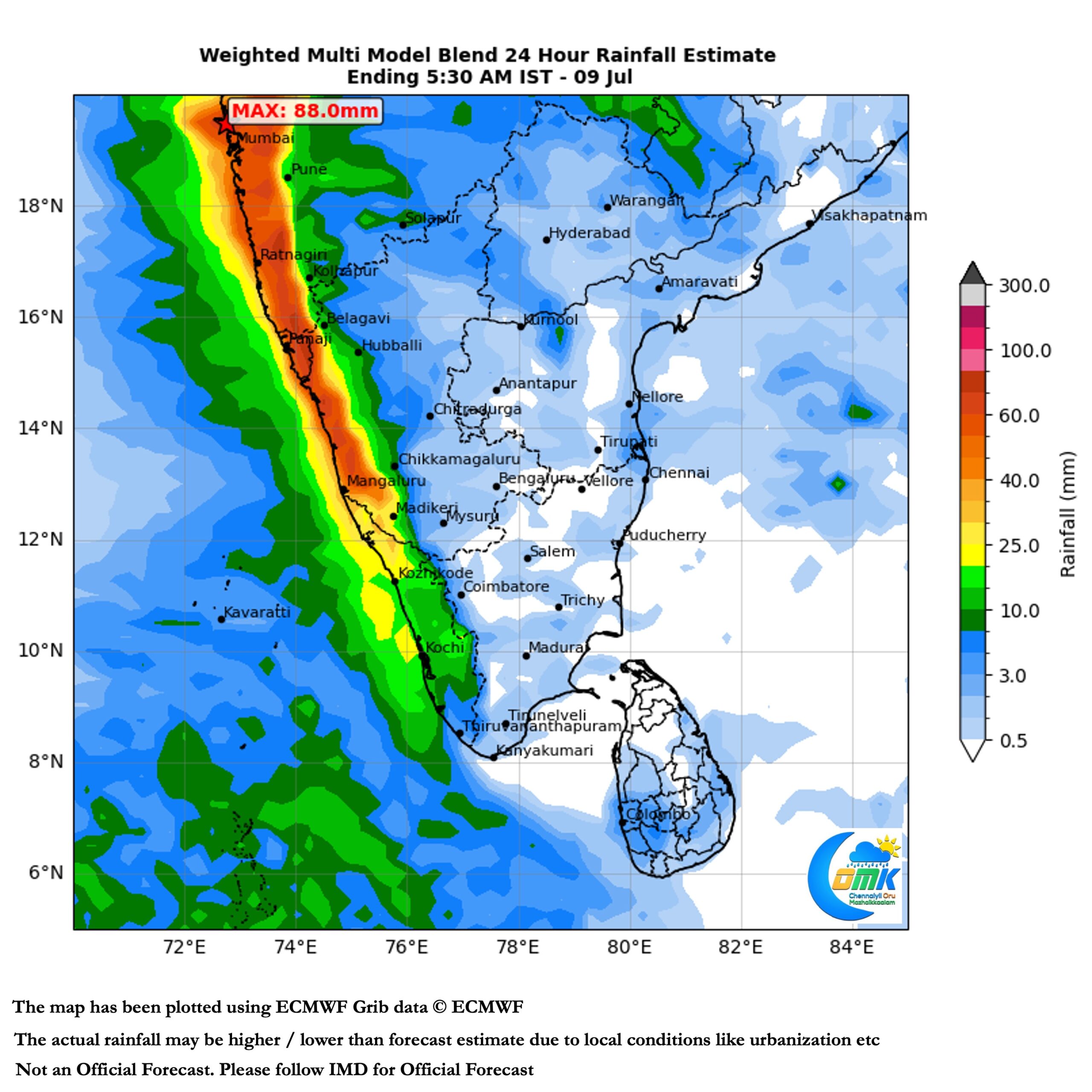
Over the last couple of days the buzz in the weather community was the extreme rainfall received over the Maharashtra Ghats. But amidst all this quietly another event unfolded down South. The plains of Tamil Nadu saw an increase in afternoon heat. Return of summer conditions across most parts of the state in the plains. Tondi in Ramanathapuram district saw two consecutive 40°C days yesterday and day before. The 40.7°C recorded on Monday is the highest ever recorded temperature for the observatory since 1959. Not only did it break the All time record for July but broke the overall All time record too.
Going by the forecasts for the plains of Tamil Nadu there is a very good chance of hat-rick 40s for Tondi. Not only that there is a good chance it may hit highest max temperature once again. The first few days of July saw monsoon not only pick up but bring exceptional rains to the Konkan coast. In a way the quick transit of MJO across Indian Ocean and Maritime continent played a role in this. Additionally support from BSISO under favourable Phase 5 meant Central India and adjoining Konkan saw extreme rains. While Coastal Karnataka and Kerala did see the revival of rains it once again flattered to deceive.
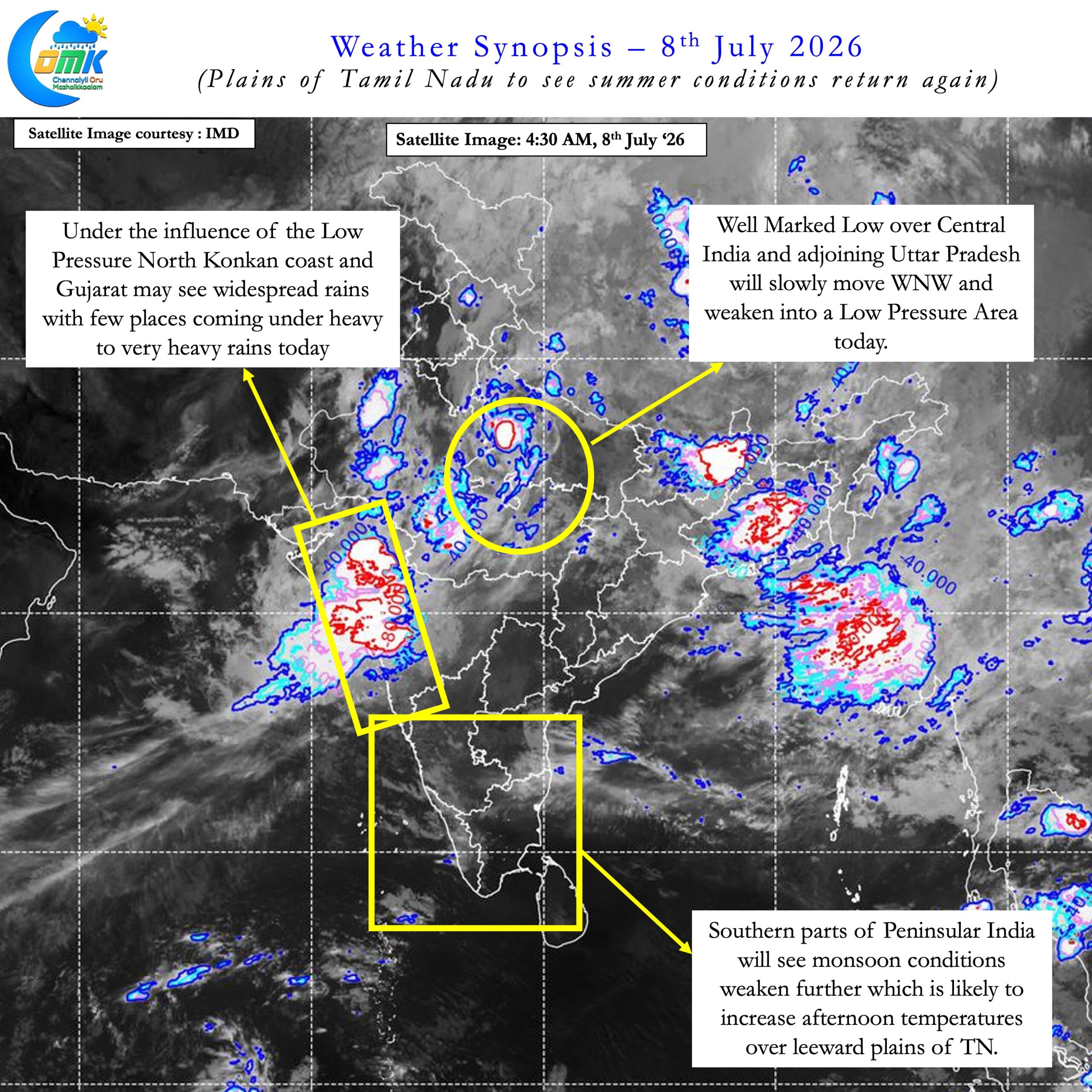
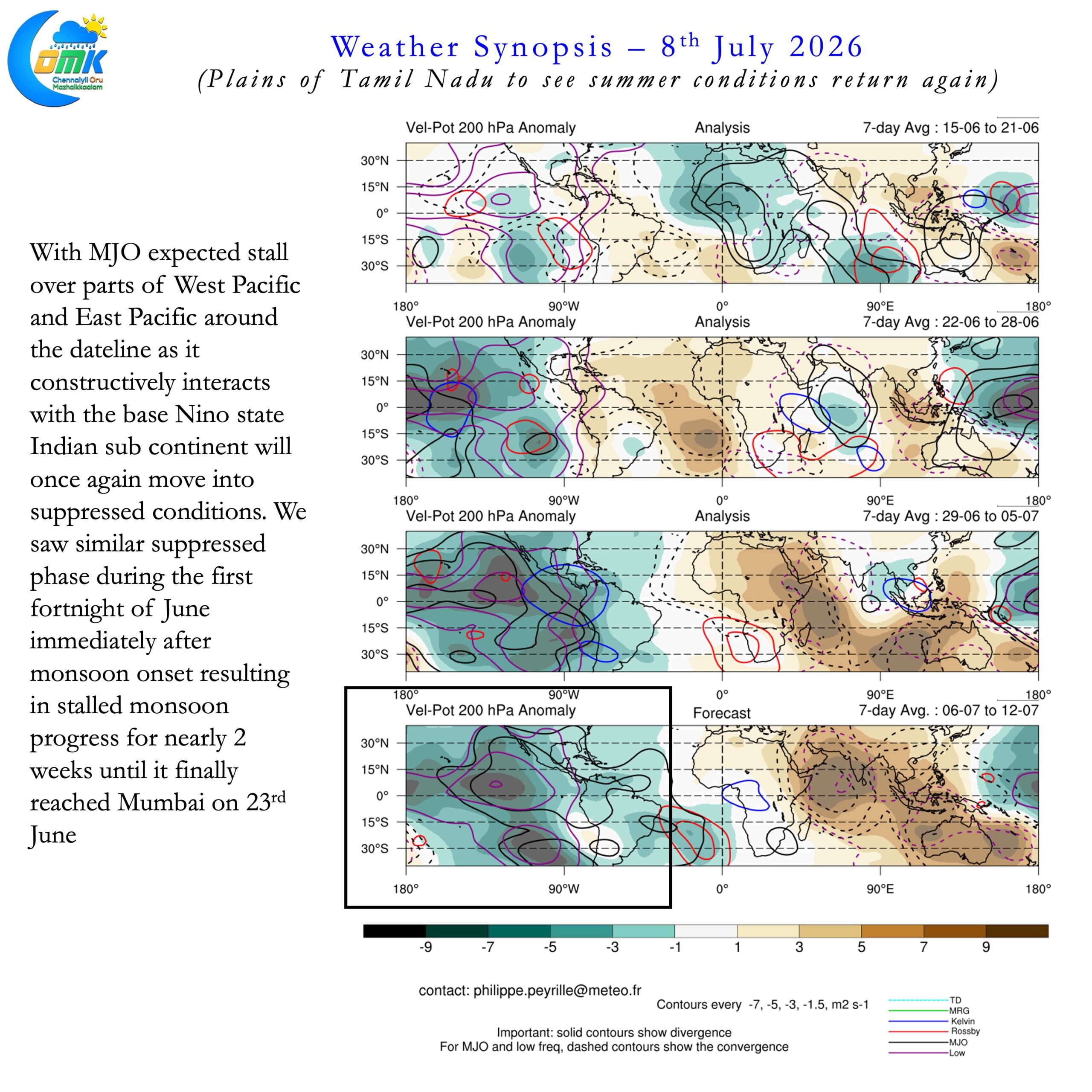
BSISO is now likely to push into Phase 6 / 7 going by forecasts. Additionally MJO is likely to stall over West Pacific / East Pacific as it constructively interferes with the Base Nino. This could bring back suppressed conditions over Peninsular India. We saw similar conditions during the first fortnight of June when monsoon progress collapsed after reaching South Konkan. For nearly 2 weeks the Northern Limit remained around Harnai.
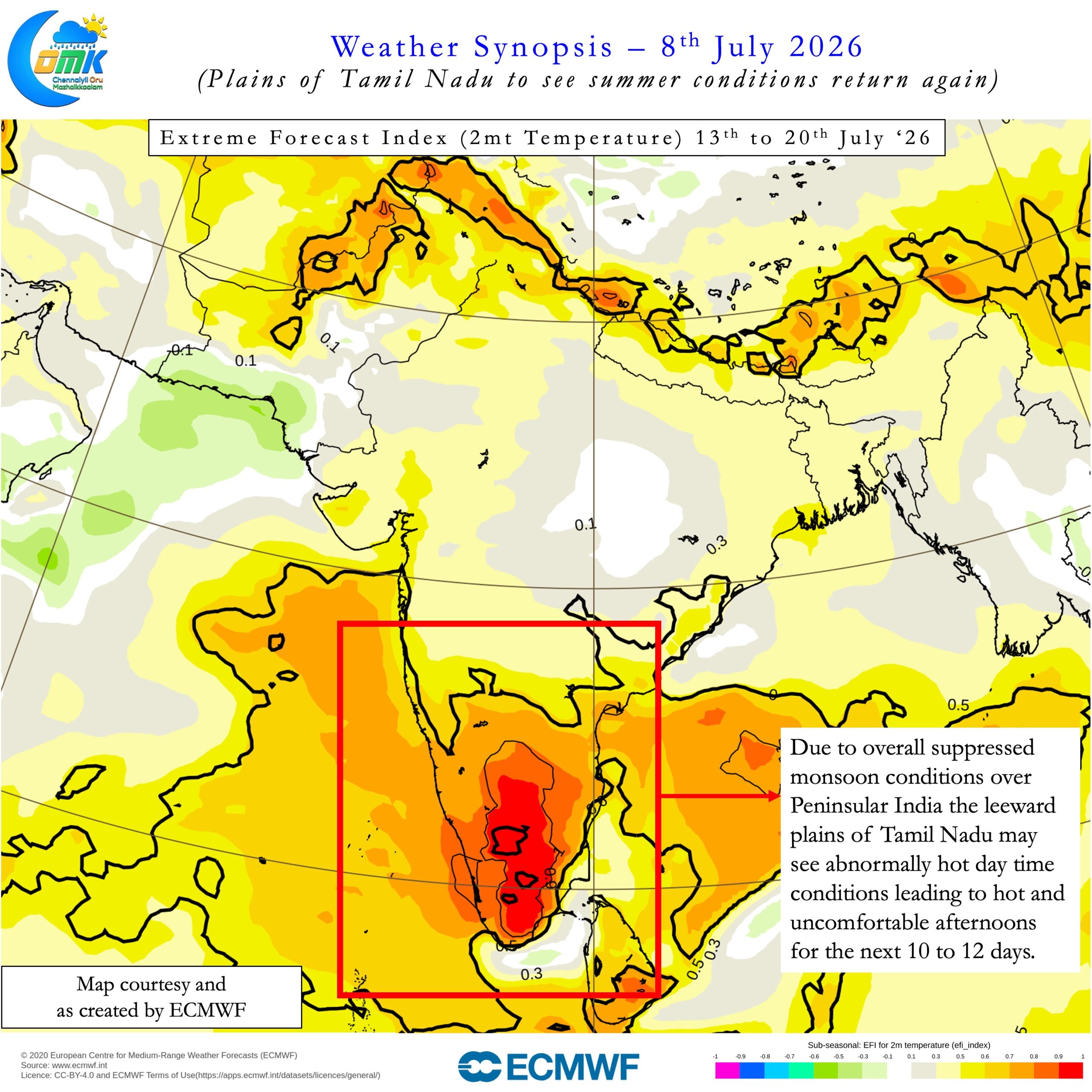
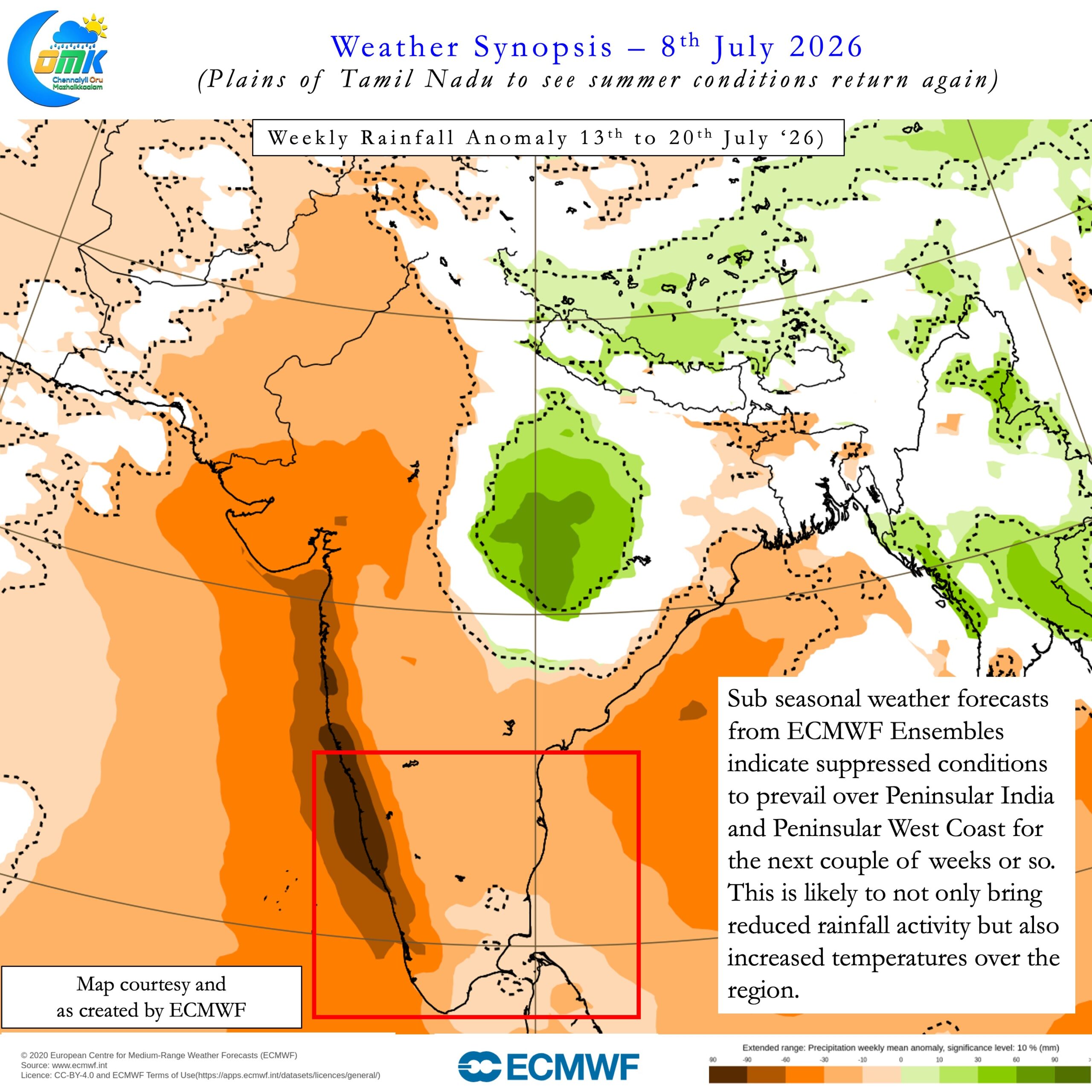
This suppressed phase also coincided with the period when Chennai AP recorded 8 consecutive days of 40°C or more. Now sub seasonal weather models indicate similar conditions to prevail. Precipitation charts show below normal rains over Peninsular India for the next couple of weeks. Simultaneously 2 metre temperature extreme forecast index also indicate anomalously hot temperatures. Overall this could effectively mean return of summer conditions over the plains of Tamil Nadu once again. We need to wait and watch to see if a classic break in monsoon unfolds. If so then we may get some respite in the form of thunderstorms over the leeward plains of Peninsular India. Weather models indicate weak thunderstorm activity over some parts of TN in the next few days.
Chennai and suburbs will continue to see hot afternoons with delayed sea breeze arrival making it uncomfortable. There is a very slight chance tomorrow we may see some thunderstorms. But overall week or two we may have to live with summer conditions once again.