
Southwest Monsoon got off to a strong start this season covering almost half of the country before MOK. The monsoon surge was so strong over the past few days even the leeward plains of Tamil Nadu saw rains. Yesterday Chennai and suburbs saw multiple spell of rains from afternoon to late evening. This spell also meant the summer heat took a back seat over the plains of Tamil Nadu.
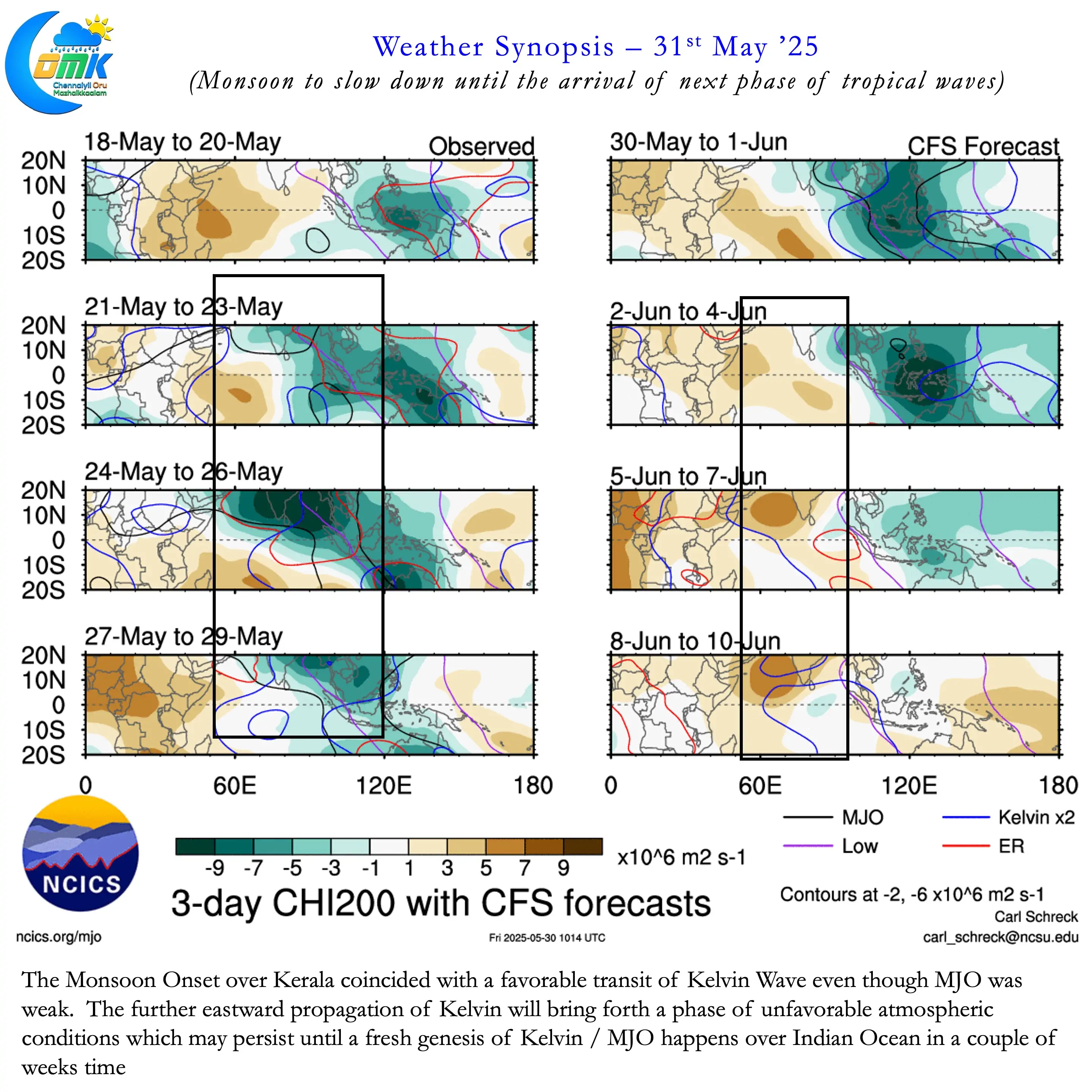
Favourable transit of Kelvin wave during the second fortnight of May set the platform for Monsoon onset. Over the past many weeks MJO has been struggling against the transitioning base state. This is likely to continue for the next month or two before a gradual return of La Nina is anticipated . The return of La Nina may change things around. During this period we are likely to see strong monsoon intra seasonal oscillation alternating between wet and dry periods. This may create a set of complications for agricultural community which expect traditional monsoon dynamics.
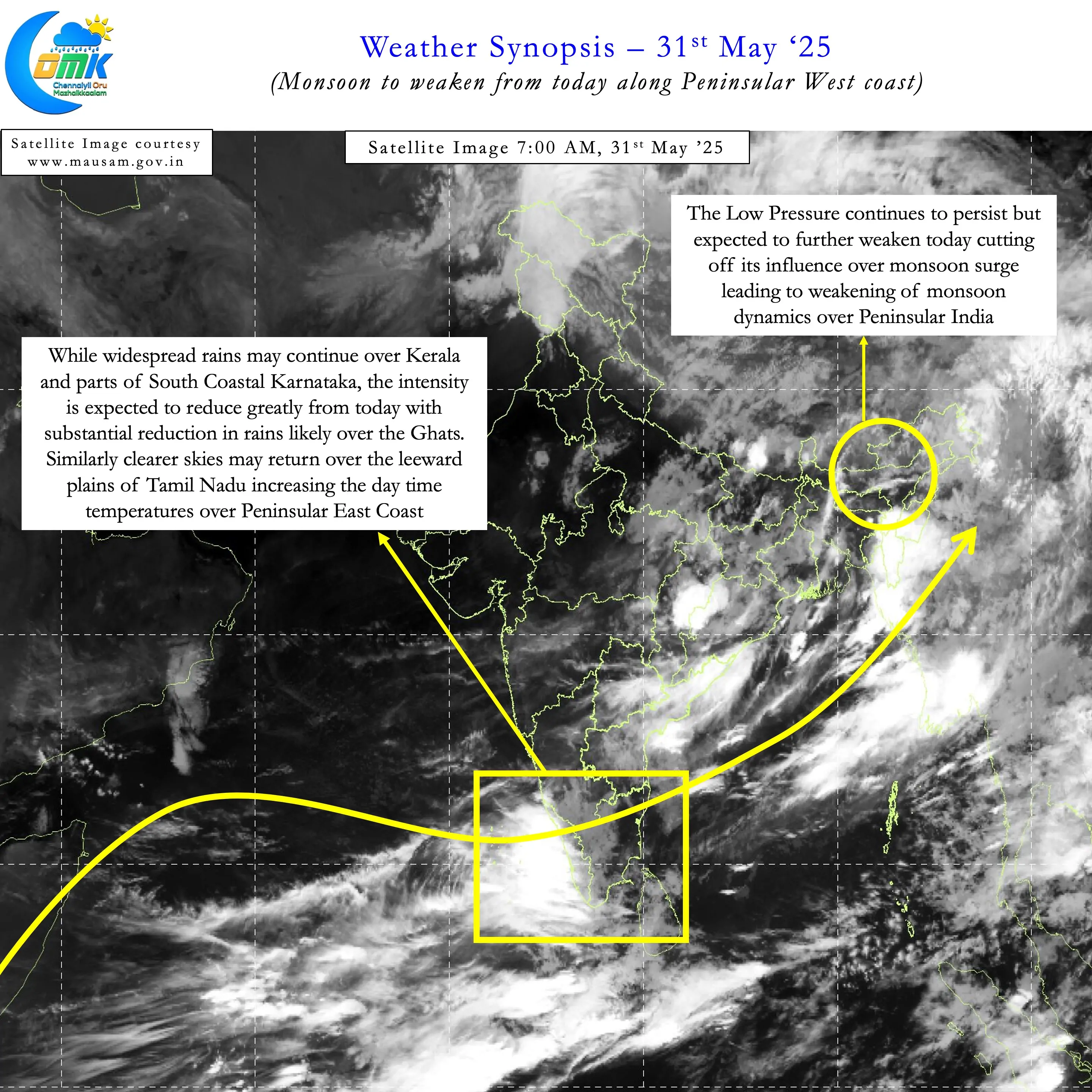
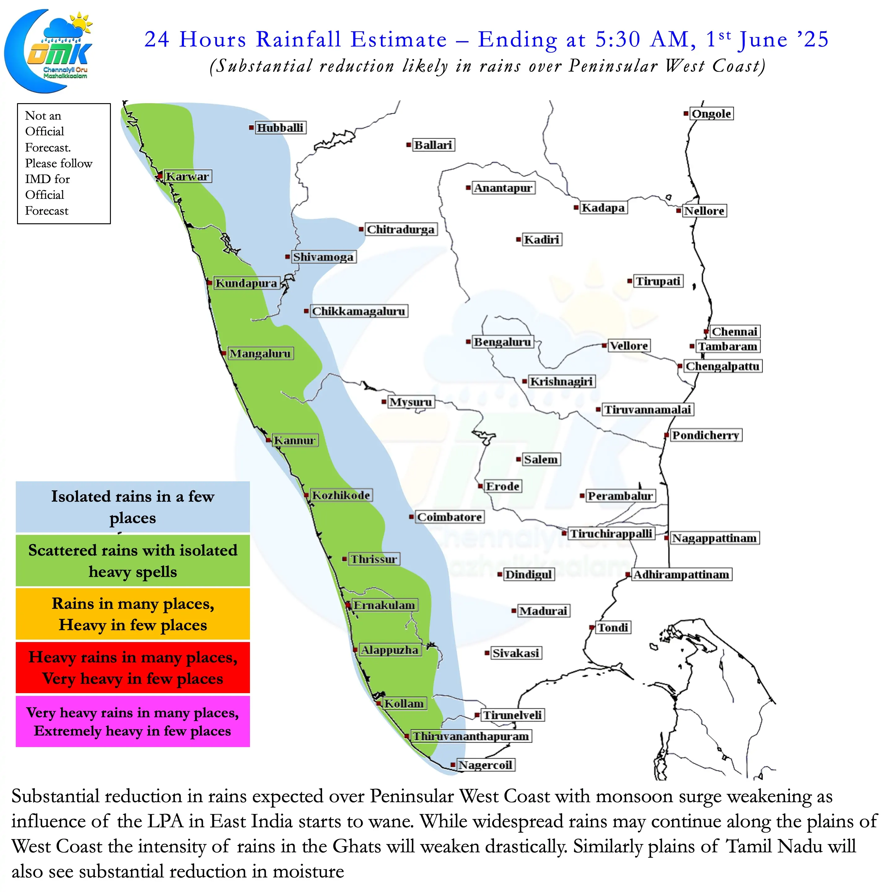
Monsoon surge over the last couple of days was primarily driven by the Depression over Head Bay. With the circulation now weakening and heading north its influence has started to wane. Yesterday was an indicator of the waning influence as contrary to model expectations Ghats received much lesser rains. Traditionally Ghats score the most when the surge is strong. Coasts score the best when there is no visible surge to monsoon or it is slightly weaker than normal.
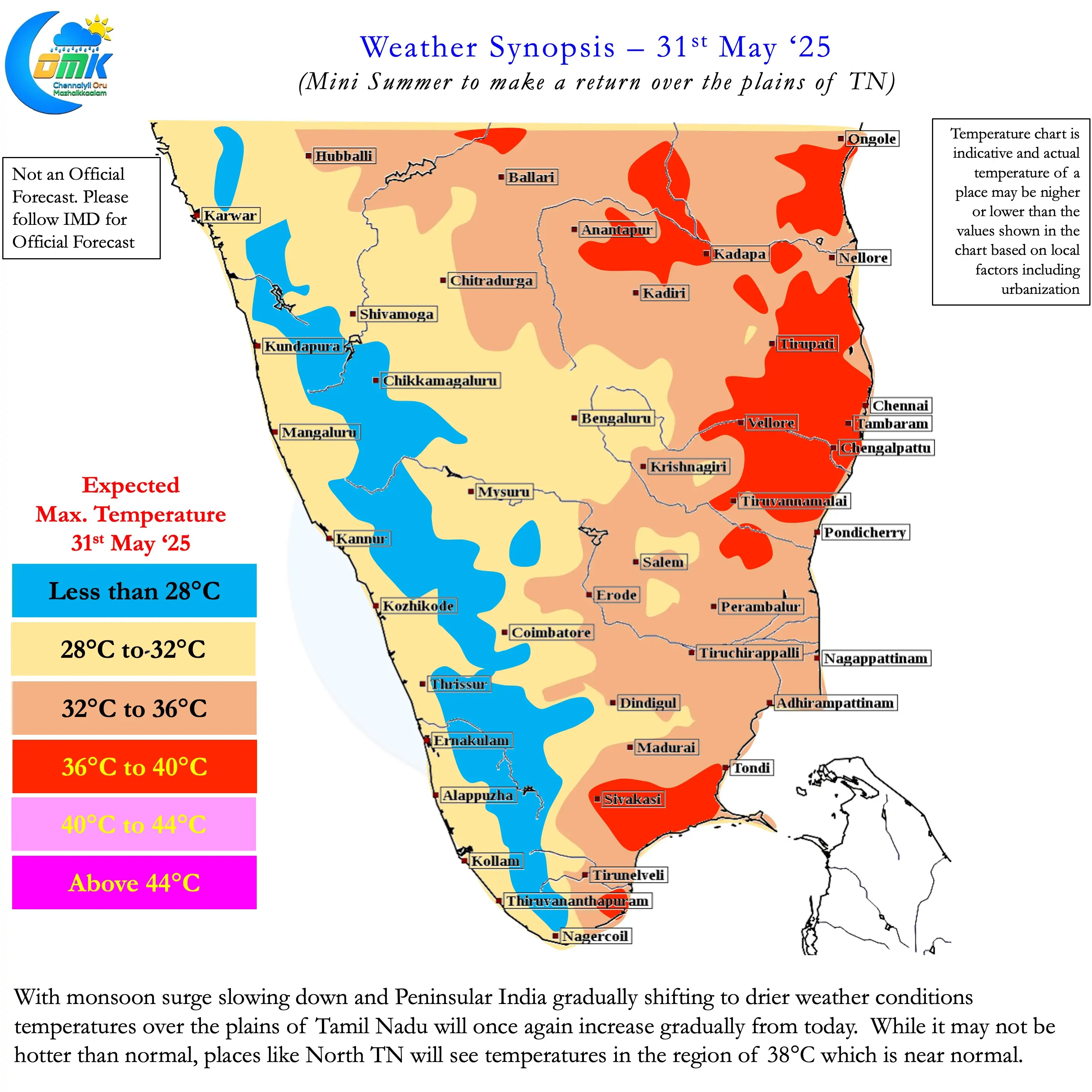
Additionally this would also mean the plains of Tamil Nadu may also go through phases of mild and strong summer. Drier weather conditions when monsoon dynamics is weak may lead to clearer skies. Clearer skies with stiff westerlies mean near normal or above normal day time temperatures. Additionally sea breeze may also make a delayed appearance due to the presence of westerlies. The upcoming couple of weeks may see a return of mini summer for places like Chennai.
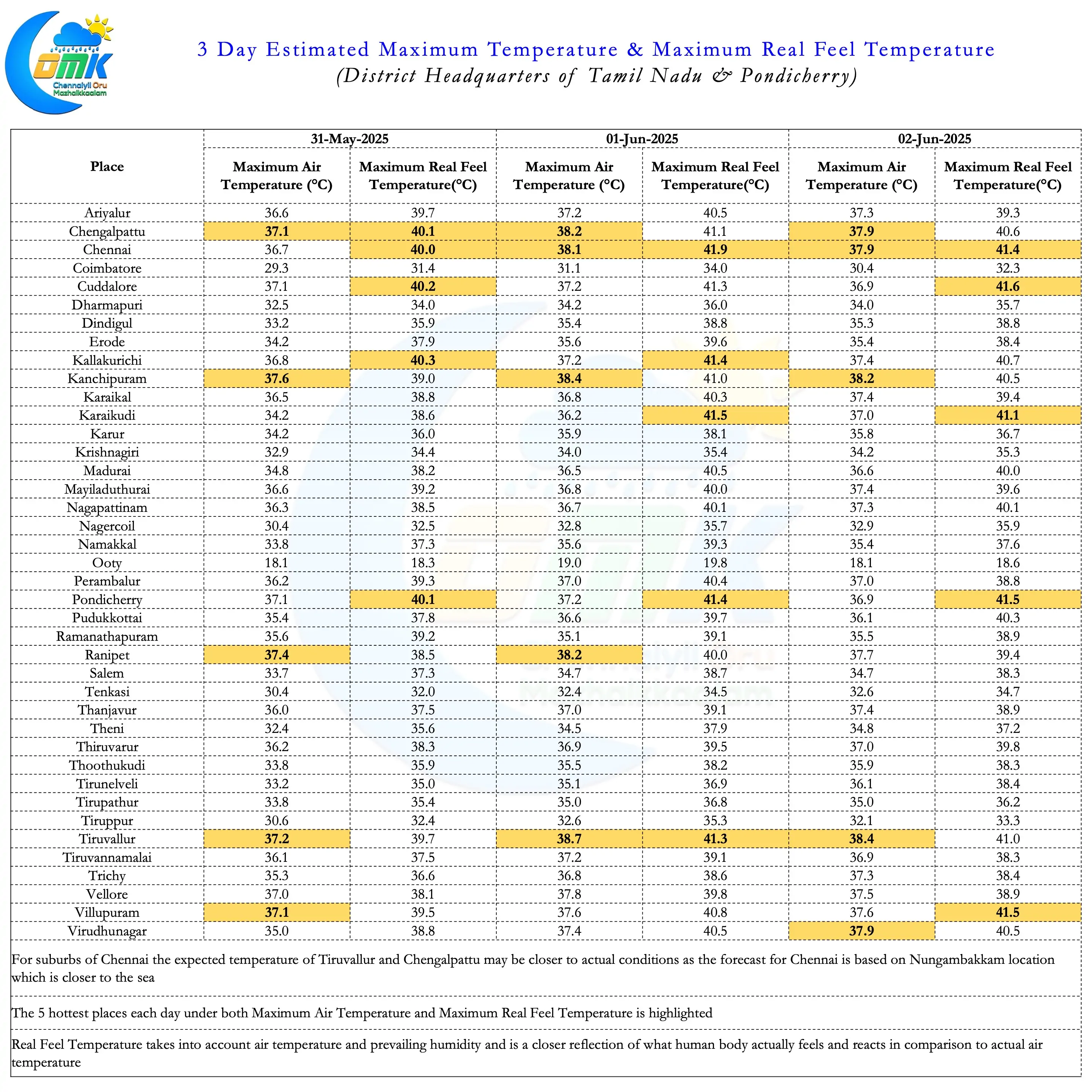
Weather models indicate temperatures to stay near normal or slightly above normal during this period. This could mean maximum temperatures over North Coastal TN may once again head back to the high 30s. The good news though is there is less chance for hitting the low 40°C. But on occasions a few places in the plains of Tamil Nadu may touch 40°C in the upcoming days. Another good news is the possible return of convective thunderstorms. A couple of days down the line we can see convective thunderstorms develop over the leeward plains of Tamil Nadu. As we get to second week of June a possible Cyclonic Circulation over South / Central Bay may bring another active phase of thunderstorms for leeward areas of TN. Just before monsoon onset we witnessed one such active phase which brought in the best phase of Summer Rains this year for TN & PDC.
From today we can expect the plains of TN to hit maximum temperatures of around 36 / 37°C. Weather models indicate some more increase from tomorrow. It is highly possible North Coastal TN may be the hottest part of the state for the next couple of weeks. As always one can check the COMK Estimated Rainfall Range to keep a tab on what is expected. This page features both short and medium range rainfall estimates.