
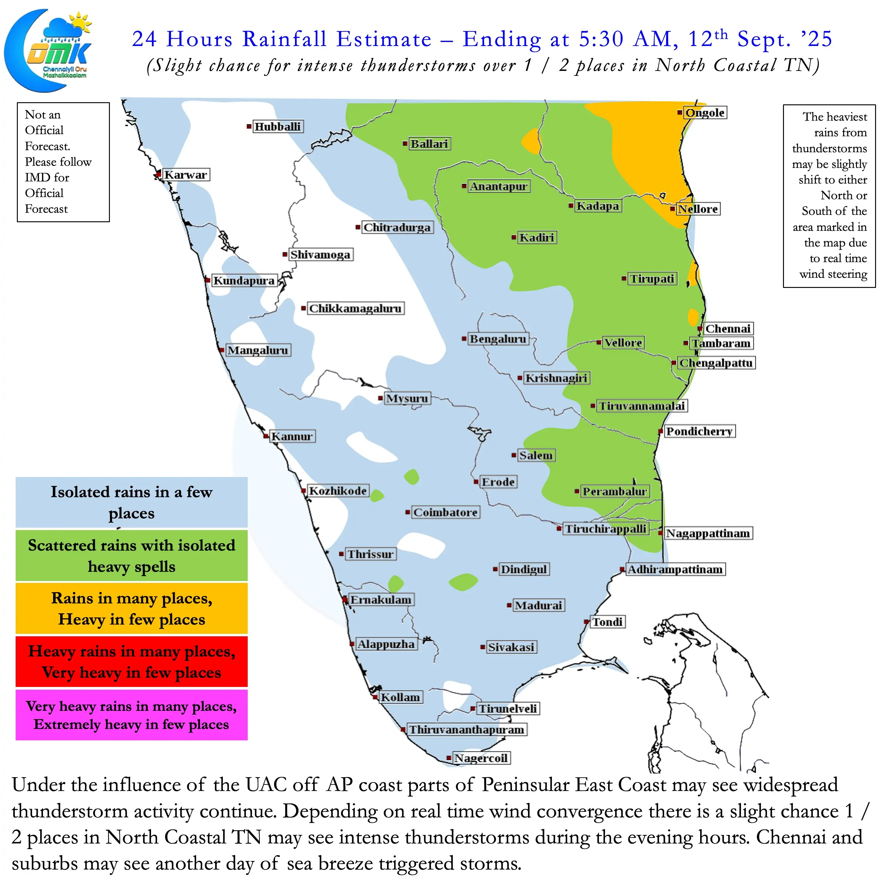
Over the past few days parts of interior Tamil Nadu saw some much needed rains through thunderstorms. Districts like Karur, Dharmapuri, Namakkal, Trichy that were in negative zone for the season benefitted from these rains. Even parts of Chennai got good rains last evening from scattered thunderstorm activity. Peninsular East Coast benefits when westerlies slow down. Wind convergence under the influence of the UAC enhanced the the intensity and spatial spread of thunderstorms.
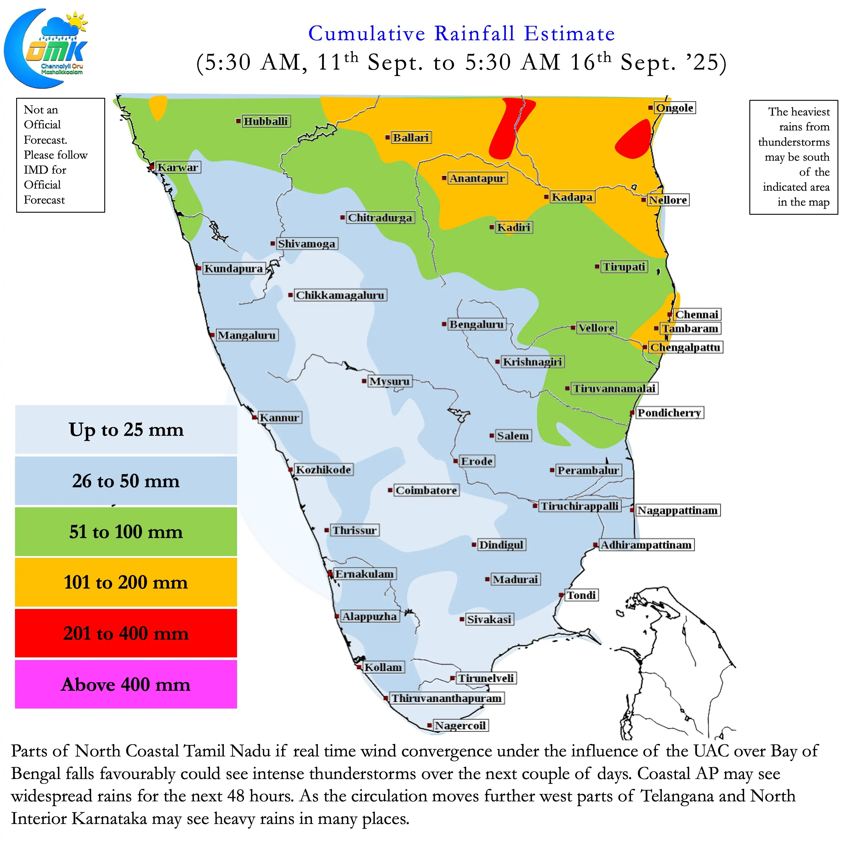
The seasonal daily rainfall charts of Tamil Nadu & Pondicherry and Kerala captures in essence the swinging monsoon dynamics. When the rains slow down over Kerala the peaks start to appear in the TN & PDC chart. As of yesterday for the month of September Telangana is the only meteorological sub division that is in positive over South India. With Peninsular East Coast likely to see thunderstorms persist Coastal AP and Rayalaseema may move into positive zone for the month in the next couple of days.
Over the past few months we have seen Kelvi and ER waves drive global atmospheric conditions rather than MJO. MJO has been struggling to put a coherent circulation across the globe. Often getting disrupted the enhanced convective base state over the Maritime Continent. The near stationery movement of MISO over Maritime Continent has brought about an anomalously rainy monsoon season over Central India. When a fresh pulse of MJO takes genesis over the Indian Ocean it favours Peninsular India.
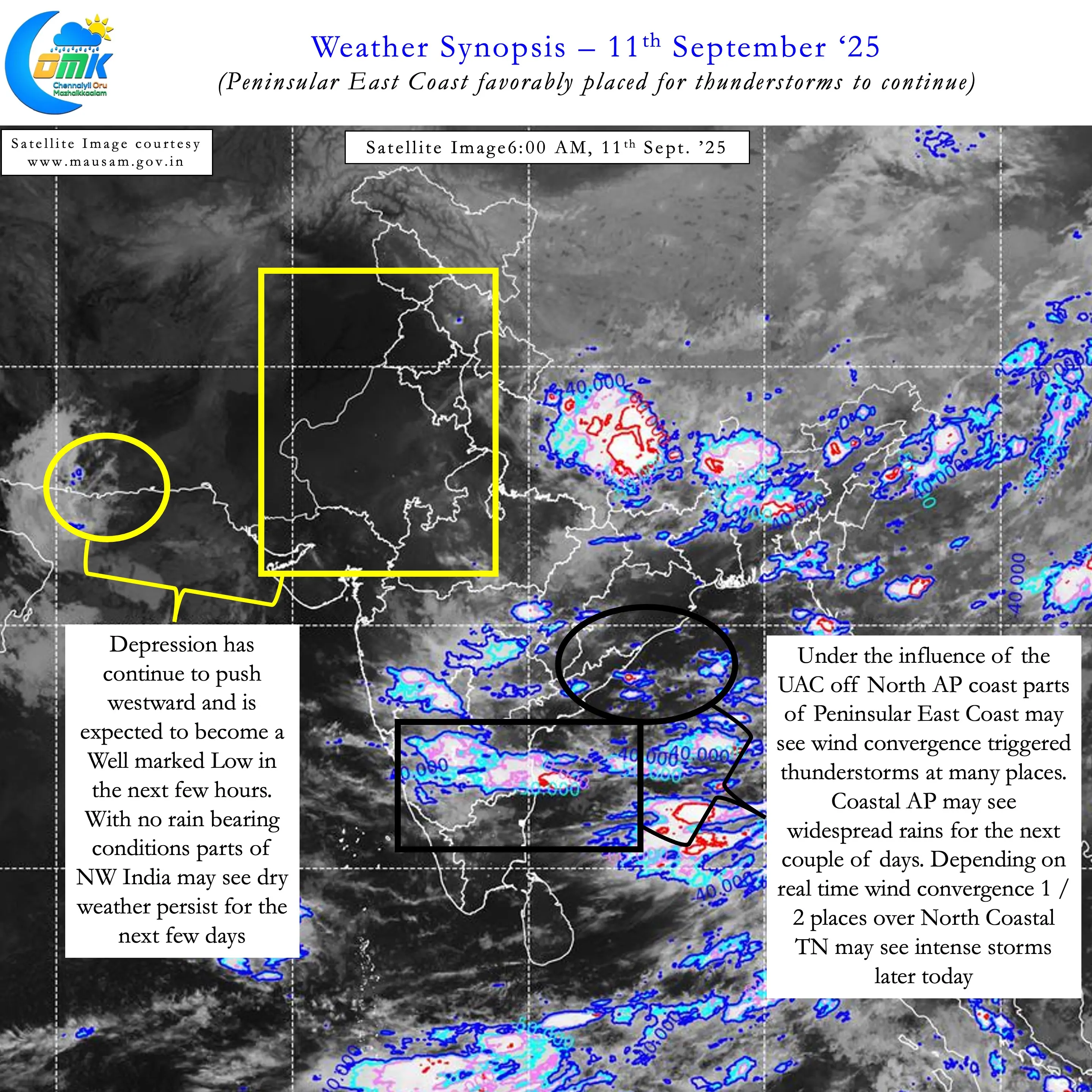
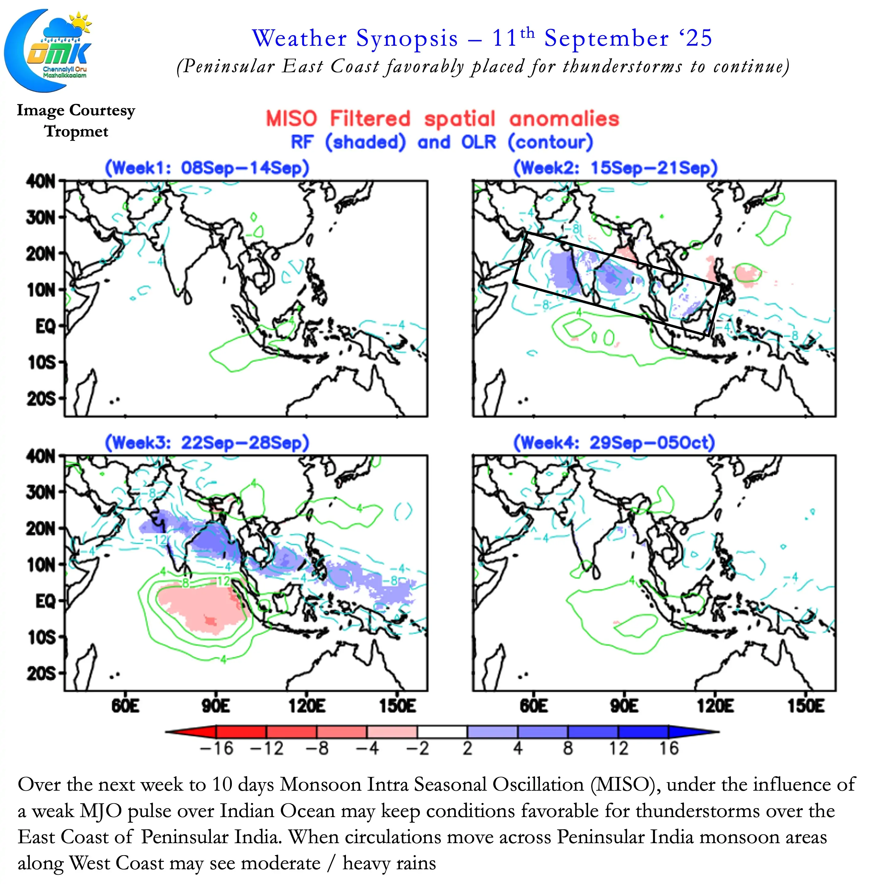

During peak monsoon period this normally favours west coast in the form of active monsoon dynamics. With things gradually shifting towards transition the current weak MJO associated MISO is unlikely to enhance monsoon dynamics. This could potentially mean Peninsular East Coast may benefit out of this phase of favourable MJO / MISO influence. Bulk of this may translate into thunderstorms for Coastal AP and Telangana. This is because of the location of the UAC currently persisting off North AP Coast. As the circulation moves across Peninsular India the rains may increase over interior areas and eventually West Coast.
North Coastal TN though is a unique place that could potentially benefit from favourable conditions over both South AP and North TN. Over the next couple of days if real time wind convergence helps we may see intense thunderstorms in a few places over North Coastal TN. This could also benefit Chennai and suburbs as the UAC gets closer to the coast. While this does not mean rest of Tamil Nadu gets into drier weather completely. Over the next couple of days the widespread thunderstorms that the state saw may not happen.
But overall September may continue to favour the leeward plains of Tamil Nadu with enhanced thunderstorm activity. Looking a little further the current spell of dry weather over NW India due to the westward movement of the depression may set the stage for monsoon withdrawal conditions. But we may have better clarity on this in a few days.