
The North Indian Ocean basin is a much more closed basin unlike Pacific and Atlantic. Because of the closed nature it borrows a lot from West Pacific and South China Sea. It borrows moisture during Northeast Monsoon time. It borrows disturbances from South China Sea to trigger cyclones in Bay of Bengal. The closed nature also is one of the reason why multiple disturbances happen rarely. But Bay of Bengal has always been very demanding of weather models. We had seen last year during Fengal models missing on a stall scenario off Sri Lanka during its early stages. This year has also been anything but a cakewalk. Now we have a pair of circulations that is sending models into a tizzy once again.
Right through Northeast Monsoon 2025 season we have had multiple vortices giving tough time to models. During October we had three circulations embedded in the East West Trough. One of it became a depression in Arabian sea and the other became Cyclone Montha. Now we have a pair of circulations, one off Sri Lanka and the other coming in from South China Sea. A week back most numerical models expected a pulse from South China sea to SE Bay and become a LPA. Subsequently it was shown to intensify into a depression NE of Sri Lanka. In the final leg these models pushed it as a Cyclonic storm over Peninsular East Coast. Some brought it closer to TN while a few pushed it towards Coastal AP.
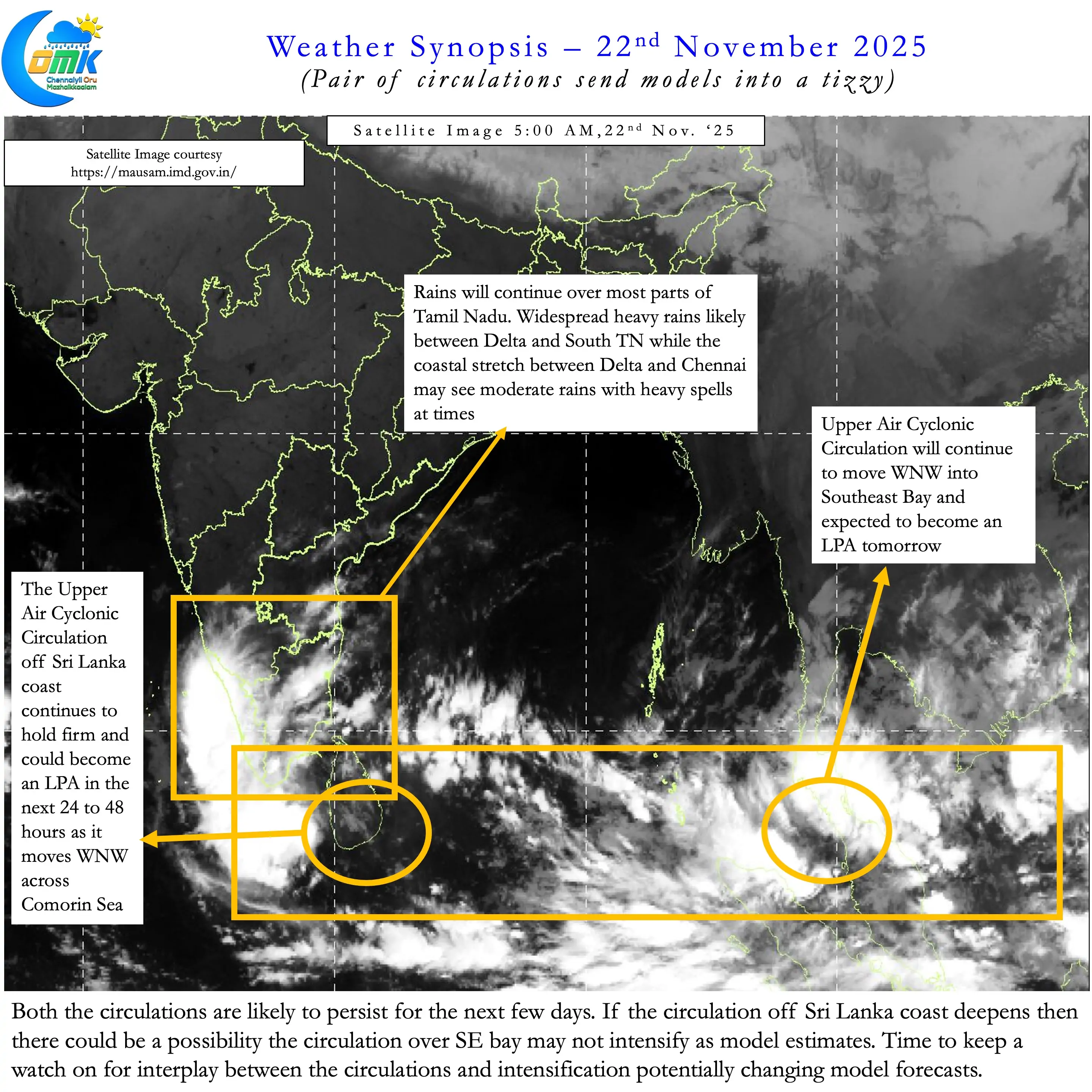
All the while except for Machine Learning models other models never gave weightage to the UAC developing off Sri Lanka. Last week we saw under similar conditions an LPA develop and move across Comorin Sea. This one brought an end to the dry spell giving good rains to parts of Delta and South TN. So for some bloggers it was a surprise to see a this model behaviour. Over the last couple of days numerical models had started intensifying the SE Bay pulse into a strong cyclone taking it further away from Peninsular India.
All the while though the UAC off Sri Lanka continued to persist. Not only did it persist but has managed to retain its individuality. This now means we are likely to see the pair of circulations fight a battle for dominance. A scenario where we could possibly see slow movement / near stationery movement of both these circulations. This is likely to re alter how models look at the next week to 10 days. Keeping this in mind it becomes imperative to look at only the next couple of days.
The Key take aways for the next couple of days. For the time being we are going to ignore the SE Bay circulation. We will allow it to develop at its pace while we keep a tab on the developing LPA off Sri Lanka.
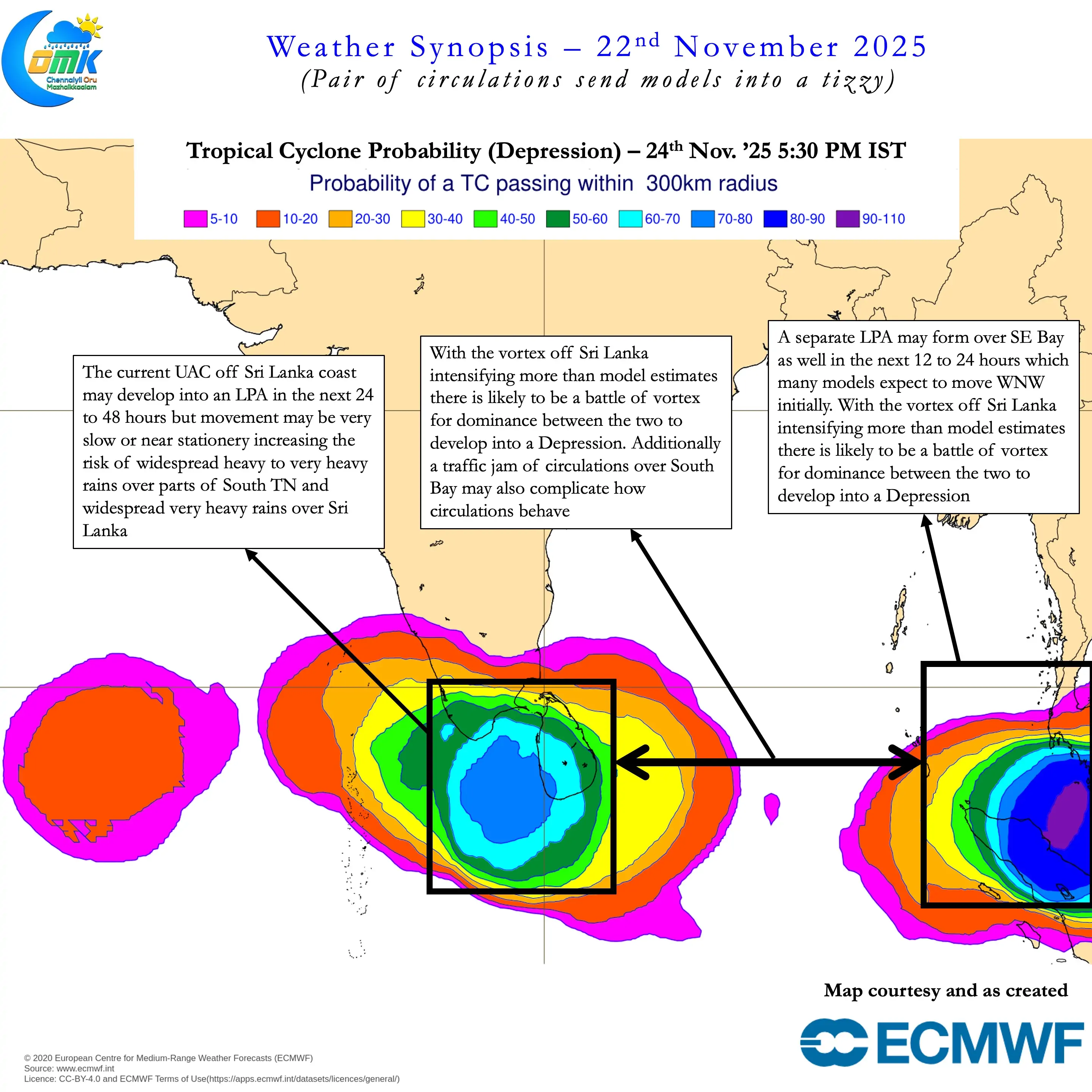
- There is a high chance two Low Pressure Area may develop over North Indian Ocean.
- The first one could be over Southeast Bay as expected by IMD for the LPA to form today
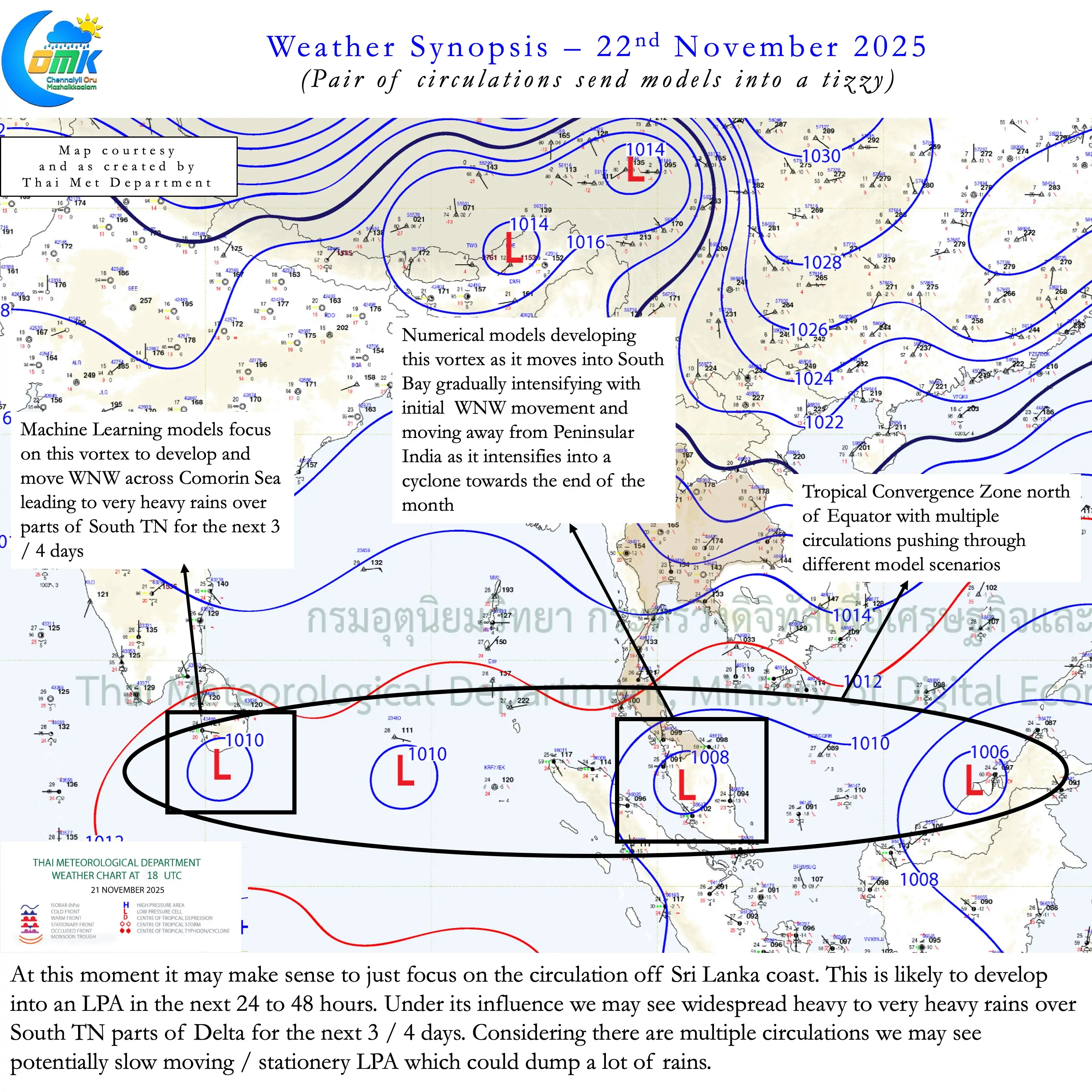
- The circulation over Southwest Bay off Sri Lanka continues to persist and has deepened opening a window for it to develop into an LPA separately
- This development of LPA over Comorin Sea is constantly picked up by Machine Learning models with slow movement / near stationery movement in the vicinity of Sri Lanka. It is also shown by a few ensembles of numerical weather models as well.
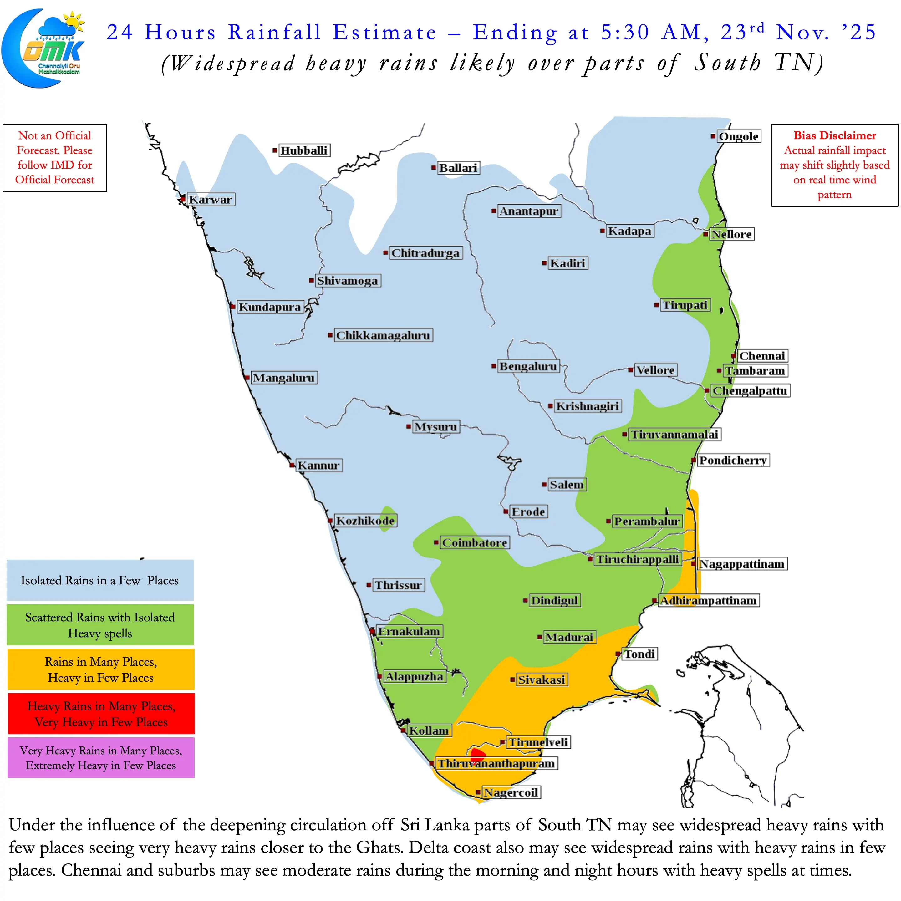
- This slow movement / near stationery movement could lead to widespread very heavy rains over Sri Lanka and wide spread heavy to very heavy rains over parts of South TN for the next 3 / 4 days.
- Delta is likely to see widespread rains during this period with many places seeing heavy rains for the next couple of days.
- North Coastal TN including Chennai may see monsoon conditions persist for the next couple of days with moderate rains during the night and morning hours. At times the spells could be heavy.
- The next 24 to 48 hours may see changes in numerical weather models as the two circulations try to become dominant.
- There is a change these could push back and forth to merge into a fresh circulation East of Sri Lanka. As of now this development is not shown by weather models though.
- It makes sense to just look at things for the next 2 / 3 days focus on the developing LPA off Sri Lanka that could potentially increase the risk of localized flooding over parts of South TN