
Northeast monsoon may not be as fanciful as Southwest Monsoon, it may not be as critical to the food security of the Indian subcontinent as southwest monsoon, surely the scale of northeast monsoon is incomparable to southwest monsoon. But still it catches the imagination of a lot of weather bloggers who spends days and sleepless nights scanning every bit of the horizon stretching all the way from Western Pacific to south Indian ocean looking for each and every cue that could throw light on the next set of events that is likely to come.
Time to time despite the advances of numerical weather models the sting in the tail of northeast monsoon catches everyone off guard. Many a times we have seen cyclones bloom contrary to estimates and die a quick death right in front of our eyes when models predict its best phase ahead of it. In a way being a less studied cousin of southwest monsoon is possibly one of the reasons why sometimes these stings come like a bolt out of the blue. It is in this context this book from Dr Madhavan Rajeevan, former secretary MOES, is going to be on the wish list of many weather bloggers.
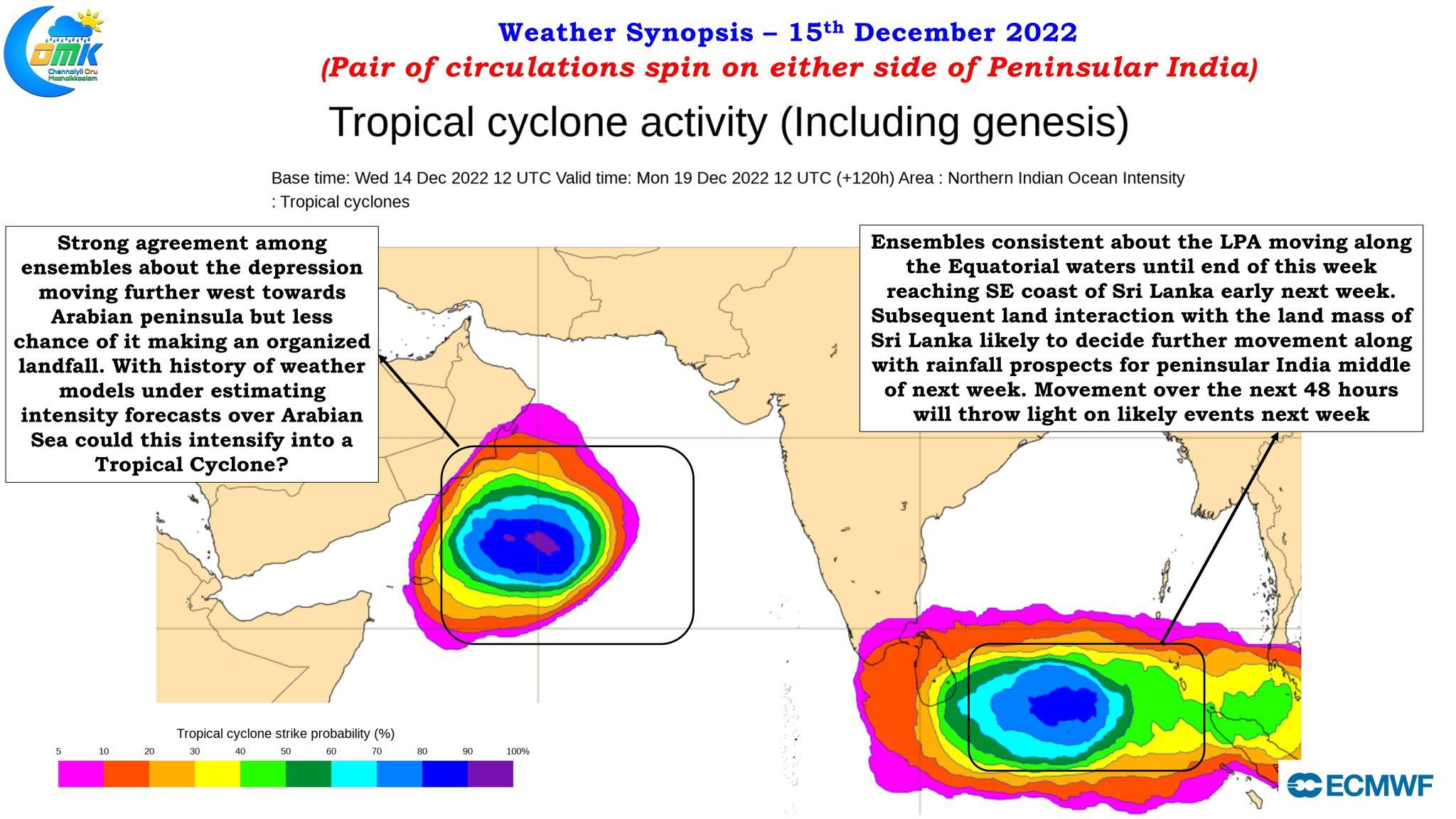
Just like the Cadburys Dairy Milk Shots advertisement goes if bloggers were eager tracking one disturbance that was expected to happen over equatorial bay waters yesterday the sting in northeast monsoon showed up though not as pronounced as the earlier stings like Cyclone Gaja or Cyclone Thane etc with IMD confirming the intensification of the Cyclone Mandous remnant into a Depression and later also confirming the development of a Low Pressure area over the equatorial waters from the cyclonic circulation that moved into South Andaman sea a day or two back. The depression in Arabian sea is expected to intensify into a deep depression and going by the history of numerical weather models under cooking disturbances over the Arabian sea one should not be surprised if this one ends up a Cyclonic Storm.
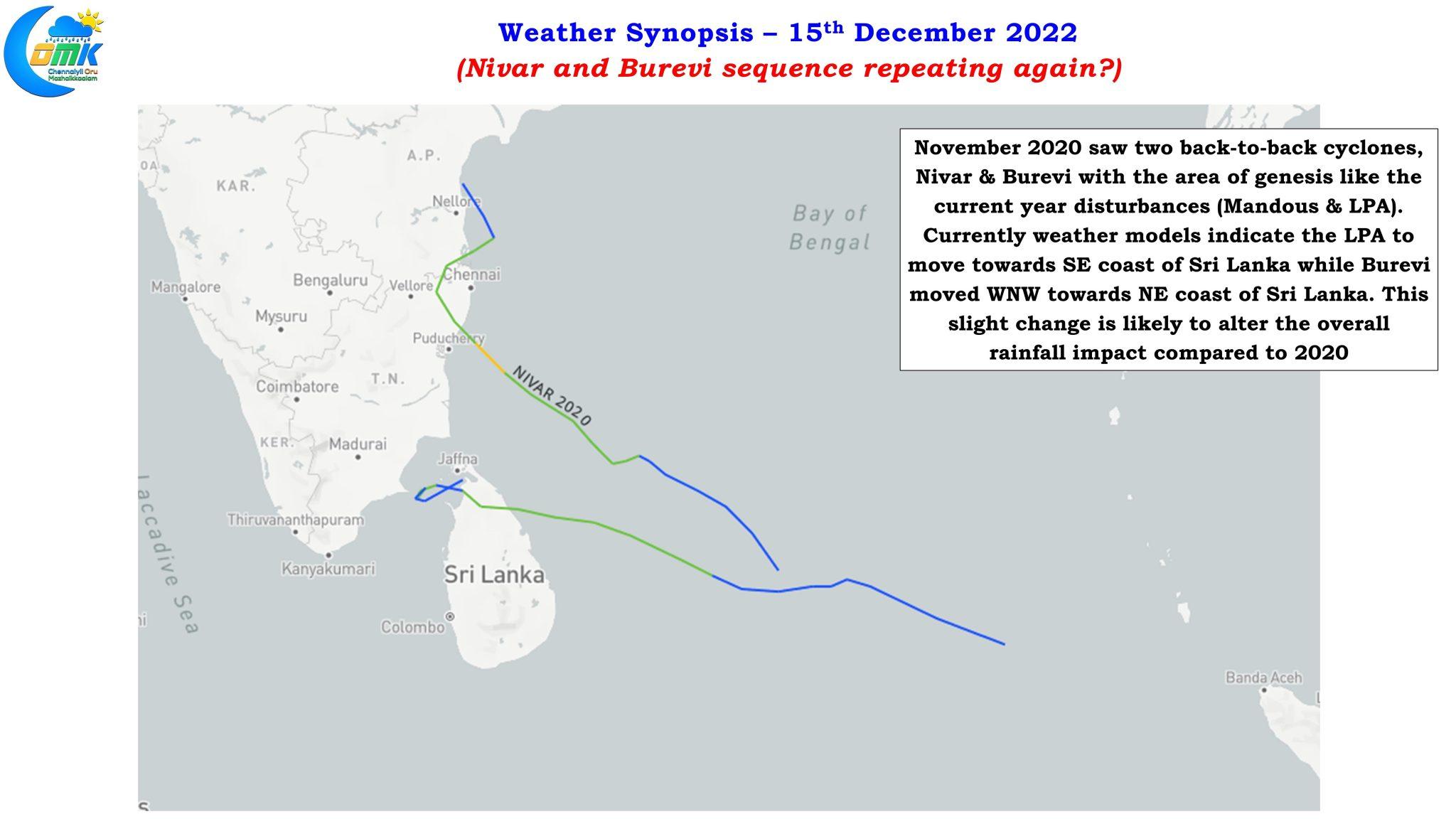
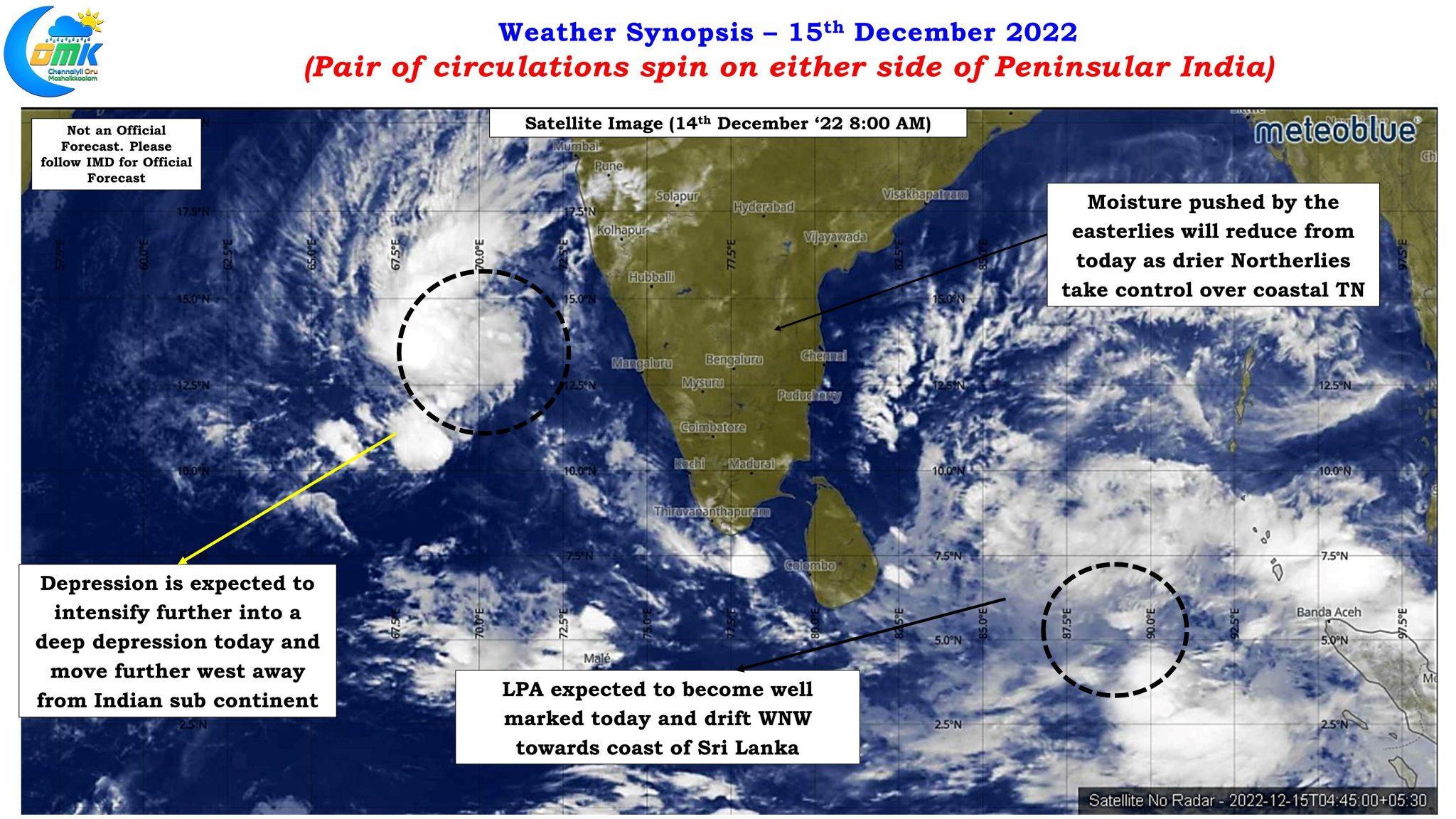

Down over the equatorial waters the LPA is expected to become well marked today and continue on its westward drift towards the coast of Sri Lanka. Interestingly the sequence of events happening now in a way is similar to what happened during the second fortnight of November 2020 when Very severe cyclone Nivar and Cyclonic storm Burevi happened back to back going through similar stages of genesis and movement. In a way set of events over last week and upcoming week may be a weaker reflection of November 2020 with both the disturbances being a weaker version. This could also mean the upcoming disturbance may end up drifting towards the southeast coast of Sri Lanka compared to Cyclonic Storm Burevi that drifted WNW towards the northeast coast of Sri Lanka.
Additionally the interaction of any disturbance over the landmass of Sri Lanka is always a wildcard with no clear predictable pattern in terms of where the disturbance gets moved after the interaction. It is therefore essential to more than ever take 48 hours at a time tracking this LPA over the Equatorial waters in real time basis look for cues in terms of how it is actually behaving in real time compared to model estimates do course corrections in terms of impact intensity & location to make a better prognosis rather than blindly follow outputs of numerical weather models.
With most models consistent about rainfall impact potentially starting nearly a week away there is enough time to assess and make a much better inference by remaining patient rather than jump the gun and trigger a scattergun warning across the state. In the meanwhile one thing is fairly assured the next few days are mostly going to be dry across Tamil Nadu as NEM takes a mini break.