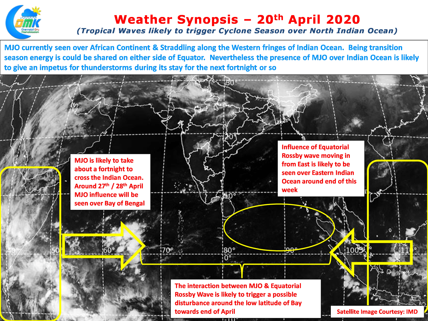
The North Indian Ocean (Arabian Sea + Bay of Bengal) typically sees two cyclonic seasons in a calendar year. Pre Monsoon & Post Monsoon Season. The Pre Monsoon Season that happens during April & May typically also sees higher instances of Intensifying Cyclones. If one were to put it as a statistic nearly every second…
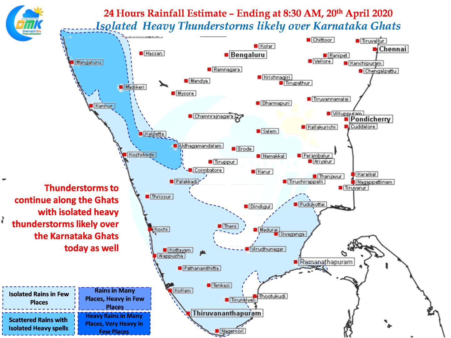
Isolated heavy Thunderstorms likely over Karnataka
The last couple of days once again thunderstorms have started to improve along the Western Ghats all the way from North Karnataka to South Kerala. The role of wind convergence can be clearly seen if one were to overlay the thunderstorm charts over the wind charts. Additionally the coastal areas of South TN have been…
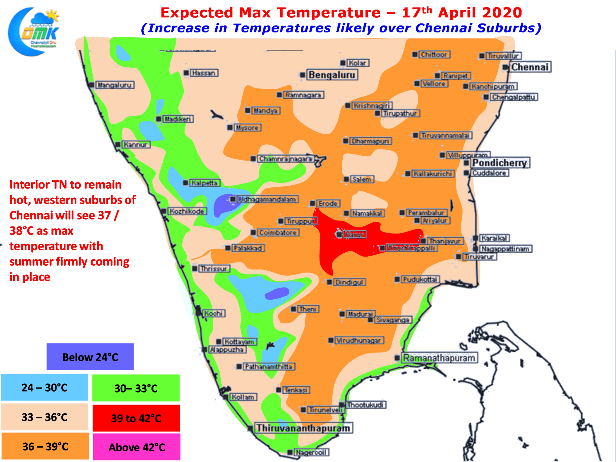
Increase in Temperatures likely around Chennai Suburbs
So far Chennai has been seeing a relatively sub par summer with temperatures staying near normal or in some days lower than normal. The persistence of Easterlies on a near continuous scale has meant we have had a comfortable summer so far. But as we often repeat the worst summer for Chennai is after the…
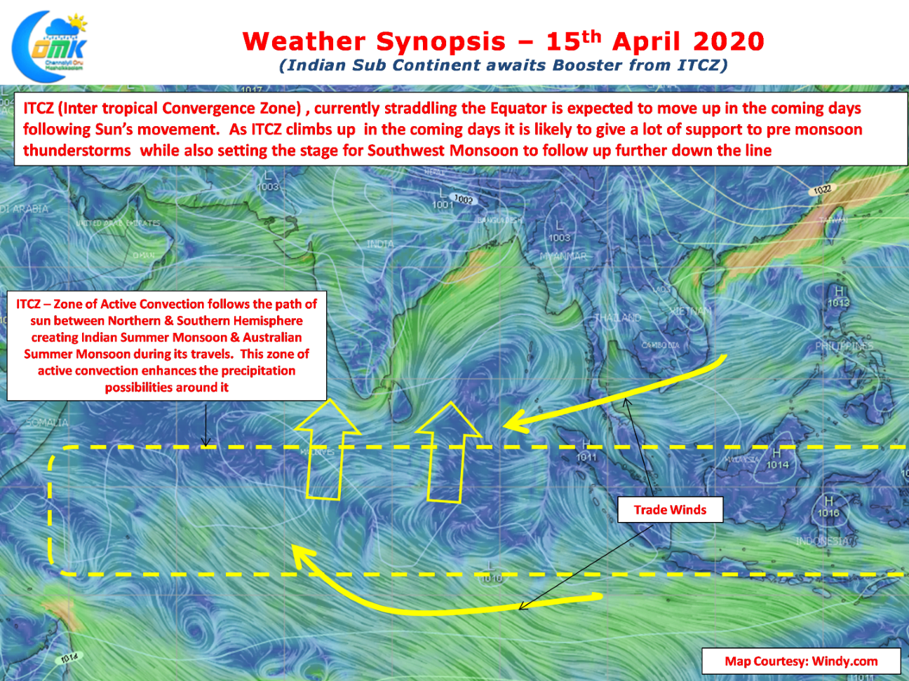
Indian Sub Continent awaits booster from ITCZ
Over the last few years this blog has been in existence we have mentioned often how the transit of Sun is the driver of Monsoon seasons over Indian Sub Continent & Australia. We have also explained many a time the importance of Inter Tropical Convergence Zone (ITCZ), an active zone of convergence that follows the…
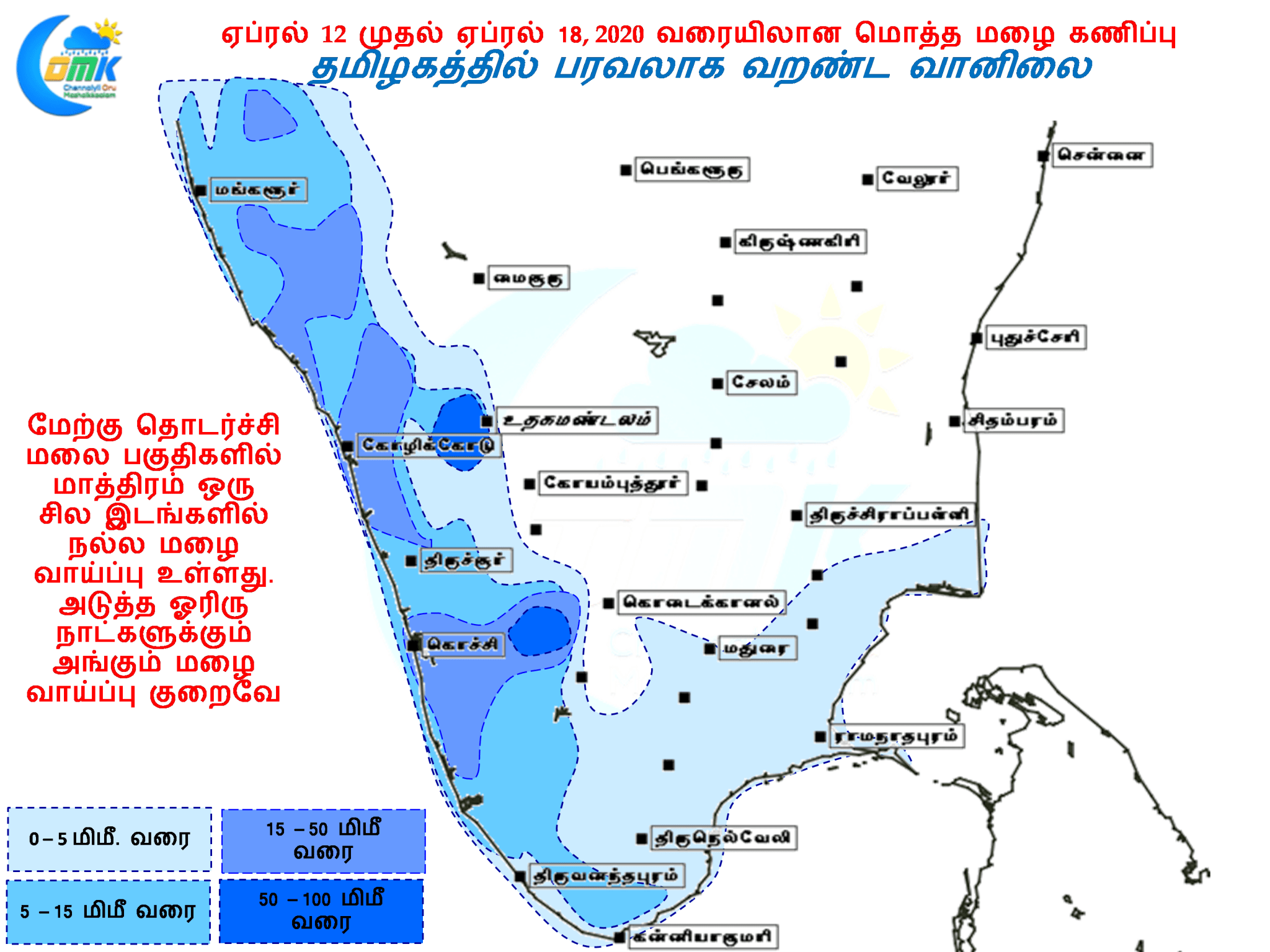
தமிழகத்தில் பரவலாக வறண்ட வானிலை
கடந்த சில நாட்கள் தமிழகத்தின் பல பகுதிகளில் வெப்ப சலனம் காரணமாக மழை பெய்தது. குறிப்பாக வியாழன் ஆண்ட்ரூ மாநிலத்தின் அநேக மாவட்டங்களில் மழை பதிவானது. இதன் காரணமாக பல இடங்களில் கொள்முதல் செய்யப்பட நெல் மழையில் நனைந்து பாழாகும் சூழல் ஏற்பட்டுள்ளதாக ஊடகங்கள் பதிவு செய்து இருந்தன. கோடை மழையின் ஓர் அம்சம் சில சமயங்களில் எதிர்பார்ப்பதை விட அதிகமாகவும் சில சமயங்களில் ஆலங்கட்டியுடன் பெய்யக்கூடியதாகும். வளிமண்டலத்தில் உருவாகும் காற்றின் சலனம் காரணமாகவே பெரும்பாலும் கோடை…