
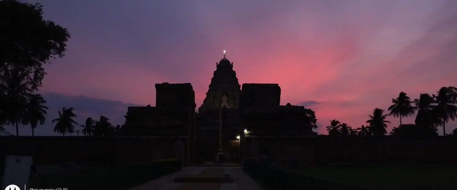
“பொறுமை கடலினும் பெரிது” is a famous Tamil saying highlighting the importance of Patience. As a weather blogger we follow Oceans actively making it all the more important to be patient. Oscillating developments are par for course in weather blogging. The atmospheric pendulum never stays still. Consequently you have phases of good and bad oscillating. More often than not weather bloggers are pluviophiles. This brings about an inherent bias in their judgements. A successful news anchor is the one who has a detached view to the events around him / her. His / Her role is to just communicate what is happening. Similarly a weather blogger should take a detached view to remove the pluviophile bias built into him.
Over the past few days we have had rainfall prospects oscillating for the rest of November. From the heights of a cyclone / depression coming close to recurving cyclone to North Bay it has swung wildly. In all this cacophony it became more imperative to not lose focus on observing real time conditions. With the real time observation as one started to match model behaviour it became easier to understand how things could evolve.
The Paradox of Choice is a concept put forth by psychologist Barry Schwartz. He argues our decision making could get clouded when more choices are offered to us. Unlike a few years back weather bloggers today have multiple tools available. Traditional Numerical Weather models, Ensemble Numerical Models and recently Machine Learning weather models. This possibly has resulted in reduced focus on sustained observation. With plethora of options available it is unlikely convergence of scenarios may happen always. Each model cluster has different dynamics built into it and also may use different initial conditions.
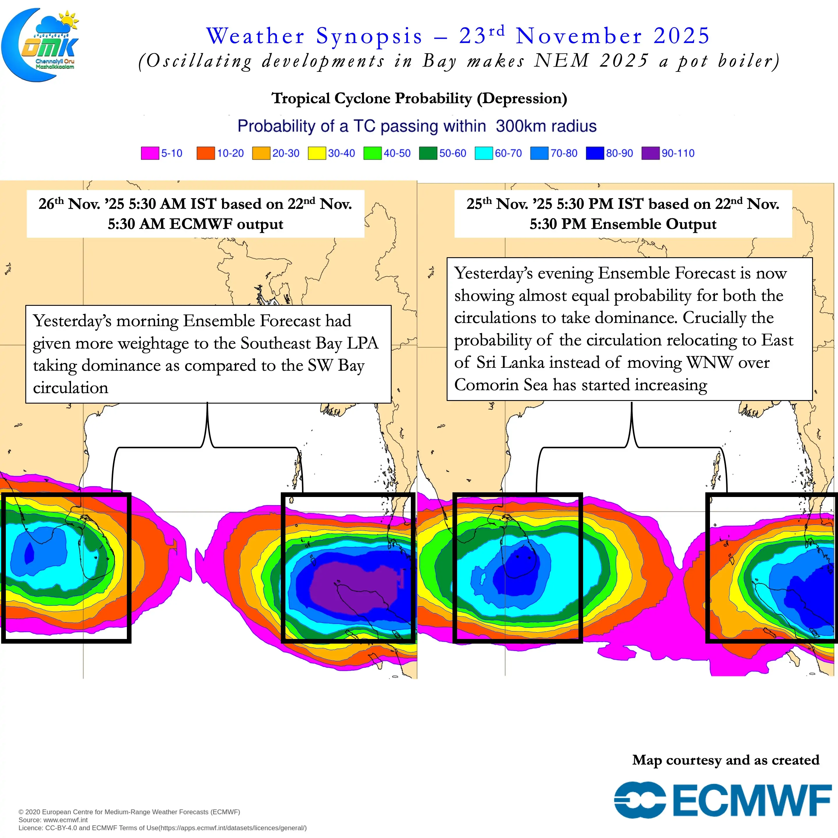
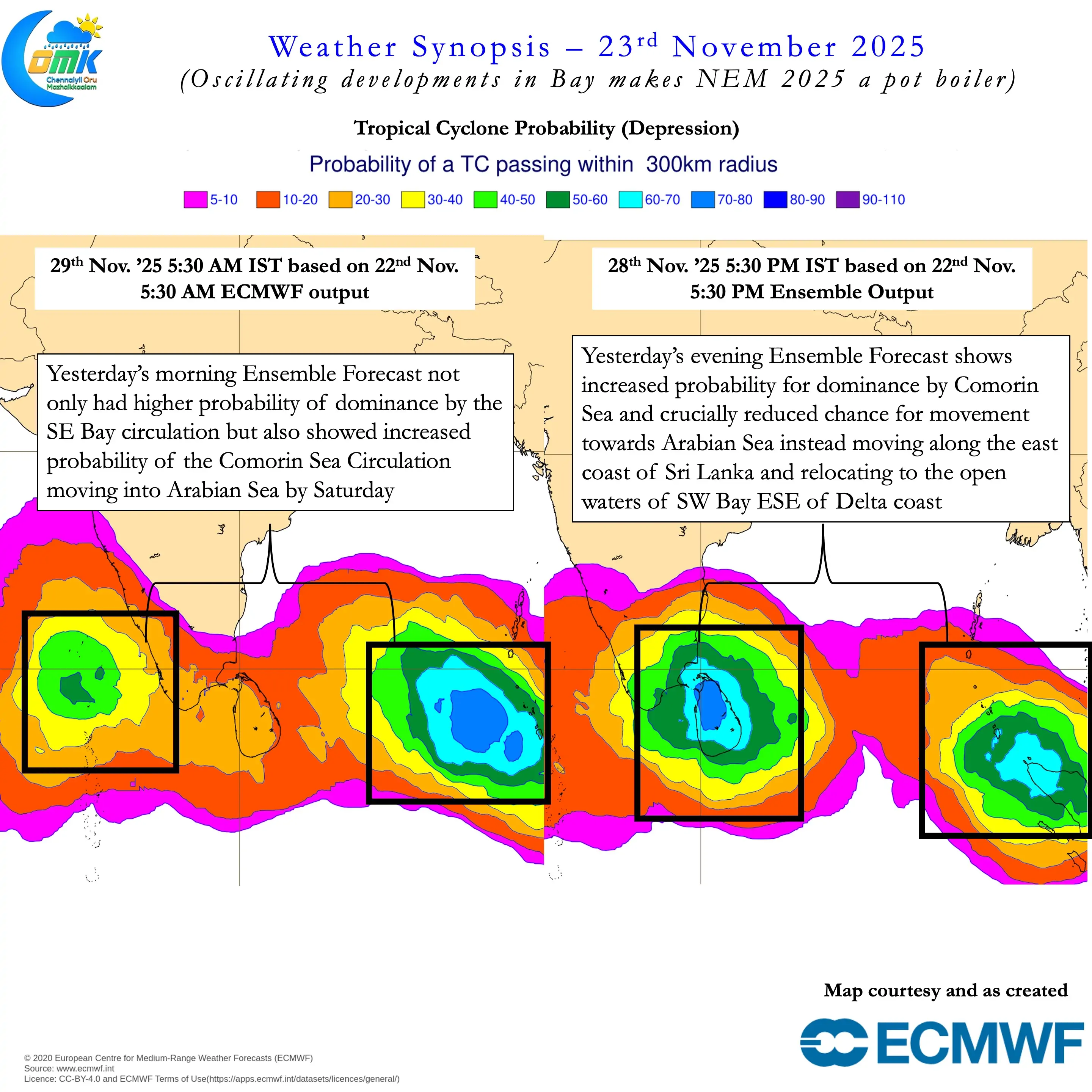
It is in this context there is no substitute to sustained observation. Observations of not only real time conditions but model behaviour as well. Through a process of sustained observation coupled with an inclination to unlearn and learn weather bloggers can see through the chaos. Between yesterday morning and evening the ECMWF ensembles underwent a complete change. A change which could alter the rainfall prospects drastically for Coastal TN including Chennai. But high resolution deterministic models have continued to indicate SE Bay LPA taking dominance. If one were to observe even the deterministic model outputs there is a subtle shift that is slowly taking shape.
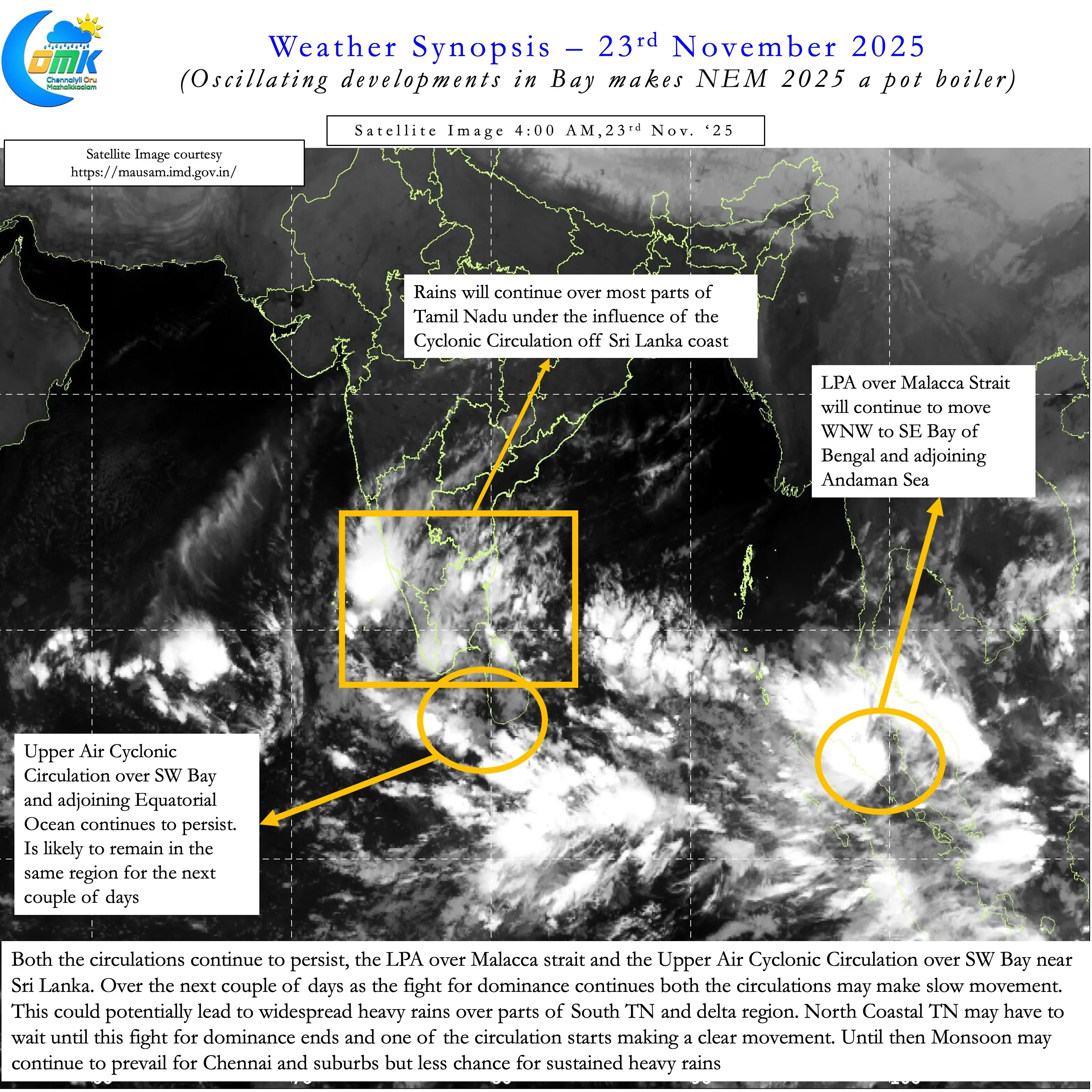
But we will continue to look at one day at a time. As things stand both the circulations continue to persist. Since IMD has not called the circulation off Sri Lanka as an LPA we will continue to call it as a UAC. The LPA which IMD expects to intensify into a depression over SE Bay is seen over Malacca strait. As mentioned in our post yesterday at the moment we will continue to ignore the Malacca strait LPA. There are two reasons for ignoring the Malacca strait LPA as of now. Firstly there could be changes in intensity and track for this LPA. Secondly the biggest influence as of now is the Comorin Sea circulation.
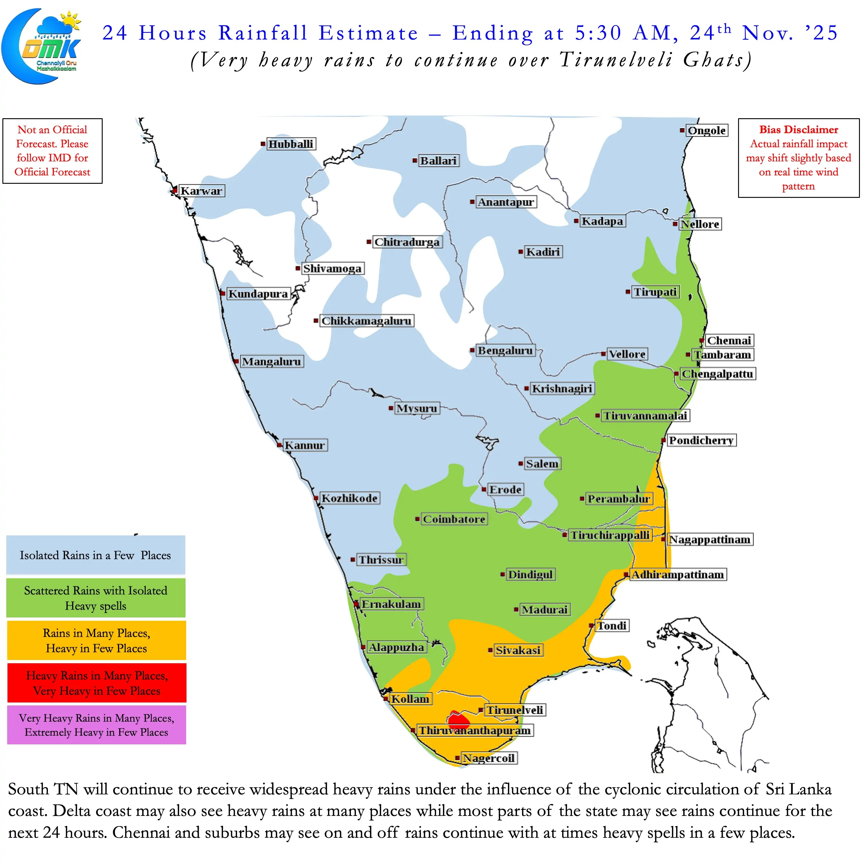
The Comorin Sea circulation is likely to remain the biggest influence for the next couple of days. For the next 24 – 48 hours widespread heavy rains is likely over South TN. Parts of Delta may also see heavy rains during this period. North Coastal TN above Pondicherry latitude may need to wait for the Comorin Sea circulation to slightly climb up for convergence to fall over places like Chennai. Will it climb up is a billion dollar question. There are indications that it is likely to climb but it may not happen immediately. For the next 24 – 48 hours as both the circulations try to outwit each other there may not be much movement from either of them. As things stand.
- South TN is likely to see widespread heavy rains continue for the next 24 – 48 hours.
- Coastal TN to the south of Pondicherry may see widespread rains continue.
- Parts of Delta may see heavy rains continue during this period.
- North Coastal TN is likely to see on and off rains continue with moderate to heavy spells at times for the next 24 – 48 hours. Sustained heavy rains unlikely during this period.
- There is a shift in how ECMWF ensembles are developing both the circulations.
- Compared to earlier yesterday’s evening forecast has increased the probability of SW bay circulation taking dominance. But we may have to wait for a day or two for consistency.
- Similarly there is increased probability for the SW Bay circulation to climb up along the East coast of Sri Lanka. This could potentially increase the rainfall / waterlogging risk for Delta and North Coastal TN later next week. But we may have to wait for a day or two for consistency.
- Deterministic numerical models continue to develop SE Bay circulation though this could potentially change in the upcoming forecasts.
Patience is a virtue. Jumping the Gun may not lead to success always even in rat races.