
Yesterday IMD announced the complete withdrawal of Southwest Monsoon from the Indian Sub Continent & along with it the simultaneous onset of Northeast Monsoon over parts of Southern Peninsular India. We all know the big brother Southwest Monsoon has clear protocols with regard to both Onset & Withdrawal conditions the small brother, Northeast Monsoon, is almost always treated in a step motherly way. Not only are lesser research being undertaken on Northeast Monsoon even though it coincides with the post monsoon cyclone season over the North Indian Ocean Basin there are no clearly defined protocols like Southwest Monsoon for onset & withdrawal. A more generic lower tropospheric winds from Northeast & wide spread rains over Tamil Nadu, not earlier than October 10th is enough to announce the onset of Northeast Monsoon. We hope in the years to come clear protocols are established for Northeast Monsoon as well in terms of onset & withdrawal.
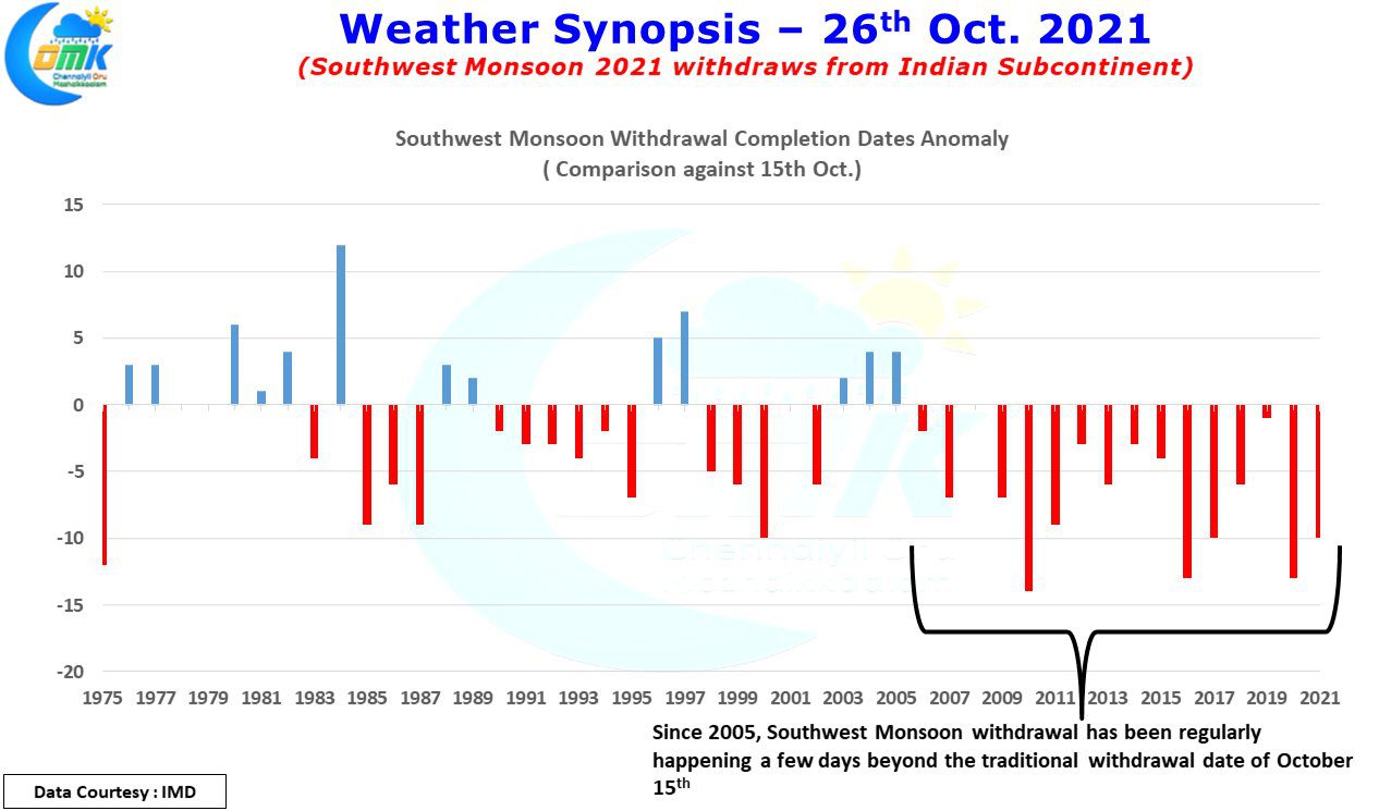
While on the topic of withdrawals, here is an interesting chart derived based on data provided by IMD on the completed withdrawal dates of Southwest Monsoon over the Indian Sub Continent since 1975. The chart tracks the withdrawal dates of each year as an anomaly plotted against October 15th, the traditional withdrawal completion date as per IMD. So delayed withdrawals will be seen as negative anomaly while early withdrawals are seen as positive anomaly. A very clear pattern seems to emerge post 2005 when the withdrawal seems to lean towards end October. It remains to be seen if it is an evolving pattern or temporary cyclical change.
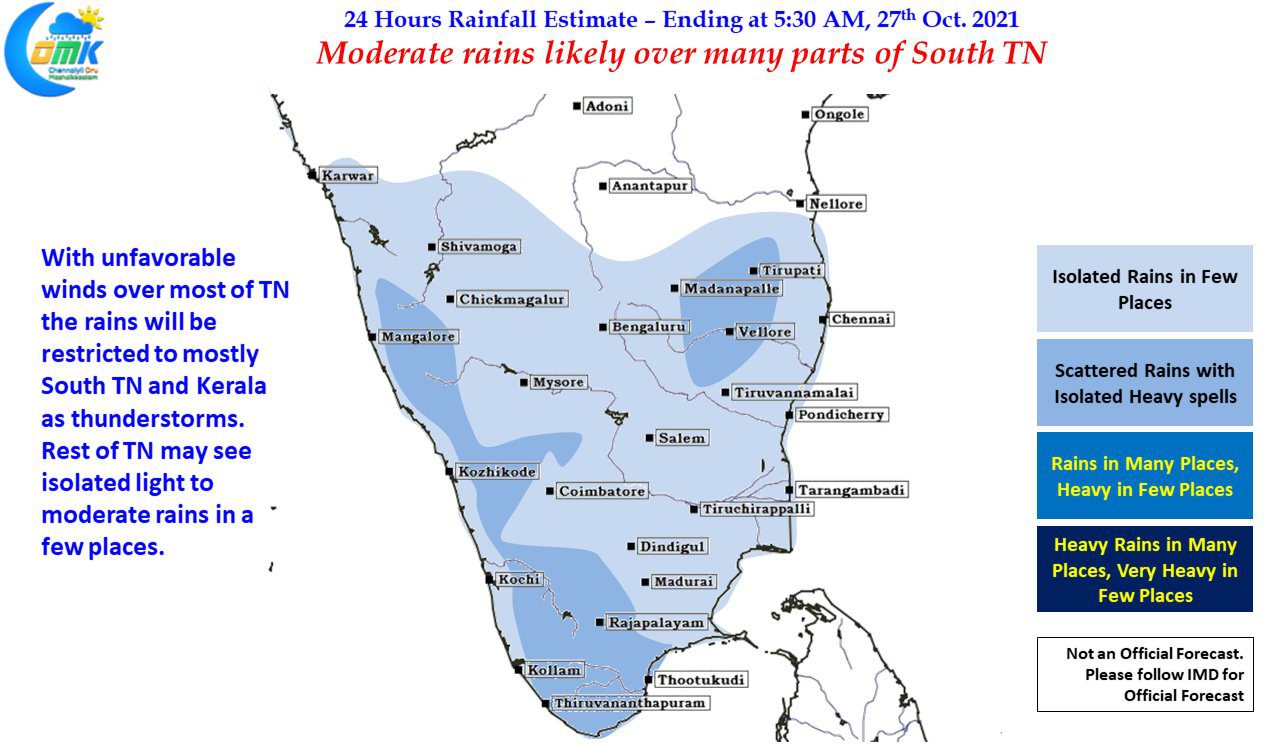

Meanwhile the next couple of days we are likely to see the rains stick mostly to South Tamil Nadu & Kerala due to the presence of the more drier Northerly winds rather than the moist winds from Northeast. This means most of TN may come under unfavorable wind pattern for rains while South TN & Kerala will see moderate rains accompanied by thunderstorms at many places. Today & tomorrow looks to be like this and from Thursday rains are expected to pick up as the UAC in Bay strengthens and comes closer to TN coast as a possible LPA.
There is a slight chance for 1 or 2 places in North TN to see dry line thunderstorms due to wind convergence, if it happens then these places could see a sudden burst of rains.