
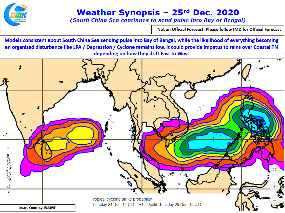
Late September / October just when it was time for Southwest Monsoon to withdraw from the Indian Sub Continent paving way for the arrival of Northeast Monsoon a train of pulses from South China Sea landed up in Bay of Bengal on the back of a stalled MJO over Maritime Continent. This string of pulses meant ITCZ got attached over central bay like Fevicol leading to the stalled withdrawal of Southwest Monsoon. During Northeast Monsoon time a similar scenario was something which was not ruled out while trying to understand the intricacies involved before season began.
In a way it was a blessing in disguise MJO did not exhibit this expected stalled characteristic during the peak NEM Month of November / early December which could have resulted in catastrophic floods for Tamil Nadu, though we had our own share of flooding in parts of Coastal TN on account of Nivar & Burevi. With ITCZ now well established over the Southern Hemisphere a remnant part of ITCZ alone continues to remain North of Equator helped by the stalled MJO over Maritime albeit in a weak amplitude.
Only Time will tell if even a moderate rainfall episode may become a curse for the farmers who are getting close to their harvesting window.