
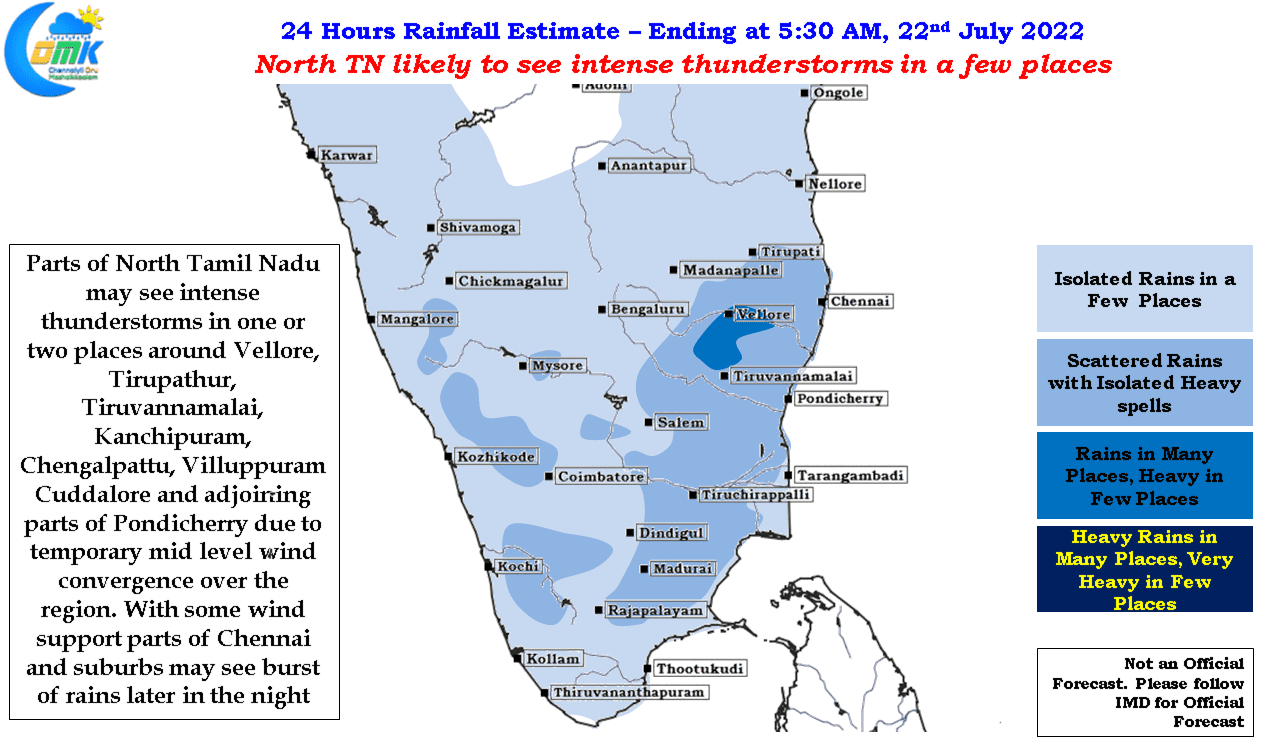
The last couple of days have seen thunderstorms return back over the leeward areas of Peninsular India including Tamil Nadu. Places in around South TN, particularly Madurai, Sivagangai district, has seen rains for both the days with weather models indicating the spell to continue today as well. Similarly places around Tiruvallur & Ranipet district also saw thunderstorms bring rains on Monday and Tuesday. Last night also saw many parts of Bengaluru record good rains with the IMD Observatory at the city recording 65 mm in three hours between 11:30 PM and 2:30 AM early morning. The intensity of these spells indicate the weak wind steering thunderstorms are going through for the past couple of days.
The weak steering is also the reason why though parts of Chennai got light to moderate rains yesterday early morning the heaviest spell of rains have happened further inland to the west or northwest of Chennai. With synoptic weather conditions and expected planetary wave movements indicating potentially the monsoon may be heading for a break even though the last couple of days have been close miss for Chennai city, and for that matter many coastal places, there is enough time for most of Tamil Nadu except for possibly Kanyakumari district and adjoining parts of Tirunelveli and Tenkasi Ghat areas to notch up a few good spells of rains before Monsoon gets back the momentum early August.
The wind charts indicate a temporary wind convergence zone at upper levels developing over North TN and adjoing areas later today evening / night which could bring intense thunderstorm activity over one or two places in the area. Vellore, Ranipet, Tirupathur, Kanchipuram, Chengalpattu, Tiruvannamalai, Cuddalore , Villuppuram districts could see thunderstorms at many places with some heavy duty action in a few places. While the bulk of the rains may stay about 50 to 100 kms away from the coast line Chennai and suburbs could see a burst of late night rains if the wind support becomes favorably as the thunderstorms eventually cross the coast.
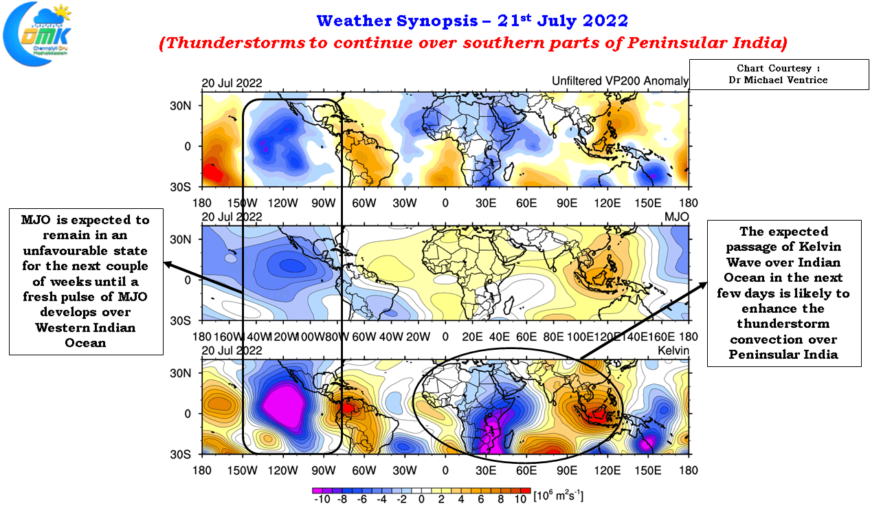
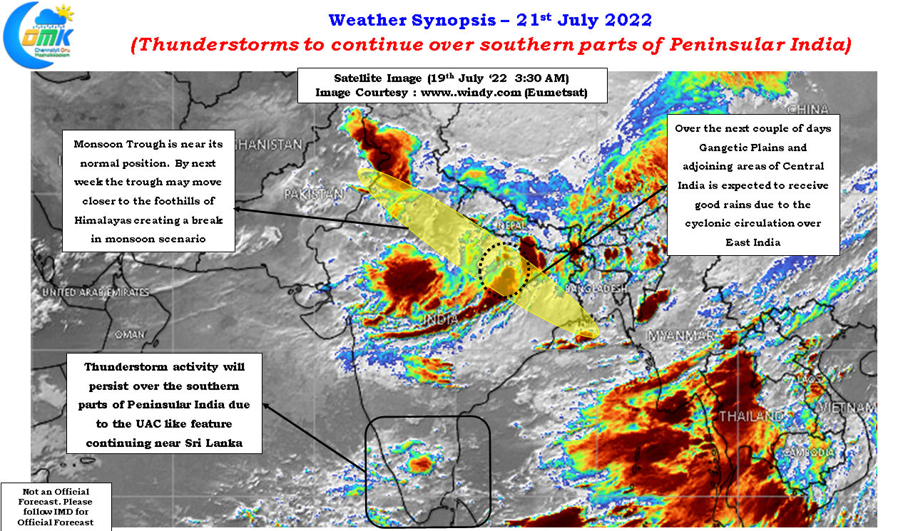
With the monsoon trough moving up to its normal position along the Gangetic Plain places in UP, Bihar can look forward to some much needed rains where so far Southwest Monsoon has been sub par. While some models indicate the monsoon trough to move south after a couple of days it appears overall dyamics indicate the trough may move closer to the foothills of Himalayas by next week bringing a proper break in monsoon period that may continue until early August.