
As we head into the second fortnight of November we are getting close to what could be called as the third intra seasonal peak of the Northeast Monsoon season for Tamil Nadu. The first peak normally happens around 3rd week of October more often than not coinciding with the onset phase of the retreating monsoon, the second peak happens around November 5th which is incidentally the peak in terms of daily rainfall indicating the heaviest phase of Northeast Monsoon that continues for about 5 to 7 days and then a lull before a mini peak happens around 3rd week of November though a much smaller one compared to the earlier one a couple of weeks before.
With the withdrawal of Southwest Monsoon getting delayed over the past decade or so the NEM cycle also may be running behind schedule at times. Nevertheless middle of November normally could be associated with peak rainfall activity though the one should never ignore the role of intra seasonal transit of Tropical waves like MJO / ER etc. If one was a Devil’s Advocate the thought of “Base State driving the entire dynamics including Transit of Waves” will always come to mind.
Current situation is a an example of what happens when the Base state is driving the dynamics. Strong La Nina has been stopping MJO on its tracks over MTC every time it attempts a global circuit. This is weak MJO presence over MTC starts pushing pulses regularly into Bay of Bengal creating a problem of plenty for Peninsular India. Two LPAs’ on either side running a pushing & shoving battle that could decide the fate of a city that is already battered from last week’s rain is the state of Chennai now. With weather models expecting the Arabian Sea disturbance to intensify at the cost of the Bay LPA what was expected to head to coastal AP a couple of days back is now heading into North TN.
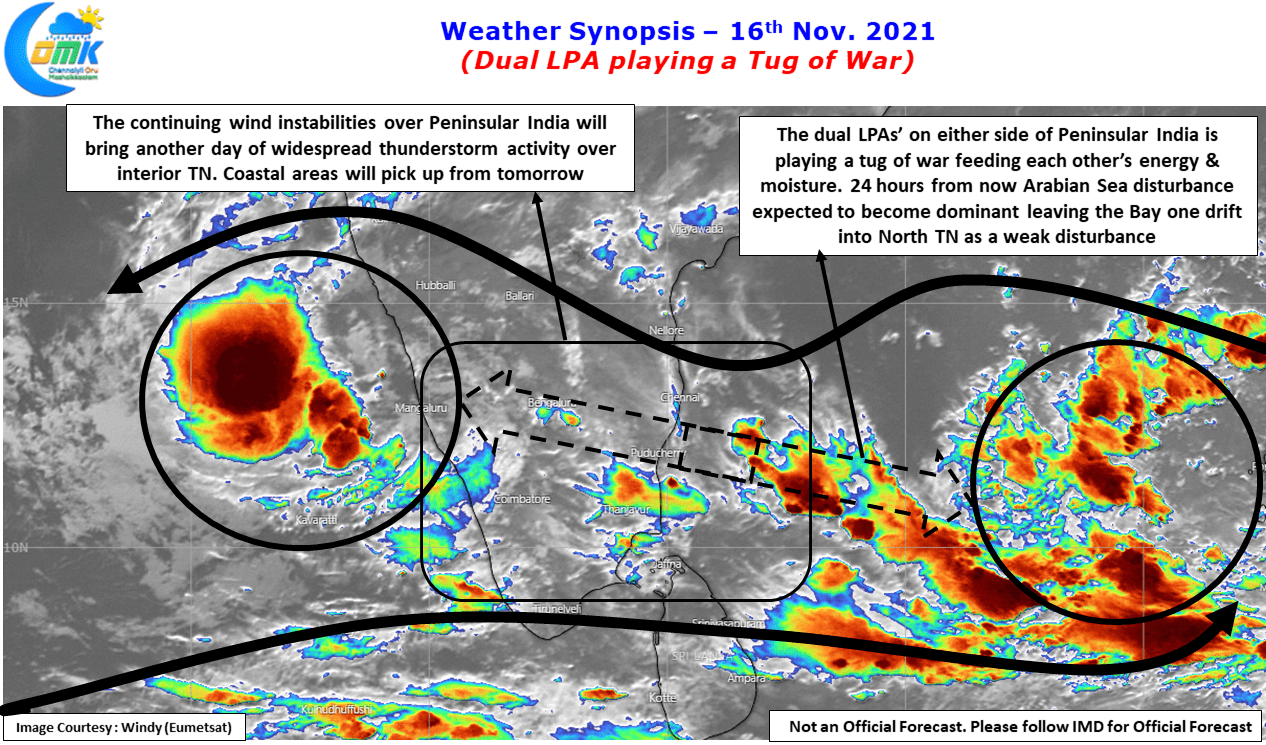
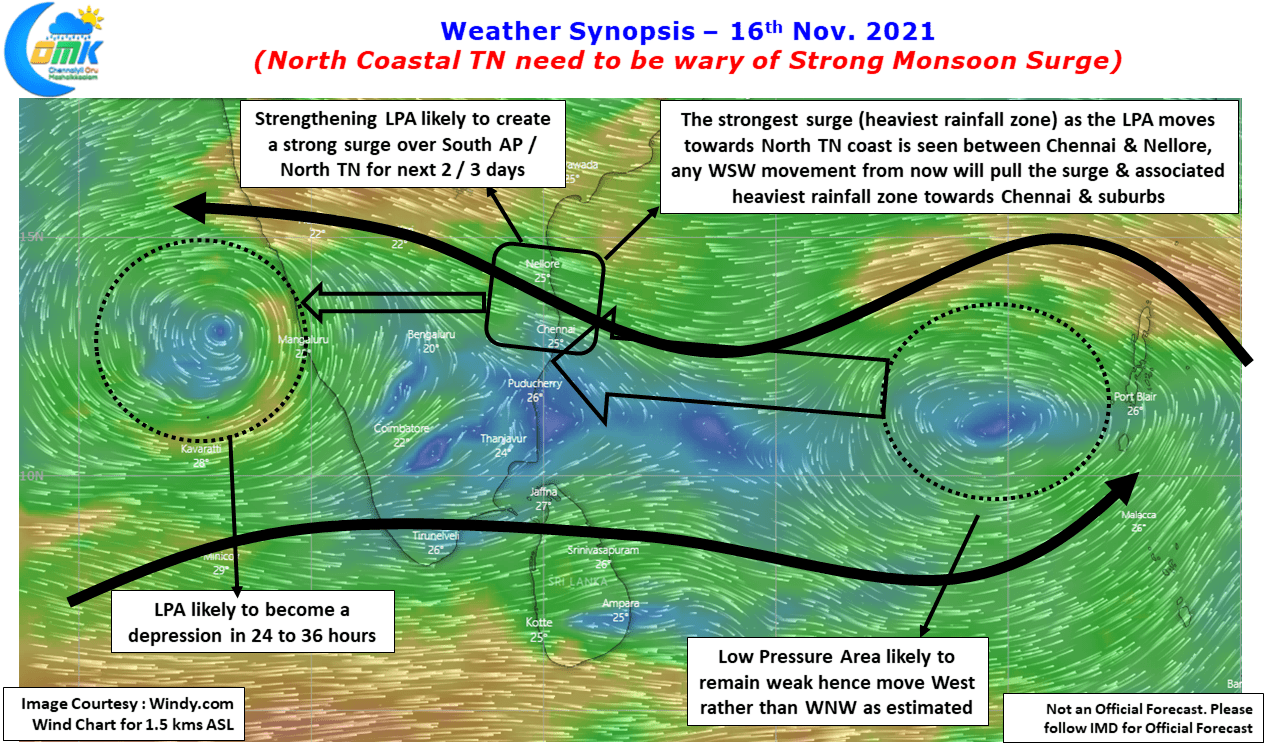
In the event of a real time further southwest dip in trajectory by the already weakening Bay disturbance could alter the dynamics completely bringing the heaviest monsoon surge created by the Arabian Sea depression dragging moisture from East now expected over South AP into North TN and associated heavy rains over places like Chennai. While the post is not to scare monger but to an attempt to put all the cards on the table so that people can be better prepared.
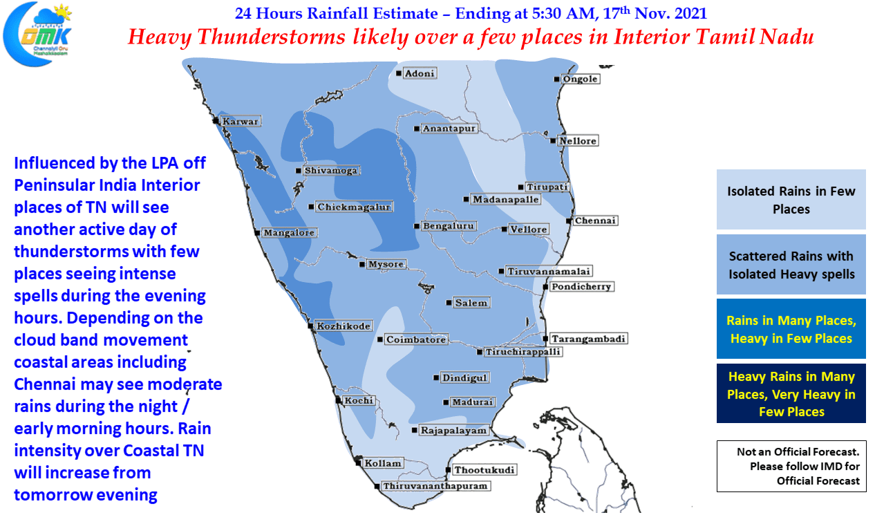
Meanwhile the multiple circulations have created a bumper week of thunderstorms for interior TN & South Interior Karnataka which is likely to see another active day of thunderstorms today which will initially start around Trichy / Karur / Dindigul area before shifting up towards Kallakurichi / Tiruvannamalai / Krishnagiri belt later in the evening / night. Coastal areas like Chennai may see rains after midnight / early morning which will increase in intensity from tomorrow evening.