
After many days Chennai woke up to light overnight rains over few areas of the city. Similarly the early morning skies over the East started showing weak cumulus clouds indicative of the weak moisture intrusion over the coastal areas of Tamil Nadu as Easterlies start to show up consistently along the coast. Parts of delta districts have been receiving light to moderate showers during the morning hours which once again confirms slowly but surely NEM2019 is trying to get its feet back after a weak couple of weeks.

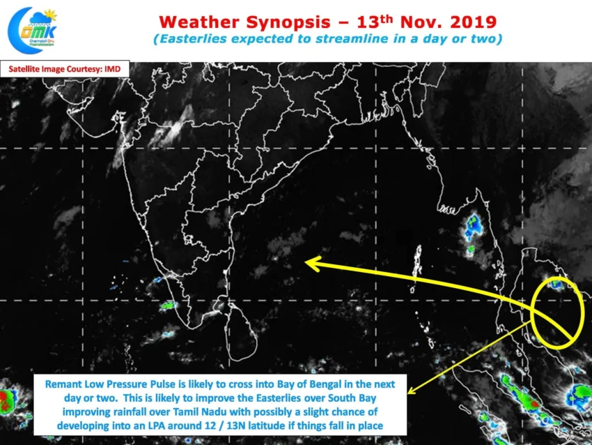
Crucially along with the return of Easterlies it appears there could be a weak pulse that might find its way towards Bay of Bengal. While the earlier Matmo Pulse became Very Severe Cyclone Bulbul last week, this one as indicated by weather models could move into Bay at a location much South compared to where Matmo pulse entered into Andaman Sea. This pulse is likely to not only help the Easterlies streamline in the next day or two but there is a slight chance of developing into a LPA over the South Bay area which could give further impetus to NEM 2019.

It is understandable that a sense of impatience creeps in while we wait for rains especially after a poor two weeks. Nevertheless patience will surely be rewarded in the form of a satisfying spell of rains soon. Today with some moisture incursion over coastal areas we could see isolated thunderstorms develop around 25 – 50 kms off the coastline in a few places while later in the night we can see coastal areas see spells of rains at many places. Isolated places could see heavy spells of rains especially in the stretch between Chennai and Puducherry.