
For the weather Bloggers of Chennai Monsoon is a word but Northeast Monsoon is an emotion. As rest of the Indian Sub Continent shows signs of transitioning to the seasonal winter conditions the South Indian States think differently & look to the East waiting for their first brush of rains from the East indicating the arrival of Northeast Monsoon.

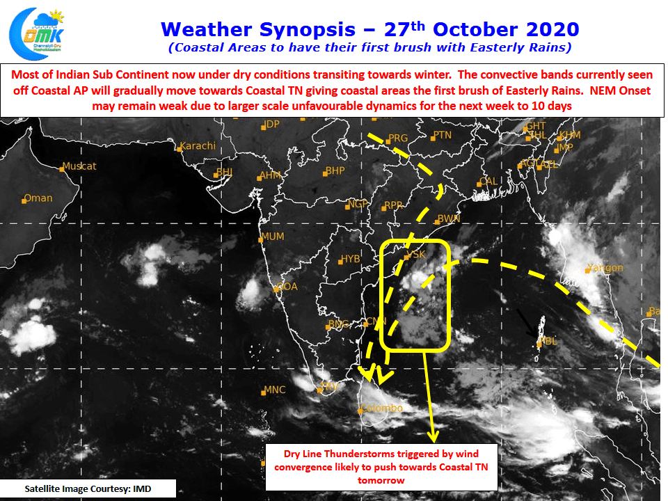
Satellite image indicates the overall dry weather conditions prevailing over Indian Sub Continent clearly moving towards winter with Northerly winds holding sway bringing in dry weather. This Northerly winds are partially the reason for the misty conditions that many parts of TN are seeing due to differential temperatures in atmospheric layers. Over the next couple of days we are likely to see some bit of Easterly winds move from the Bay towards Coastal Tamil Nadu.
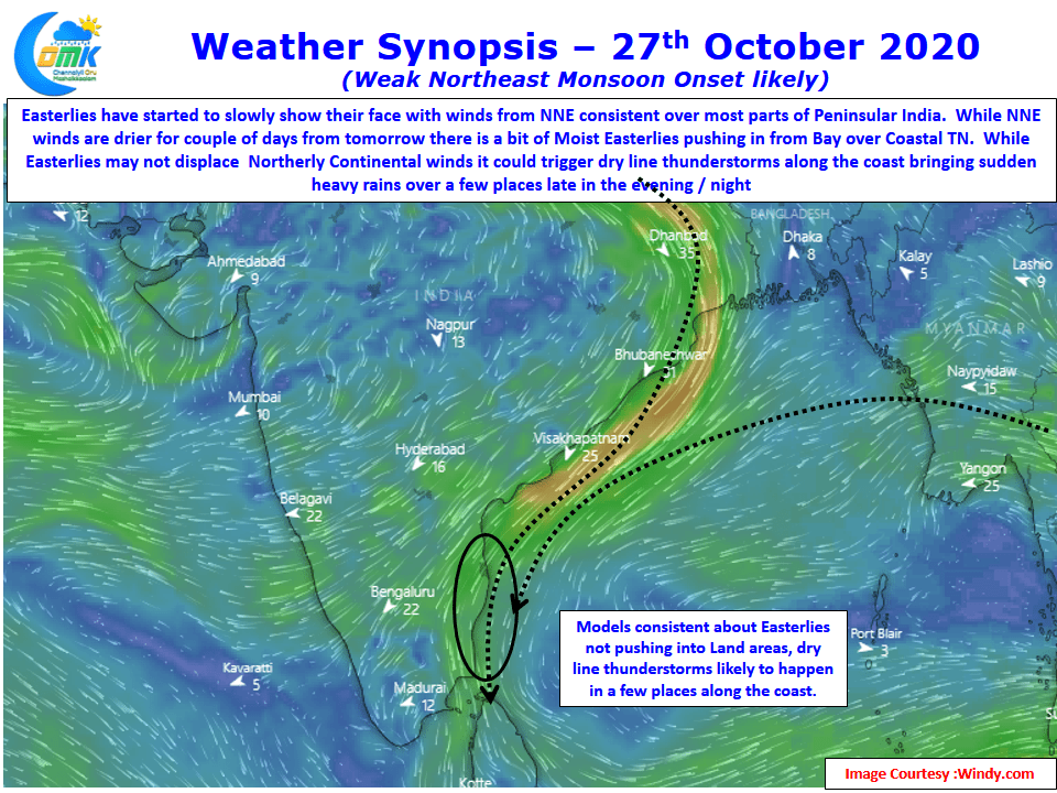
But one has to admit in the overall scheme of things the wind pattern is skewed towards Northerly or winds from NNE rather than from the East. While the winds from the North are drier due to their continental nature the winds from the East pick up moisture as they move across Bay. This convergence of winds is expected to happen off the coast of TN / South AP creating conditions for dry line thunderstorms (a Narrow band of thunderstorms that form along the line where winds of different mass converge).
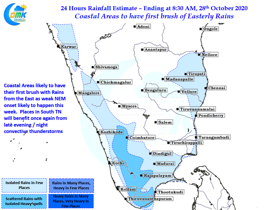
Models indicate though the best conditions are likely to be seen just off the coast between SriHariKota & Delta with heaviest rains falling over the sea. But there could be some bit of intrusion into the places closer to the coast with areas up to 20 kms from the coast line possibly seeing sudden burst of rains in a few places. While rains are likely to start from tonight in a weak manner tomorrow & day after promises moderate rains over the coastal stretch. South TN though will continue to benefit from convective thunderstorms like the past two days.