
Unlearning and Learning is an essential part of scientific temper. Over the years as research throws new light some of the older understanding becomes irrelevant. Understanding weather is also similar. This becomes even more pertinent in the context of oceans warming like never before. The last couple of weeks have seen NEM 2025 pretty much collapse. A collapse so bad there was a genuine worry about a potential deficit year ahead. But if one continued to look deeper there were signs that indicated things were not actually so bad.
Active and weak phases are essential part of Northeast Monsoon. NEM 2025 is no different with a weak phase extending from 3rd week of October. The IMD study on the variability of Northeast Monsoon has a detailed listing of these active and weak phases during the period 1981 to 2021. Over the past couple of weeks MJO got stalled over MTC and adjoining West Pacific. This brought about a period of suppression over Indian Ocean.
Crucially this period also saw anomalous westerlies and the absence of any other tropical wave. With MJO now decaying after its interference with the La Nina base state the period of anomalous westerlies is coming to an end. Kelvin broke the spell of suppression last week while moving West to East bringing enhanced thunderstorm activity. The collapse of MJO will put a halt to the train of typhoons over West Pacific.
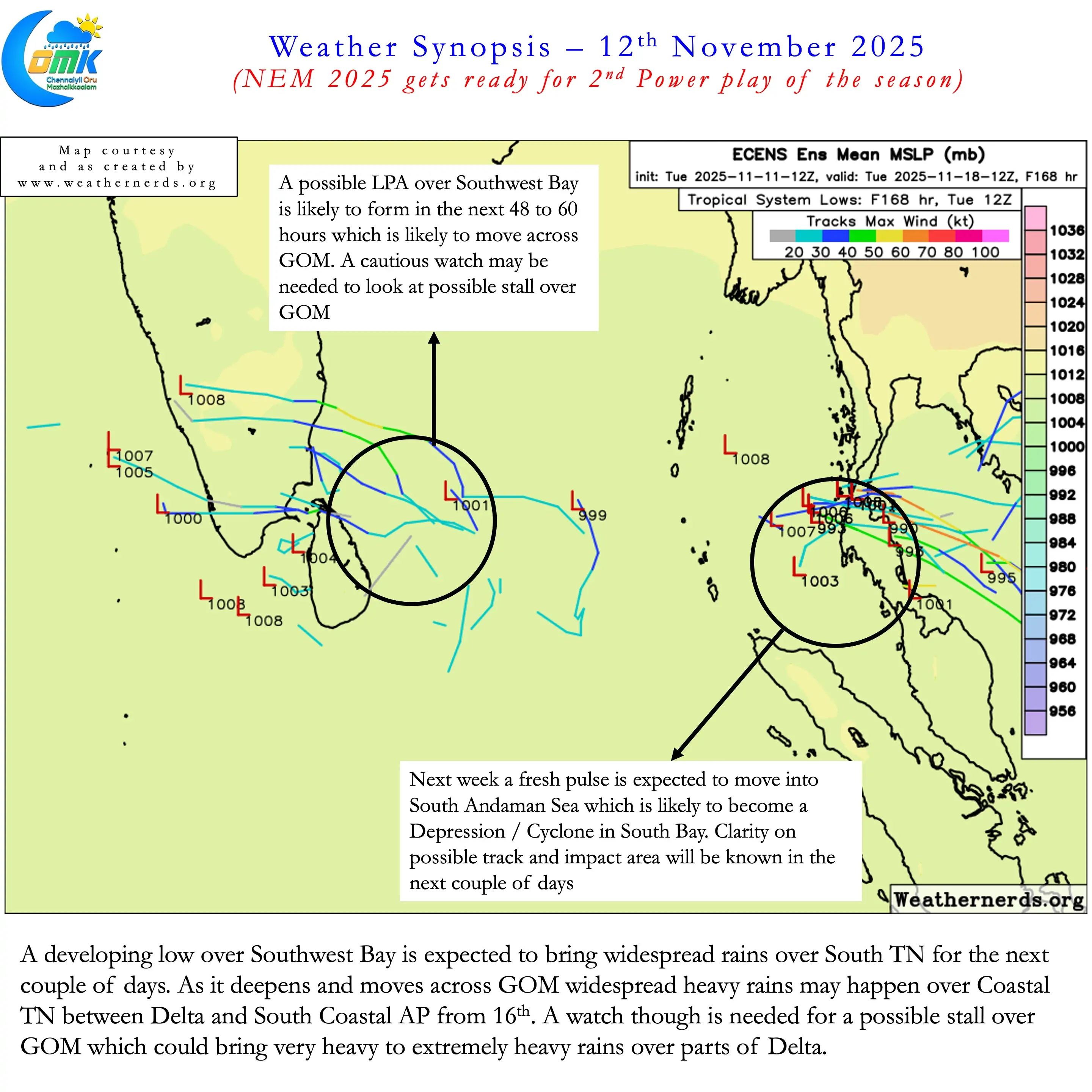
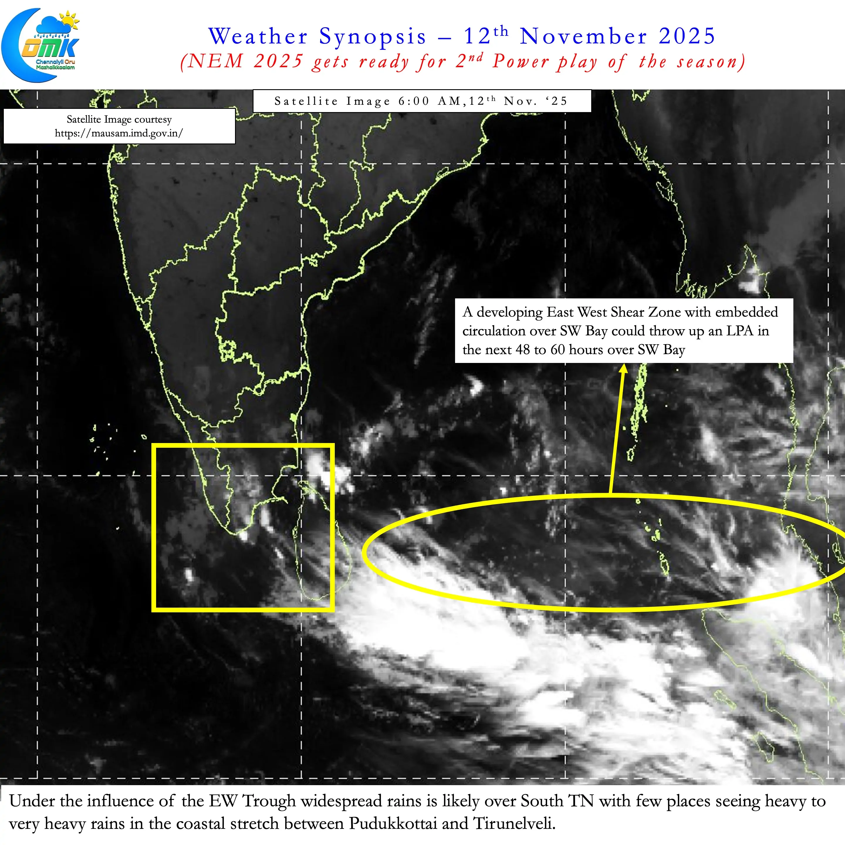
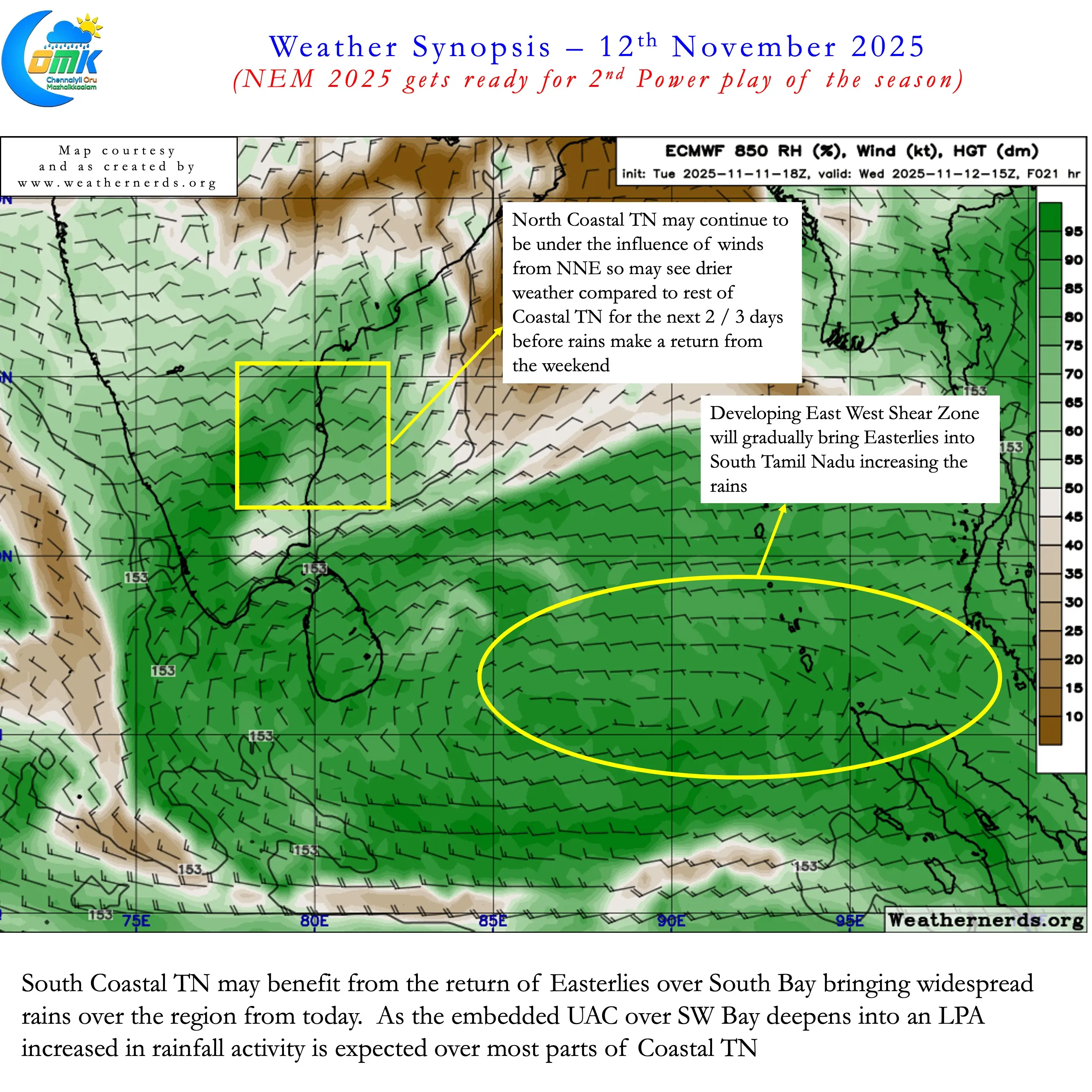
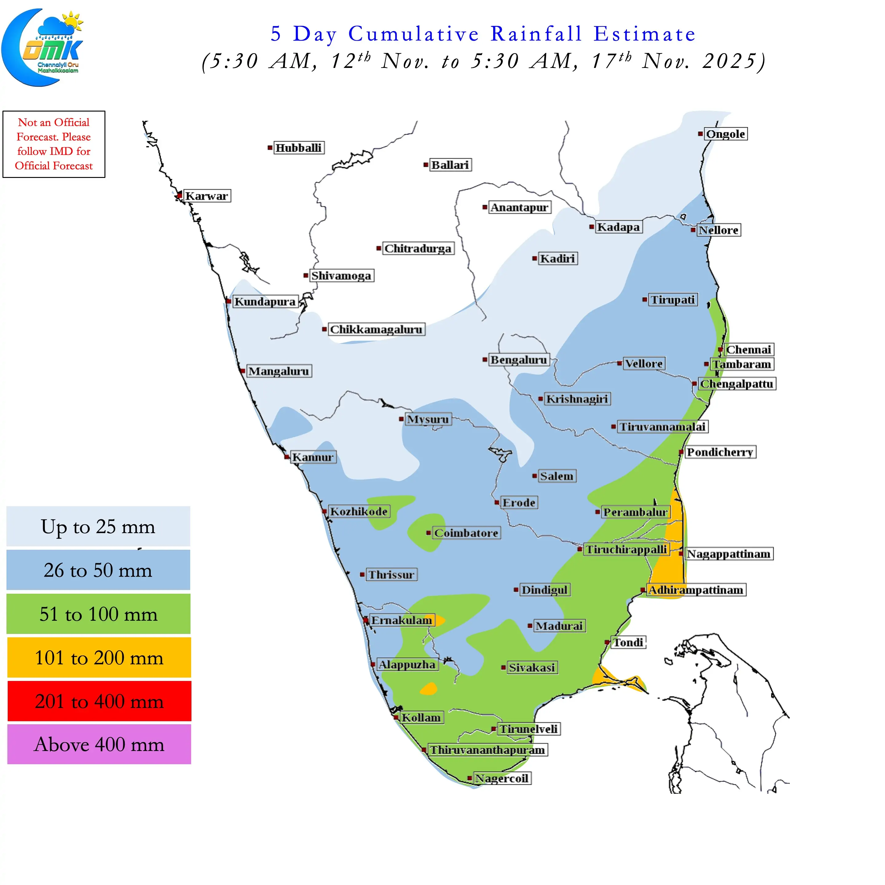
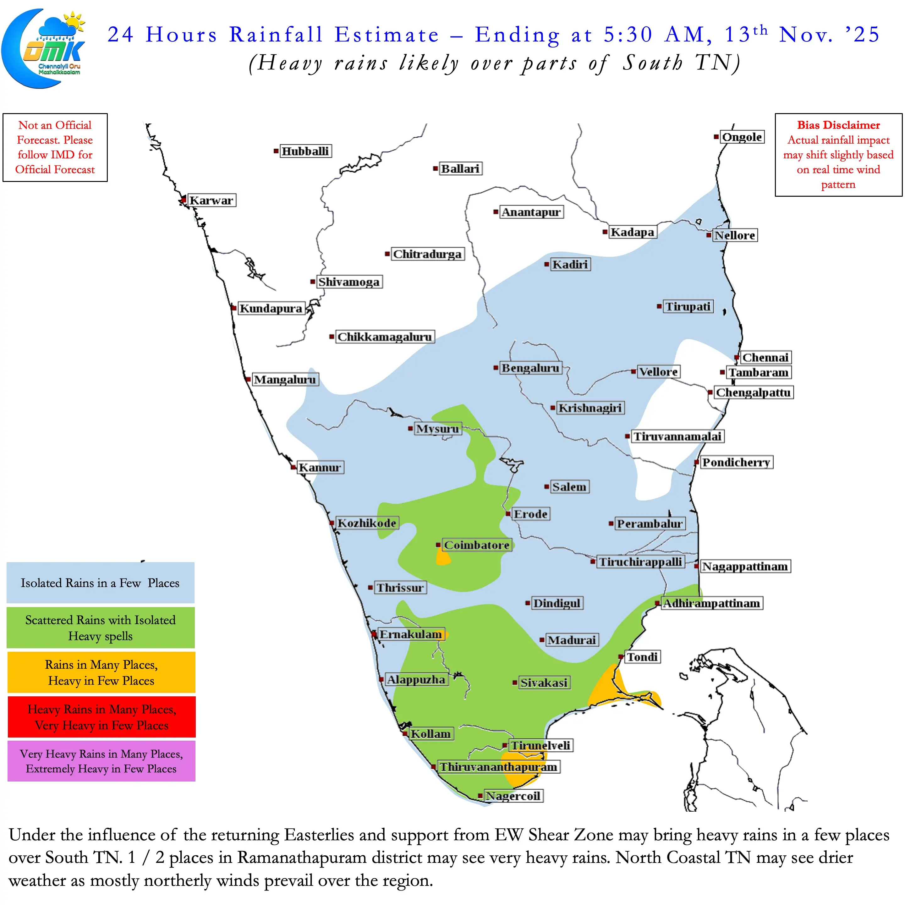
Under the influence of the East to West moving ER wave now NEM is likely to get is mojo back. Currently a broad EW Shear zone over South Bay is seen persisting. This is likely to spawn an LPA in the next 48 to 60 hours over SW Bay. This circulation is likely to move across GOM providing widespread rains to coastal TN between delta and South TN for the next couple of days. As it moves further west North Coastal TN including Chennai is likely to see rains from 16th November.
But this is just the start of what is likely to be a train of pulses from Subsequently a 2nd pulse is likely to enter South Andaman sea later next week. This is also likely to move WNW / NW towards the southern parts of Peninsular India during the last week of November. That week could favour coastal stretch between Delta and South Coastal AP.
All in All it is time for the 2nd round of power play for Northeast Monsoon during the middle overs. There is a good chance of another round of power play during the 1st fortnight of December though we may have to wait and see if there is consistency among the models on events that may happen during that period. Delta coast that has been under deficit could cover up all of its deficit by end of Next week. Similarly including Chennai and Chengalpattu, currently in negative zone, may move into excess by end November.
Northeast Monsoon tests your patience every year. 2025 has been no different so far.