
It is nearly 4 weeks now since northeast monsoon 2022 made its onset over the eastern coast of peninsular India on 29th October. While the overall performance of the monsoon season so far is 334.9 mm against the long period average of 337 mm for Tamil Nadu and Pondicherry subdivision it is always an interesting exercise to do a little bit of deep diving into the data and understand the performance on a finer scale where ever possible. TNSDMA in an effort to bring to move towards open data has now made the daily rainfall data for all reporting stations under its network available for everyone. This means instead of just the districts and about 30 IMD stations we can make an effort to understand monsoon performance on a better scale with access to more than 500 stations across the TNSDMA network.
Today’s COMK NEM 2022 summary is an effort towards that with focus on some interesting elements which are normally not seen in most official summaries too. The summary is for the period 1st October to 25th November and broadly tries to provide for an update on the following themes to give a better understanding on how monsoon has performed. Please note this summary has been made using the data from the TNSDMA portal so at times it may vary with the IMD data due to differences in recording periods.
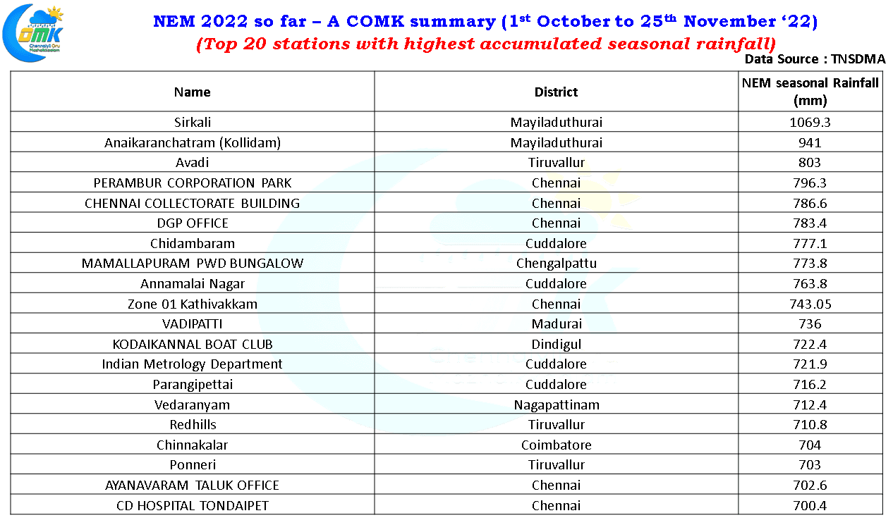
- No summary can be complete without a topper list. Top 20 stations in terms of seasonal rainfall accumulation up to 25th November ’22
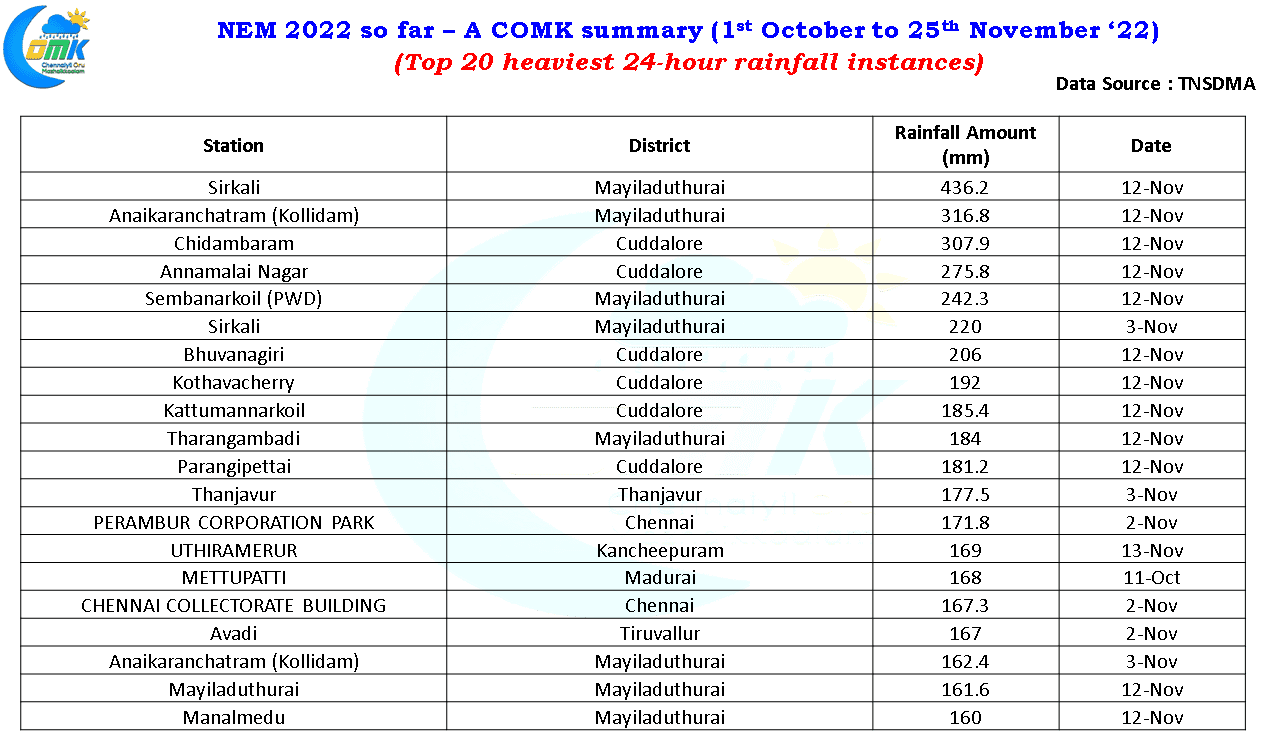
- Top 20 instances of heaviest rains during the 24 hours period. In this list as you can observe Sirkali and Kollidam is featured twice in the Top 20. Ironically nearly 2/3rd of the seasonal rainfall accumulation for Sirkali has fallen on two days, 12th November when nearly 40 cms fell in a few hours and 3rd November when 22 cms was recorded.
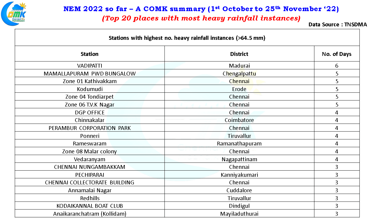
- Stations with highest number of heavy rainfall instances during the season so far ( more than 64.5 mm). Interestingly it is not a station from the coast but Vadipatti in Madurai district that has got 6 instances of heavy rainfall so far.
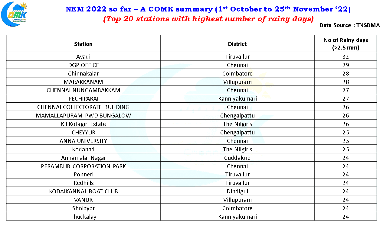
- Stations with highest number of rainy days (2.5 mm or more). It is essential to always note how the spells of rains have been not only in terms of intensity and accumulation but also as a time series. A spell of 400 mm spread out over may be 20 days is more welcome by the farming community than all of 400 mm falling on a single day
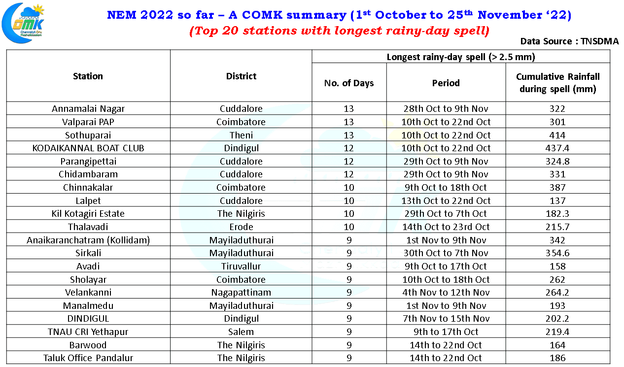
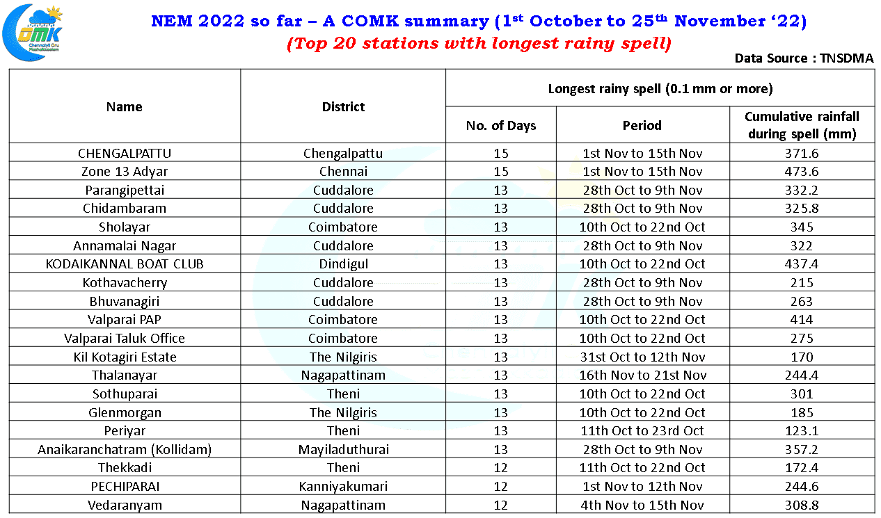
- In the same context we have also given the stations with longest spell of rainy days (more than 2.5 mm) and longest spell of rains (0.1 mm or more) to understand which of the station has be more consistent this NEM season. Due to missing data issues the stations with longest dry spell was avoided to prevent misrepresentation.
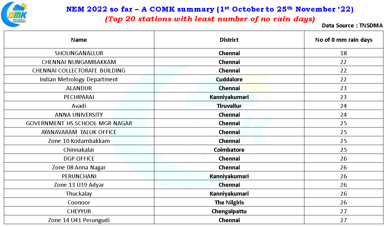
- The top 20 stations with least number of no rainfall days will also give an idea on the places that have been consistent this NEM
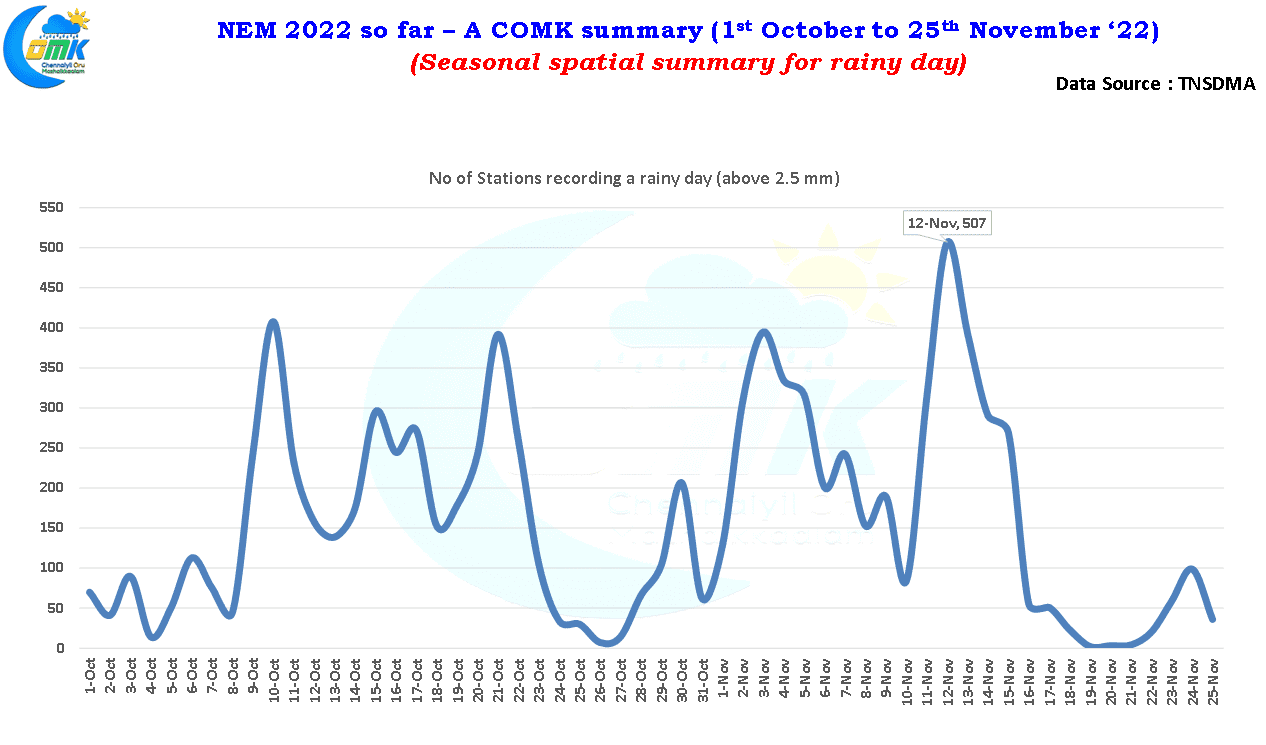
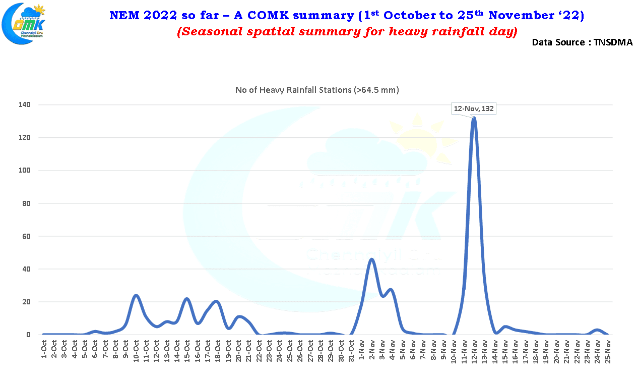
- Finally two charts which indicate the spatial scale of the rainfall on a daily basis, namely number of stations which recorded a rainy day and number of stations which recorded heavy rainfall in a particular day. This is essential to understand how widespread the spells were during the season. As one can see on 12th November we had more than 500 stations in the state record 2.5 mm or more and 132 of those stations recorded 64.5 mm or more effectively making it the peak rainfall day for NEM season this year. To give a perspective on 12th November more than 85% of the stations in the TNSDMA network recorded at least 2.5 mm
On the weather front due to lower level wind convergence over places closer to the ghats few places on the eastern slopes in South TN and a few places in West TN may see moderate to heavy spell of rains today. Isolated places in the plains of delta and south TN may see light to moderate showers.