
As we get to closer to the second half of December it is traditionally the time to look for possible hints on when Northeast Monsoon could withdraw and herald the short winter for Tamil Nadu. But more often during the La Nina years this cycle gets slightly pushed back due to the slow movement of ITCZ towards Southern Hemisphere. Many would remember Cyclone Thane had its genesis on Christmas day & made landfall on New Year Eve. The year this happened was 2011 when a fairly strong La Nina episode had evolved over the Pacific waters.
Similarly a few years back Karaikal recorded 80 mm on 21st January 2017 which saw crop damage in many places & also the crops ready for harvest had to wait for nearly a week for the under foot conditions to dry sufficiently enough to undertake harvest. That is why it becomes critical to sort of give a head start on when the next set of rainfall episodes could happen over Tamil Nadu particularly in the context of these rainfall episodes being brought forward by possible disturbances.
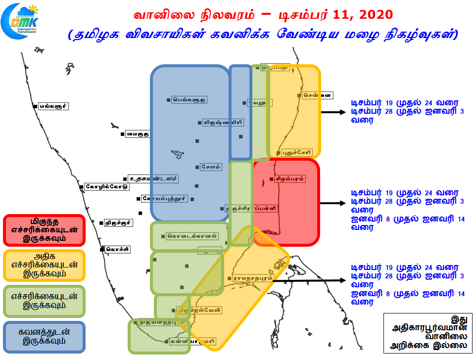
Today’s post is an attempt in that direction to give a head start to the farmers on what the coming few weeks might look in the context of rains and which part of TN need to be extremely wary of possible rain related damages.