
The Southwest Monsoon 2017 has been vigorous over the West Coast with the stretch between North Kerala & Konkan seeing the heaviest rains. In what could be called as the first defining spell of this year’s Monsoon we are likely to see the Konkan coast join the party today under the influence of the off shore trough running from Maharashtra & Kerala and aided by the disturbance in Bay of Bengal.

Southwest Monsoon has been making slow but steady progress over the past few days though in effect the Bay Branch around East & Northeast India has been stalled since June 2nd. The Depression off the coast of Bangladesh is likely to intensify into a possible Deep Depression (Tropical Cyclone Strength) and make landfall today around the Bangladesh / West Bengal border. But not much improvement is expected in the Bay branch after landfall as numerical models do not indicate any progress in the wind pattern to bring in more areas of the region under Monsoon spell.
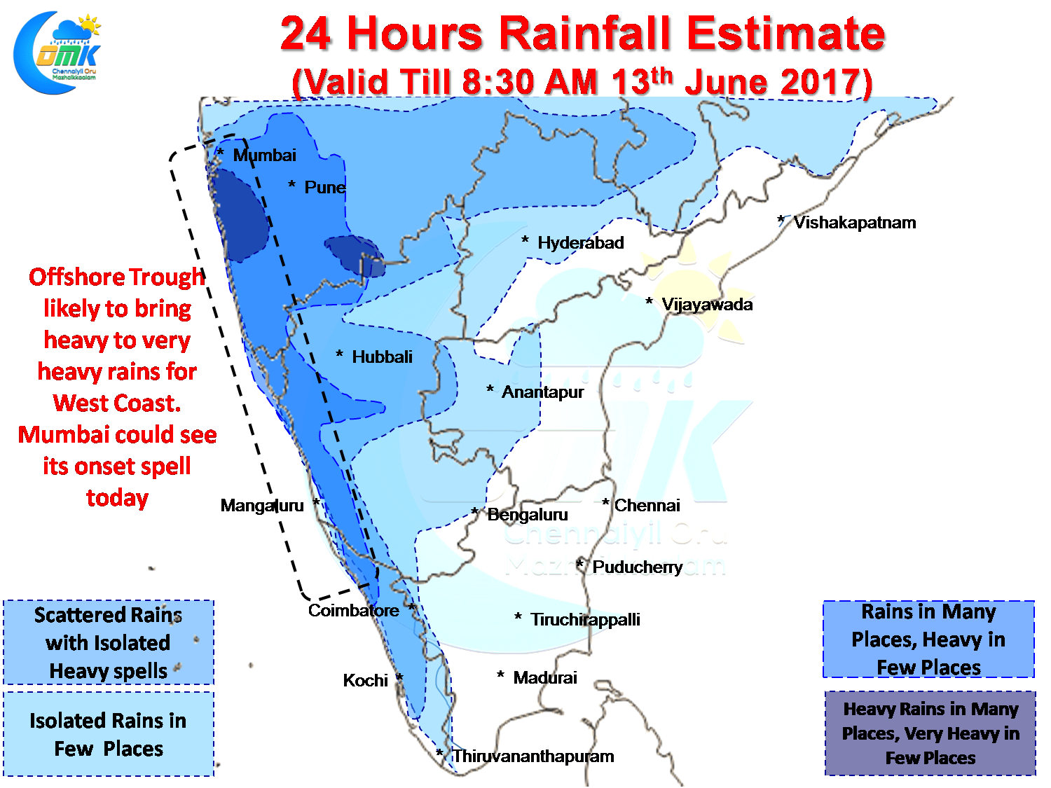
In the meanwhile more parts of Konkan is likely to see onset of Monsoon 2017 with possibly Mumbai also seeing its onset spell today. Numerical Models indicate heavy rains along the West Coast from Maharashtra to North Kerala with few places expected to get very heavy rains in the Konkan stretch. With the Bay disturbance moving up North slightly we can expect the heavier rain bands also to move slightly further up Peninsular India.
As far as rains for Tamil Nadu goes we could possibly see some isolated thunderstorms in North Tamil Nadu but mostly due to the strong monsoon winds any major development of thunderstorms is unlikely. Skies should clear from today / tomorrow improving our chances for Convective thunderstorms this week.
Powered by WPeMatico