
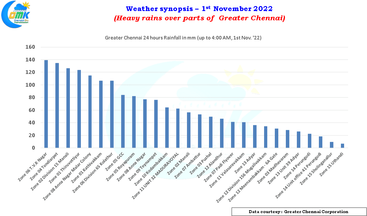
Better late than never goes a famous saying. The northeast monsoon may have made onset 9 days behind schedule, an onset that could have been considered as weak during most years, but yesterday at least over parts of north coastal Tamil Nadu brought in rains at many places. Even though it was not as widespread as weather models indicated it did bring heavy rains over many parts of Chennai, with few central and northern parts recording very heavy rains in the IMD rainfall classification (115.6 mm to 204.4 mm for 24 hours).
In a classic case of diurnal rainfall pattern that happens during most days of northeast monsoon after a lull of practically no rains for most parts of the daytime the intensity of rains increased as the sun went down. At one point the COMK AWS at Anna Nagar recorded rainfall intensity of more than 100 mm / hr between 8:40 and 8:45 PM. The southern parts of the city and southern suburbs which on many occasions record heavier spells missed out yesterday enjoying only moderate rains on most occasions with the IMD observatory at Meenambakkam recording only 30 mm till 2:30 AM. The AWS network maintained by Greater Chennai corporation recorded more than 10 cms of rains in 7 locations though except for Malar Colony, Anna Nagar all the other locations were around the northern parts of the city.
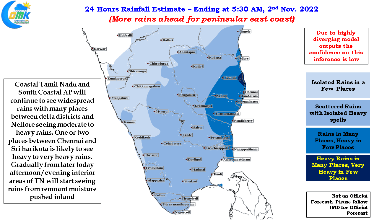
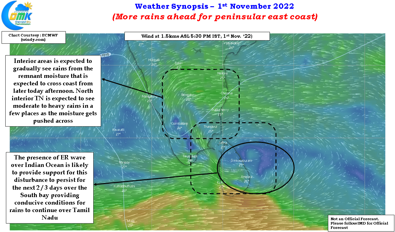
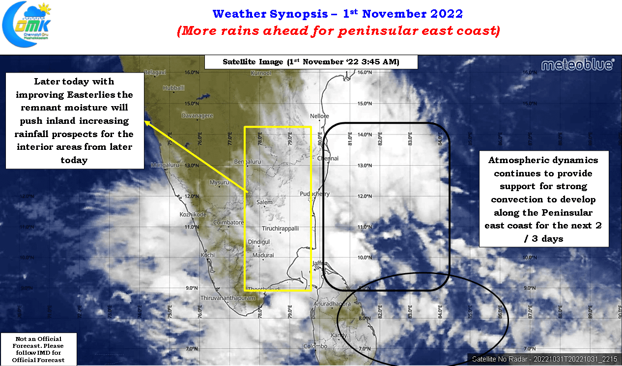
With atmospheric conditions continuing to provide support for rainfall activity over the east coast of peninsular India things look good for the next 3 / 4 days in terms of rainfall prospects for Tamil Nadu. While today once again the heaviest rains are likely to be along the coasts of Tamil Nadu and South AP the easterlies are expected to strengthen further later today improving the chances for the interior parts of Tamil Nadu and adjoining Rayalaseema region to get rains from the remnant moisture that is expected to push inland.
The presence of Equatorial Rossby wave over Indian Ocean is expected to provide support for the trough of low that continues to persist over south Bay near Sri Lanka. This would mean conditions will remain favorable for the rains to persist over parts of South India. Weather models show a bit of divergence in terms of the potential rains today for places like Chennai with ECMWF expecting a reduction today while GFS expecting heavy to very heavy rains over North coastal Tamil Nadu between Chennai and Pondicherry. Nevertheless it looks like once again the hotspot for heaviest spell of rains may be around Chennai with the patch between Chennai and Sriharikota likely to see heavy to very heavy rains particularly during the early morning and night time.
All in all though most of this week is likely to bring rains across Tamil Nadu to keep the seasonal rainfall chart ticking and allowing coastal places like Chennai to catch up with some of the deficit accumulated during the month of October.