
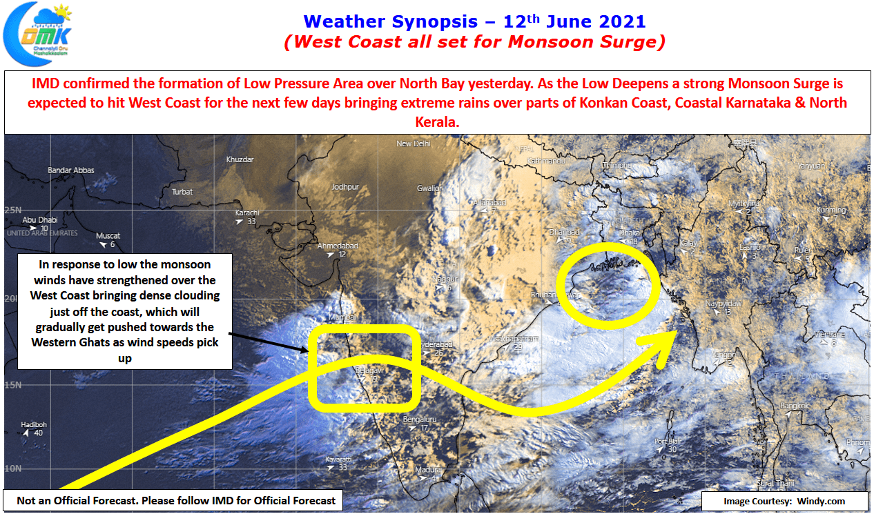
The first Monsoon Surge of Southwest Monsoon 2021 is all set to hit West coast starting today influenced by the Low Pressure that has developed over North Bay. IMD confirmed the formation of LPA off the coasts of Odisha / West Bengal yesterday. As we mention often, while Arabian Sea remains the carrier of moisture for Southwest Monsoon the moisture drag created by a Low Pressure over Bay of Bengal is what triggers the most active spell of Monsoon or for that matter create conditions conducive for Monsoon Surge. Many a times Low Pressure Area in the Bay is complimented by a trough over Arabian sea either as an off shore trough off West Coast or in some cases a trough which extends form West Central Arabian Sea as in the current case.

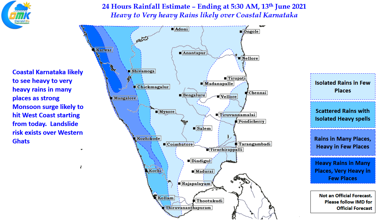
Weather models indicate the next few days is likely to see heavy to very heavy rains over the West Coast with bulk of the rains expected to happen over South Konkan & adjoining parts of Coastal Karnataka and the Western Ghats. The river basins of Thunga & Bhadra is expected to see heavy inflows in the days to come. While Cauvery Basin may not see widespread surge conditions we might see heavy inflows into Hemavathi which in turn could turn out beneficial for the basin overall. Kabini being a smaller dam compared to KRS & Hemavathi we could see it reach FRL before the end of the month giving an opportunity for Tamil Nadu to receive inflows from Karnataka by 1st week of July. With Mettur opening its shutter today, the traditional date of opening weather bloggers will be keeping a close watch over Wayanad & Kodagu dts for any uptick in rainfall.
In the meanwhile Tamil Nadu will see hot day time conditions, particularly along the coastal areas as westerlies strengthen. Sea Breeze will take a temporary break which means Hot evenings are going to be the order of the day while dry afternoons with low humidity will persist for the next few days.