
Southwest Monsoon this year started with a bang even before the traditional onset date over Kerala. Late May saw a Monsoon surge that brought one of the earliest monsoon onsets in recent years. Subsequently as we came to the traditional onset window monsoon stalled for nearly two weeks. Between 26th May and 15th June the Monsoon onset stalled around Mumbai latitude. Subsequently influenced by favourable conditions we saw once again monsoon dynamics pick up.
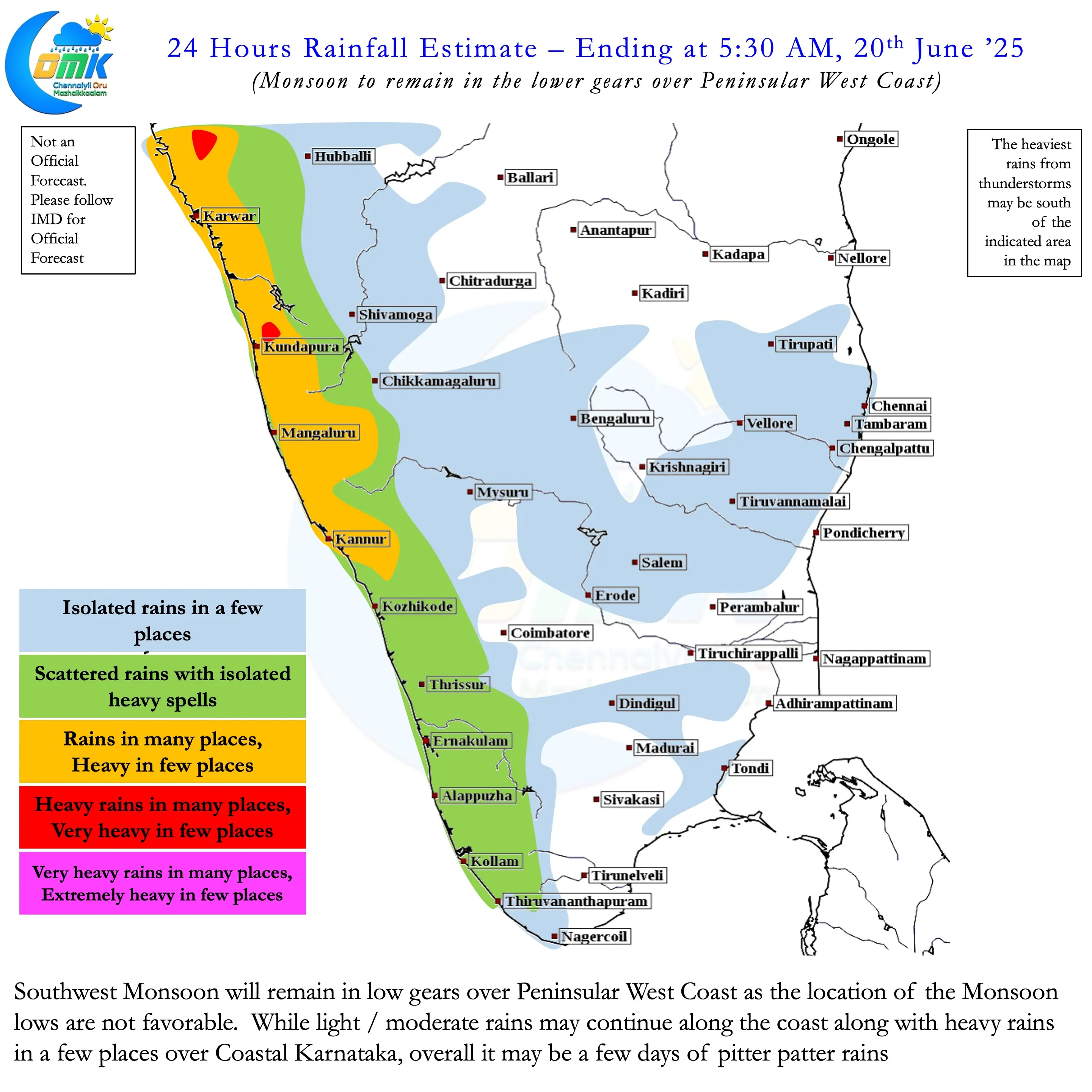
During this period we saw monsoon surge once again over Peninsular West Coast for a couple of days. Since the last 24 to 48 hours there has been a discernible slow down of monsoon dynamics over Peninsular India. While the rains have not completely stopped they have slowed down drastically. Heavy rains continue to happen along the coast and in the Ghats over a few places. Nevertheless the change is visible and is likely to continue for the next week or 10 days going by model outputs.
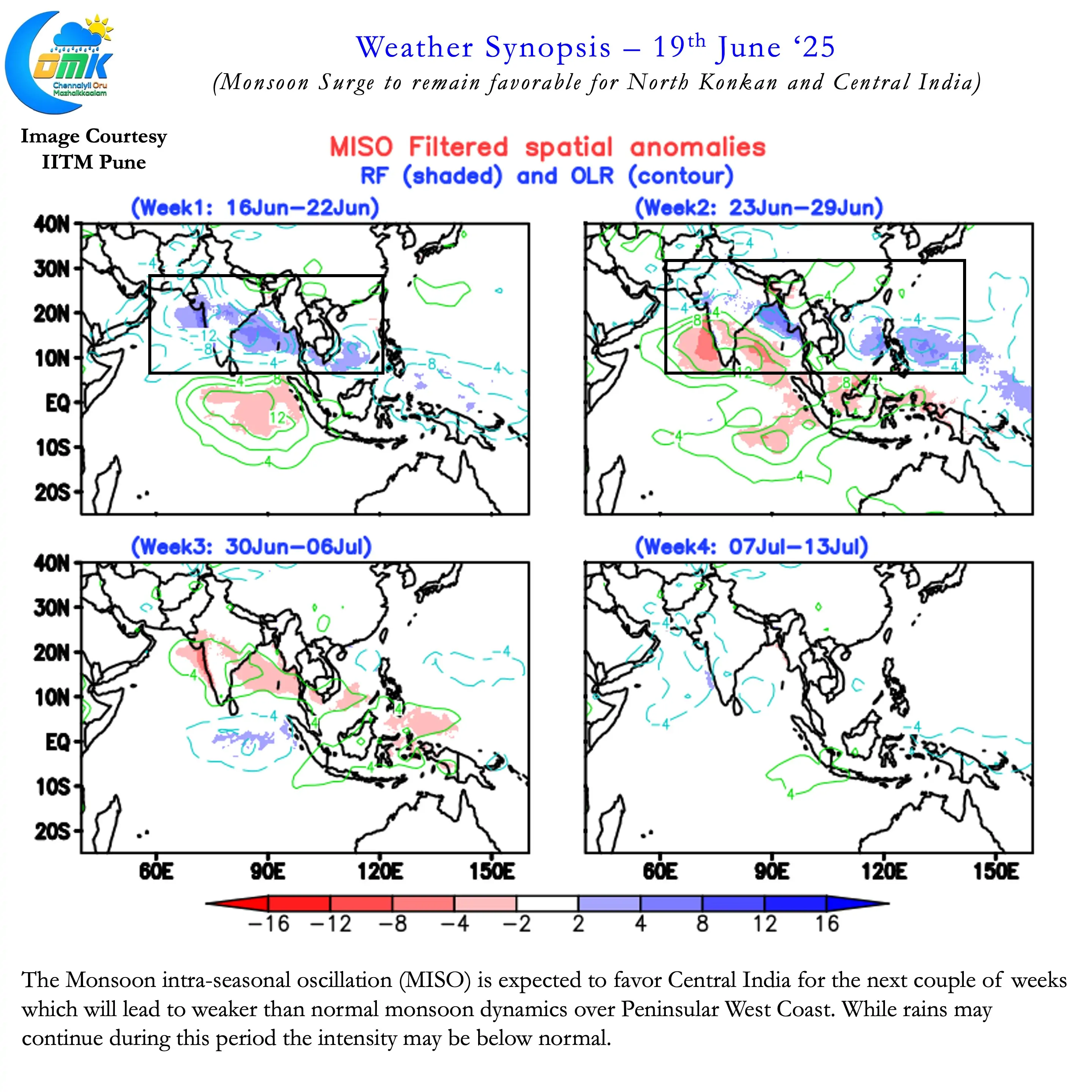
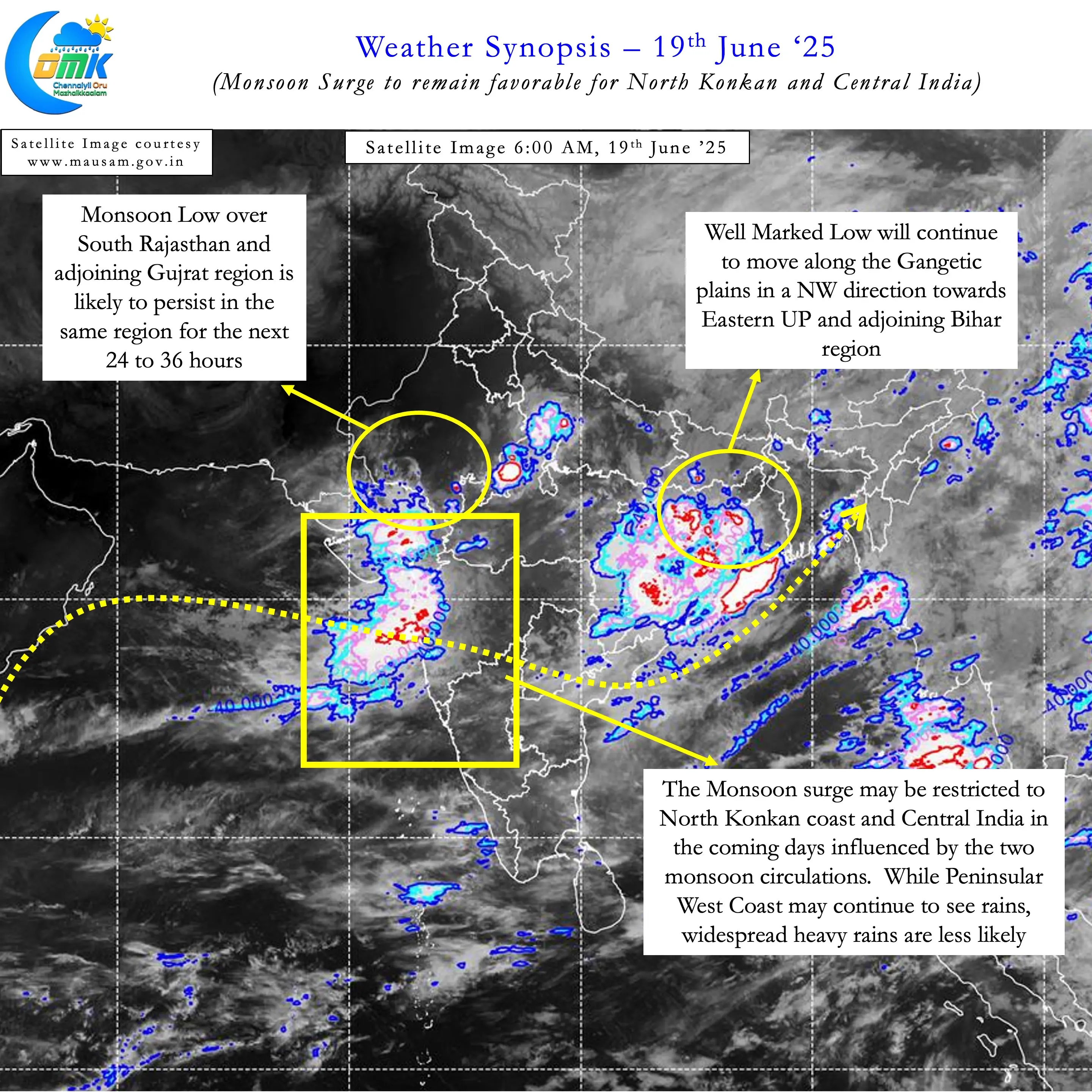
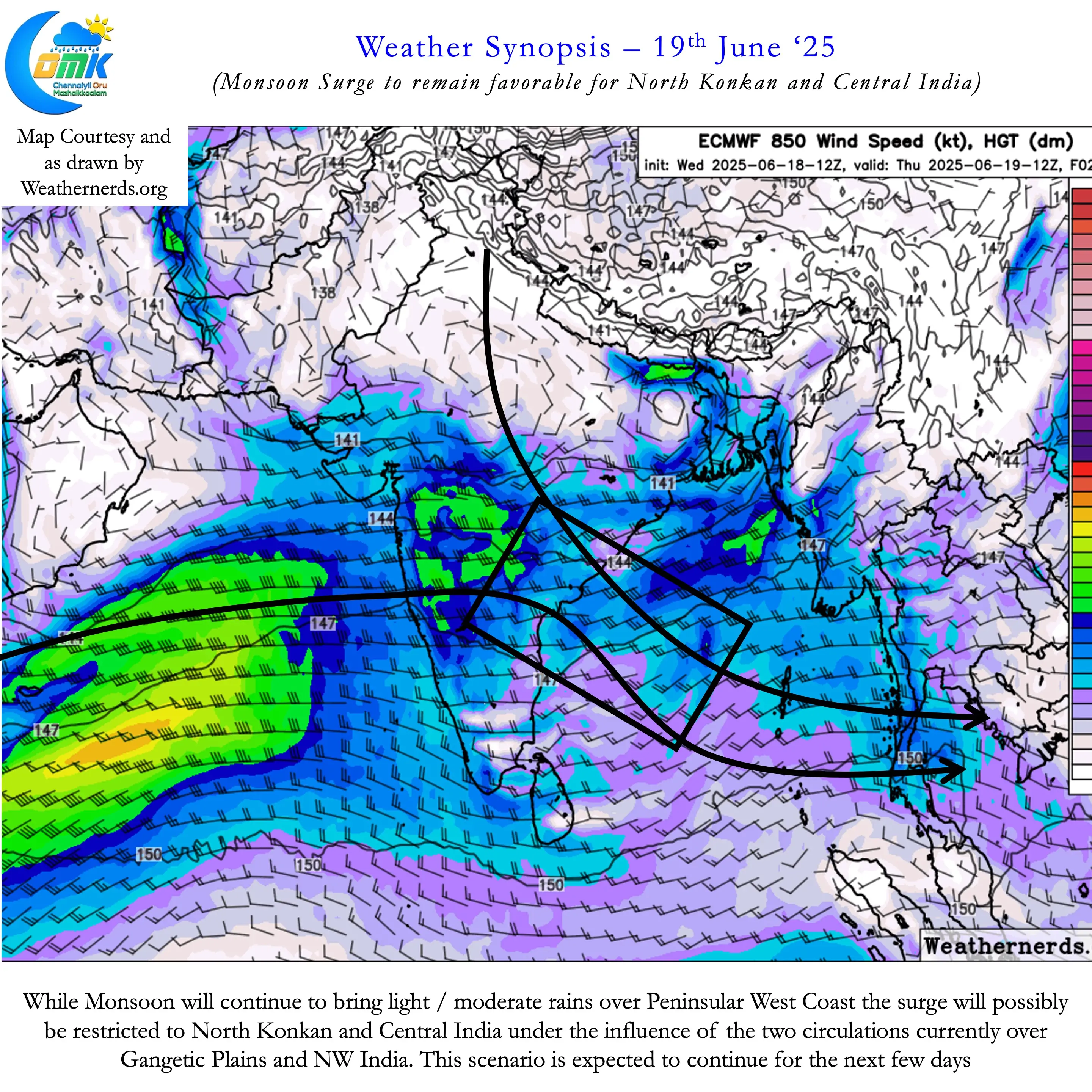
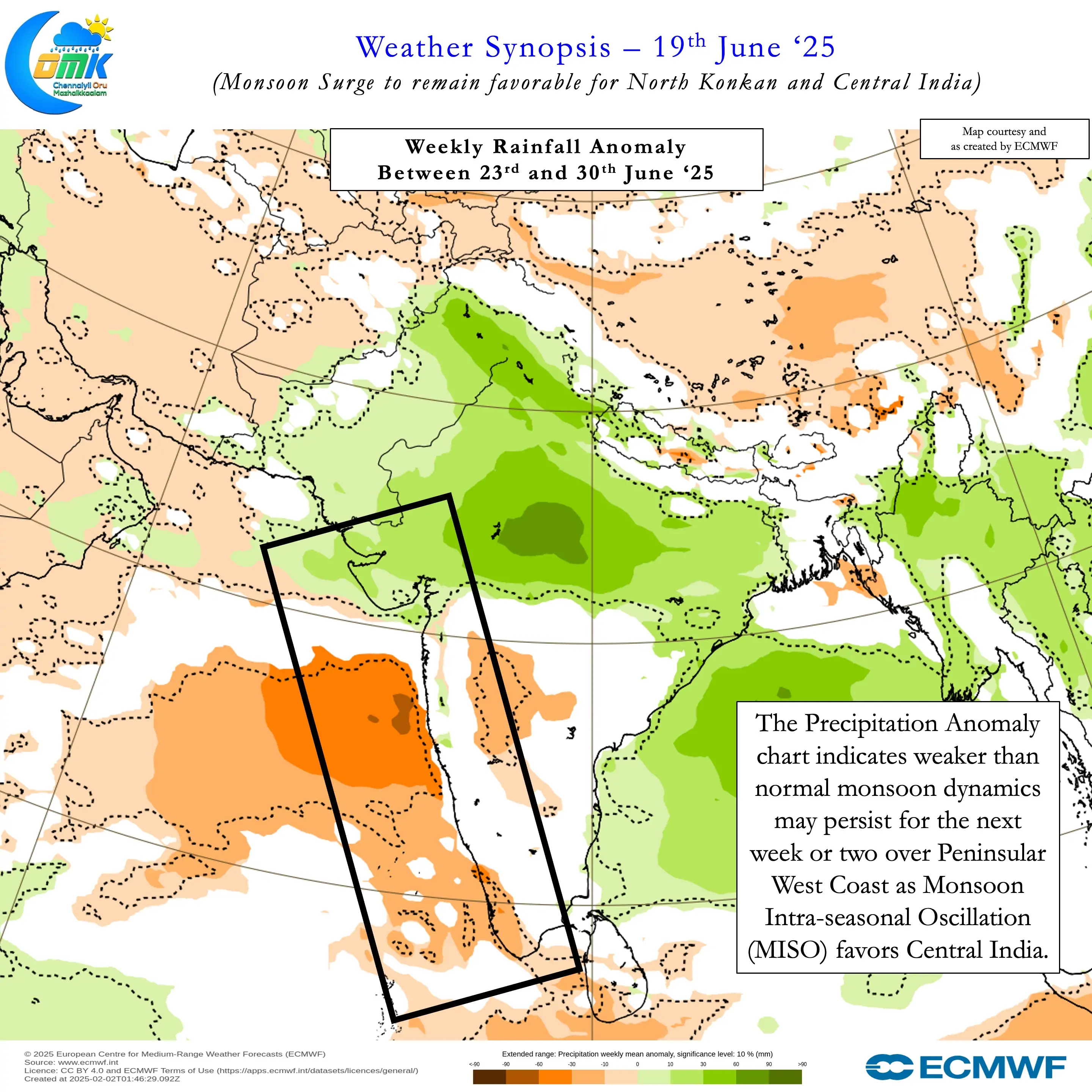
Currently the transition of Monsoon Instraseasonal Oscillation (MISO) is likely to favour parts of Central India and Bay of Bengal. This would mean over the next few days Konkan coast along with Central and East India may be beneficiaries. The Well Marked Low over East India may continue to move NW along the Gangetic Plain. The one over NW India will gradually weaken and merge with the Low coming in from the East. This transit of the Low over Gangetic Plains is likely to bring widespread rains over Central India.
As mentioned above during the next couple of weeks Monsoon may remain weaker than normal over Peninsular India. While the rains may not completely stop the intensity is expected to be lower. Most of the plains may see light to moderate rains. At times under favourable moisture transit few places in the Ghats may see heavy rains. Unlike the traditional break in monsoon period this period of two weeks may not bring any identifiable thunderstorms to the leeward plains of Tamil Nadu. It remains to be seen if we may see an increase in afternoon temperatures over places like Chennai.
As always do keep a tab on the COMK Estimated Rainfall Range page for an update on expected rainfall pattern.