
Southwest Monsoon since the onset has been going through a stop start journey even though it touched down the sub continent shores before time. Like an express train not only forced to run behind a slow moving freight train ahead but also the presence of near continuous TSRs’ monsoon so far has been forced to play a subdued role though thunderstorms over many parts of Peninsular India has brought about large excess rains for the leeward areas like interior Tamil Nadu.
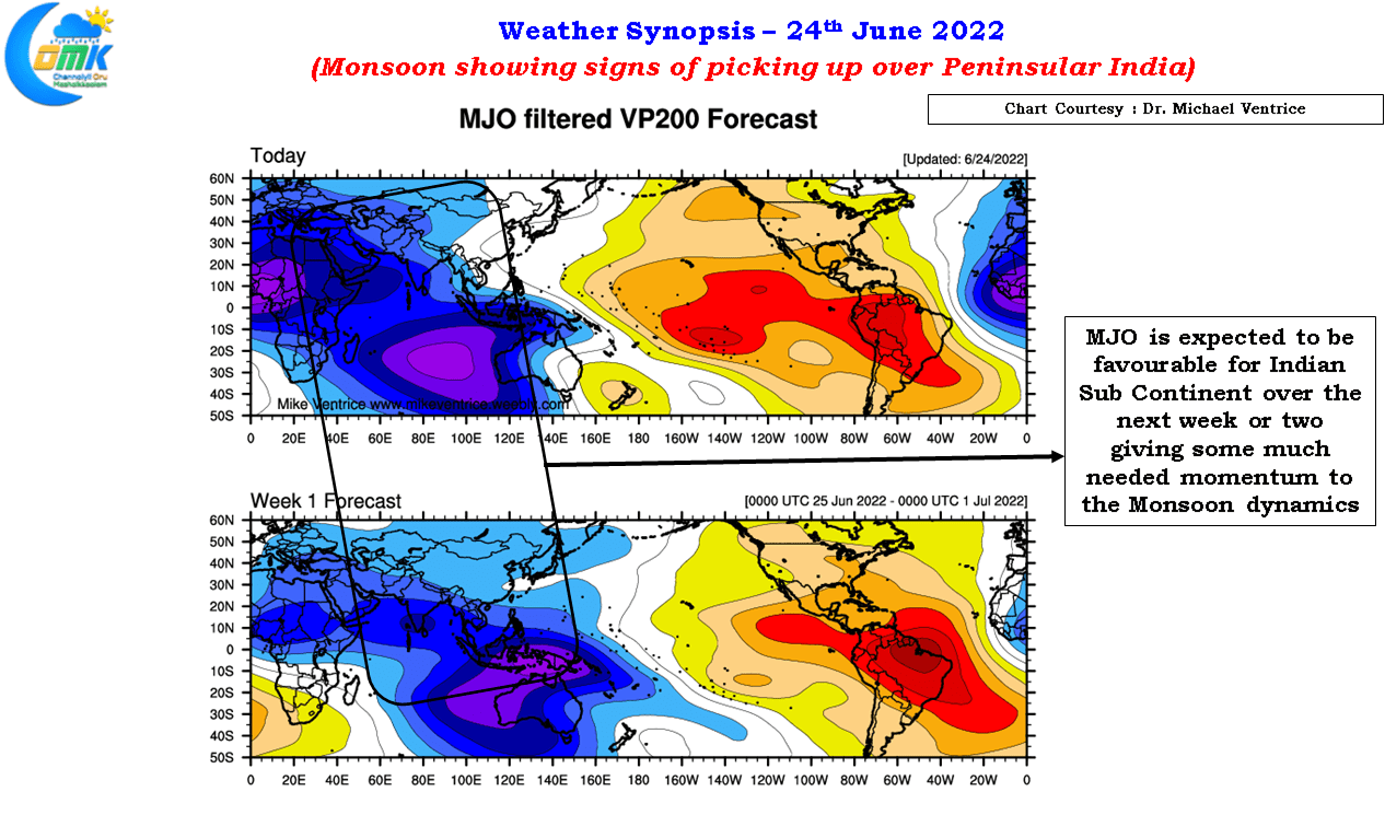
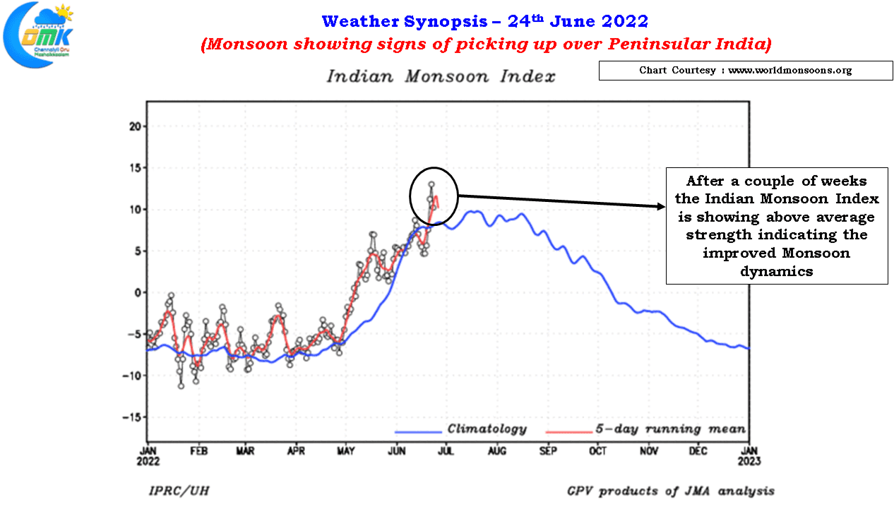
The arrival of MJO into Indian Ocean though is likely to bring about a change in operational conditions similar to a proactive section controller who realizes the sectional traffic efficiency may be better off with the express train overtaking the freight train. MJO will possibly give the much needed green signal to the Monsoon express train which has been riding double yellows so far behind the freight train. Over the next week or two MJO might be favorable for Monsoon to pick up some much needed momentum.

The morning satellite image certainly looks much better for the west coast compared to the past few days with overnight and early morning moderate to heavy spell of rains reported over many places along the coast and the Ghats. The rainfall numbers from the Ghats surely indicate the monsoon surge has still not picked up yet with mostly coastal areas so far enjoying better rainfall numbers. WIth the UAC seen off the Konkan coast we can expect many places in west coast and along the Ghats to receive heavy rains from today for the next few days. Consequently we might see reduced thunderstorm activity over Tamil Nadu due to the strengthening westerly winds though with lot of moisture being pushed inland it may not be a surprise to see one or two places in South TN and North Coastal TN come under fast moving thunderstorms.