
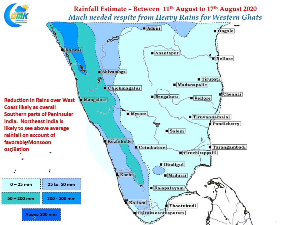
After a few days of beast mode for Southwest Monsoon things have slightly eased from yesterday with rainfall number tapering over most parts of the West Coast including along the Ghats. This will come as welcome relief to the authorities for getting the things back on track in areas like Wayanad, Idukki, Kodagu etc where landslides have happened.
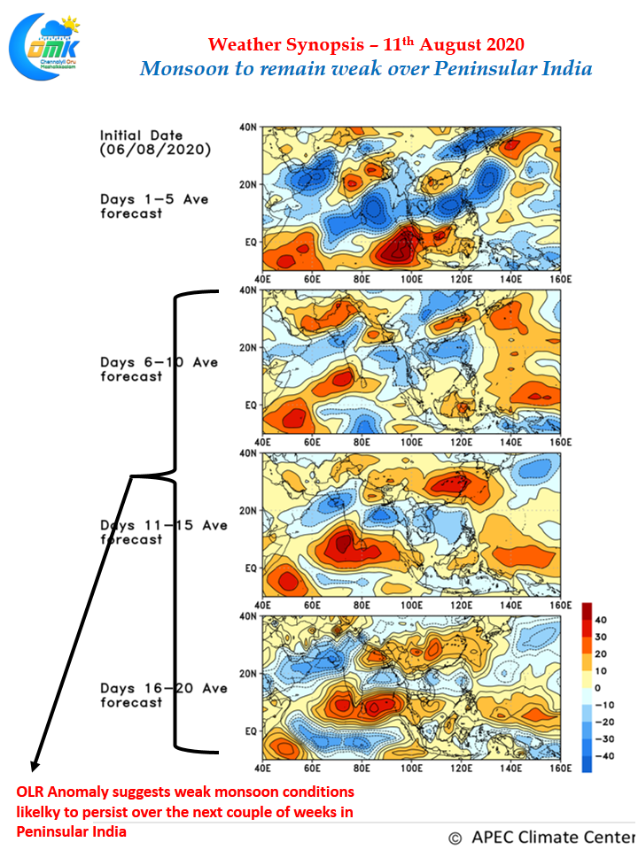
While overall monsoon may remain weak on account of Monsoon oscillation favoring the Maritime Continent & the adjoining parts of Bay of Bengal there will be moderate rains along the West Coast & Particularly in the ghats where orographic effect will ensure rains on most days. Due to unfavorable phase of Monsoon dynamics we could possibly see thunderstorms also limited over leeward side of Peninsular India like Tamil Nadu etc. The OLR anomaly map for the next couple of weeks suggest a subdued phase almost right across Peninsular India though we might see some scattered thunderstorms over Tamil Nadu & possibly sea breeze induced thunderstorms in a few places along the coast like Chennai Pondicherry etc. Overall expected precipitation pattern is likely to be well below the numbers that happened last week.

Influence of MJO is seen over the Eastern Side of Maritime continent and it would possibly further move Eastward bringing a slightly suppressive phase of atmospheric conditions over Indian Sub Continent. It remains to be seen if once again the pattern of long lull interspersed with sudden burst of extreme rainfall episodes will happen once again as has been the case since the start of Monsoon 2020