
Monsoon is a word but Monsoon onset over Kerala (MOK) is an emotion. It is an emotion not just for the weather community but most of India. Despite all the manufacturing advances over the past couple of decades agriculture still remains India’s largest provider of rural employment. Agriculture still contributes to about 16% of the Indian GDP. Ask any consumer durable / automotive company they will confirm the importance of rural employment. Some of their best years have coincided with robust monsoon years. An early onset and good monsoon is an important driver of this sector. Yesterday IMD announced “The conditions are likely to become favourable for Monsoon onset over Kerala during next 4-5 days“.
Over the past few days Tamil Nadu and most of leeward Peninsular India saw an active phase of thunderstorms. The Pre-Monsoon thunderstorms brought about water logging in places like Bengaluru bringing copious inflow into rivers like Pennar and Cauvery. Even Chennai and suburbs saw a spell of rains last evening bringing relief from heat. The cyclonic circulation that provided conducive conditions for these thunderstorms will now play a role in Monsoon Onset.
Additionally a developing cyclonic circulation in Arabian Sea will make things better for Monsoon onset over Kerala. Weather models indicate this circulation may become an Low Pressure Area by tomorrow. Subsequently there is a good chance it may deepen into a Depression. There is also a 50:50 possibility of Deep Depression or Tropical Cyclone. Weather models tend to underestimate the intensity of tropical disturbances in the Arabian Sea.
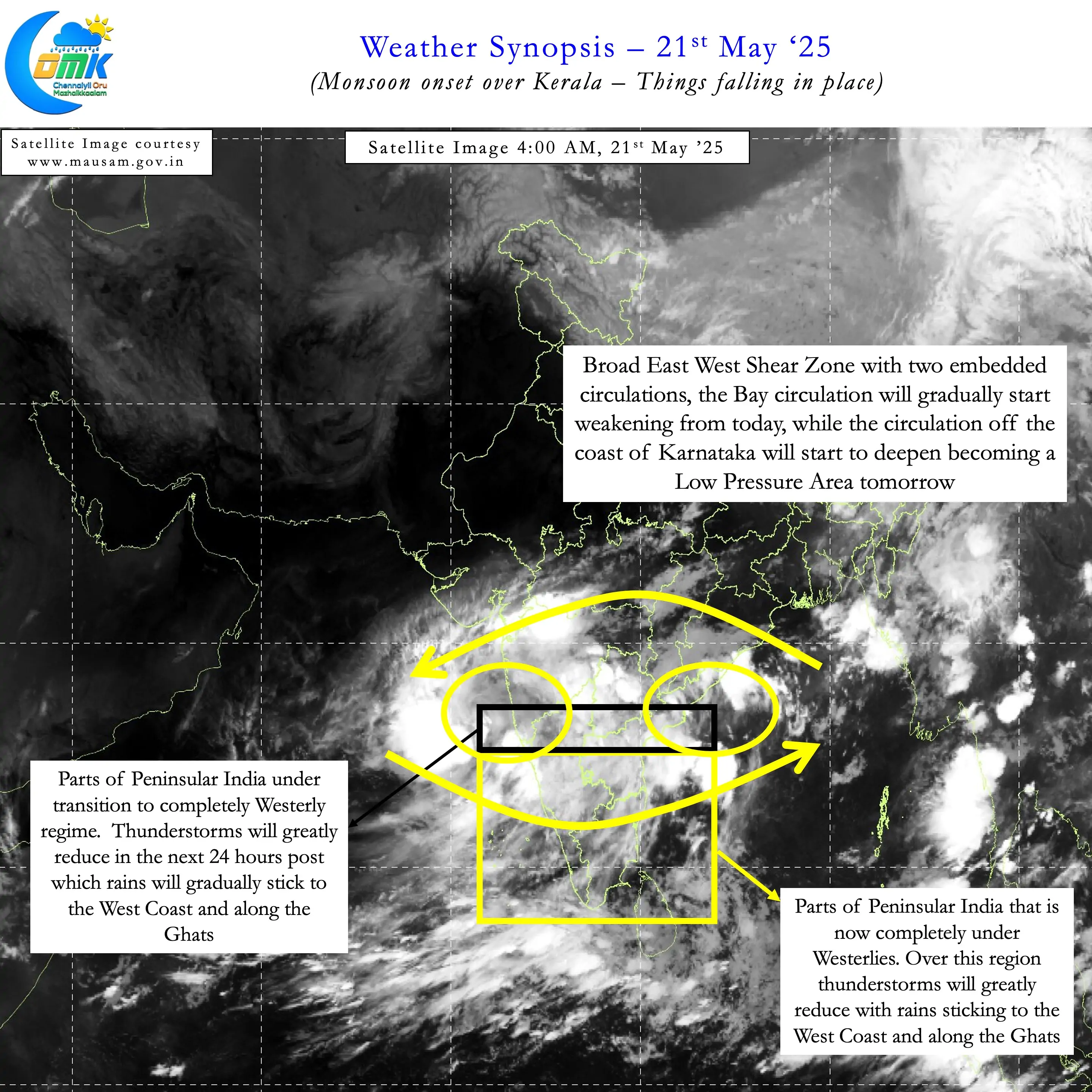
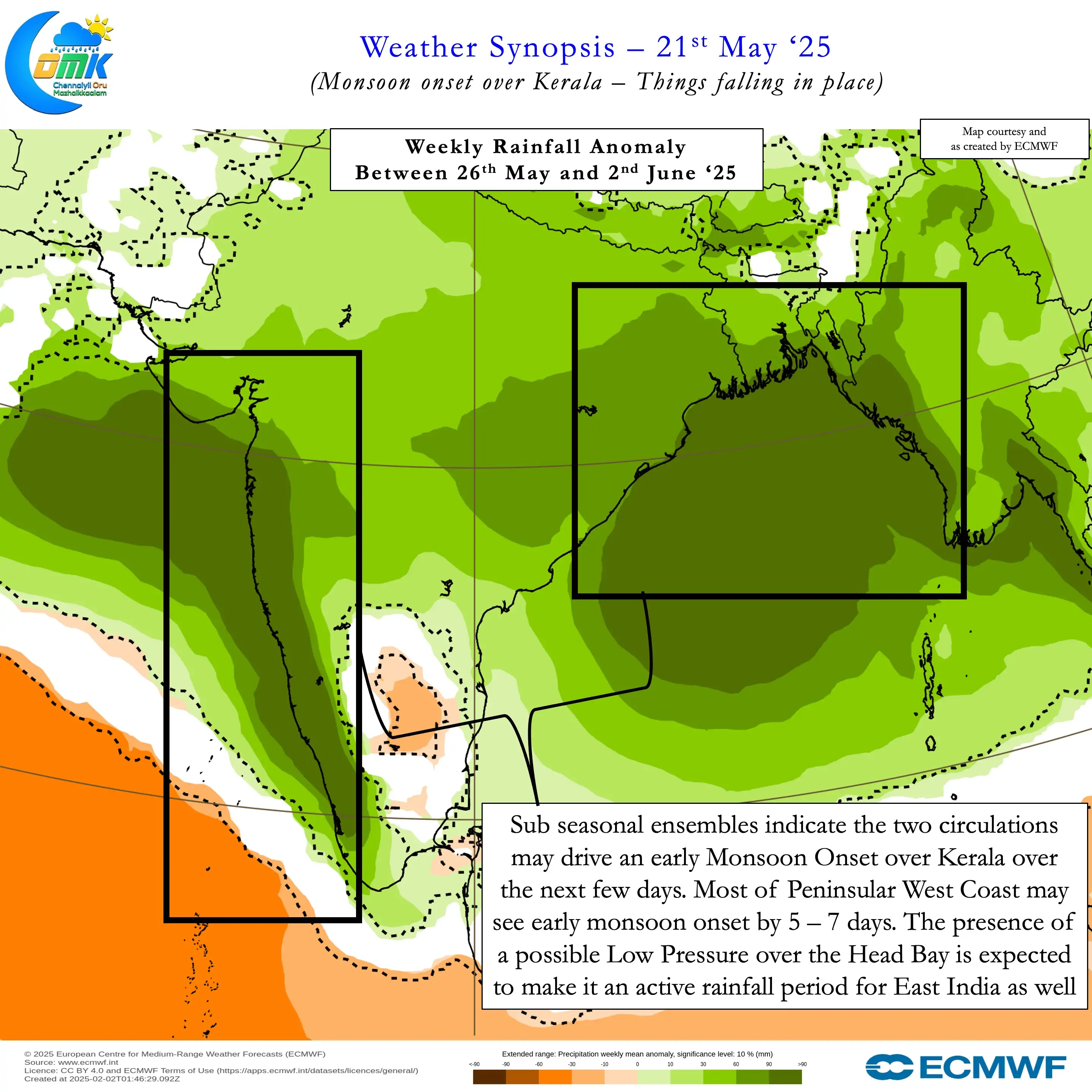
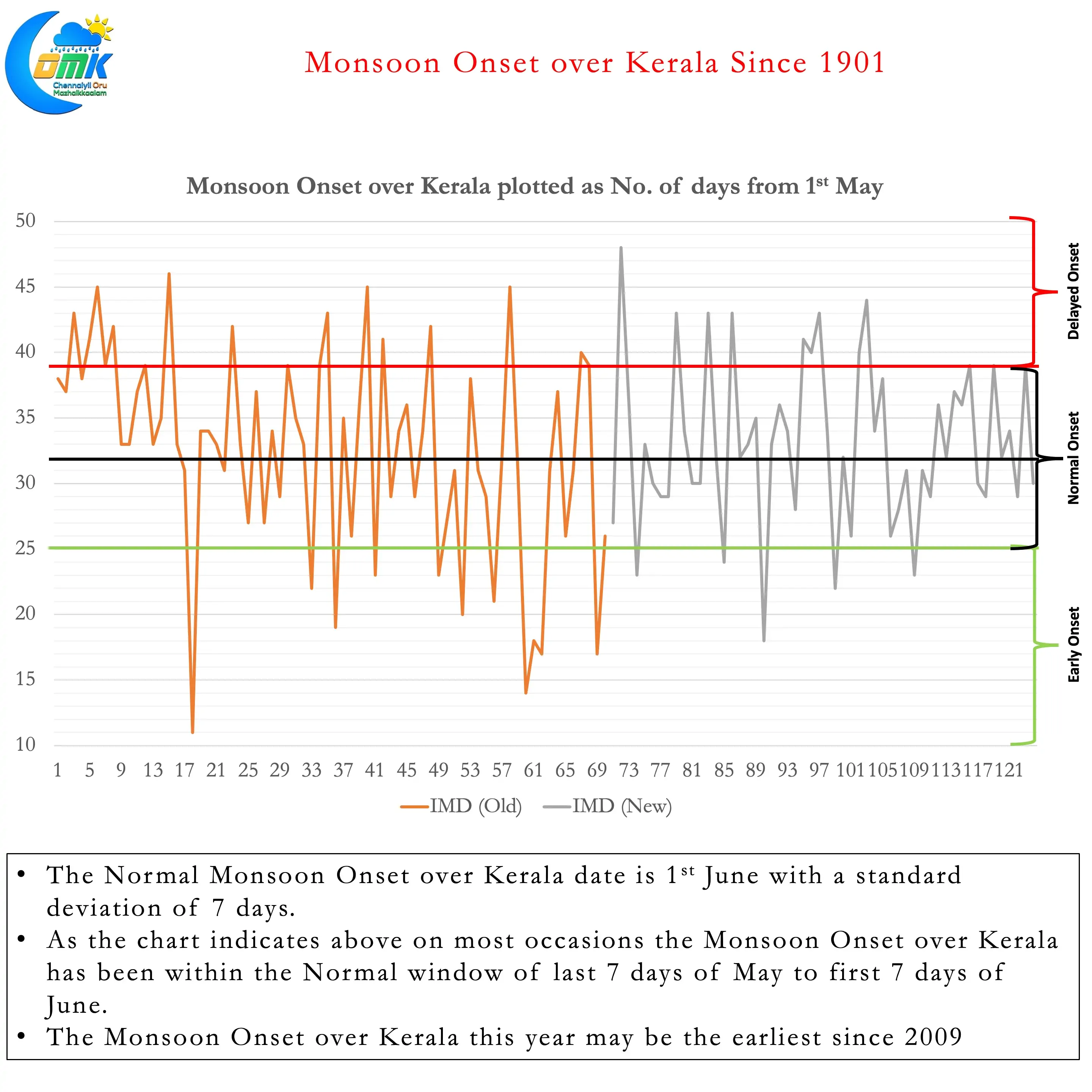
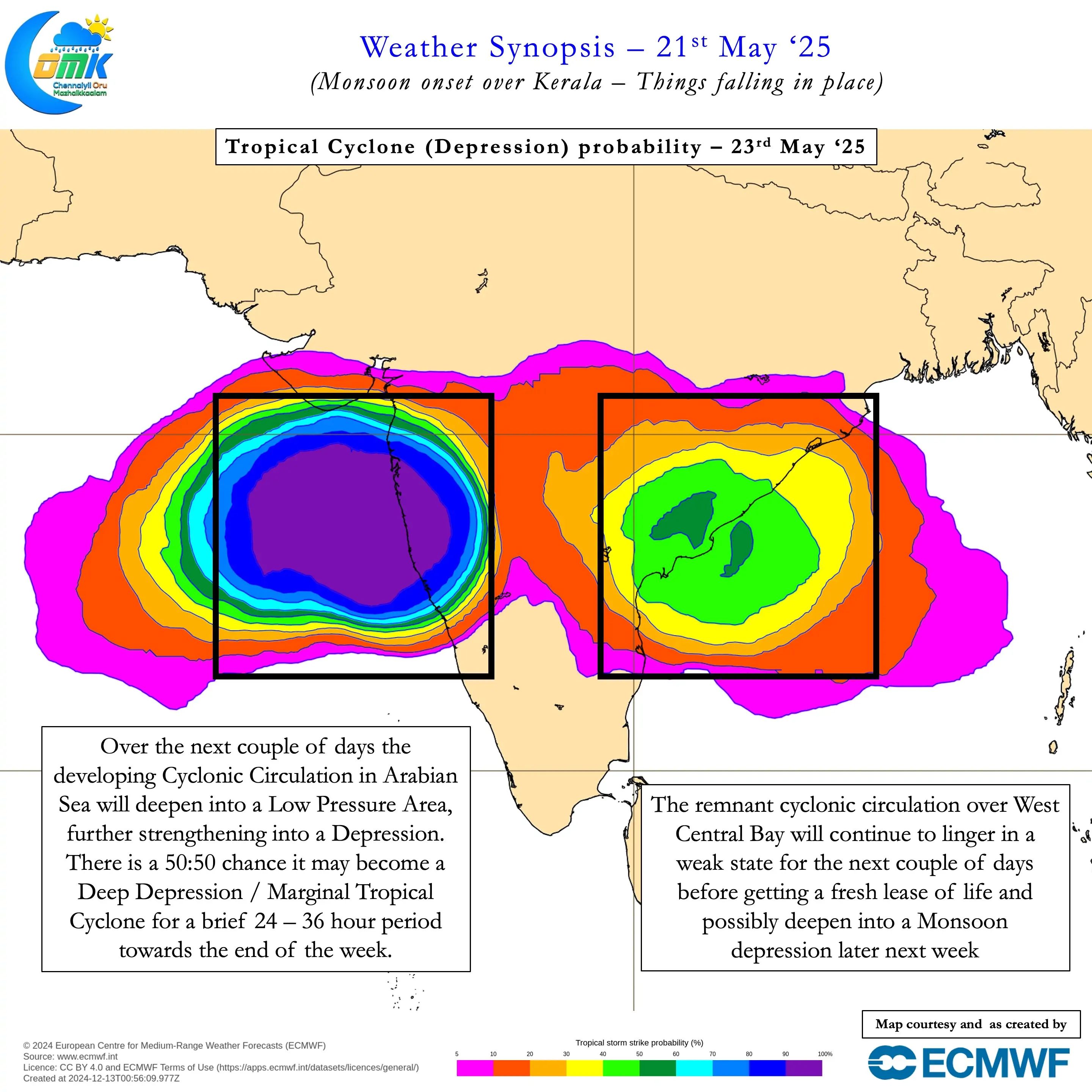
In all this it is essential not to forget about the cyclonic circulation in Bay of Bengal. Though it may weaken when the Arabian Sea circulation strengthens. It is likely to strengthen once again while it drifts North when the Arabian Sea circulation moves further west. This could potentially mean a fresh LPA may develop over Head Bay the upcoming week. The presence of this LPA may provide an impetus to monsoon dynamics bringing not only an early onset but also a very robust onset. 2025 may see one of the earliest onsets in recent time. In 2009 Monsoon onset over Kerala happened on 23rd May while this year is is likely to happen between 24th and 26th May.
Sub seasonal models indicate a very wet period for not only Peninsular West Coast but also East India for the next couple of weeks. Subsequently there is a chance we could see a lull though it may be prudent to wait and watch. In the event there is a lull in monsoon dynamics we may see a very quick return of thunderstorms over leeward plains of Tamil Nadu. Until then convective thunderstorms will take a back seat as strong monsoon winds create high wind shear over Peninsular India.
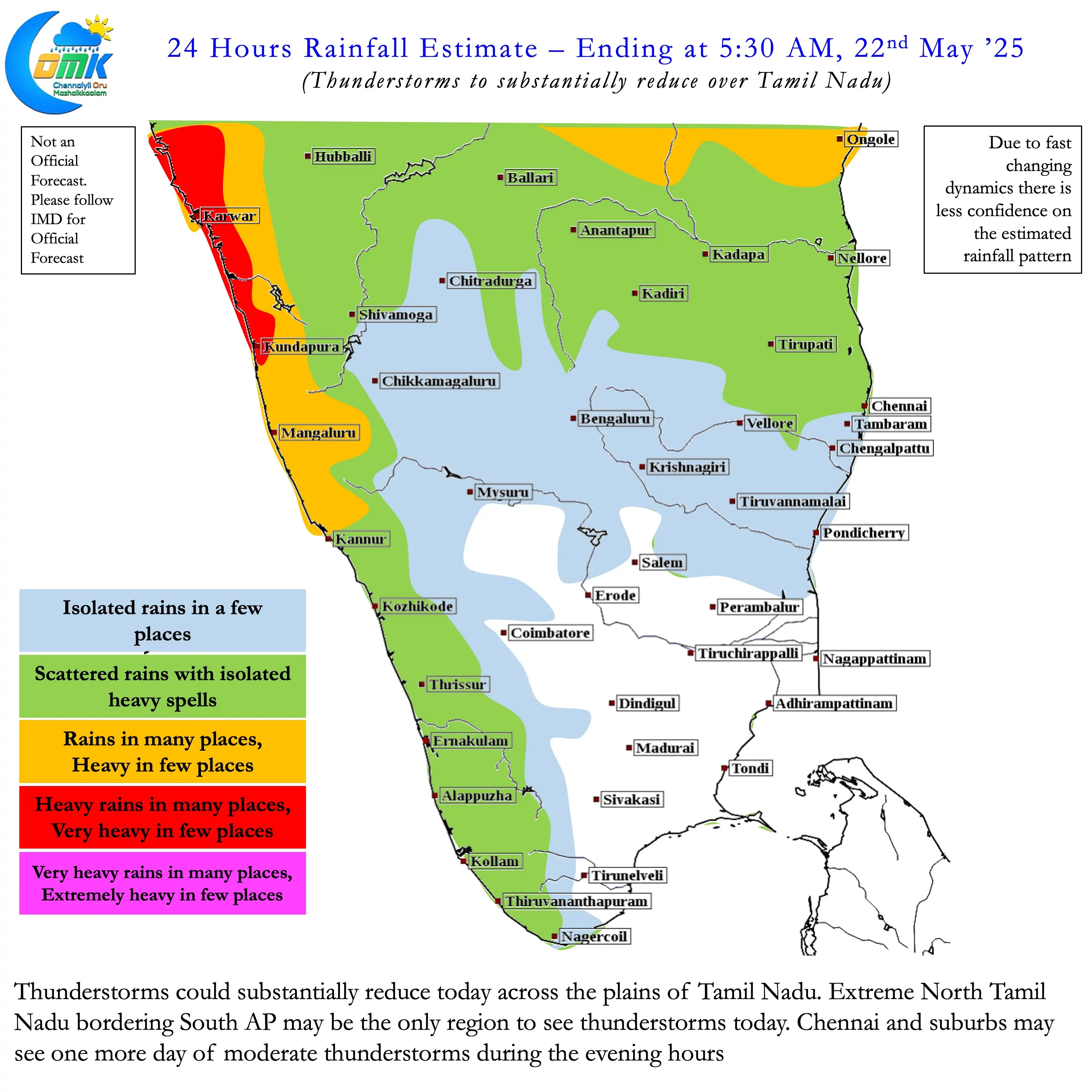
Today we could see thunderstorms over North TN, around the borders of South AP as still weak wind convergence will prevail. From tomorrow even North TN may see very little thunderstorm activity. The 2 week rainfall forecast for district headquarters of TN & PDC also confirm this lull. Chennai and suburbs with some luck may catch some spell of moderate rains today and some isolated rains tomorrow. Post which we will have to get used to delayed sea breeze as westerly winds rule the roost.