

Weather Models are run by super computers which can do millions of calculations by the second, but to say the most powerful super computer is the human brain is an understatement. Time & again we have seen it with thunderstorms over Chennai that happen just as an Upper Air Cyclonic Circulation becomes a Monsoon Low over Bay of Bengal. More often than not weather models tend to underestimate this phenomenon along with one other unique pattern that happens, when it rains in Chennai during Southwest Monsoon rest of Tamil Nadu is mostly quiet. This becomes particularly true during the transition time to & after Break in Monsoon period. Two areas possibly signify the arrival & withdrawal of Break in Monsoon Period. Places closer to the Ghats in the North Coimbatore region & Chennai and Suburbs.
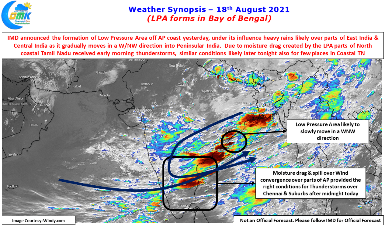
With moderate rains lashing the city with some severe ground strikes for nearly an hour many parts of Chennai and suburbs recorded nearly 2 to 3 cms of rains, most of which fell during the early hours of Tuesday. A combination of spillover wind convergence from Coastal Andhra Pradesh & moisture drag created by the LPA triggered these storms after midnight bringing much needed relief to the citizens of Chennai. With the LPA expected to move slowly in a WNW direction, today may provide another opportunity for coastal areas of Tamil Nadu to catch a spell or two thunderstorms in a few places under similar conditions.
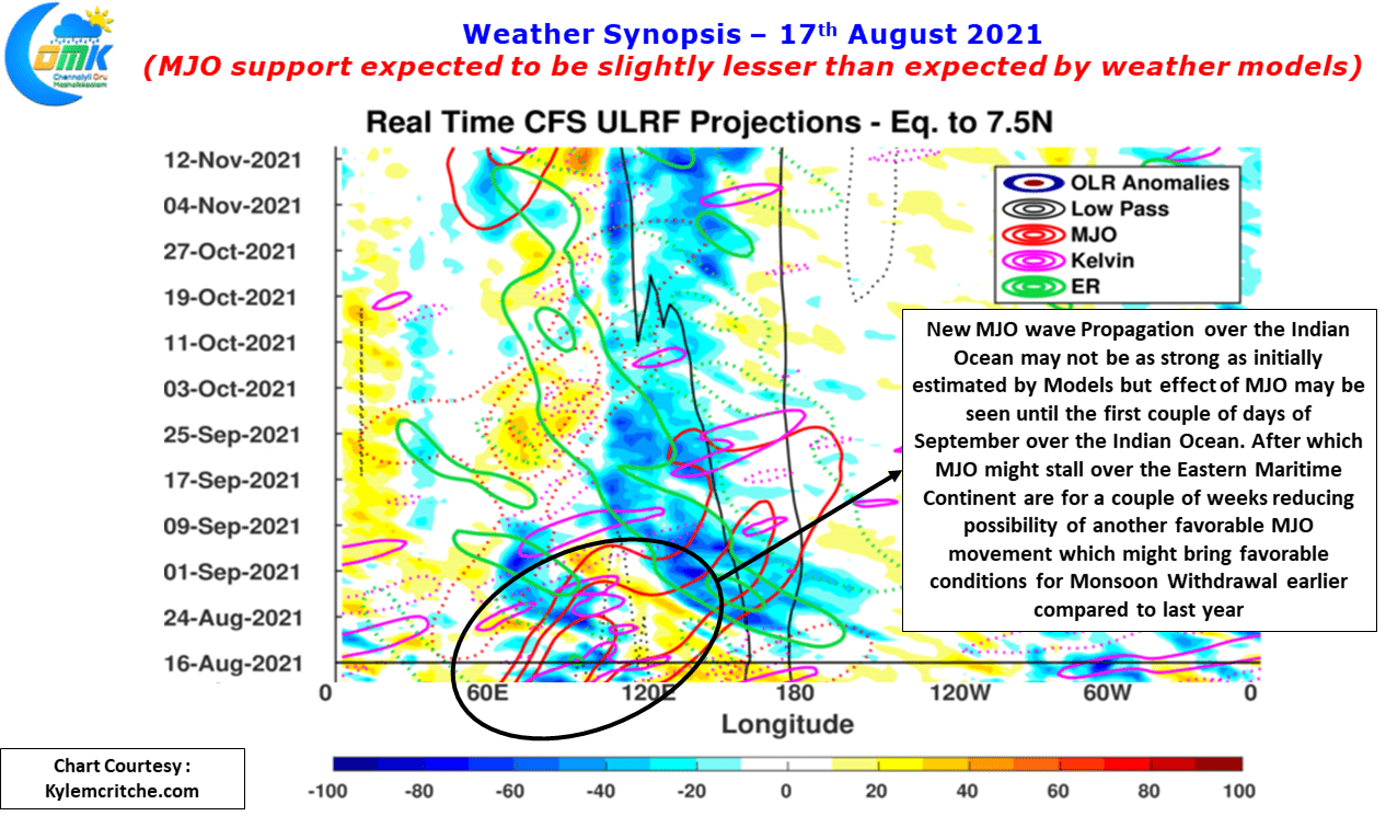
If one were to look at a slightly larger picture particularly in the context of Long Term Southwest Monsoon Average for this year currently at -9% deficit MJO it appears may not be exactly favorable as initially expected by weather models. With the fresh MJO wave propagation expected to start from Indian Ocean not expected to completely favor the Indian Sub Continent though it will still impact the rainfall events over Peninsular India up to the first couple of days of September we may not see Monsoon surge replicate that of June or July days. Additionally a near stationary movement expected over the Eastern parts of Maritime Continent subsequently we may not see MJO come back again into Indian Ocean to help Southwest Monsoon once again this year leading to favorable conditions for the withdrawal process to start earlier compared to last year.