

It is almost middle of May. That time of the year when weather discussions become more mainstream. Discussions will revolve around the arrival of one of the largest annual global weather events. The earliest indication of Monsoon dynamics is the strengthening of Westerlies. Southwest Monsoon in a way is recreation of large scale sea breeze. In response to the thermal low over North India the Low Level Monsoon Jet moves across the equator from the Mascarene High.
The Low Level Monsoon Jet popularly known as Somali Jet was first documented by John Findlater. But it has existed for many millennia. The word monsoon traces its origin to the Arabic word “mausim” based on the winds that helped sailors. Closer home the Chola Maritime conquest was built on the back monsoon winds. Their strong knowledge of monsoon winds helped naval movement between Peninsular India and SE Asia.
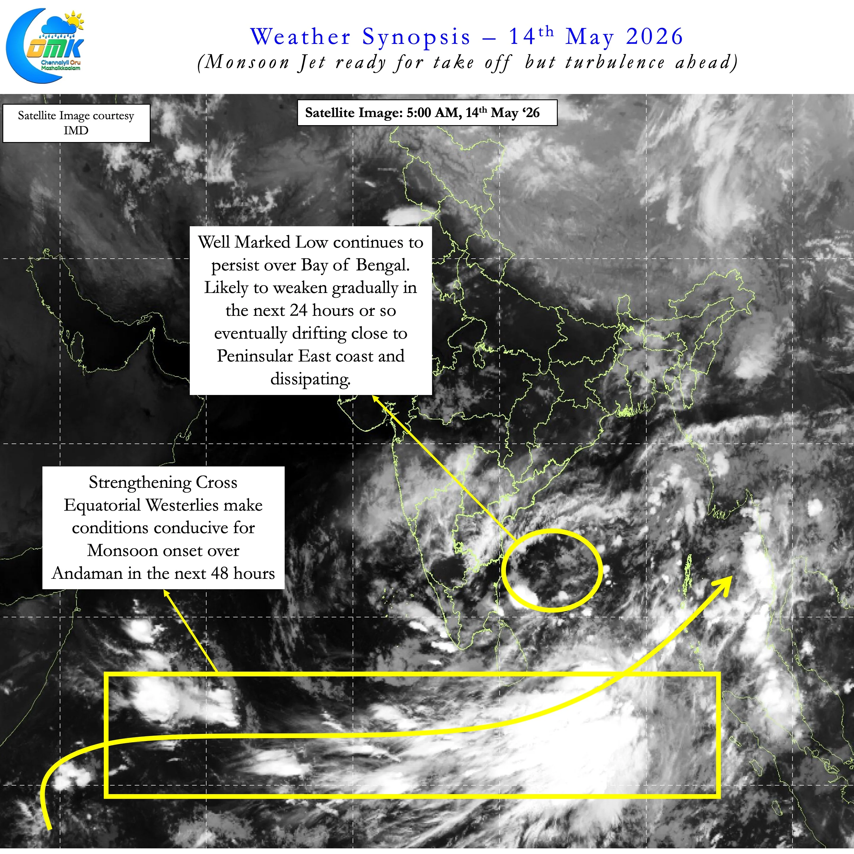
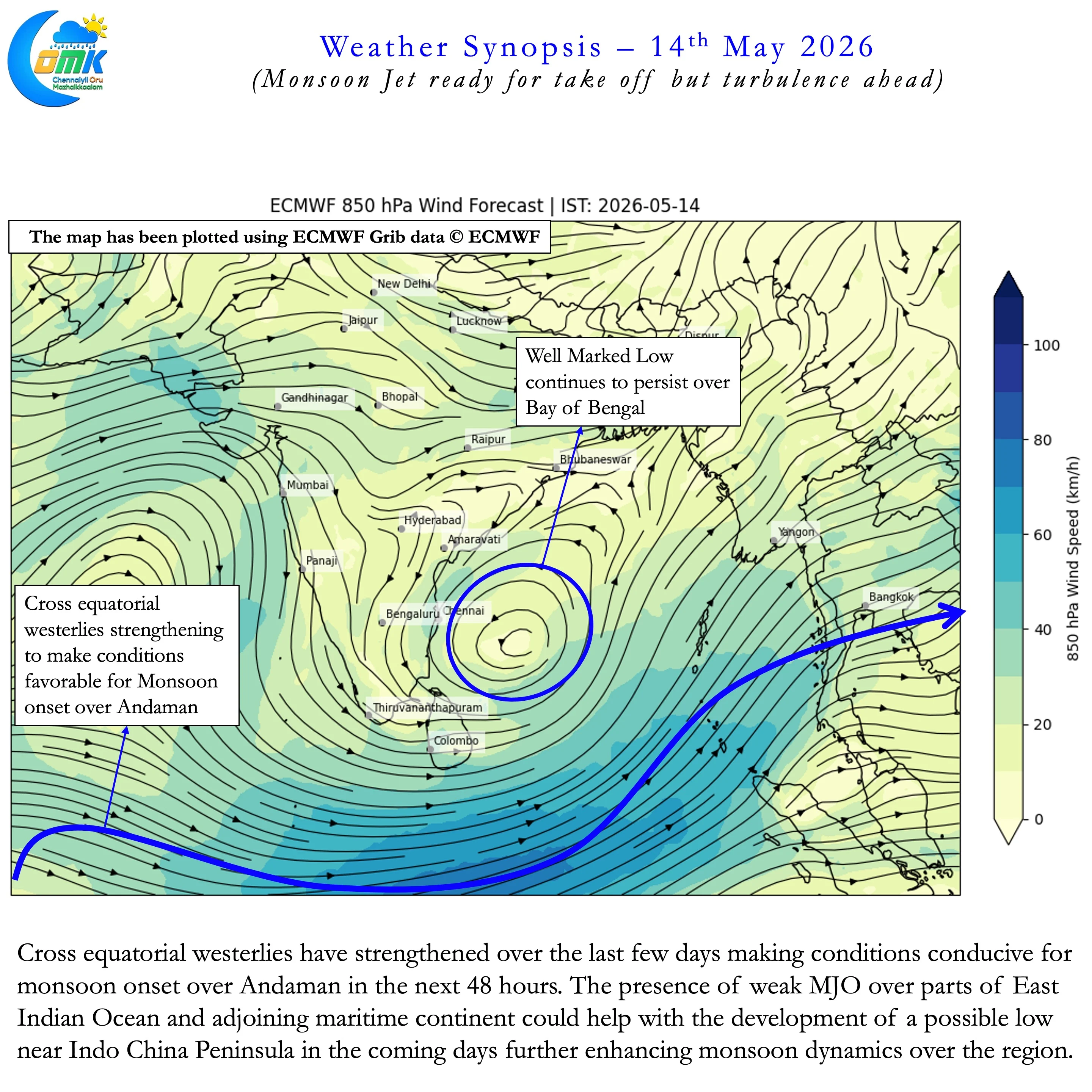
While Monsoon Onset over Kerala is most looked out for the first check point for SWM is Andaman. As per IMD the traditional onset date for South Bay and adjoining Andaman & Nicobar islands is 22nd May. Roughly a week to 10 days later Monsoon normally check in over the mainland. But unlike MOK onset over Andaman is primarily driven by winds and precipitation. IMD has indicated in their daily bulletin yesterday about conditions turning conducive for Monsoon onset over Andaman on 16th May. Weather charts indicate equatorial westerlies are strengthening. Additionally East Indian Ocean is also benefitting from the presence of weak MJO over the region. This sets the stage for both wind and precipitation to favour monsoon onset over the A&N Islands.
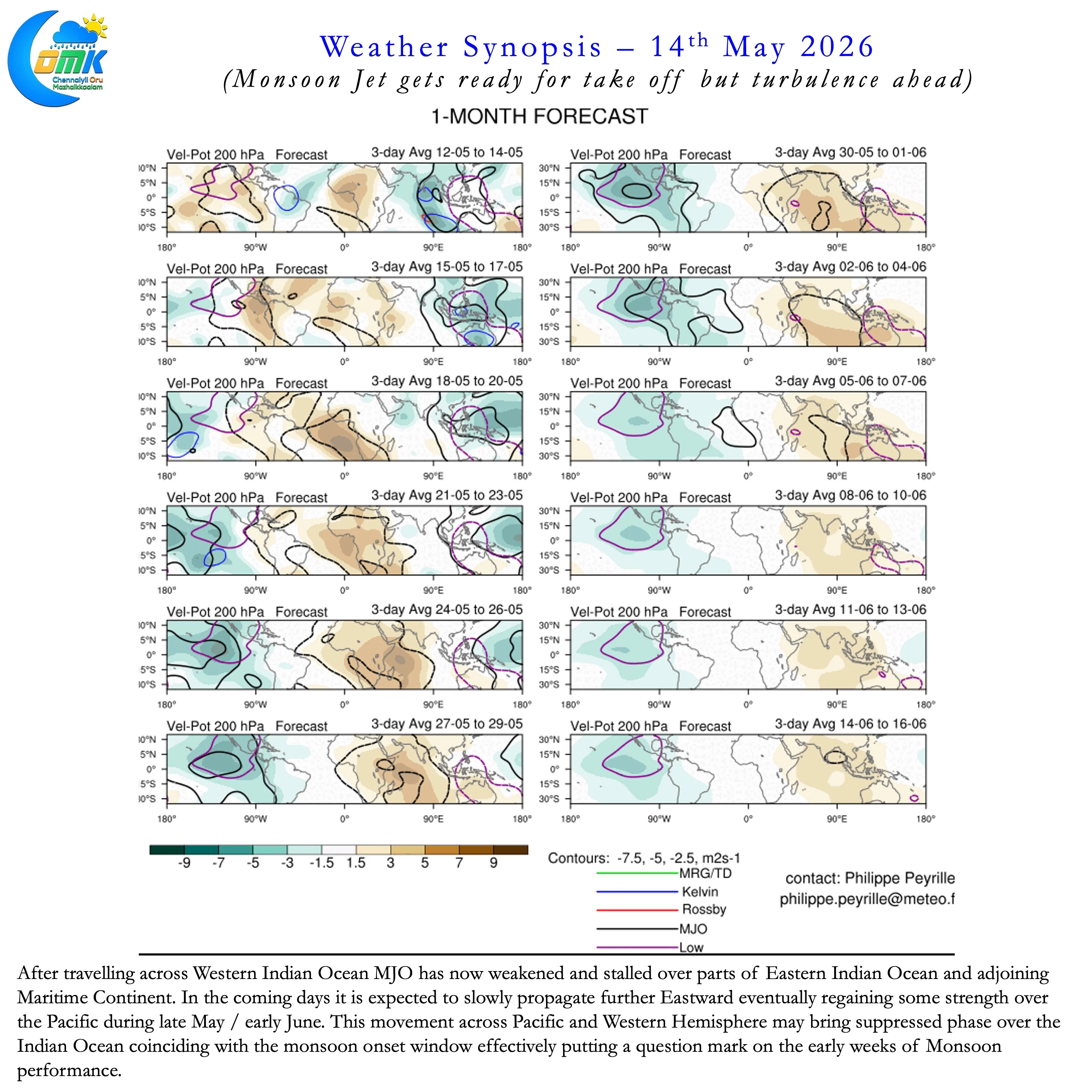
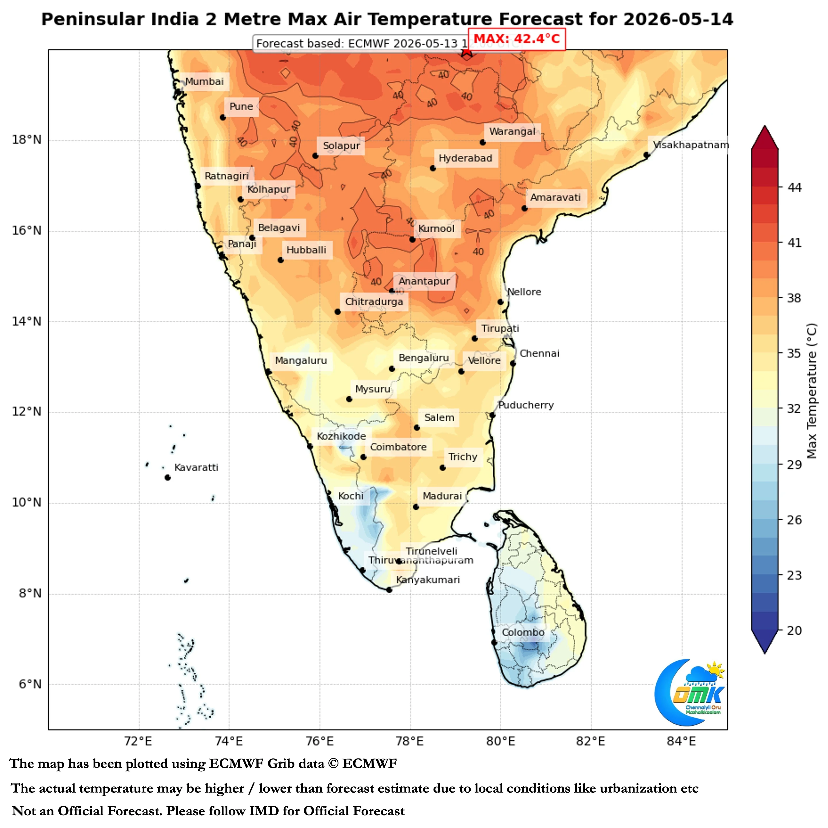
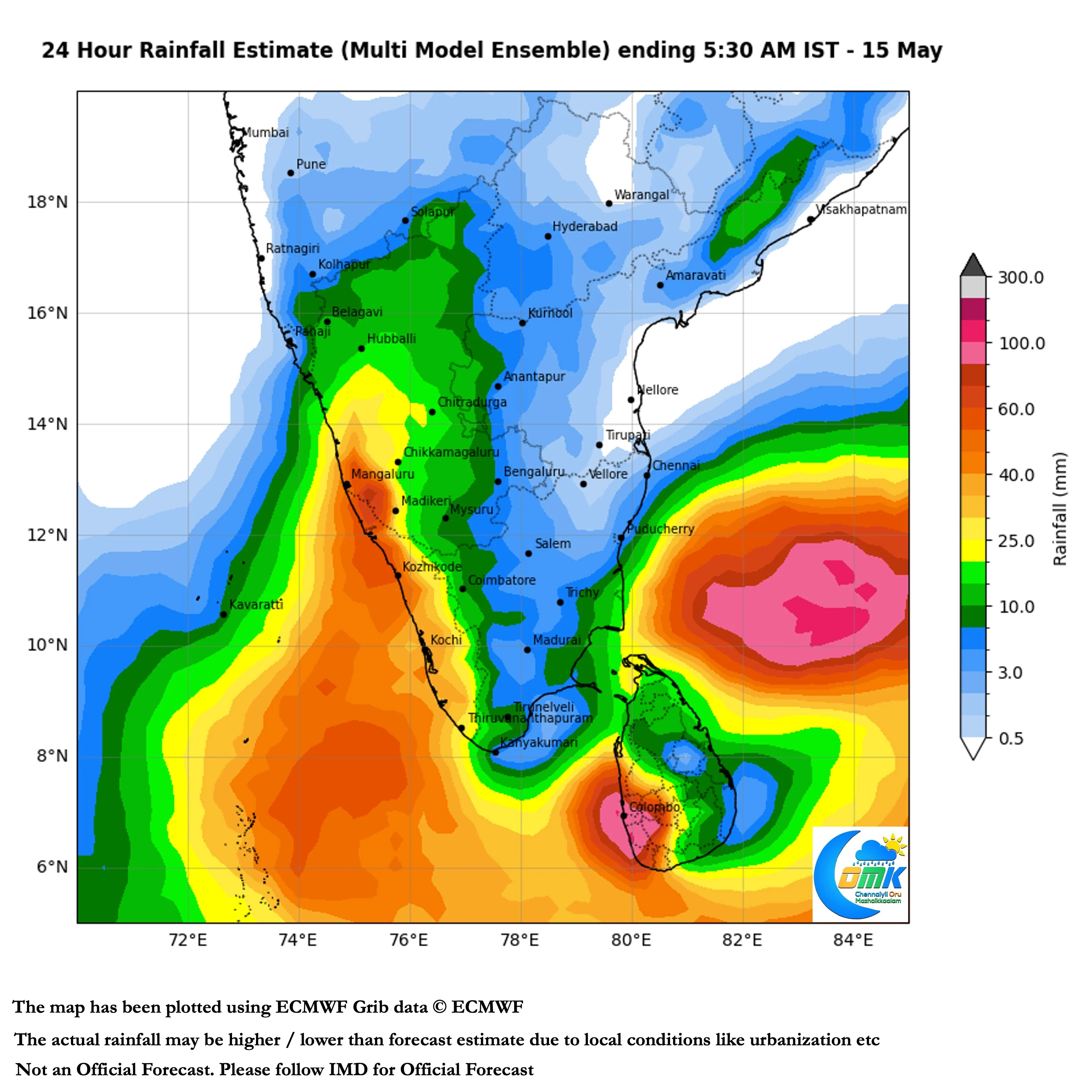
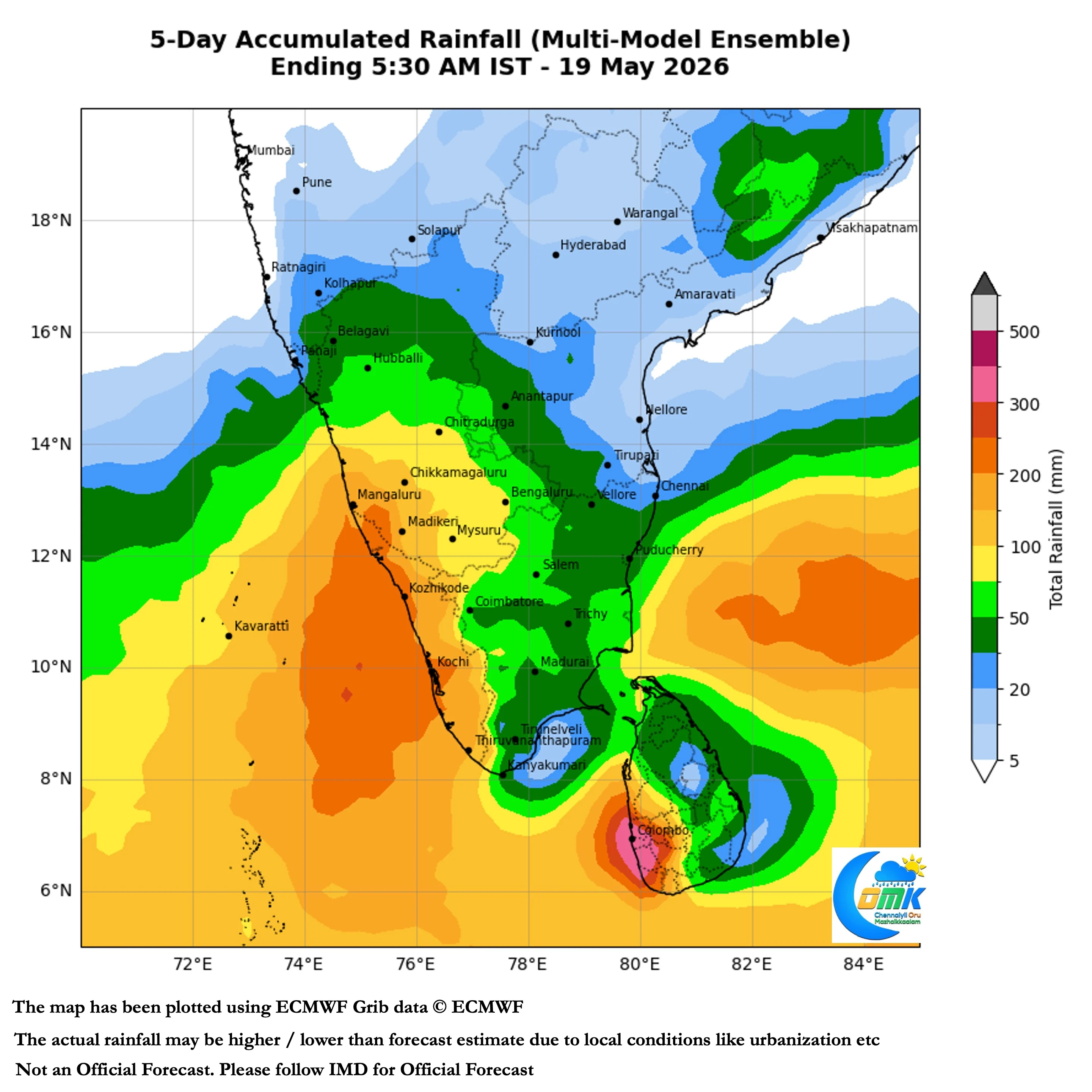
But looking deeper despite Monsoon Jet getting ready for take off there is potential turbulence on the cards. The weak MJO that is likely to help onset over A&N Islands is likely to drift further East in the coming days. It is likely to strengthen while moving over Pacific and continue further East. When the MJO moves over Western Hemisphere it is likely to bring suppressed atmospheric conditions over the Indian subcontinent. This suppressed phase may coincide with the monsoon onset window over Peninsular India.
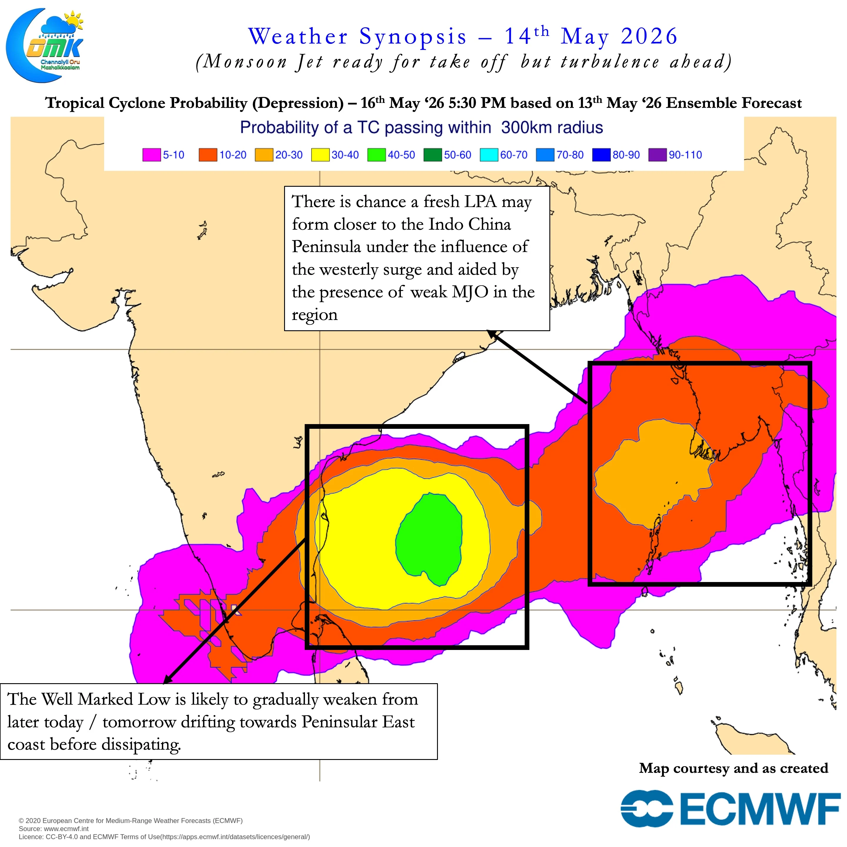
In all this let us not forget a Well marked low continues to persist in Bay of Bengal. It is likely to persists for the next 12 to 24 hours before gradually weakening. As it weakens it may drift closer to Peninsular East coast before dissipating. As things stand we may see an uptick thunderstorms over Peninsular India from tomorrow with strengthening Westerlies. Coastal areas like Chennai may not see much rains though we are likely to see increase in day time temperatures.