
During Northeast Monsoon not only do we look to the East for rains but have to look to the Far East for some support as well. Many a time it is the pulses from the South China Sea that develop into organized disturbances in Bay of Bengal as they move from East to West bringing some momentum to the Monsoon.
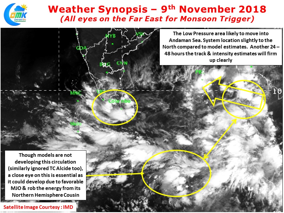
One such scenario is now evolving with a pulse moving in from Gulf of Thailand giving some hope for a renewal of monsoon dyanamics. Currently straddling the Malay peninsula the circulation will complete its movement into Andaman Sea today. Lying at around 9N latitude it is slighty to the North of what models orginally estimated. While all eyes on this pulse one should also not ignore another one that is slightly to the South of Equator at almost similar longitude. With MJO influence in the region this one may develop stronger than what models estimate this could possibly influence the Andaman pulse. Nevertheless the next 24 – 48 hours will give us complete clarity on what to expect.

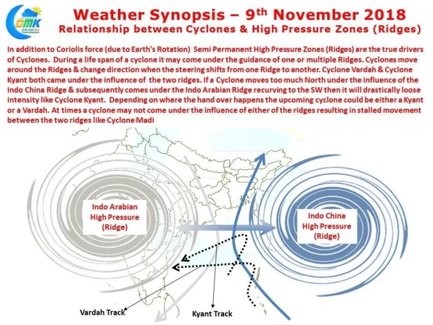
In the meanwhile there is a lot of discussions on whether a cyclone will hit Tamil Nadu or not. In this context we have tried to simplfy how cyclones move to give an understand on what to expect. As the image shows Cyclones always are guided by Ridges and moves around them. In Bay of Bengal & Arabian Sea the two ridges that guide cyclones are Indo Arabian & Indo China Ridges. In the case of the Andaman Pulse models are estimating both the ridges to influence the movement thereby creating a track which could be NW initially and W/SW subsequently. When ever two ridges are involved the hand over point is critical on the overall life cycle of the cyclone. Whether it becomes a Kyant or a Madi or a Vardah will depend on how North the cyclone travels initially and how fast the handover happens.
Hence our request to all our regular followers is to just wait till tomorrow before things will be very clear on how these sequence of events will happen and there influence on intensity / track / landfall. Please note all of these are interrelated and cannot be seen in isolation.