
Normally we see Monsoon dynamics swing like a pendulum between active and break phases with break phases known for the thunderstorms over the leeward areas of Tamil Nadu. Sometimes we also within the Monsoon dynamics go through intra seasonal oscillations. These oscillations tend to be created by not only tropical wave movement but also inter play between Pacific and Indian Ocean Basins and subtle role played by oscillations like BSISO or MISO which work like MJO in a smaller scale over the Indian Ocean & Pacific Ocean basins.
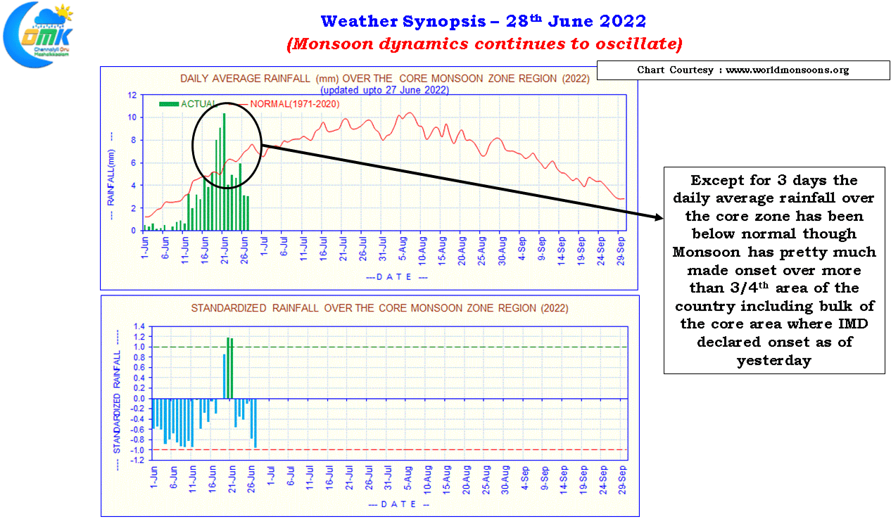
The look at the daily rainfall average over the core monsoon area indicate except for 3 days so far the daily average has been below normal though Monsoon has covered nearly 3/4th of the Indian Sub Continent as of yesterday. IMD announced Monsoon has made onset over most parts of Central Indian including large swathes of Gangetic plains which fall under core monsoon area tracked for the active and break in monsoon sequences.
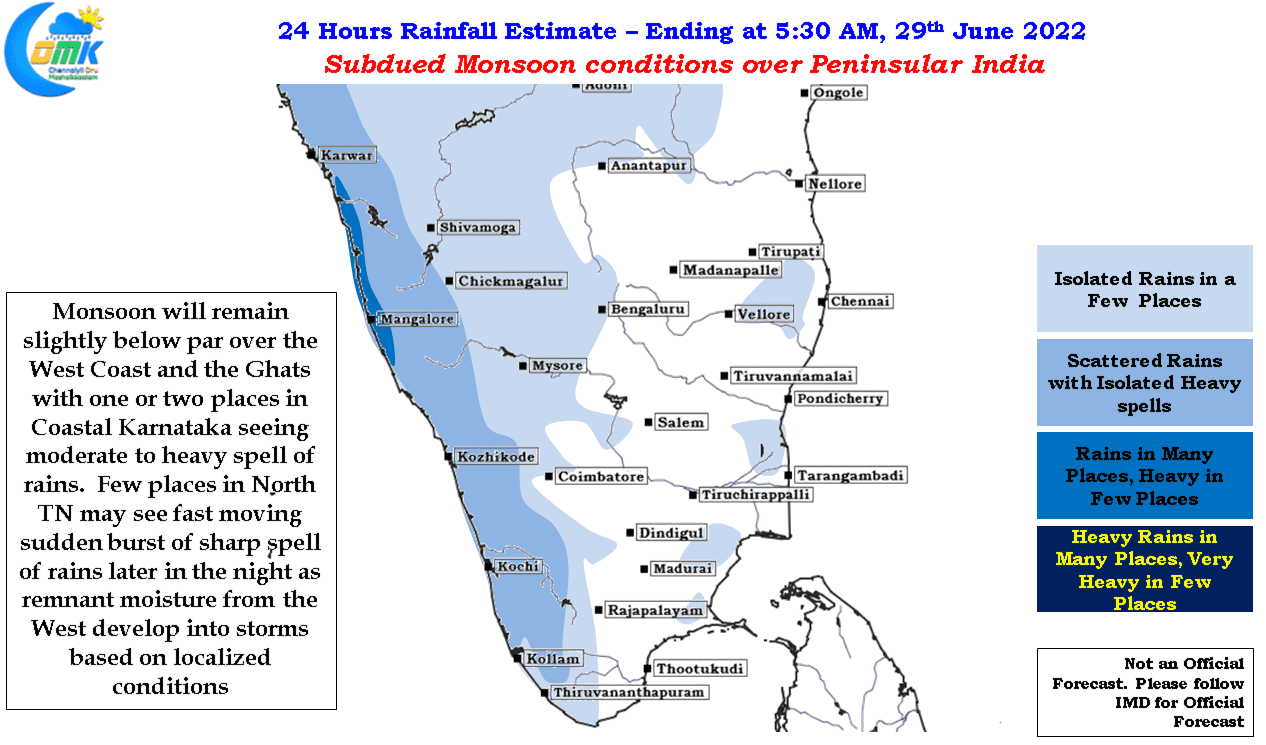
In the meanwhile after a couple of days of good rains in the West Coast and adjoining Western Ghats of Peninsular India, courtesy the offshore trough and UAC off the Konkan coast, yesterday rains reduced in Peninsular India as the UAC moved further west after strengthening into a Low Pressure Area briefly thereby becoming less marked and less influential for the monsoon dynamics. Westerlies continue to remain strong over Peninsular India though the overall dynamics because unfavorable due to the development of this LPA.
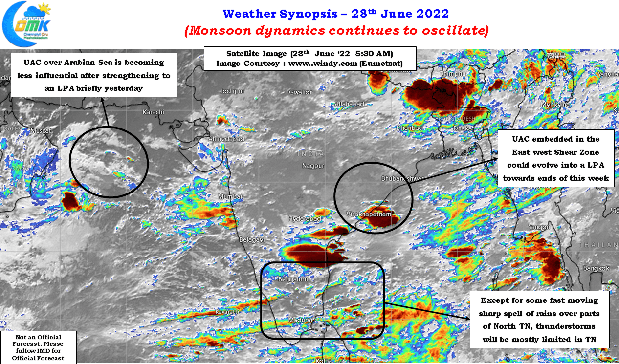
Central India and adjoining areas though have been benefitting from the presence of an East West Shear Zone which is expected to spawn a possible Monsoon Low over Central Bay and adjoining areas from the weak UAC that is seen developing in the region. This could possibly bring about an impetus to Monsoon dynamics giving another shot of active rains over West Coast and the Ghats. It is ironic that a station like Ratnagiri sitting on the Konkan coast has accumulated more than 10 cms in 24 hours only in two instances, both in the immediate past week when the conditions were better due to the presence of UAC.
On the thunderstorm front while most of Tamil Nadu will remain subdued parts of North TN will see sudden short burst of rains from fast moving storms that develop based on localized developments from the remnant moisture brought in by westerlies through down wind convergence similar to the past couple of days.