
Last couple of days as Southwest Monsoon got into a relatively quiet phase known at Break in Monsoon thunderstorms have picked up over many parts of Tamil Nadu. Monday night saw many places in Tiruvallur district hit by fairly intense thunderstorms. Tuesday saw the active convection shift to the South hitting many parts of Villuppuram distrct while yesterday saw parts of Cuddalore & adjoining areas of Delta areas like Mayiladuthurai, Nagappattinam hit by once again fairly intense thunderstorms. In all this places like Trichy & Madurai also saw good rains brought forward by wind induced instabilities.
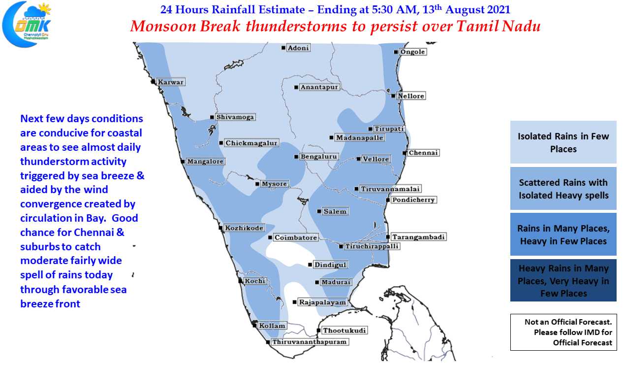
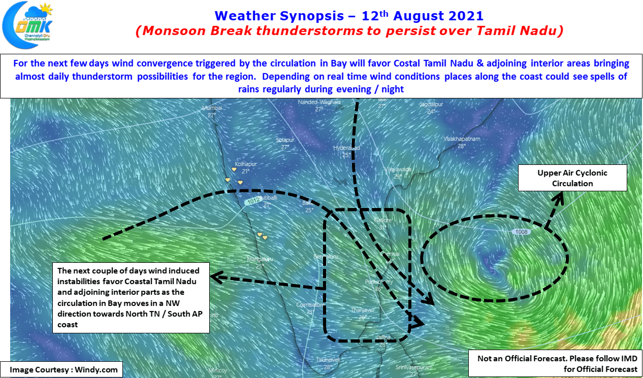
Weather models indicate a Mid tropospheric circulation over the southern parts of Bay which is likely to create conducive conditions for thunderstorms to develop. With wind convergence falling favorably over the coastal areas of Tamil Nadu & South AP, coastal places & interior places adjoining the coast will benefit from moderate thunderstorm activity over the next couple of days as the circulation moves in a NW direction towards North Coastal TN / South Coastal AP.

In the meanwhile yesterday saw parts of Chennai receive sea breeze induced thunderstorms, an indication of the weakening of westerlies. This is likely to improve today with better sea breeze penetration expected going by models. This will trigger some moderate thunderstorm activity over Chennai & suburbs bring a spell or two of moderate to heavy rains.
While the circulation is expected to be the pre cursor for a Monsoon Low likely to form in about 5 – 7 days time from now, this period will possibly be a good period of thunderstorms for most parts of Tamil Nadu except the places along the Western Ghats. Looking at long term weather outlook MJO may be expected to move into Indian Ocean in about 7 to 10 days time from now. Till then leeward areas of Tamil Nadu will stand a chance to benefit from some Veppasalanam Rains.