
Intra-seasonal monsoon oscillation is an integral part of SWM every year. The onset and withdrawal of Monsoon is a much discussed phenomenon. Onset and withdrawal has ben religiously monitored and documents for the last many decades. A lesser discussed characteristic is the Intra-seasonal oscillation. In other words active and break events of Monsoon. This paper was one of the first attempts to establish a clear protocol for identifying these oscillations. This was based on the standardised precipitation anomaly over the core monsoon region. If one were to look at this chart for Monsoon 2025 it will be clear why the headline calls “Early Season Pause” and not break.
One may also wonder why the leeward plains of Tamil Nadu need to bother about active / break events. The leeward plains of TN have their best chance for thunderstorms during a break event when Monsoon remains weak. The last couple of days saw the leewards plains of Tamil Nadu receive good rains. Even yesterday parts of Chengalpattu district saw intense thunderstorms. The IMD observatory at Pondicherry recorded 8 cms for the 24 hours ending today morning. When the monsoon winds are strong it is not only prevents formation of thunderstorms the winds are streamlined as well. After an early onset the All India Rainfall for the season now stands at -34%
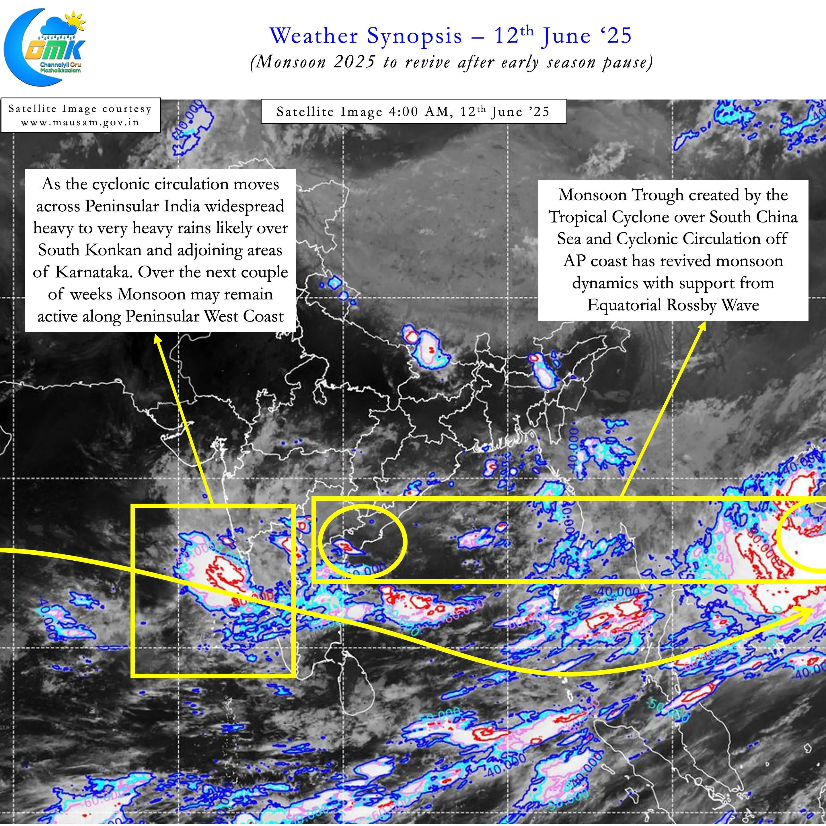
But Monsoon 2025 is now back on track, with westerlies strengthening from yesterday. Aided by some bit of support from South China sea the monsoon dynamics have picked up. Over the next couple of weeks we may see fairly active monsoon conditions. During this period Monsoon 2025 that has stalled since 26th May over Peninsula and 29th May over East India will start moving again. The cyclonic circulation currently seen over Coastal AP is expected to move across Peninsular India. This will provide some much needed momentum to SWM.
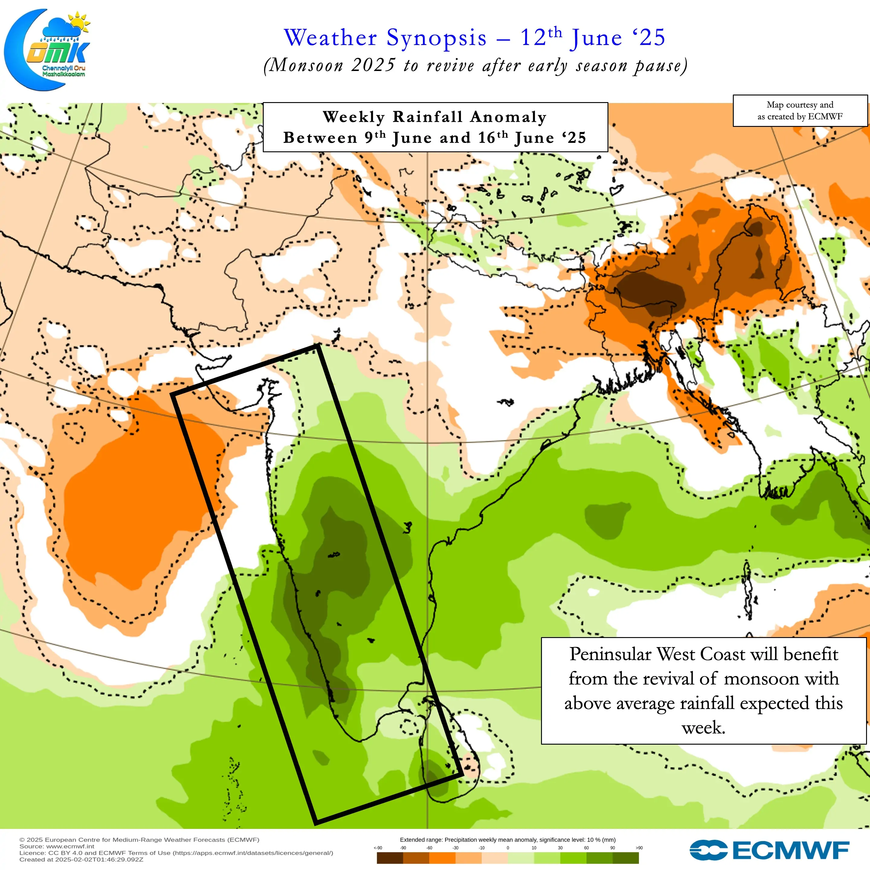
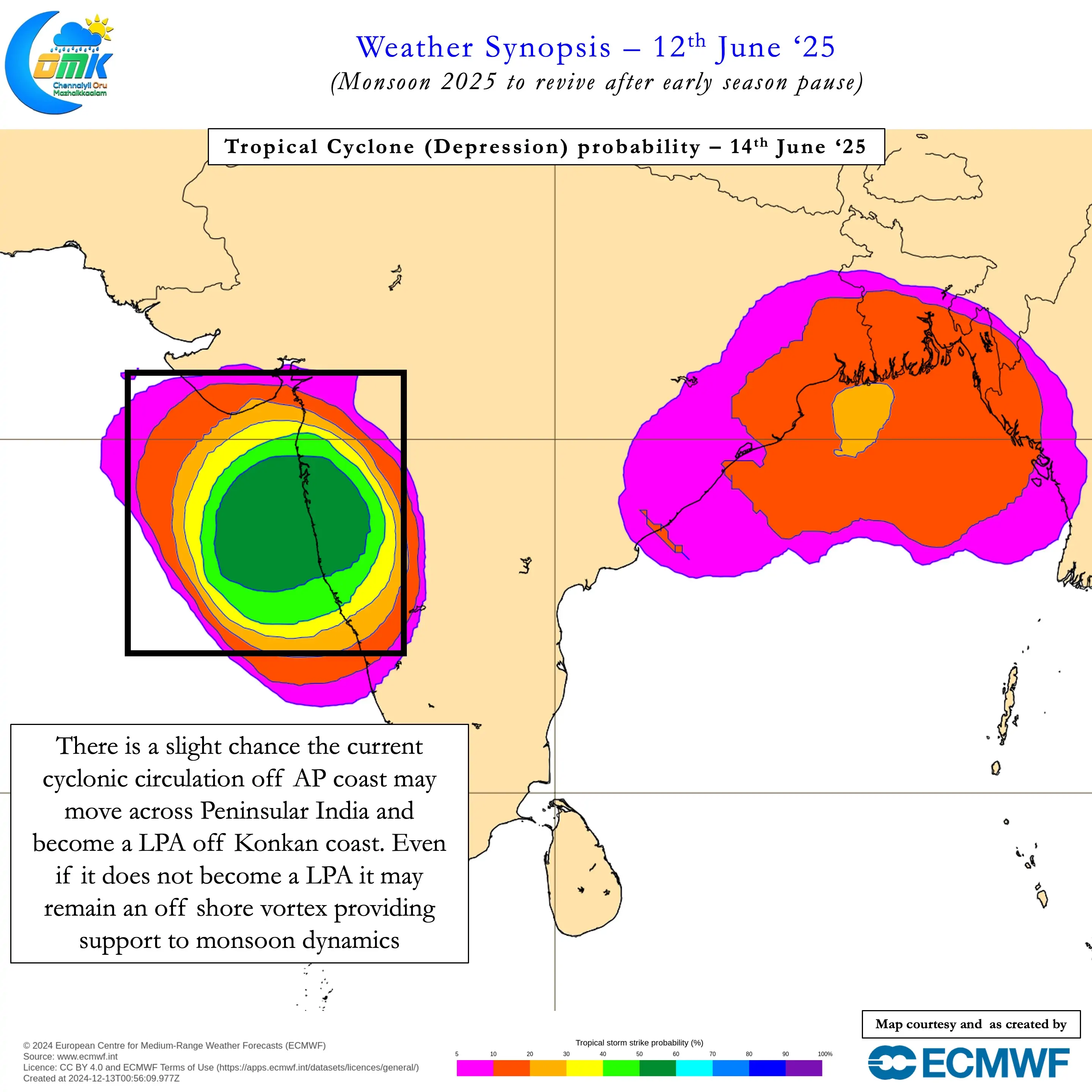
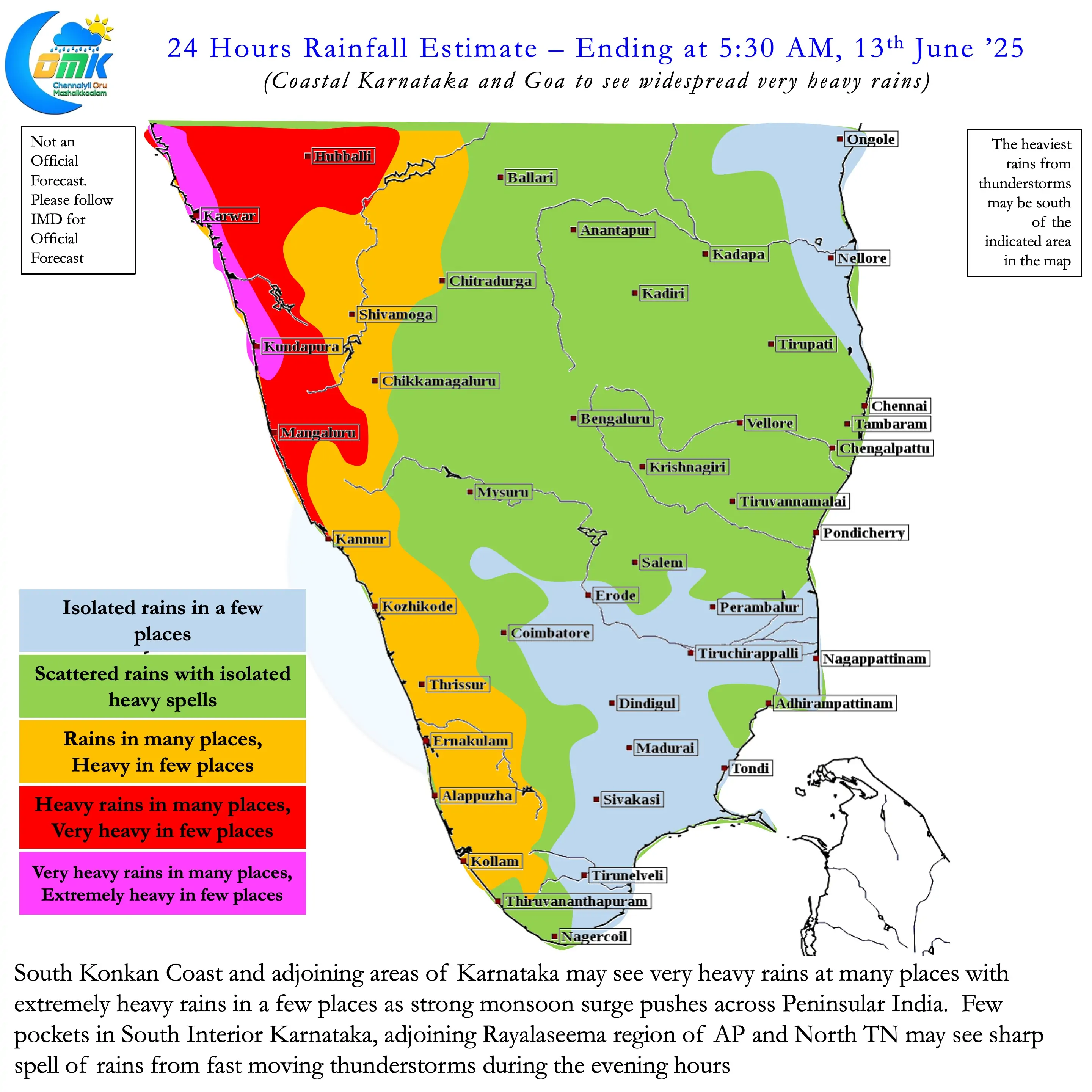
While there is a slight chance this circulation may become an LPA when it reaches Arabian Sea. Even if it does not become an LPA it may stay as an off shore vortex making it favourable for monsoon dynamics. Sub seasonal models indicate monsoon to remain active for the next couple of weeks. Though there is some indication southern parts of Peninsular India may not be as active as Central India and adjoining Konkan coast. Nevetheless for the next week to 10 days most of the Ghats in Karnataka, Kerala and Tamil Nadu may receive good rains along with the Peninsular West Coast.
As far as the leeward plains of TN goes, today and tomorrow there is a chance for some rains. Influenced by strong westerlies we may see intense heavy spell of rains that may be of short duration. North Coastal TN including Chennai and suburbs have a chance to get these spells. Similarly parts of South TN around Dindigul, Pudukottai and Sivagangai districts can see these sharp spell of rains. The other bit of good news is temperatures also may see a reduction making afternoons slightly better.
As always keep a tab on the COMK Estimated Rainfall Range Forecast for rainfall status. It features daily and cumulative rainfall range for the district headquarters in TN & PDC. Additionally this section also features select places from Peninsular India that receive good rains during Southwest Monsoon.