
Thunderstorms continue to persist over the leeward areas of Tamil Nadu with places in West TN & closer to the Ghats in South TN recording moderate rains yesterday. With weather models indicating the next few days to see Break in Monsoon type of conditions to continue we might see similar thunderstorm activity to persist over Tamil Nadu though the impact areas will change according to the wind pattern & day time convective build up along with of course the lift provided by the various broken patches of Eastern Ghats.
With wind instabilities likely to continue today also at 3 kms ASL over parts of Peninsular India thunderstorms will shift slightly to the North of the pattern for the past couple of days which favored Central TN & South TN areas. Rayalaseema region could benefit from this changing with pattern with weather models indicating few places in this region along with one or two places in Interior parts of South Karnataka to come under fairly intense thunderstorms later in the evening.
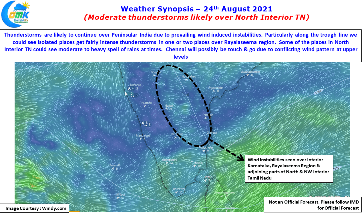

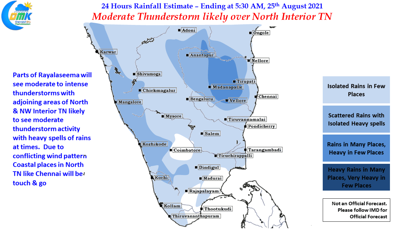
This could mean some good news for North Interior TN as well with the trough line dipping up to North Tamil Nadu parts of North & NW Interior TN that is adjoining the areas of South Interior Karnataka & Rayalaseema region could see moderate thunderstorm activity. At times one or two places in Vellore & Tirupathur dt could see heavy spell of rains depending on localized conditions.
While overall the pattern of thunderstorms may shift slightly to the North compared to the past couple of days, conflicting wind patterns closer to the coast particularly at Mid Tropospheric levels could mean chance for coastal areas like Chennai could be Touch & Go. Yesterday there was a clear East to West Movement of storms in which case the coastal areas could miss out if the wind pattern shifts to NNW to SSE then possibly one or places around Chennai could benefit from the changing wind pattern