
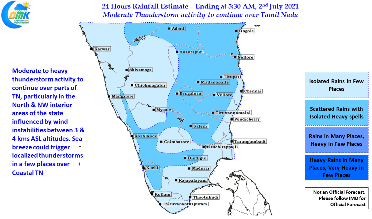
As break in monsoon conditions strengthened right on cue yesterday thunderstorms over Tamil Nadu increased. After what was a fairly clear sky day over large parts of Peninsular India, places in South TN initially started seeing thunderstorms develop at many places towards the evening bringing some moderate to at times heavy spells over places like Madurai. In the meanwhile as the evening gave way to the night slowly thunderstorms started to light up the skies over Northwest Interior TN & adjoining areas of South Interior Karnataka & Rayalaseema region. Making slow progress from West to East it continue to trigger new cells during the process bringing good rains to the districts of Vellore, Ranipet, Tiruvannamalai, Krishangiri, Dharmapuri, Tirupatthur & parts of Kanchipuram district along with a few pockets in Tiruvallur district. The slow movement though took its toll with the storms just falling short of touching the Chennai boundaries leaving the weather bloggers wondering at potential “What If” scenarios.
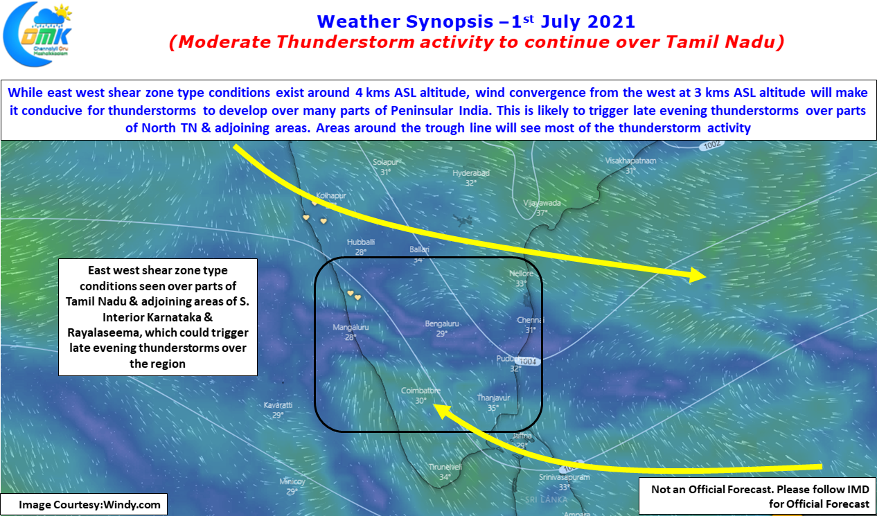

The next few days though promises more thunderstorm action for Peninsular India with once again pockets of Northwest TN & adjoining areas of Karnataka & Andhra Pradesh likely to benefit. Today weather models indicate once again wind induced instabilities providing conducive conditions for thunderstorms to develop over interior parts of Tamil Nadu. Once again though looking at the wind charts thunderstorms will be moving slowly as upper level winds have slowed down completely with some parts of Peninsular India almost resembling an East West Shear Zone type of conditions indicating the absence of winds.
With slow winds it will once again be touch & go for Chennai and the day could turn out to be similar to last night with thunderstorms just falling short while coming close to Chennai. Nevertheless the next few days Chennai will get its fair share of thunderstorms & Rains