
After nearly a week Thunderstorms made a return back over the leeward areas of Tamil Nadu yesterday. While most parts of Chennai missed the midnight thunderstorms except for few pockets around Kolathur / Ambattur / Perambur parts of Kanchipuram, Tiruvannamalai, Villuppuram, Thanjavur, Madurai & Trichy dts got some light to moderate rains at many places. The IMD AWS at Kanchipuram & Madurai recorded more than 4 cms while the one at Tirukovilur recorded 3 cms. The ones at RK Pet, Tiruvallur dt and Orathanadu, Thanjavur dt recorded 2 cms of rains from thunderstorms yesterday & in the wee hours off today.
Interestingly the TNSDMA Rain Gauge at Kilpennathur in Tiruvannamalai dt recorded more than 10 cms of rains from slow moving thunderstorms. This also indicates the slowing down of Westerlies because of which the rainfall quantum is higher in certain places while many other places completely miss out. Nevertheless the good thing though is the return of thunderstorms after a break of more than a week. Wind charts indicate similar conditions today also particularly the role of sea breeze in the coastal areas of TN while also additionally bringing a Mid Tropospheric Wind Instability over parts of South Tamil Nadu.
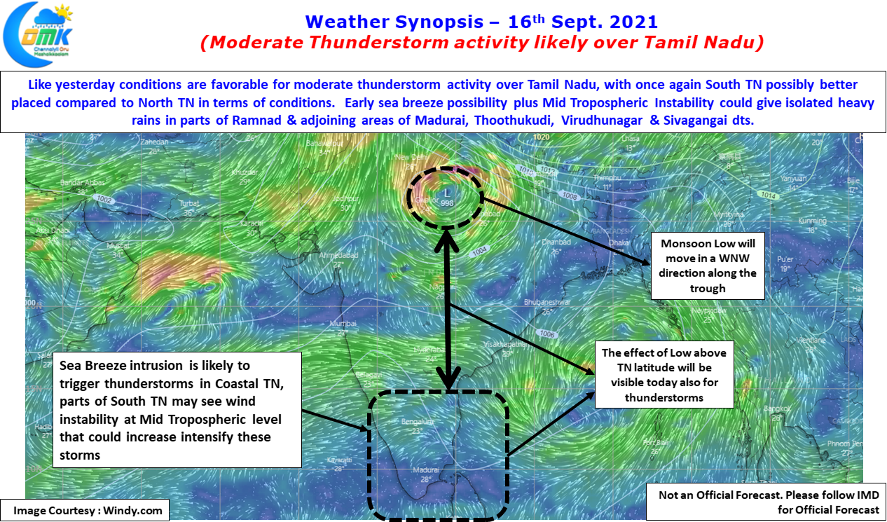
This Mid Tropospheric Wind Instability is likely to make atmospheric conditions good for thunderstorms triggered by the intrusino of Sea Breeze over South TN to develop & intenisfy bringing heavy spell of rains over isolated places in Ramanathapuram dt & adjoining parts of Madurai, Virudhunagar, Thoothukudi & Sivagangai dt.
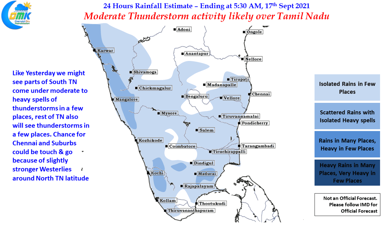
Like yesterday it could be touch & go for Chennai and suburbs today also due to slightly more streamlined westerlies over North TN & adjoining parts of South AP. But we could see sudden burst of rains late evening / night.