
After an extremely high decibel & high intensity thunderstorm action over Chennai & surrounding areas during the wee hours of Wednesday North Tamil Nadu remained slightly subdued though thunderstorms returned back over parts of South TN after a couple of days gap. Parts of Madurai & adjoining areas of Virudhunagar & Thoothukudi dts recorded moderate thunderstorms in a few places while later in the night isolated coastal areas around Pondy, Cuddalore & Delta dts also some some thunderstorms. While North TN did have a subdued night interiors saw some isolated thunderstorms which slowly made its way towards the coast near Chennai just as day broke. But as some of the models expected the storms did not give much rains to the land area but intensified upon reaching the sea.
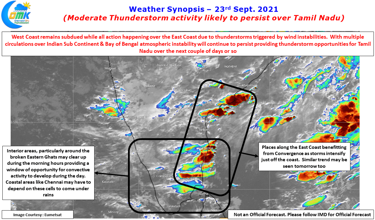
With multiple circulations seen over the Indian Subcontinent there is no dearth of triggers for thunderstorms to happen over the leeward areas of Peninsular India. The Satellite image pretty much sums up the story of weak convective clouding over the West Coast while the East coast was under many bands of intense clouding all the way from Coastal AP to delta dts. All in all indicates a state of atmospheric flux which augurs well for thunderstorms to persist over Tamil Nadu for the next couple of days. Interestingly with multiple circulations happening the chance for them becoming into Monsoon Low / Depression reduces there by providing multiple opportunities for places like Chennai to come under rains during the intervening period between two circulations moving East to West.

Today once again the early part of the day may remain unfavorable due to the cloudy skies / remnant thunderstorms & associated stratiform clouds around North Coastal TN. But satellite images indicate the interior areas to clear up during the morning hours providing a window of opportunity for convective to build up in the interior areas particularly over the Eastern Ghats. Coastal places like Chennai though have a slight chance for sea breeze induced thunderstorms because the low over Central India may be more west compared to yesterday will possibly have to depend more on the cells from interior areas to come under rains later in the night.