

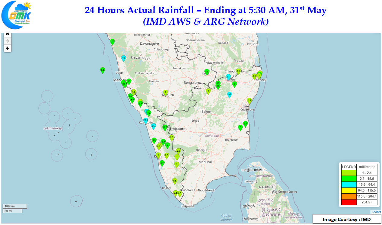
After a few days of reduced thunderstorm activity over Tamil Nadu, yesterday saw parts of North TN come under moderate to heavy thunderstorms with places in Vellore, Tiruvannamalai, Kanchipuram & Tiruvallur dts seeing dcent spell of rains. Southern suburbs of Chennai also benefited from some of the interior storms triggering fresh cells closer to the coast though the rains were patchy & isolated in what is typical of late May / early June storms. The IMD AWS in Tiruvannamalai recorded nearly 4 cms of rains during the late night spell while the AWS at Vrinchipuram in Vellore district recorded more than 6 cms.
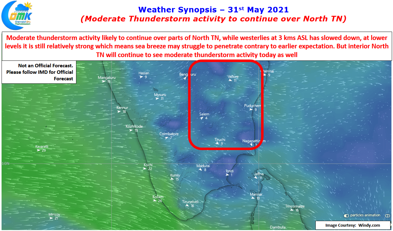
Days are likely to remain hot over most parts of the state consequent to lower level westerlies continuing to remain relatively strong compared to Westerlies at 3 kms ASL. This stronger than expected westerlies at lower levels has been preventing the intrusion of sea breeze thereby preventing coastal areas to benefit from development of thunderstorms. Possibly the presence of a weak UAC like feature off the Karnataka coast may have been the reason for that though weather models are expecting the same to fade away further weakening the westerlies.
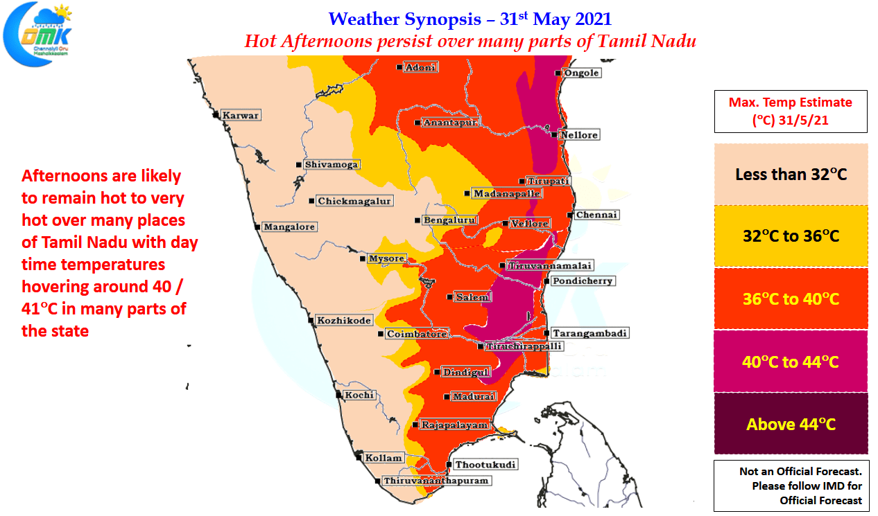
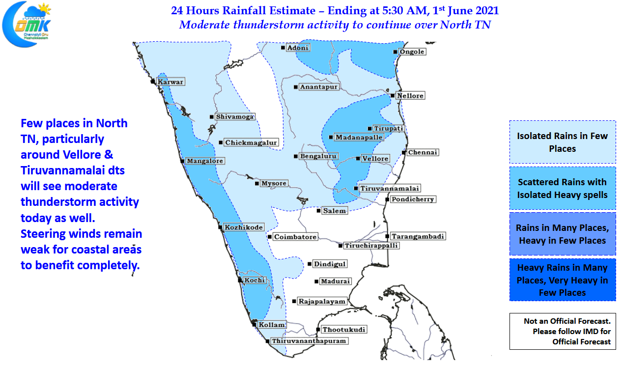
Nevertheless today is expected to be very hot across many parts of TN particularly the belt of about 25 to 100 kms away from the East Coastline of the state. Many places in this belt is likely to see afternoon temperatures stay around 40 / 41ºC making afternoons extremely uncomfortable. With wind instabilities currently prevailing over parts of North TN the interiors areas of North TN will see moderate thunderstorms in one or two places, with steering winds remain the chance for coastal areas like Chennai will be limited to fresh pulse getting triggered by the interior storms.