

September is a month that is known for thunderstorms that are fairly intense, travel long distances and sustain for hours together. When Southwest Monsoon starts withdrawing from the country it slowly starts to create scrambled wind pattern bringing with in atmospheric instabilities along with it conducive for thunderstorms to develop & thrive. As things stand we are not yet into the window of Monsoon withdrawal though the next Low Pressure that is likely to develop in West Bay holds the key on that aspect.
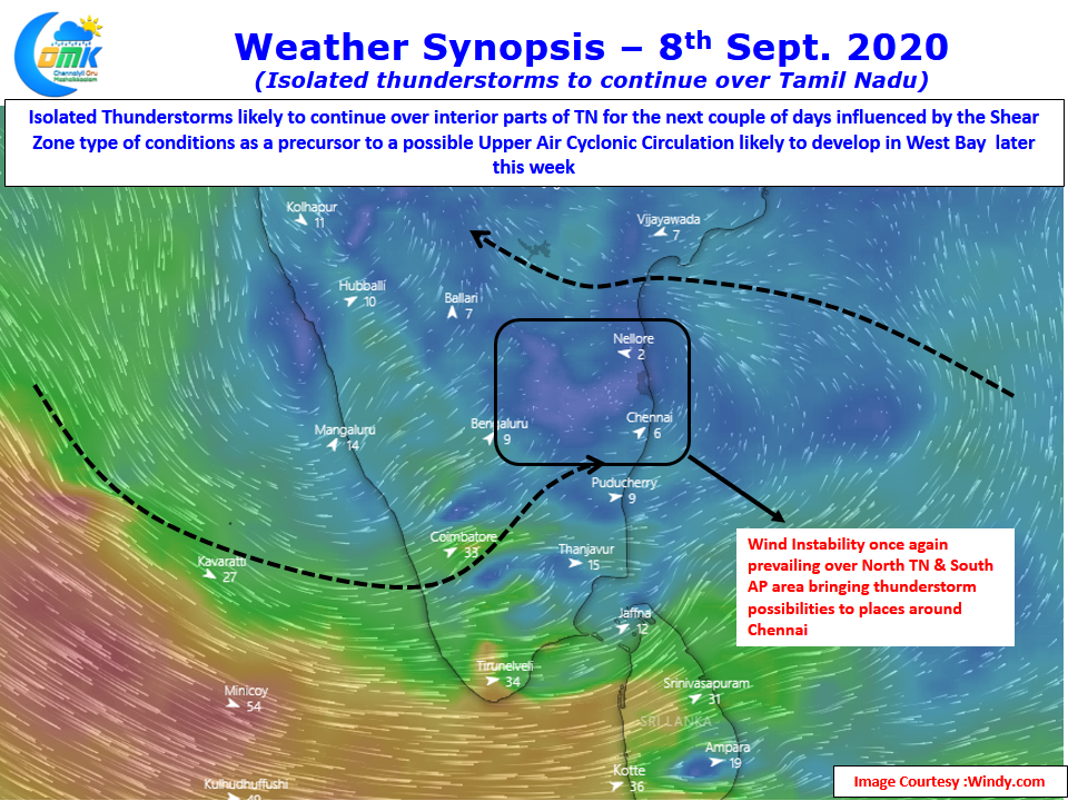
With Westerlies making a gradual return yesterday saw sudden thunderstorm development around the west & Northwest suburbs of Chennai bringing a short burst of heavy rains as sea breeze made its way across the landscape. Partially the prevalence of East West Shear Zone around 13N was also the reason for these thunderstorms to develop over North TN & adjoining parts of South AP. Weather models indicate similar conditions to continue for the next couple of days giving a possible window of thunderstorms over Chennai & surroundings over the next couple of days. Like yesterday don’t be surprised if suddenly you find yourself under a burst of sharp showers later in the afternoon.
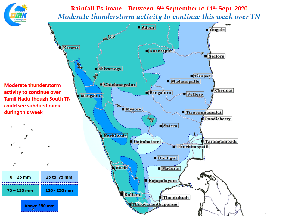
As usual today’s COMK post carries the weekly precipitation outlook which indicates moderate thunderstorm activity to continue over Tamil Nadu though it appears South TN could see lesser rains which might bring some respite to places like Pudukottai district where agricultural activities are affected by the daily thunderstorms and associated rains. Depending on how the UAC is likely to develop over West Bay towards this weekend thunderstorm activity will continue or peter out over the next week.