
“It takes years to build up, it takes moments to destroy.” – Haruki Murakami. Before going to today’s Post A Heartfelt Apology for not providing the right inference through our daily post yesterday and completely missing to judge the intensity of the extreme spell of rains in Chennai & surroundings. Over the past few years many have started to plan their days from the weather perspective based on our daily posts.
It is never easy to create a post the day after of an extreme event happens. If the event was picked up the excitement of adrenaline rush creates a sense of euphoria & an aura of invincibility. On the contrary if the event was not picked up not only the disappointment of missing out the event leaves a bad after taste like the one Football fans have the morning after a disappointng derby day defeat for their team. But putting the personal bias aside and looking at the available data could not only clear up the mind but also provide for indications that could be watched & observed in the future so that a similar mistake is not repeated again.
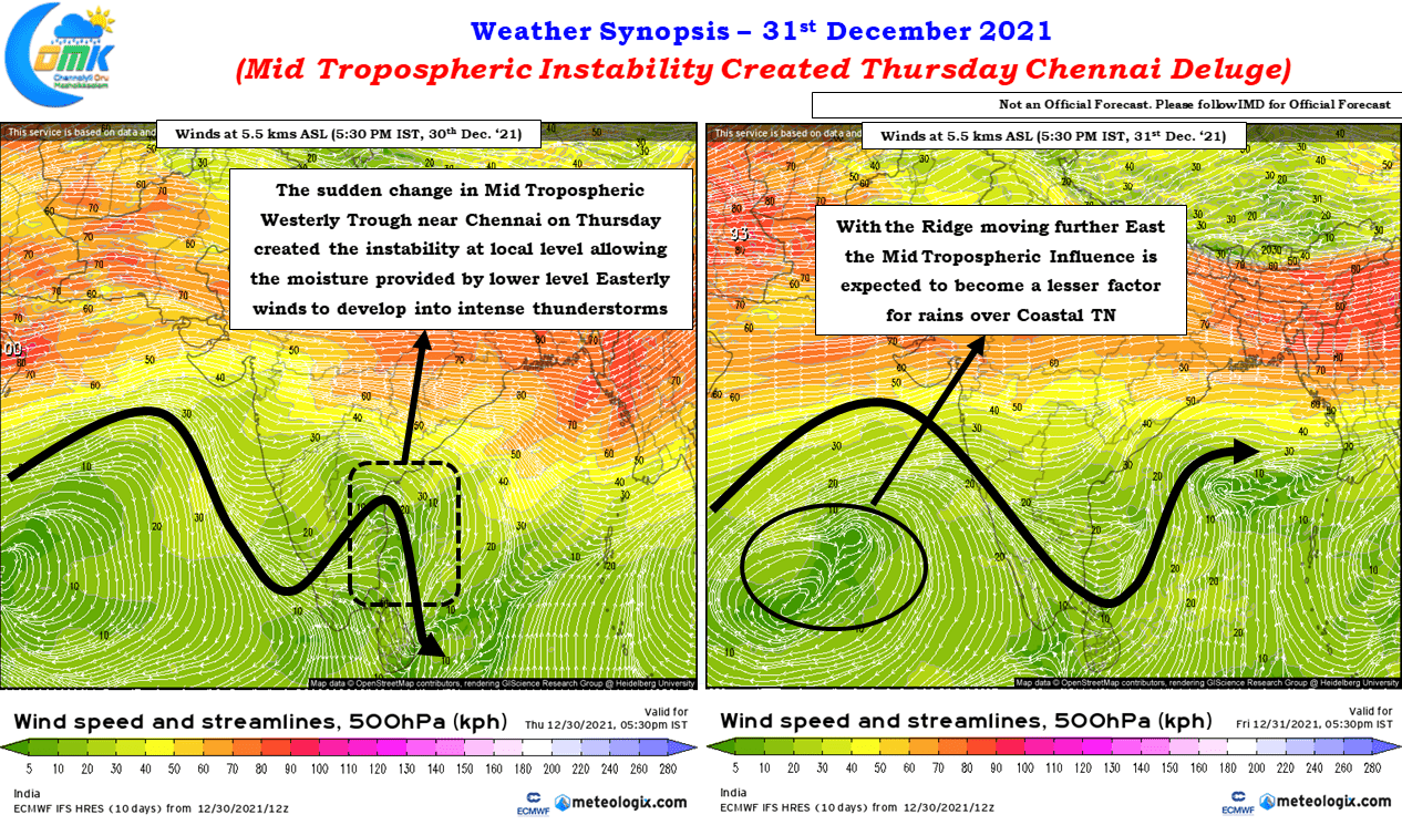
Yesterday’s record deluge over Chennai provides for one such instance where clearing the mental cobwebs created by the disapointment of missing an event of such a magintude. While the focus was on the lower level Easterlies bringing in the moisture from Bay the Mid Tropospheric winds created perfect conditions for the available moisture to develop into intense thunderstorms around Chennai & surrounding. While the larger atmospheric factors like base state of atmosphere etc will continue to be relavant the extremely divergent rainfall numbers around Chennai & suburbs does indicate it was factors at local level that created the trigger though one can argue always Mid Tropospheric Westerly Troughs are global scale phenomenons.
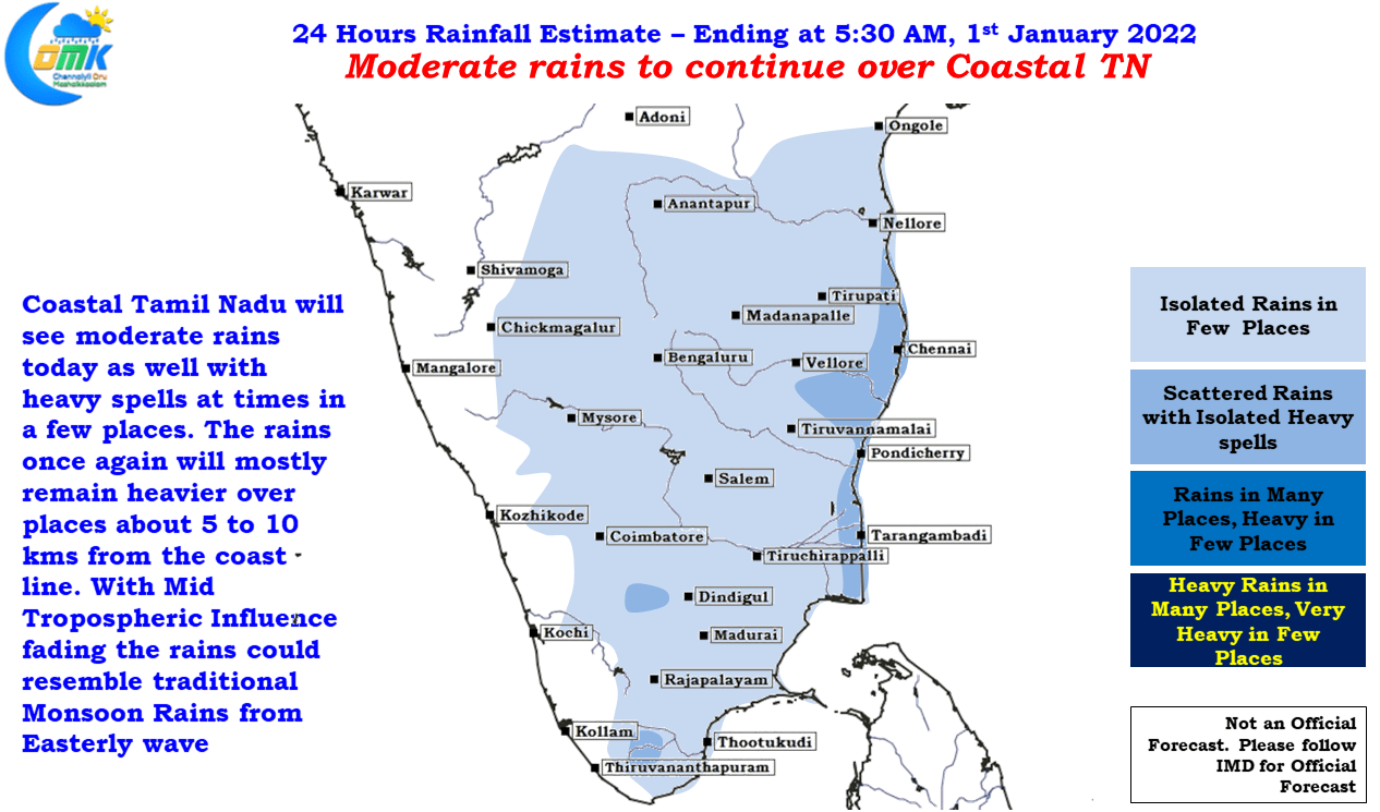
The sudden change in direction of winds at 5.5 kms ASL off the coast of Chennai enhanced the lower level moisture brought in from the Bay. We have seen in the past interplay between lower level Easterly winds & upper level Westerly winds provide for Mid Level Shear that enhances thunderstorms. Yesterday was possibly another instance of such interactions providing conducive coditions. Looking at the weather model outputs the Mid Tropospheric Wind Influence could fade gradually from today as the ridge over the Arabian Sea pushes further East bringing less favorable condtions for the convection to enhance. This could mean over the next couple of days the rains could lean closer to the traditional monsoon rains that may be seen at more places rather than the isolated intense rains that crashed into Chennai & surrounding on Thursday. While the rains could be seen at more places on Friday & Saturday compared to Thursday the intensity may not be extreme like Thursday.