
After two days of battering though the rains did not completely stop over Kanyakumari district it certainly reduced in intensity yesterday with more relief likely from today. The prevailing atmospheric instabilities brought thunderstorms to a lot of places over Tamil Nadu yesterday including places in Trichy, Pudukottai, Krishnagiri, Tiruvannamalai dt. After midnight storms from the sea brought rains to parts of Pondicherry, Cuddalore & Villuppuram district while southern suburbs of Chennai & Chengalpattu district also saw heavy spell of rains in one or two places.
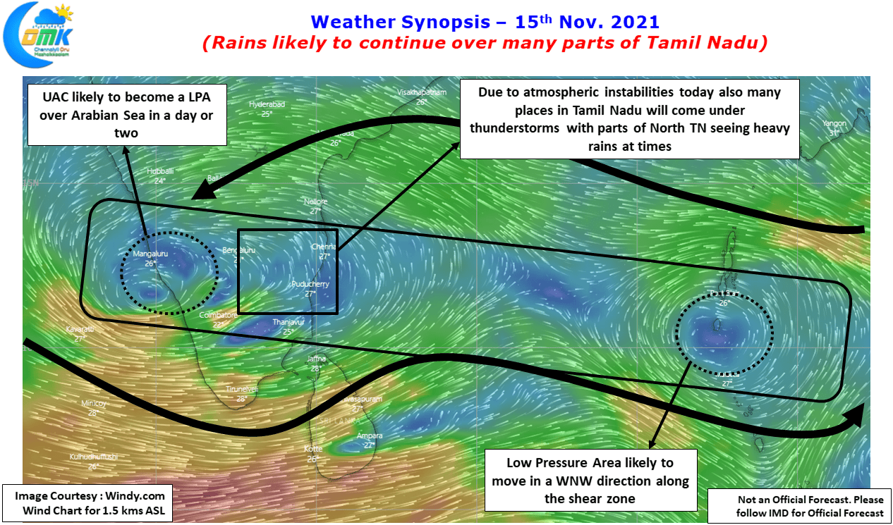
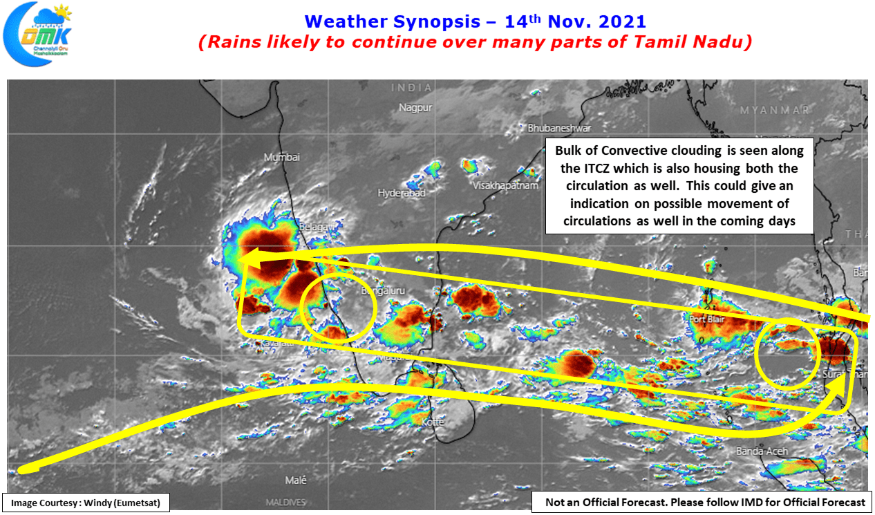
With the ITCZ in the form of East West Shear Zone firmly entrenched over southern parts of Peninsular India & adjoining seas bulk of the rainfall action is happening along this stretch. With two circulations entrenched as well within this East West Shear Zone convection is active all the way from Arabian Sea off the Karnataka coast to the Andaman Islands and subsequently continuing into SE Asian Peninsula.
With weather models struggling to pick up the trend of two circulations within this east west shear zone, most models now pushing the Bay system to become a victim of the faster developing Arabian Sea disturbance it may be wise to look at one day at a time for the next 3 / 4 days. It though remains to be seen how much this everchanging dynamics affect the overall precipitation pattern over Peninsular India.
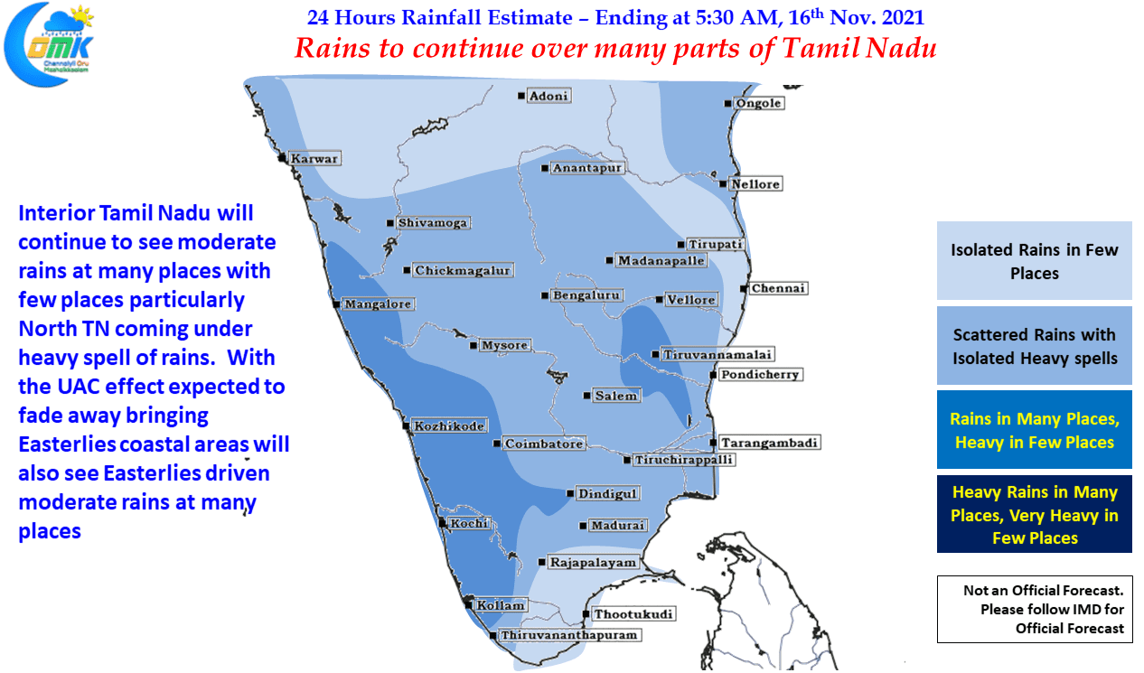
In the meanwhile moderate rainfall activity is likely to continue over Tamil Nadu today as well due to the continuing atmospheric instabilities created by the East West Shear Zone. This is likely to trigger heavy thunderstorm activity in a few interior places of the state while coastal areas may see moderate rains during the late night hours / early morning hours. Chennai & suburbs may see isolated heavy spell of rains in one or two places as well.