
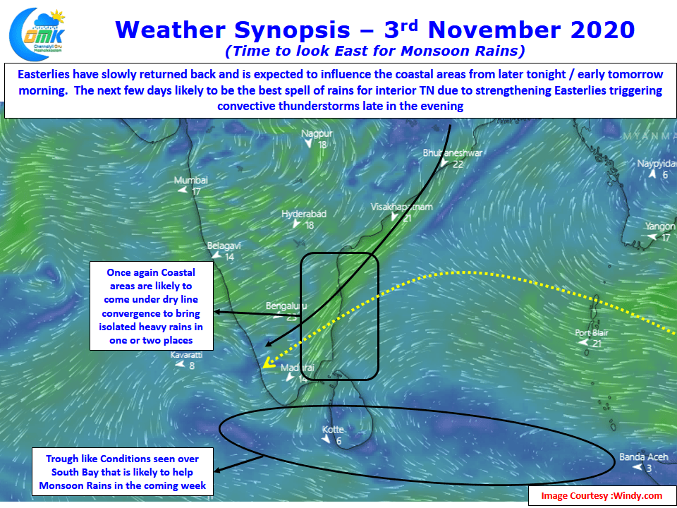
Since the “Onset” on 28th October Northeast Monsoon has been fairly quiet over the coastal areas though thunderstorms on account of Line of Wind Discontinuity have been happening over the places closer to the Ghats. Yesterday saw the return of thunderstorms over the plains of Western Tamil Nadu after many days bringing some much needed rains for the region.

Weather models indicate the return of Easterlies / Northeasterlies over coastal area from today which could mean the return of rains from the East for Coastal places like Chennai. With some bit of Northerlies still coming over Peninsular India there is a chance for some dry line thunderstorms to happen over one or two places in the coastal areas bringing heavy spells at times.
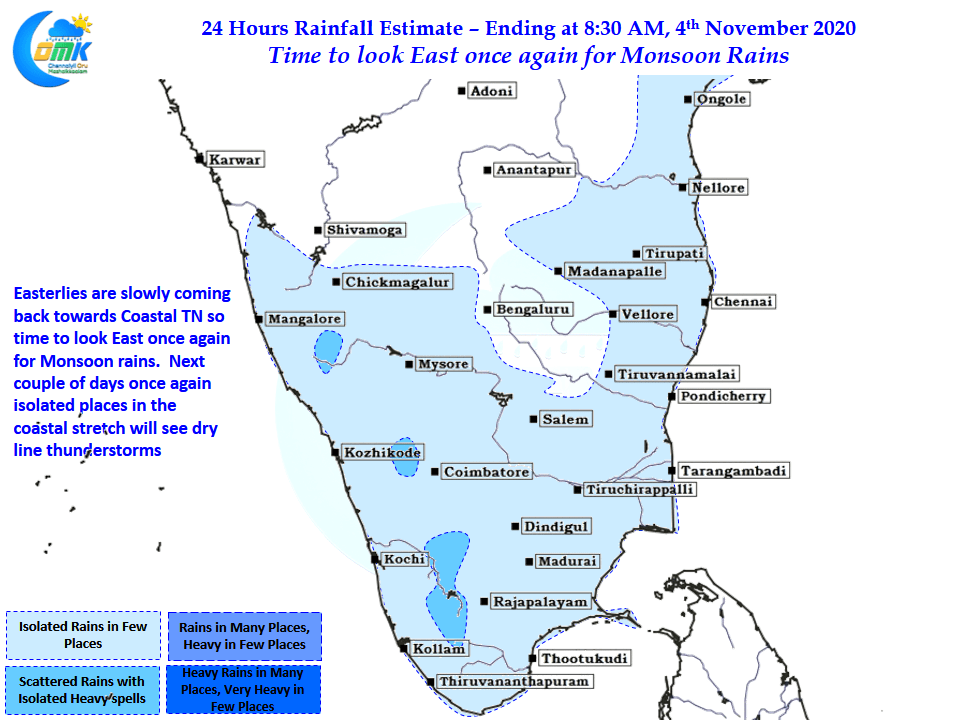
While coastal areas are likely to benefit from the return of Easterlies the biggest beneficiaries are likely to be the interior areas who will see convective thunderstorms develop after day time heating as the Easterlies bring the remnant moisture across the landscape. The coming few days possibly will see places in the West Interior TN & South TN see moderate to heavy thunderstorm activity during the evening hours bringing some much needed rains before active Monsoon conditions shifts towards the coastal areas.