
Yesterday saw thunderstorms stay closer to the Ghats with most of the plains in Tamil Nadu seeing fairly suppressed weather. Parts of Coimbatore & Tiruppur district saw intense spells of rains in the evening as convective activity triggered thunder cells and pushed it against the Western Ghats. We are heading into the last week of July but so far the absence of Monsoon Lows / Depressions have been conspicuous.

It is ironical even parts of Central India and the northern fringes of Peninsular India is recording rains through thunderstorm activity rather than proper monsoon rains. Today also many parts of North AP along with adjoining parts of Chhattisgarh, Telengana & Odisha are likely to see intense thunderstorm activity due to wind convergence. Isolated places are likely to see very heavy spell of rains from this instability.
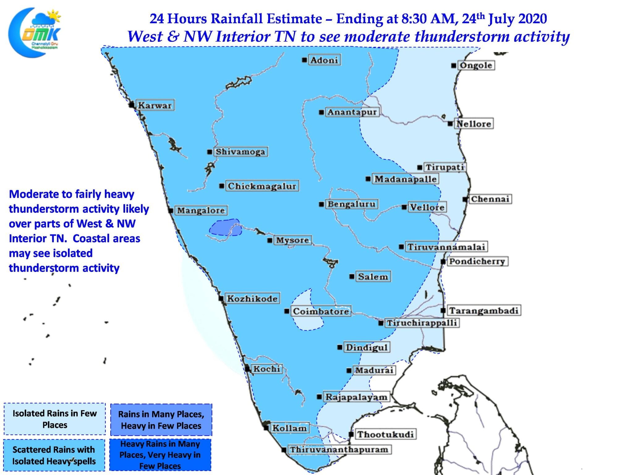
Similarly weather models indicate West & Northwest Interior TN is likely to benefit from the wind instabilities expected at 850 hPa levels with moderate thunderstorm activity likely over the districts of Krishnagiri, Salem, Erode, Karur, Namakkal and along with isolated places in the districts of Vellore, Tiruvannamalai in North TN.

Slow steering may be an issue for coastal areas but nevertheless one or two places in the stretch between Chennai & Pondicherry may benefit from interior thunderstorms making slow movement towards the coast later in the night. These places could see intense spell of rains for a duration of about 30 – 45 minutes as slow moving storms cross.